The Ultimate Grand Designs Map
179 Self Builds Across the UK and Ireland
The Timber Frame | The English Barn | The Co-Op | The Water Tower | The Eco-House | The Chapel | The House of Straw | The Glass-House | The Regency Villa | The New England Gable House | The Wool Mill | The Isolated Cottage |
Sevenoaks | South Lincolnshire | Bletchley | Liskeard | Huxham | Billingshurst | Kinross | Ely | Chichester | South Lakeland | East Essex | South Manchester |
I’ve updated the detailed map plotting the latest 2025 – Series 27 builds. This makes 179 Grand Designs locations across the UK and Ireland each one a real-world example of what’s possible when imagination meets determination. Whether you’re dreaming of your own self-build, looking for location inspiration, or just fascinated by where the most ambitious builds take root, this is your go-to resource.
What’s New in 2025
Five additional homes from the latest season have been added, bringing the total to 179.
Colour coding by series remains, so you can track patterns over time.
If you’re a Grand Designs fan, self-builder, or just someone who likes maps and patterns, this is the most detailed Grand Designs Map available.
 Spot Self-Build Hotspots
See where ambitious homebuilders are really making it happen. For instance, the recent Big Woods episode is located 8.7km away from the lifeboat station episode from Series 11. Understand Regional Trends
Discover which parts of the UK and Ireland attract the most innovative builds. Plan Your Own Project
Use the map to draw inspiration and using other resources available through MTBO avoid common location pitfalls, and understand the challenges others faced before you lay a single brick.
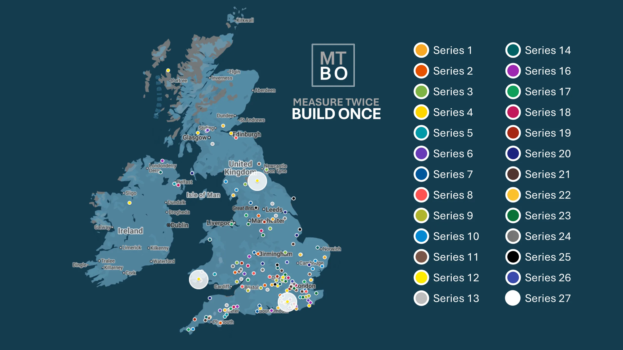
This map has been created using Google MyMaps. Map data ©2025 GeoBasis-DE/BKG (©2009), Google, Inst. Geogr. Nacional
Built for Self-Builders
This project is part of my mission at Measure Twice, Build Once (MTBO) to educate and empower more people to build homes of their own. Understanding where people build is just as important as understanding how they do it. This map helps you connect the dots (literally) between ideas and action.
By subscribing to our MTBO newsletter, you’ll receive immediate access to other resources, along with regular insights, tips, and updates on self-building.
Join Our Self-Build Community:
Subscribing not only grants you access to the glossary but also connects you with a community of like-minded individuals passionate about self-building. Share experiences, seek advice, and stay informed with the latest industry news.
Why isn’t the map interactive or zoomable?
You might be wondering why this map isn’t interactive, especially in an age where we’re used to clicking, zooming, and diving straight into details.
The reason is simple: privacy and respect.
While every location plotted on this map has been carefully deduced from publicly available TV episodes, many of these Grand Designs homes are private residences, often in rural or secluded settings. Making the map interactive and zoomable could unintentionally bring unwanted attention to homeowners who never agreed to have their exact address widely accessible online.
Rather than risk overstepping that line, I’ve chosen to display the data in a way that highlights the trends and geographic spread of Grand Designs builds, without putting anyone’s personal privacy at risk. The goal is to inspire, not expose.
“This project is about understanding where bold self-build ideas take root, not turning someone’s dream home into a landmark on a digital map.”
If you’re planning your own project, you’ll still gain plenty of insight from the regional patterns shown here. And if you’re just browsing, you can enjoy the big-picture view without peering too closely into someone else’s.
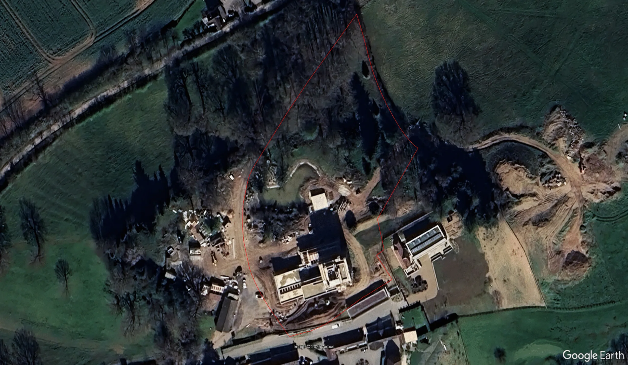
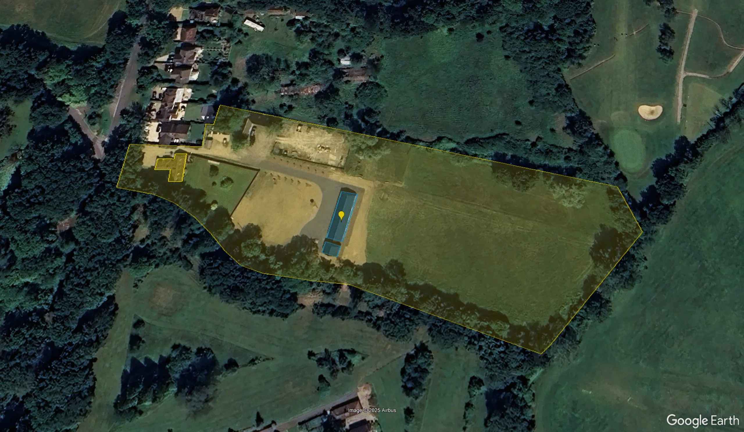
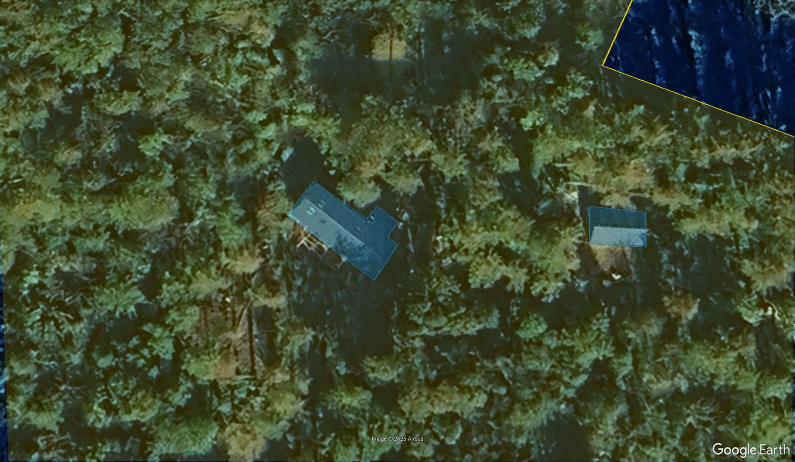
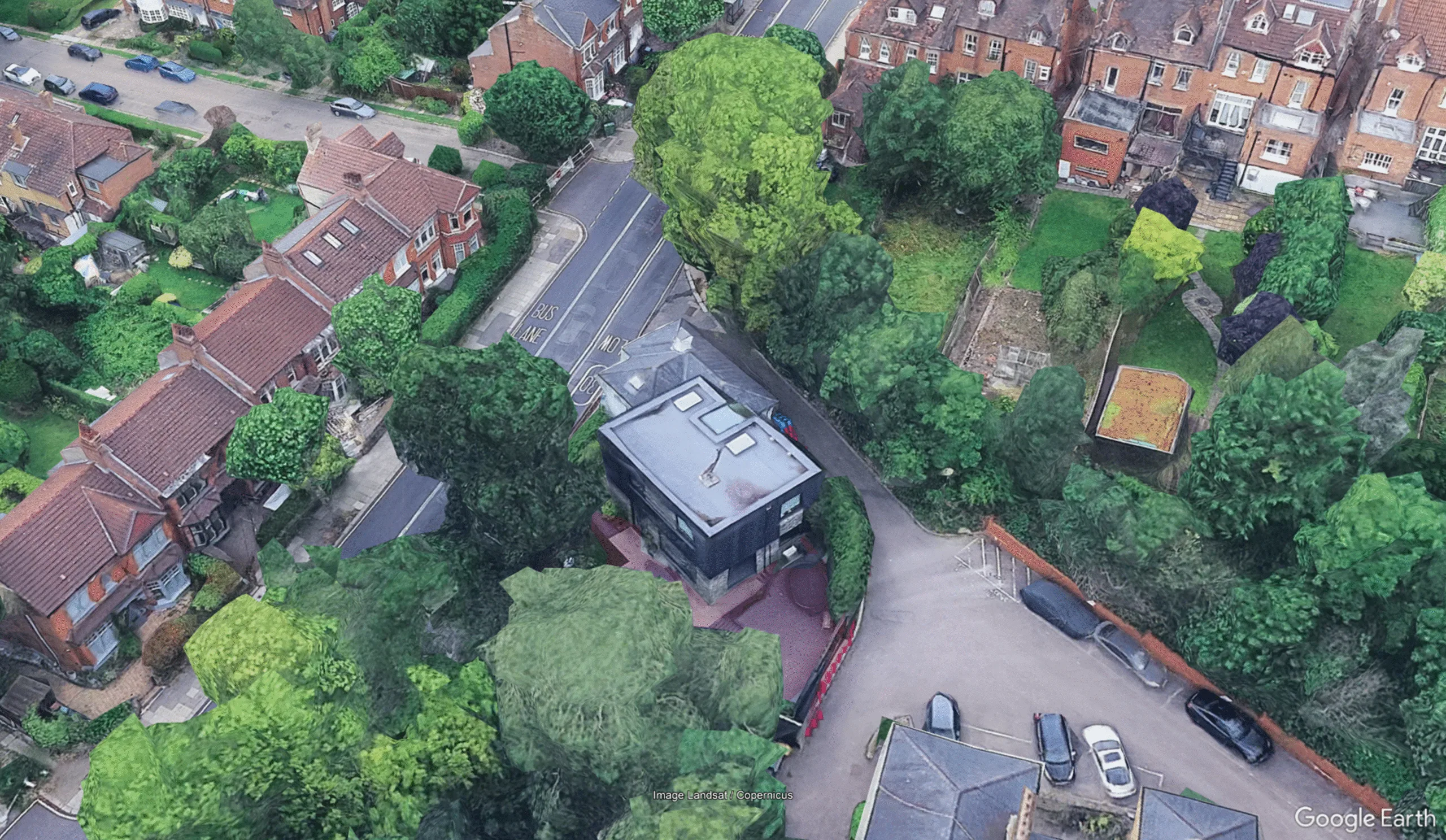
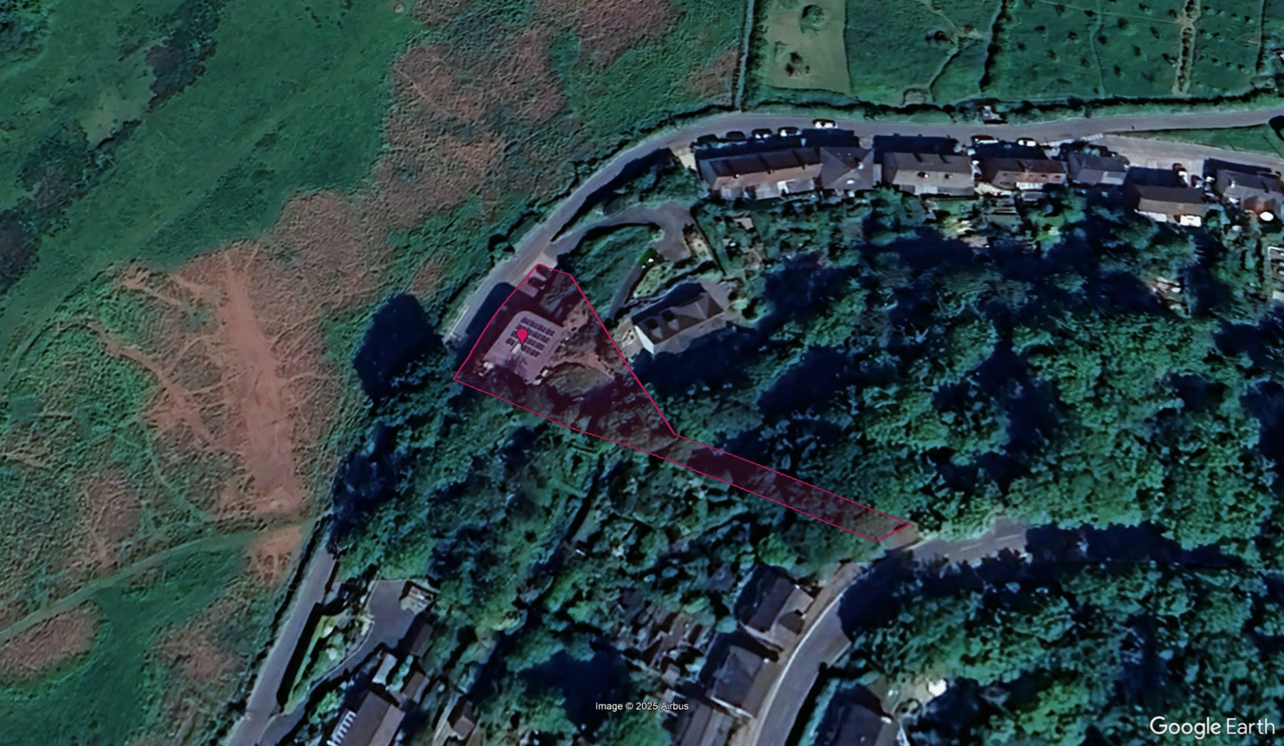
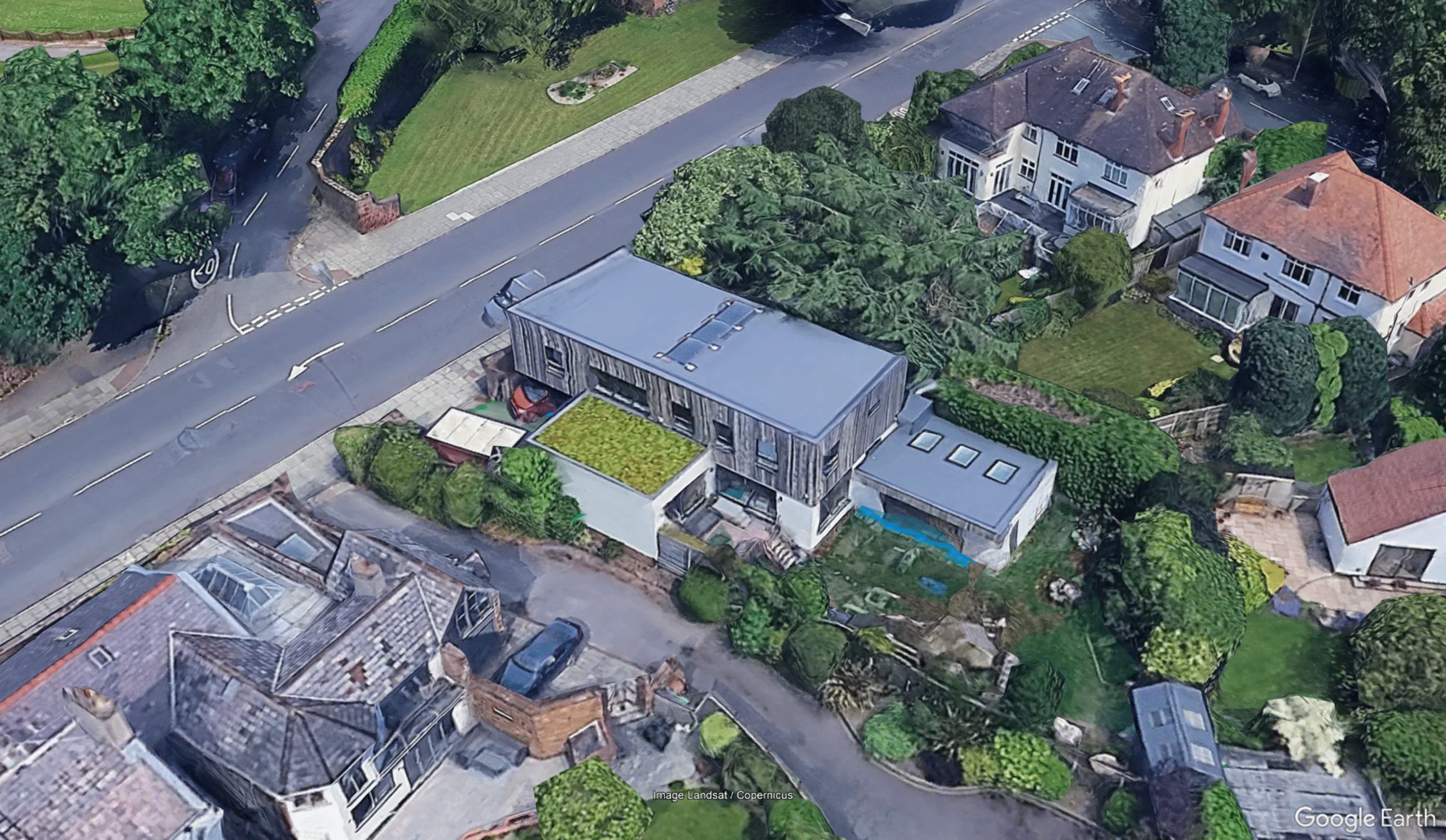
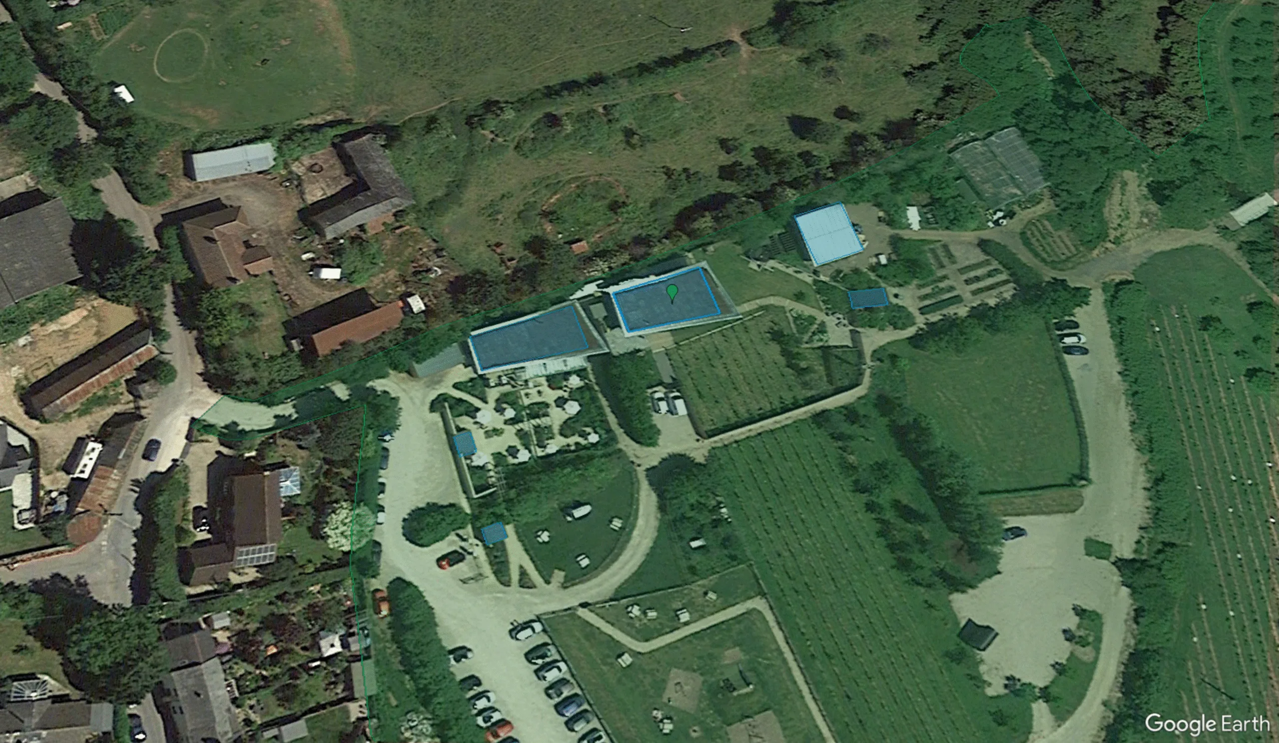
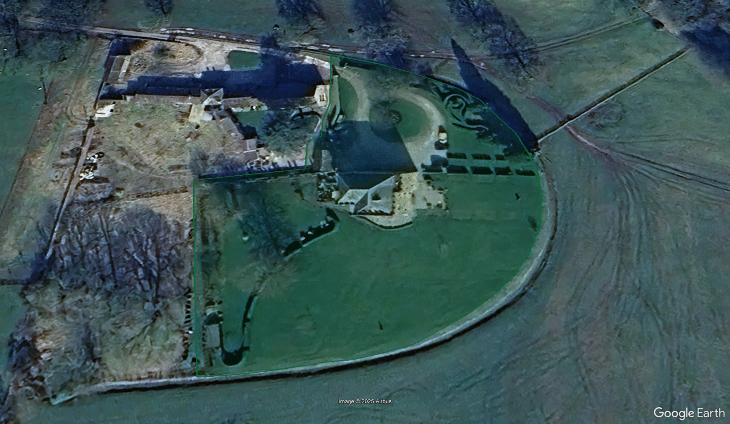
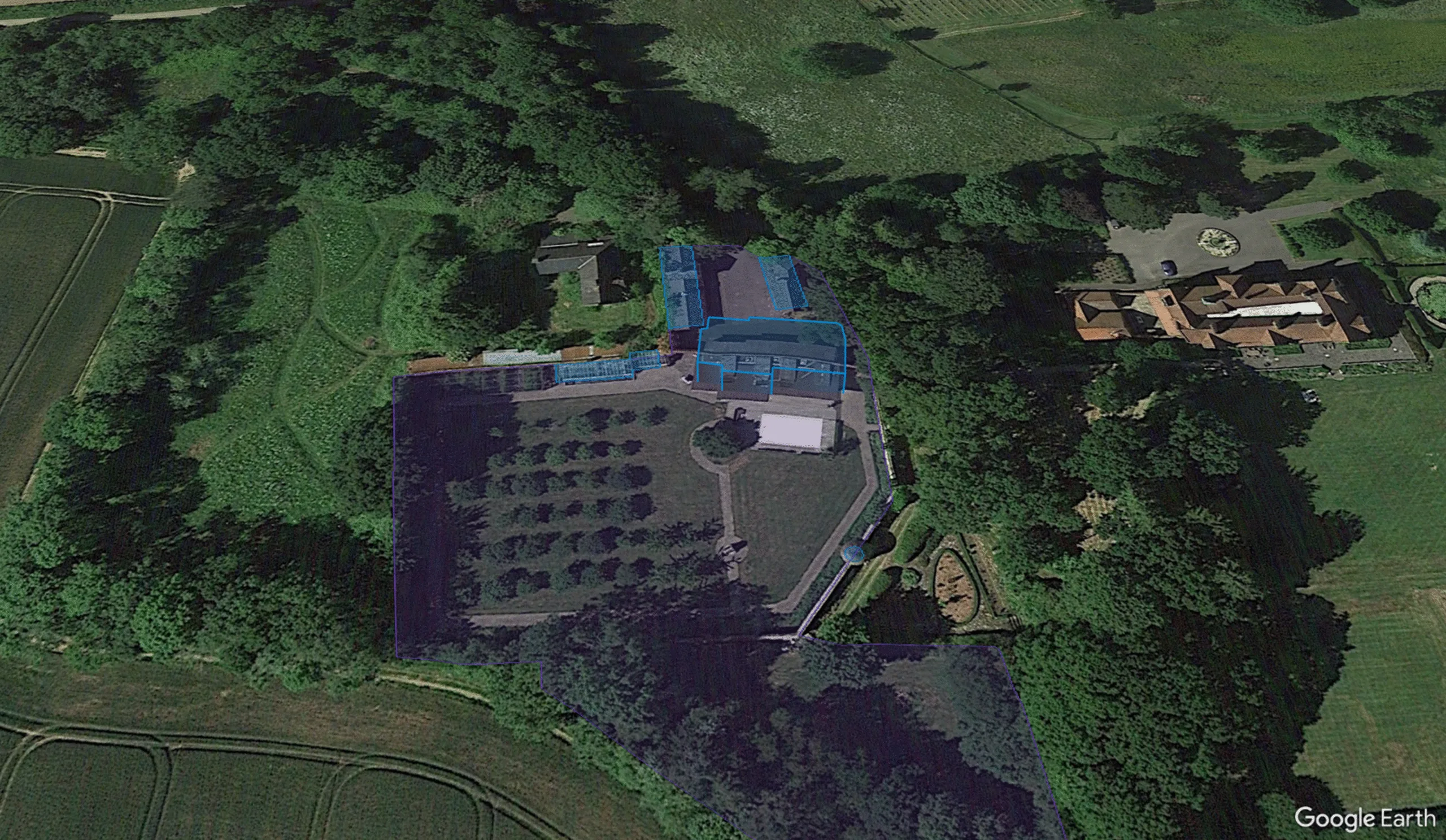
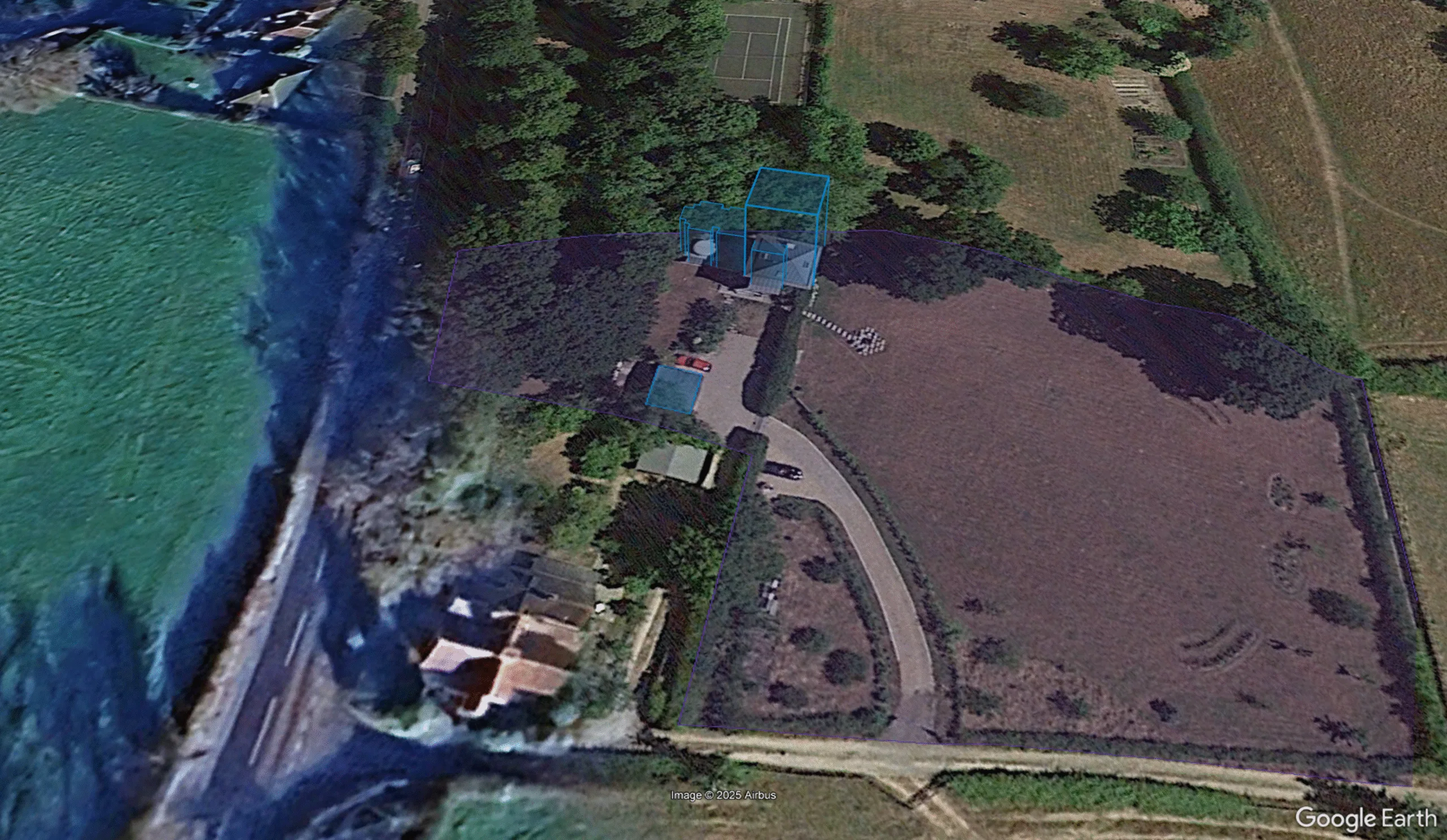
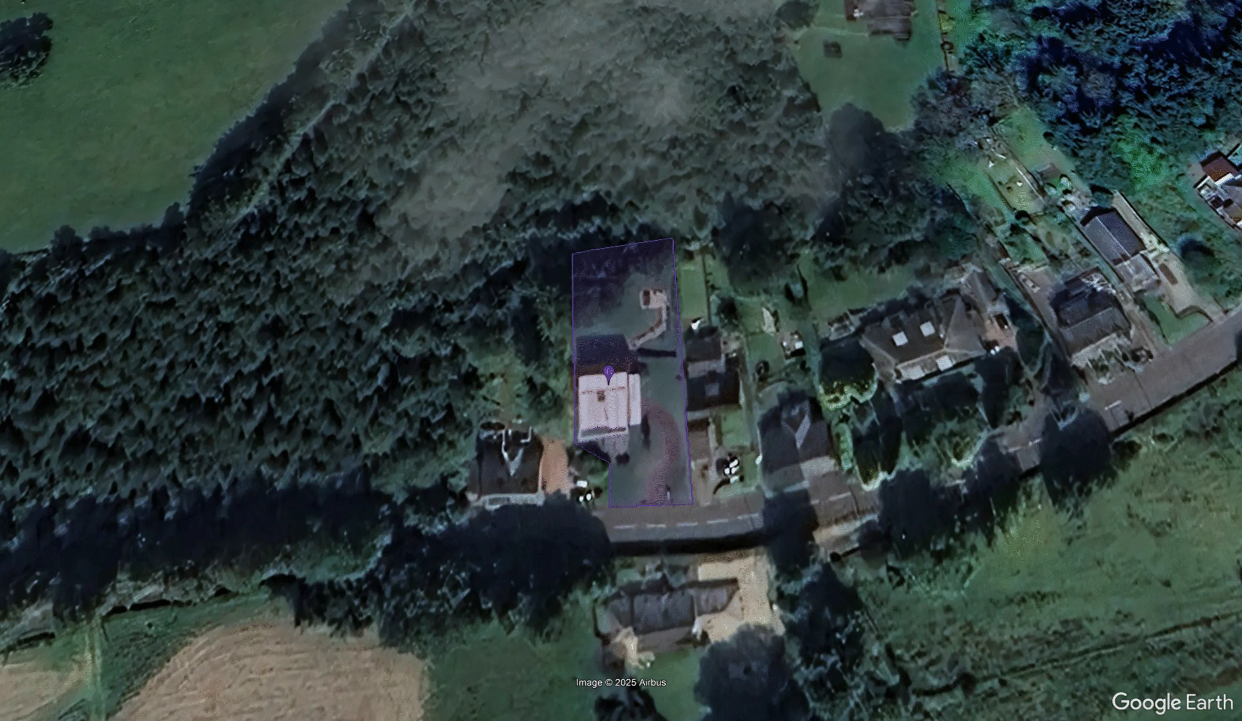
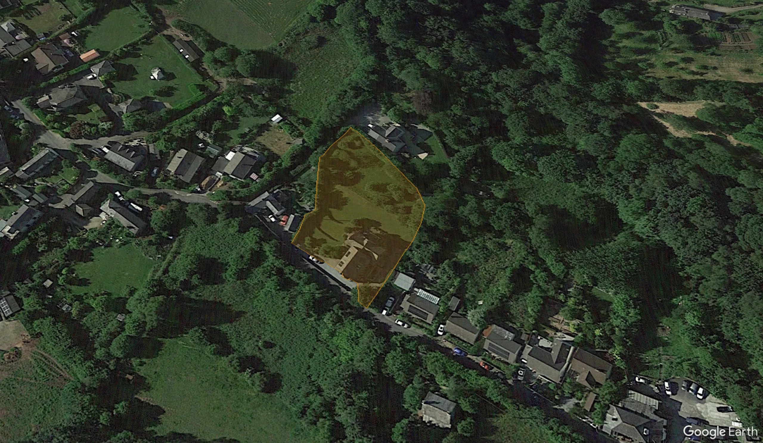
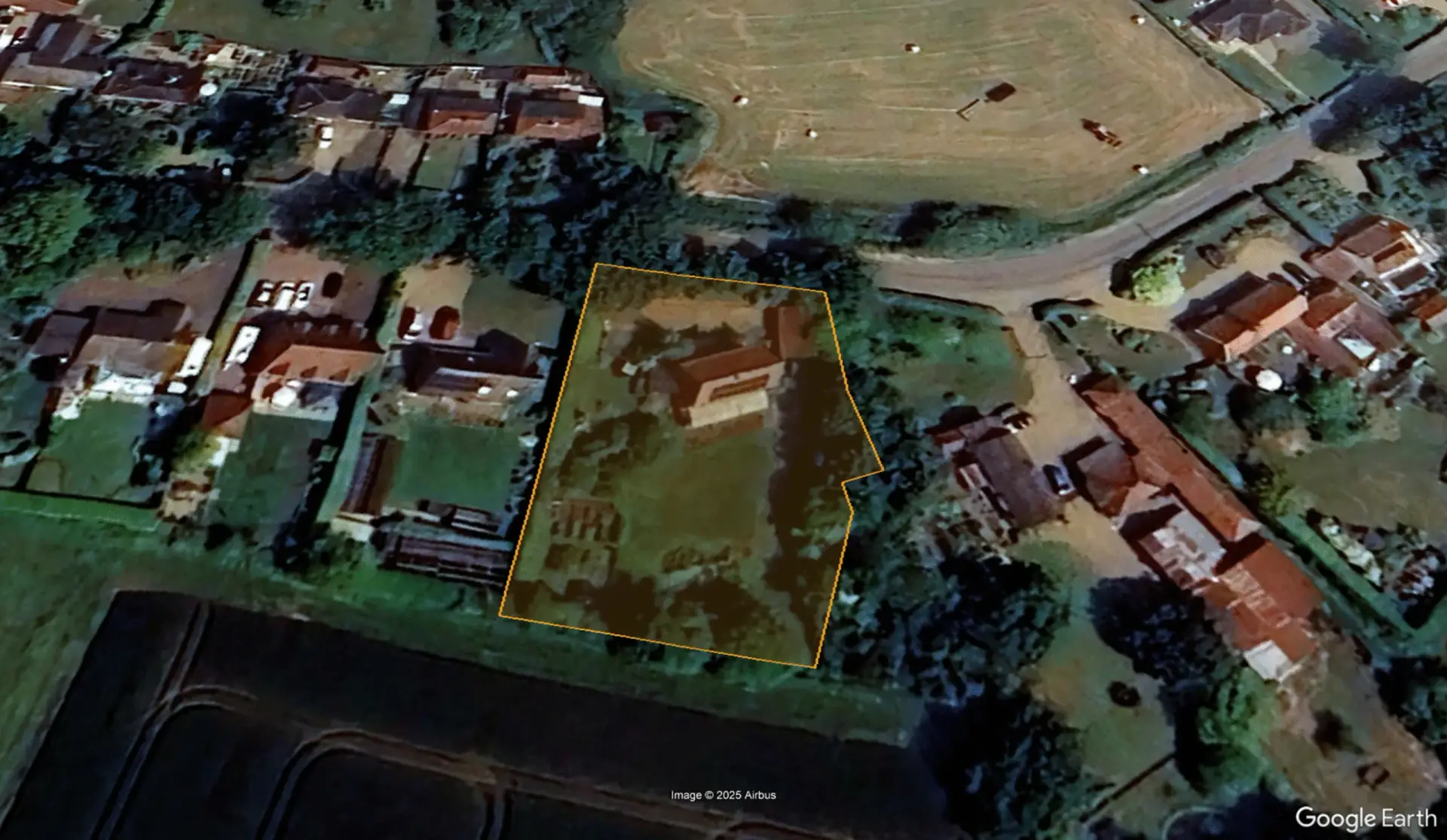
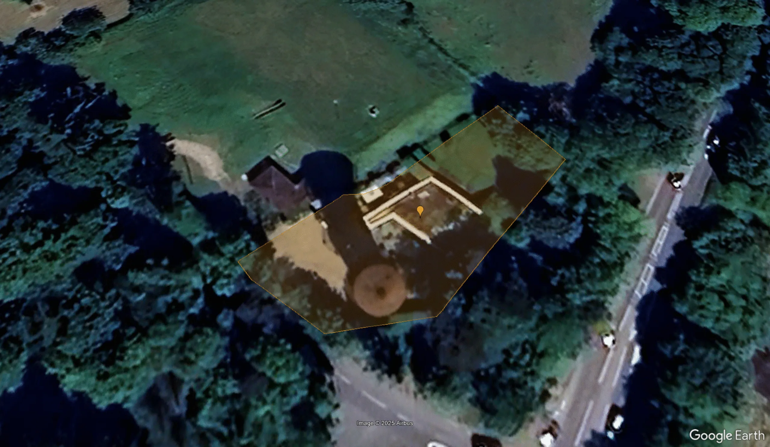
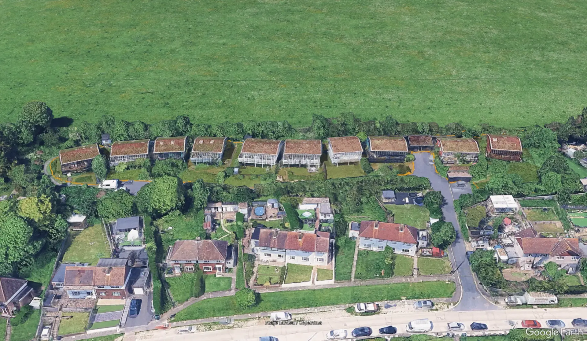
How accurate is the map?
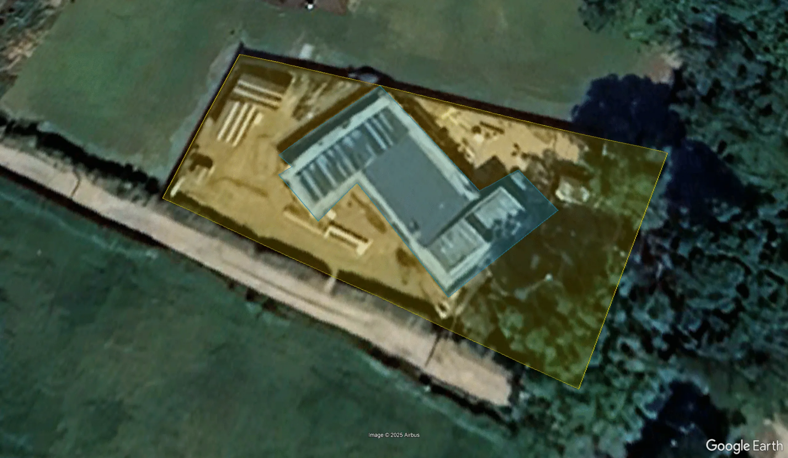
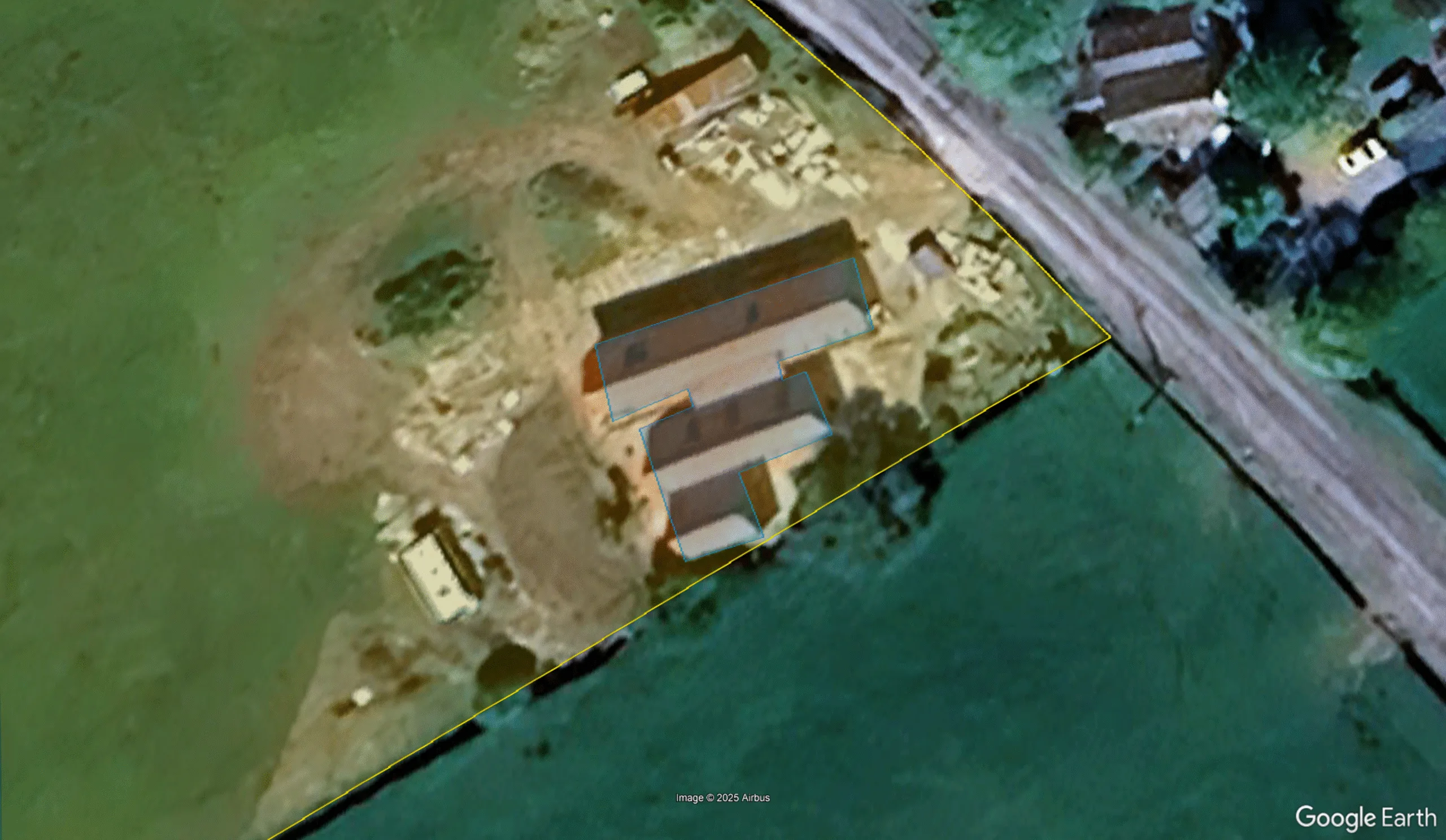
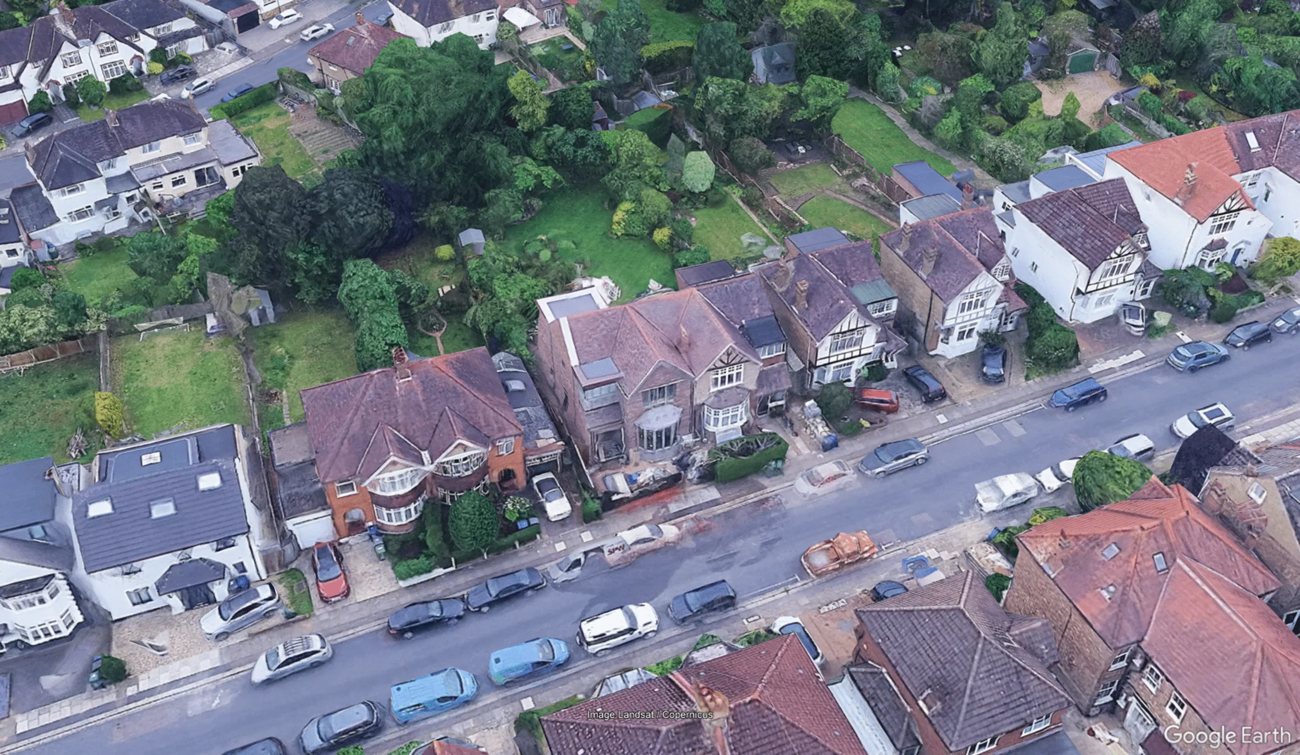
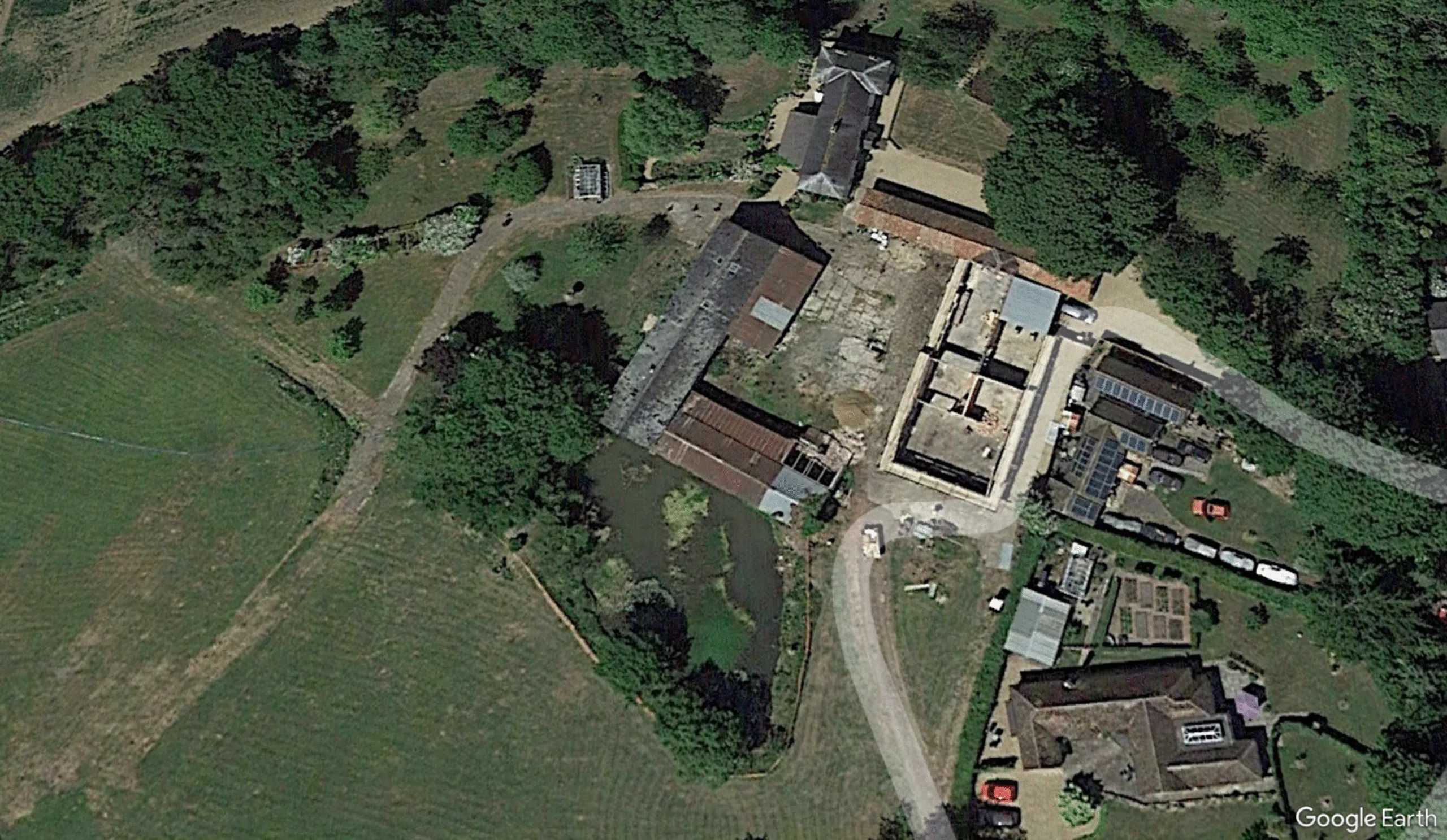
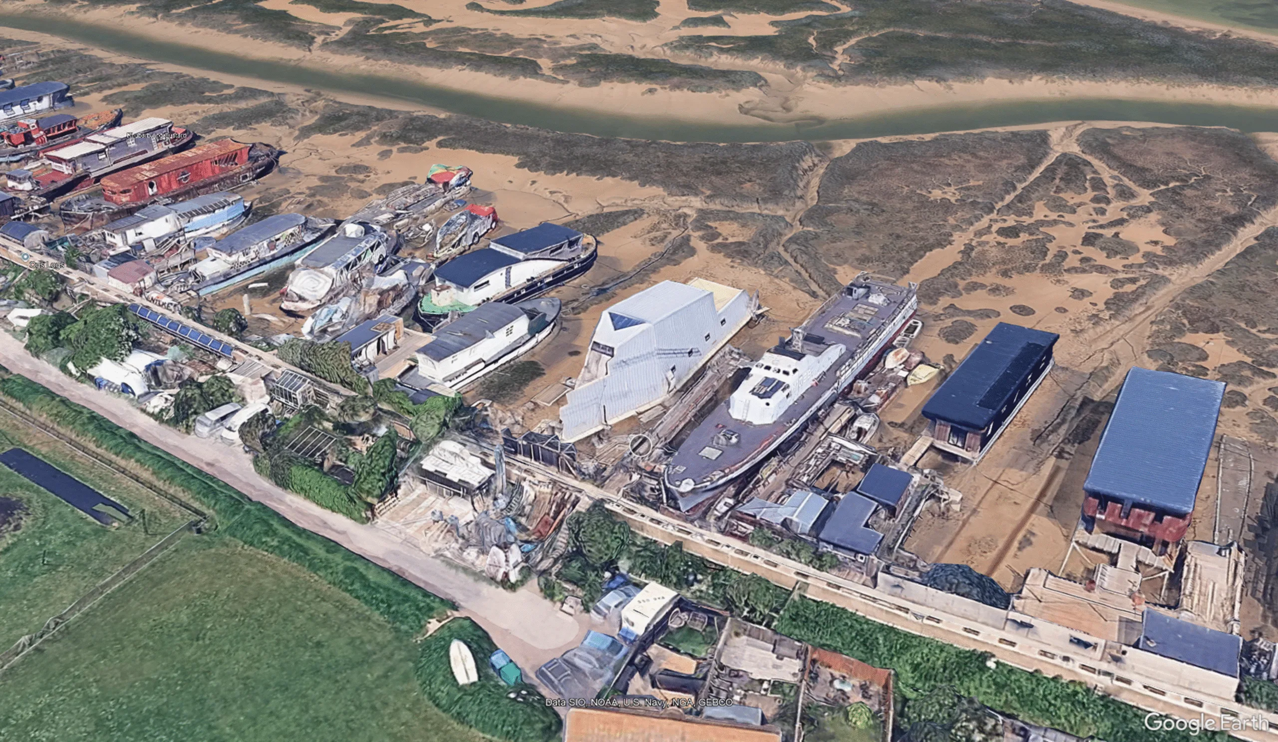
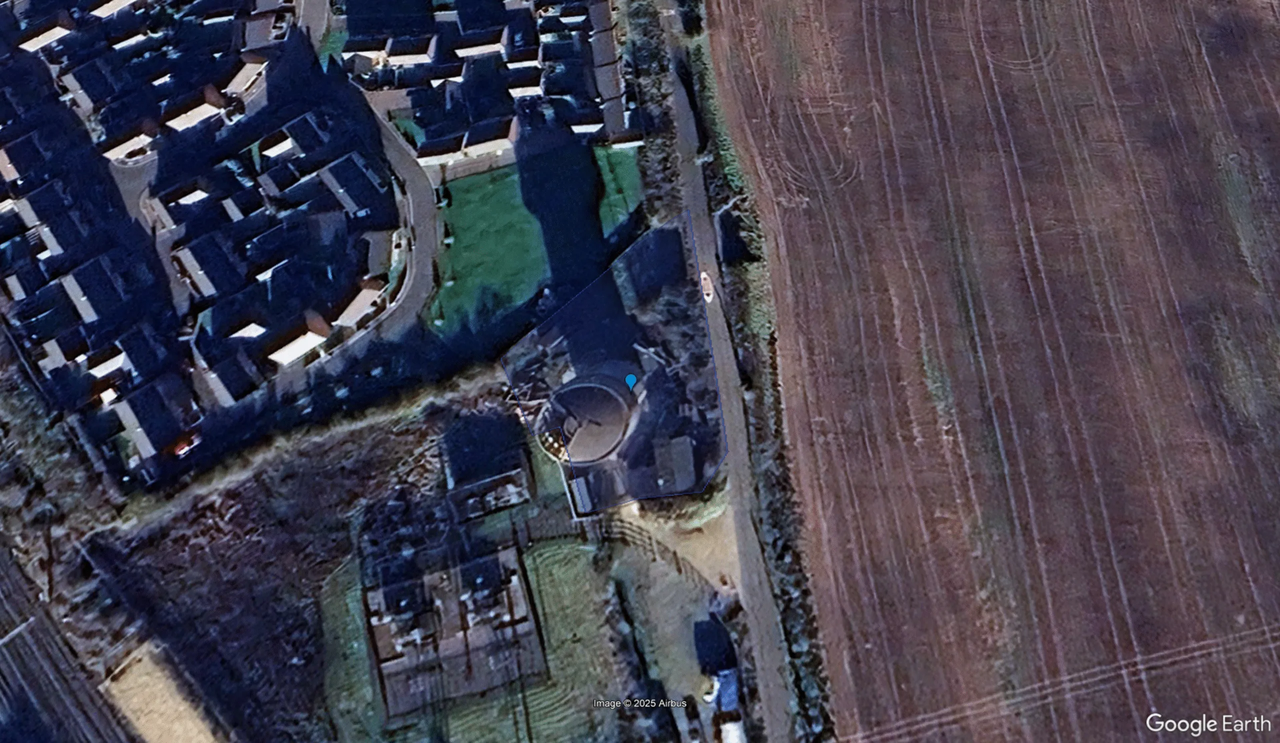
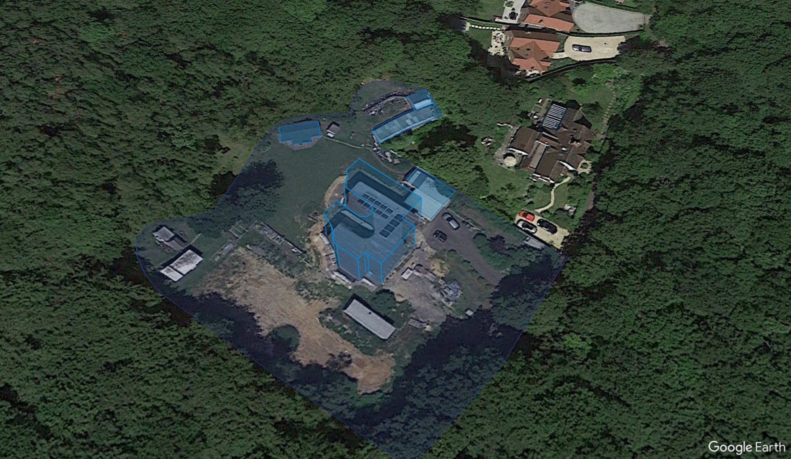
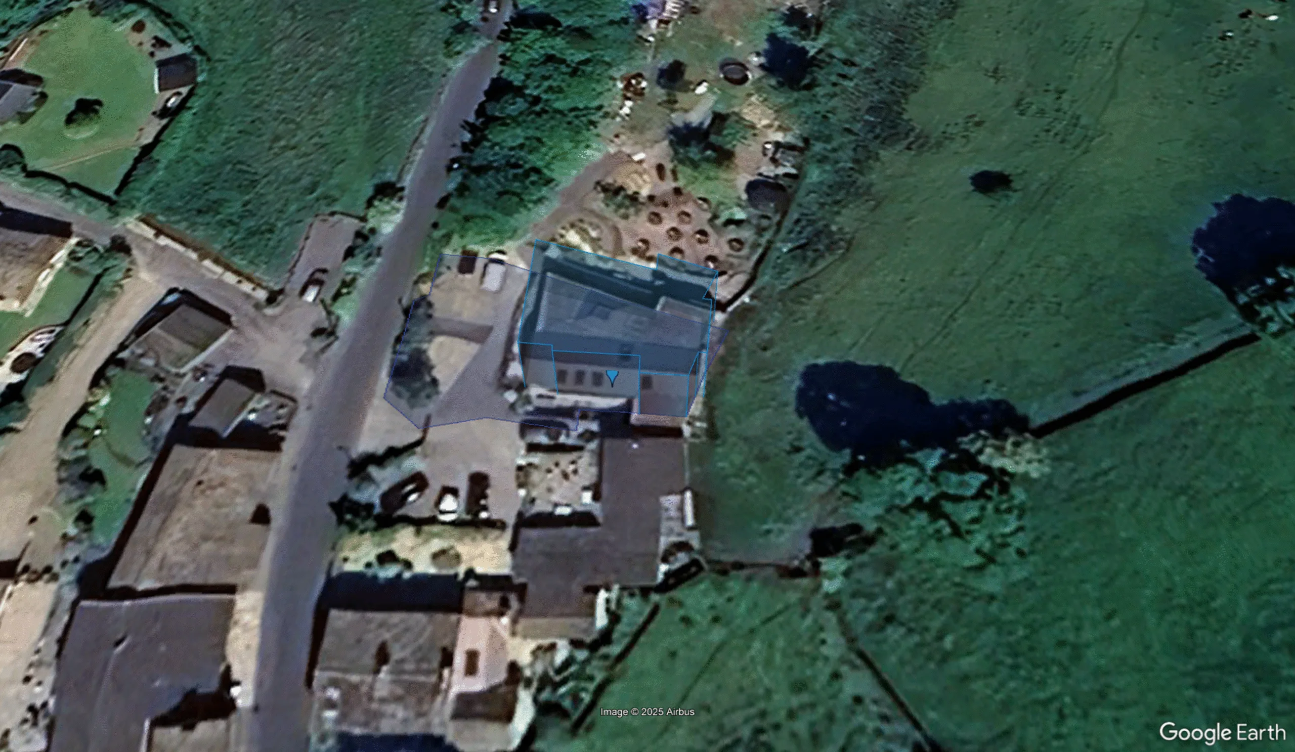
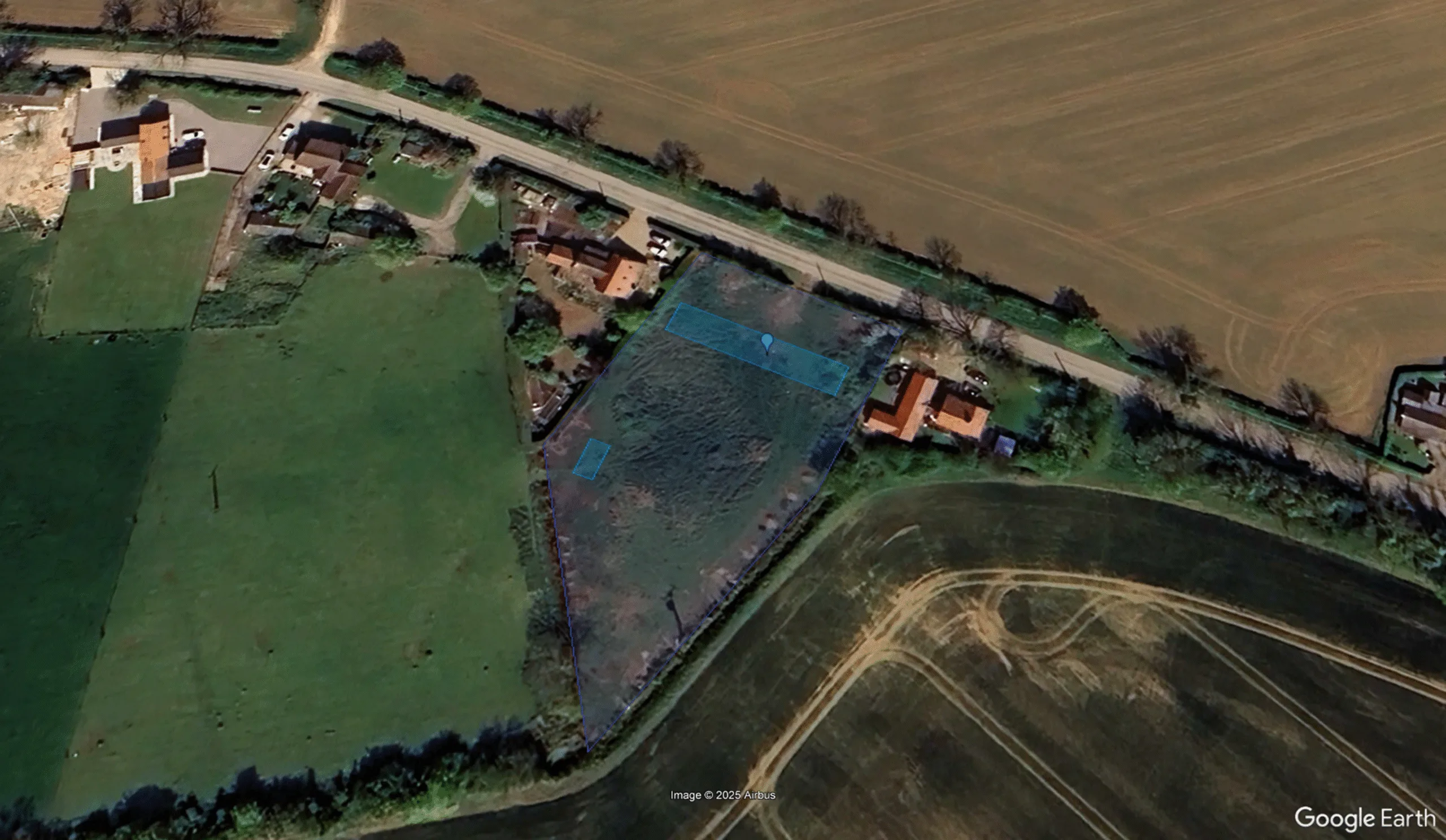
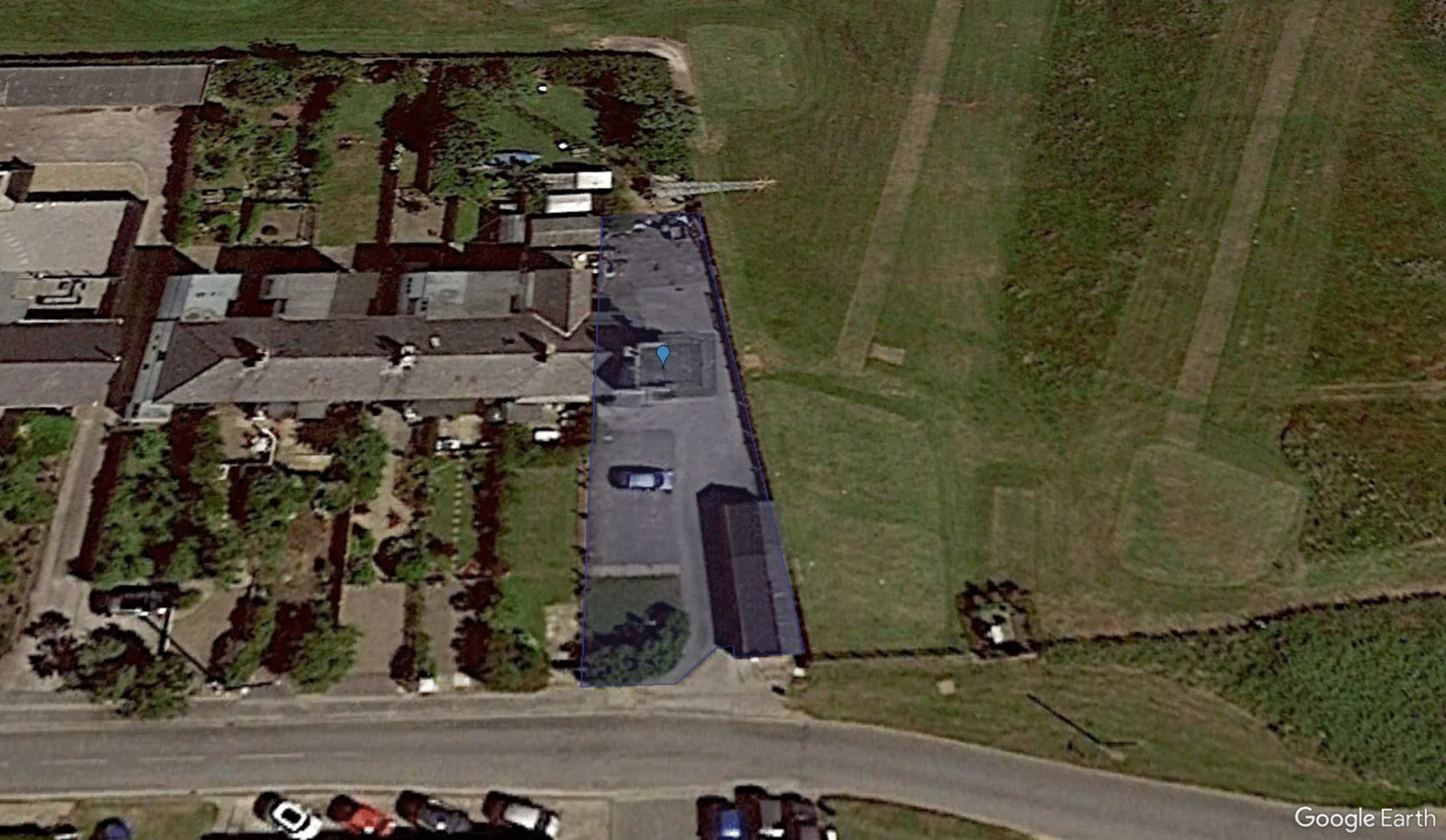
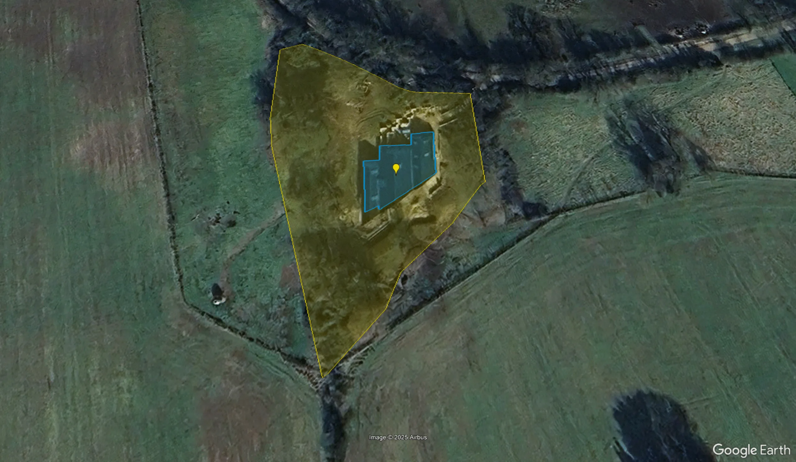
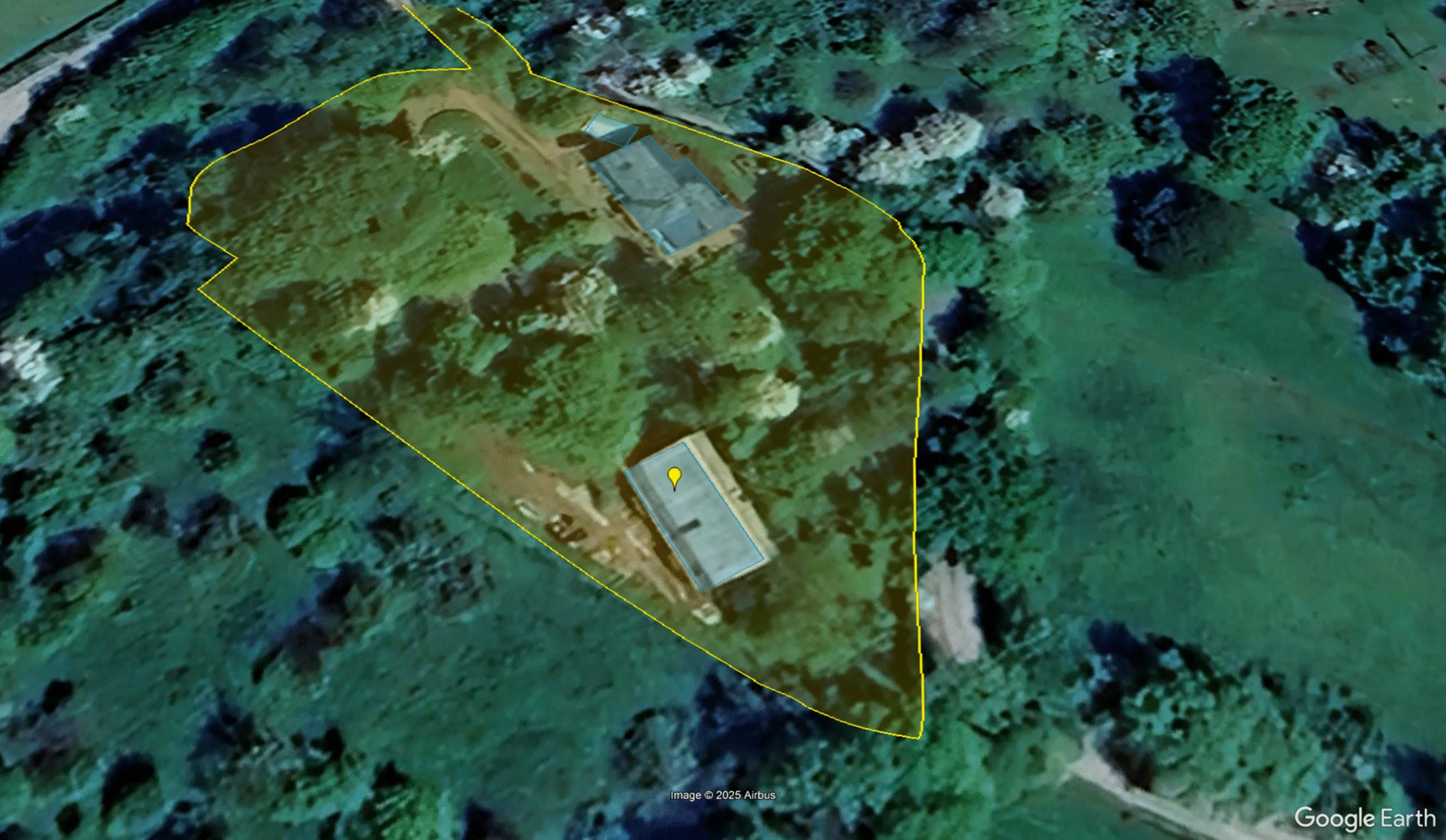
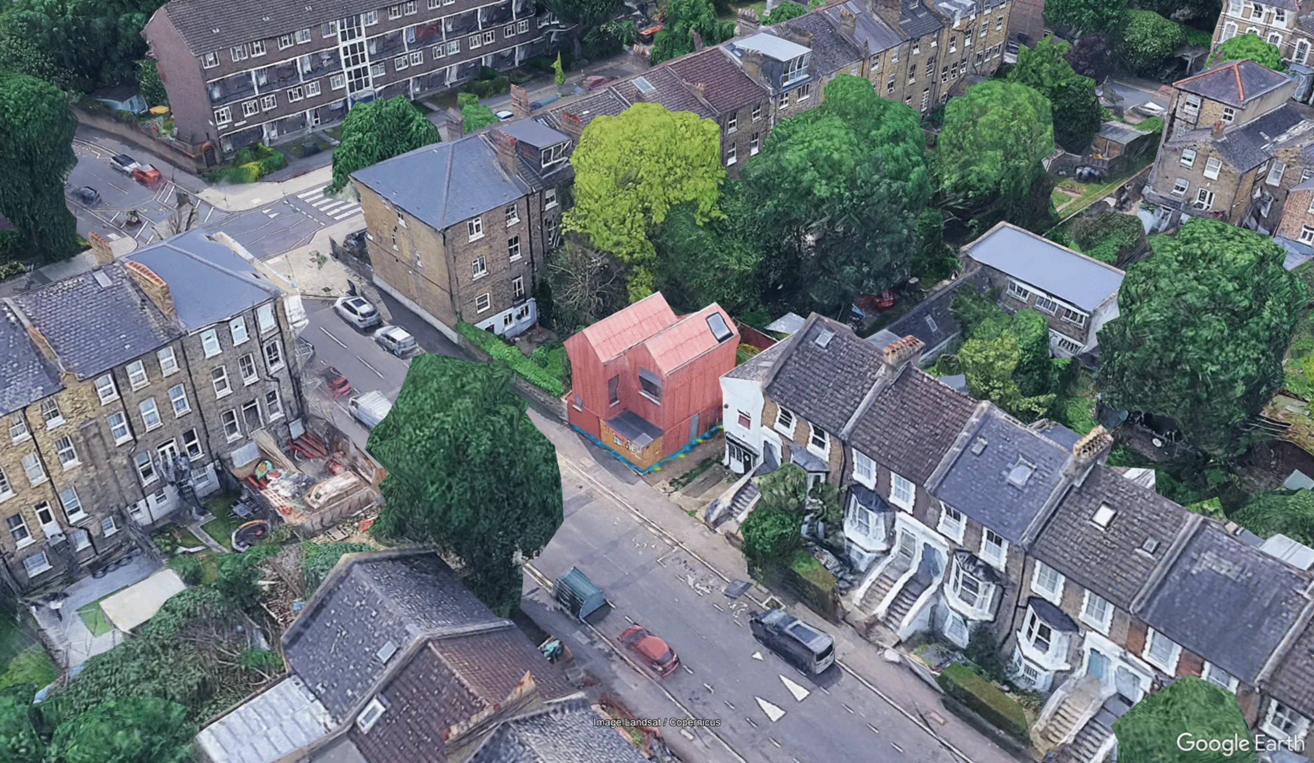
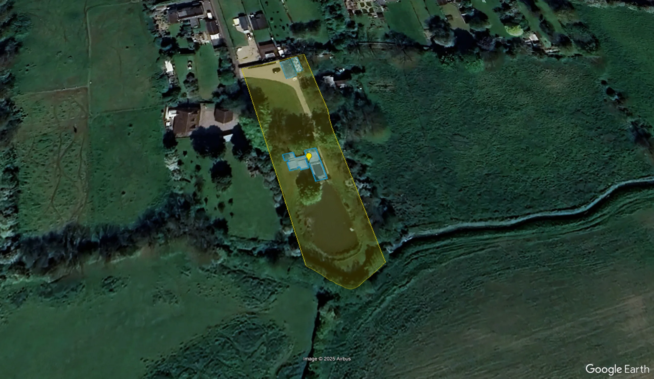
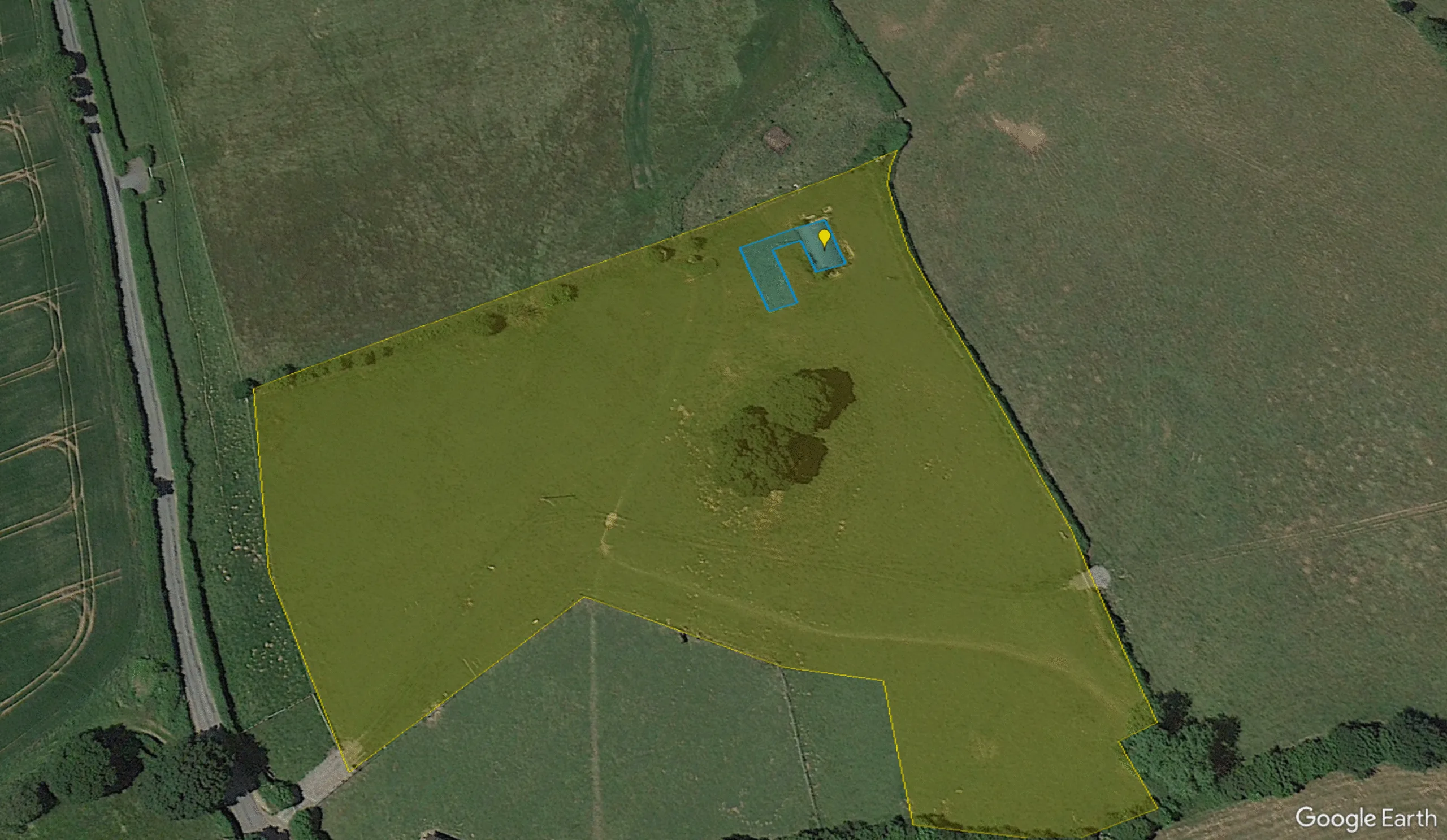
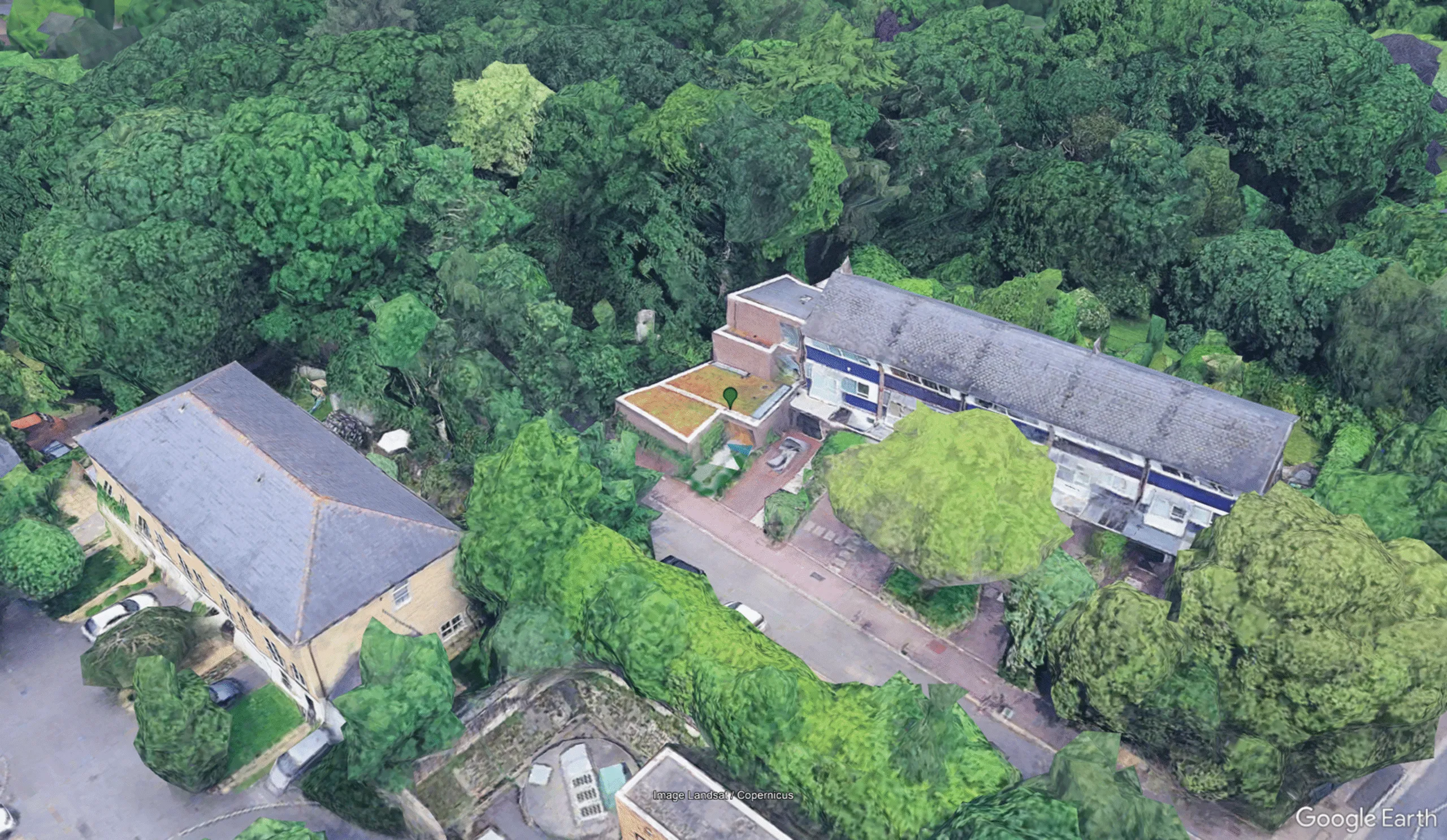
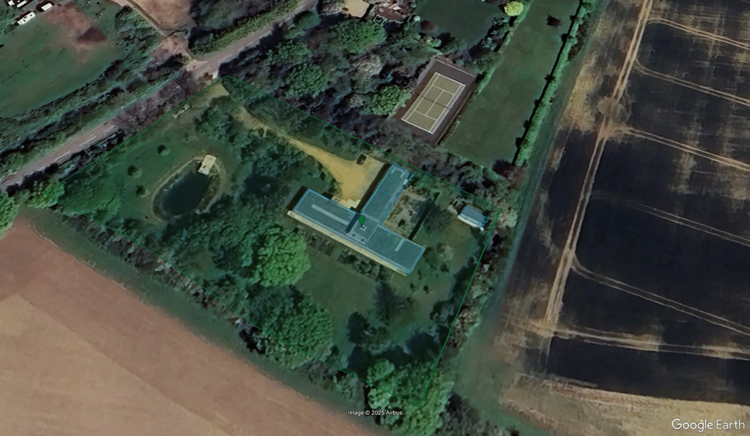
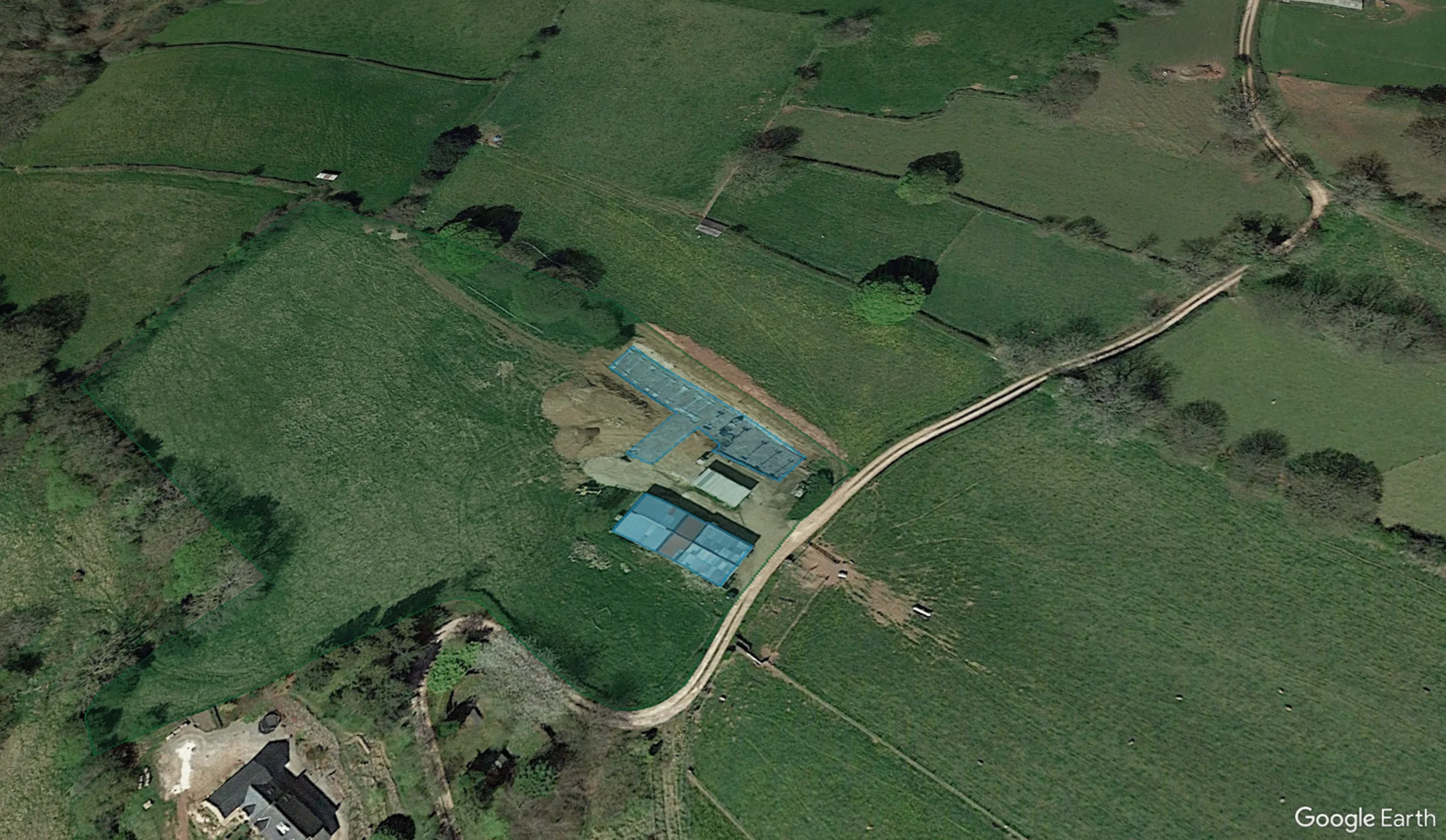
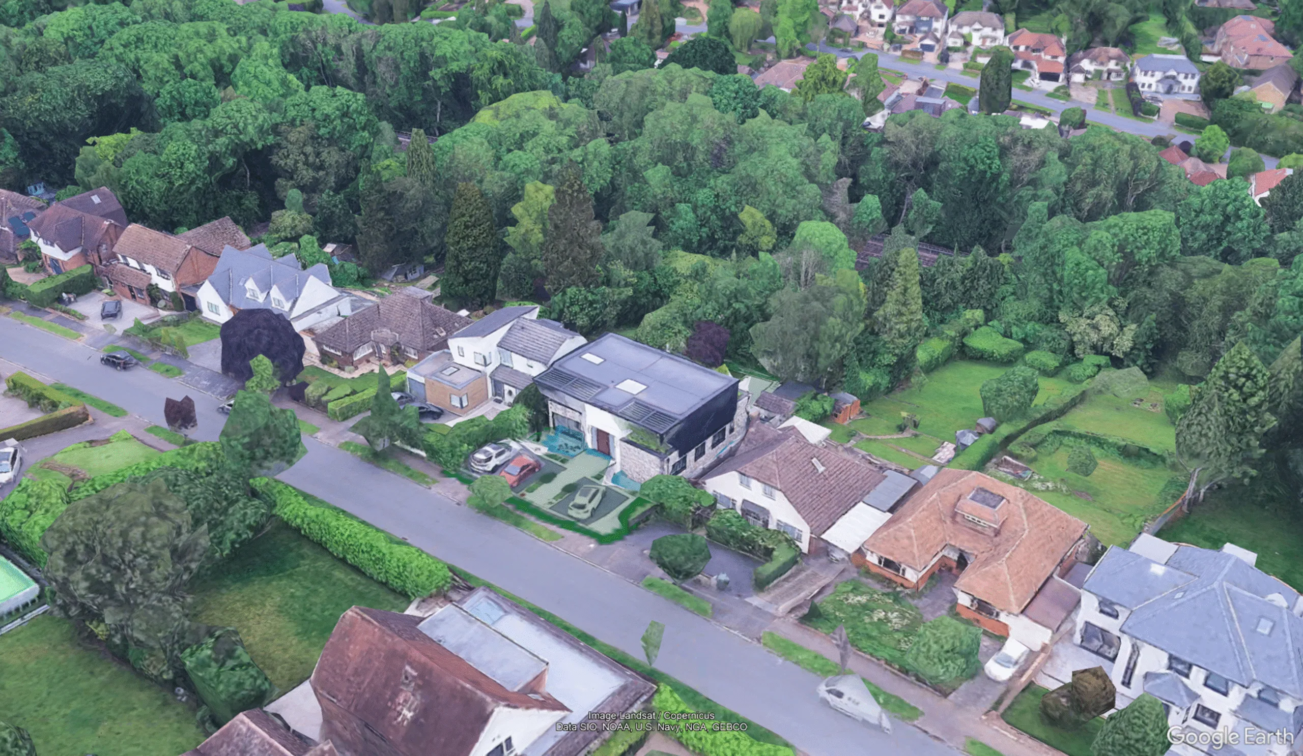
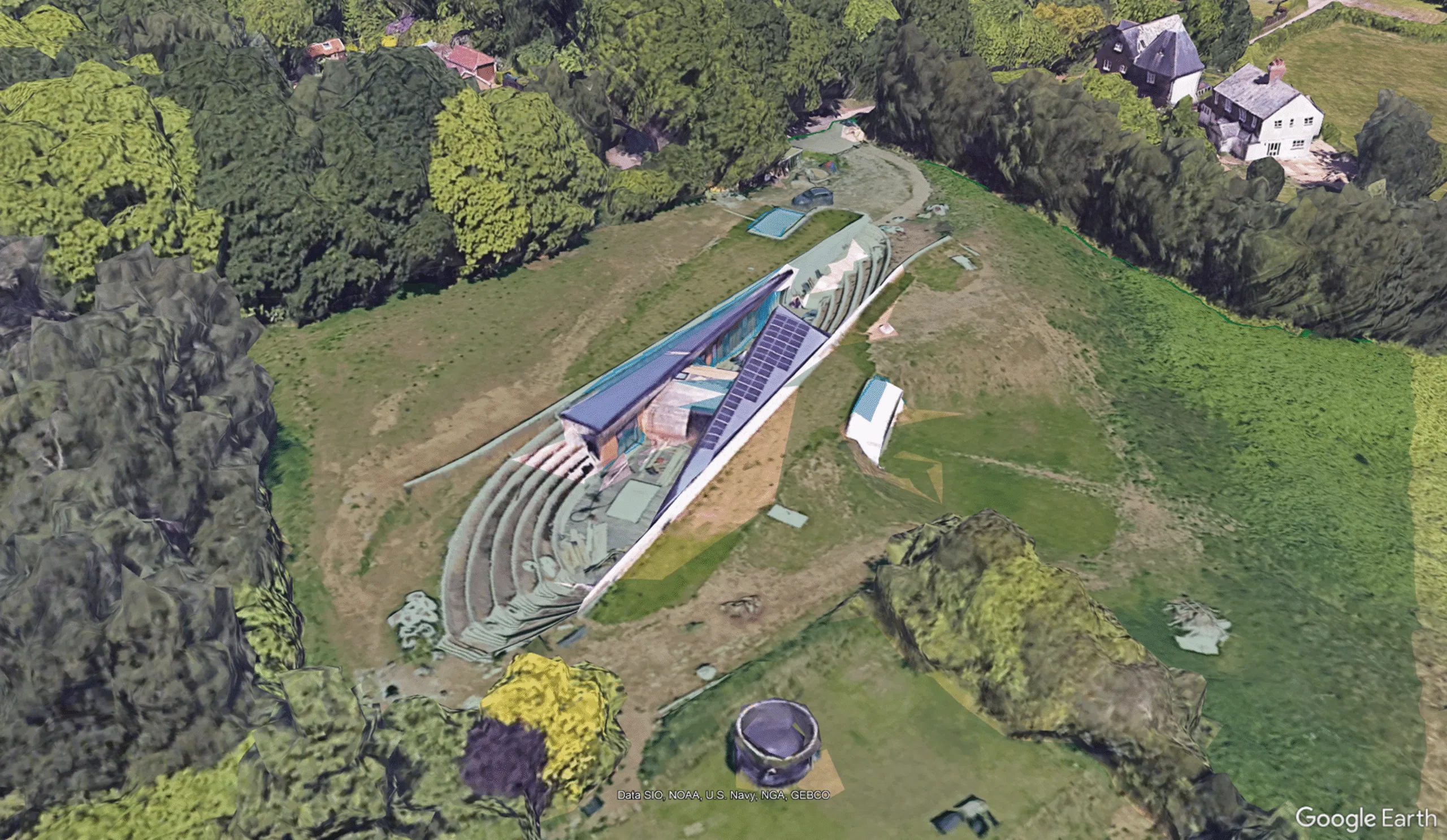
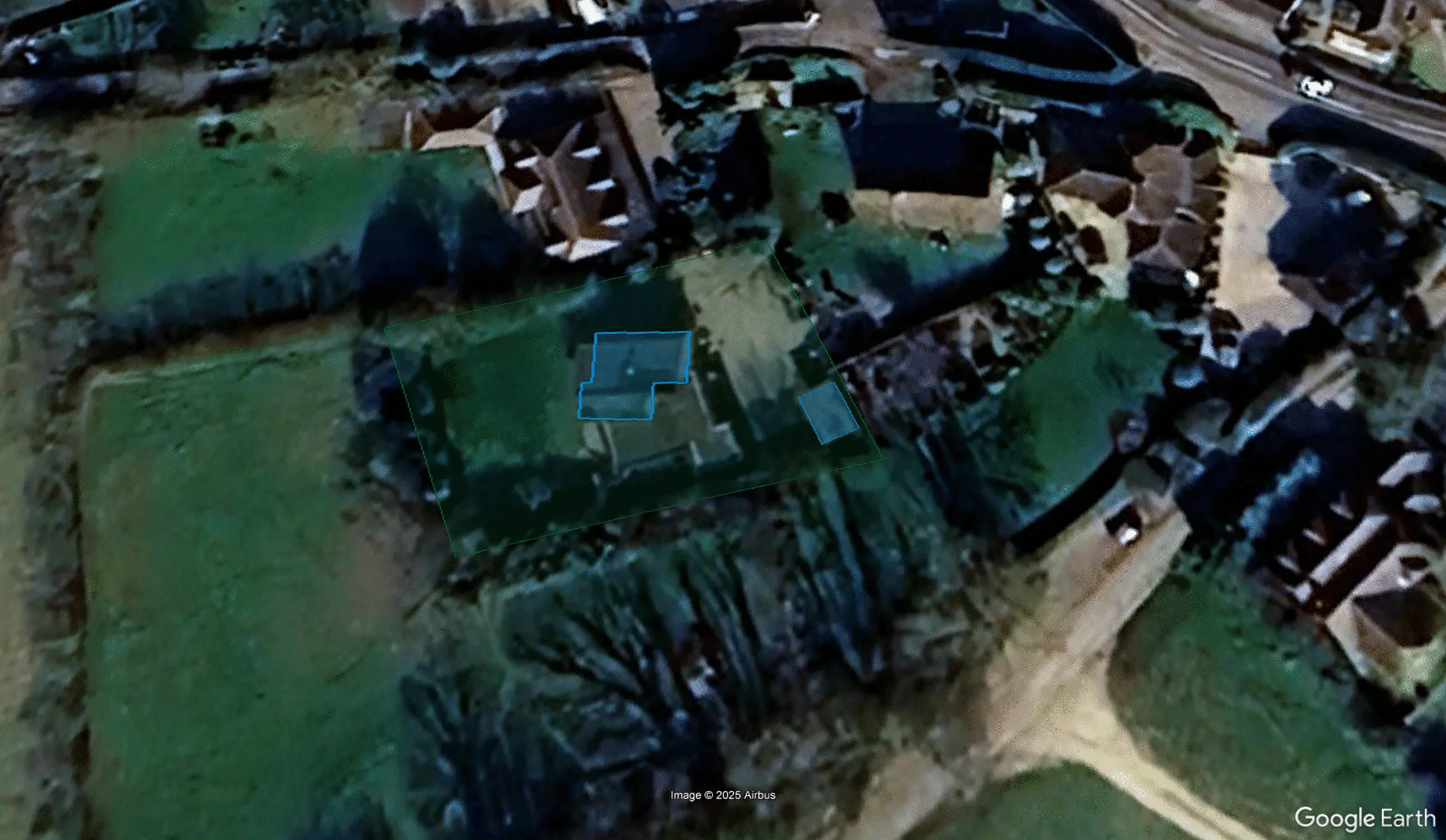
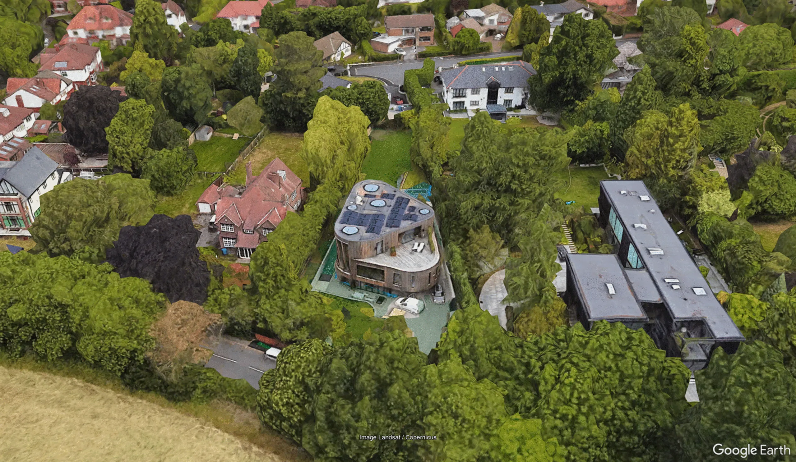
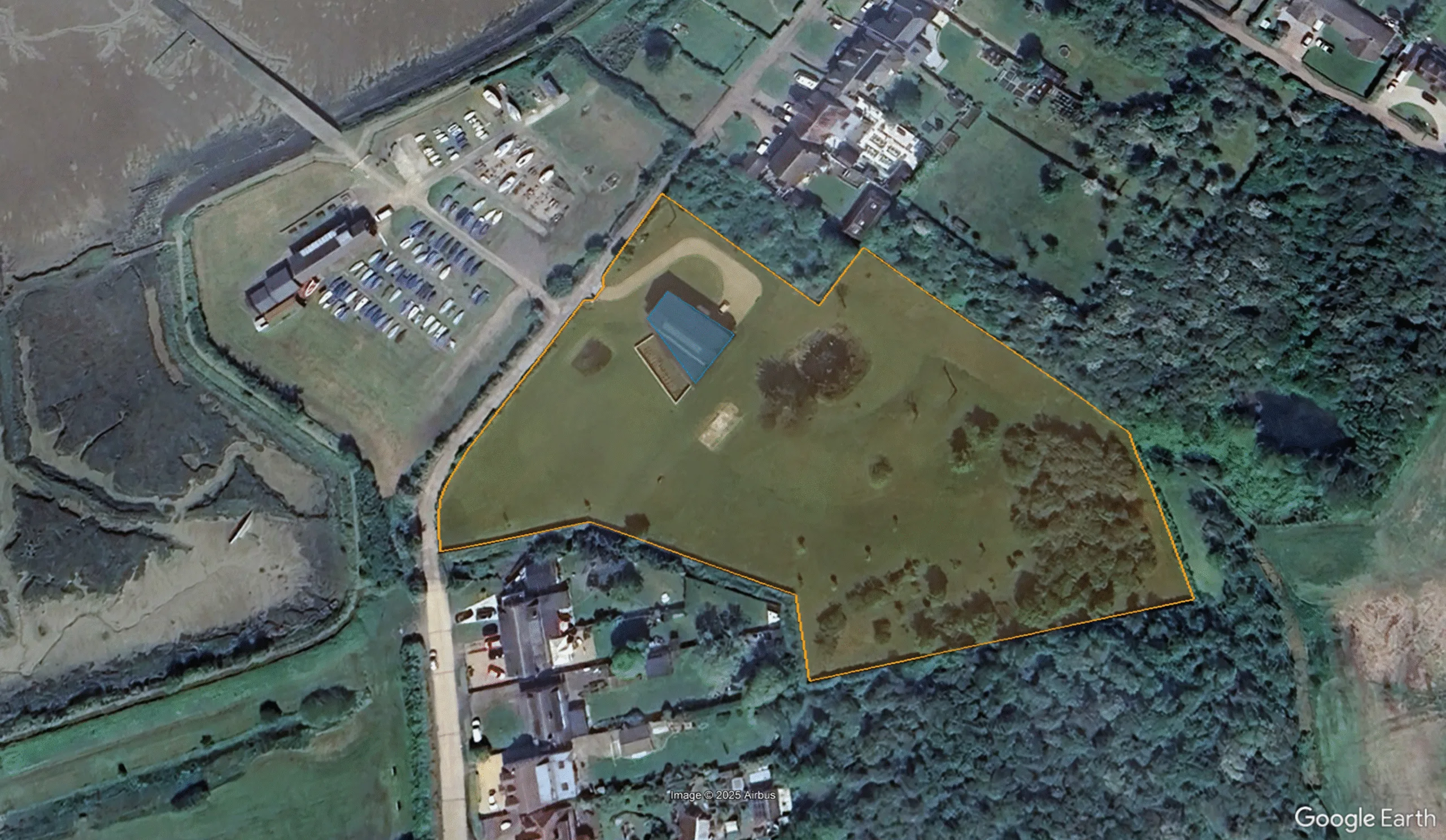
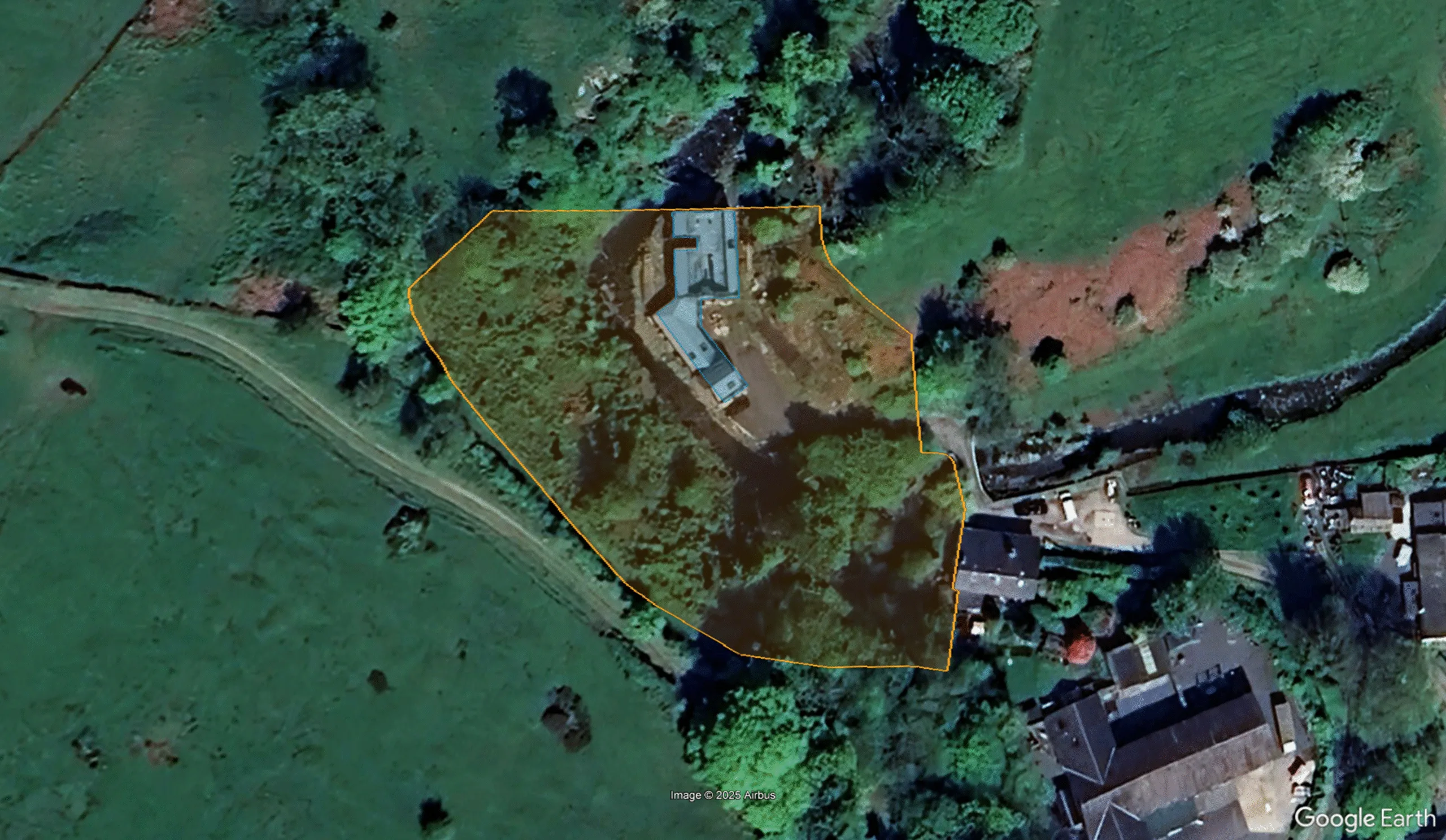
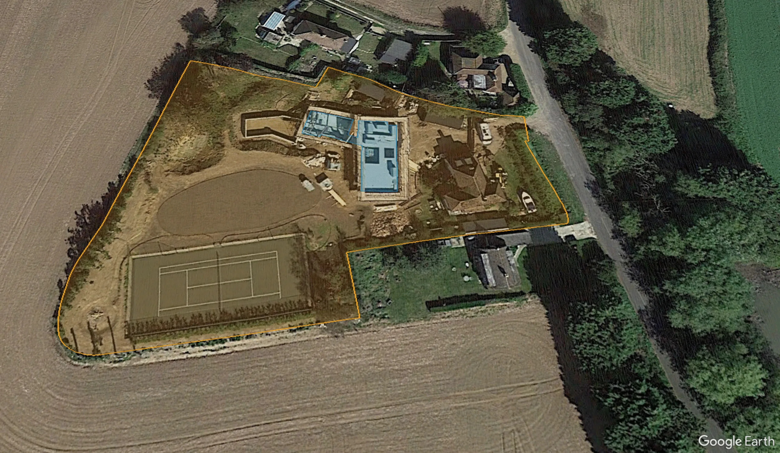
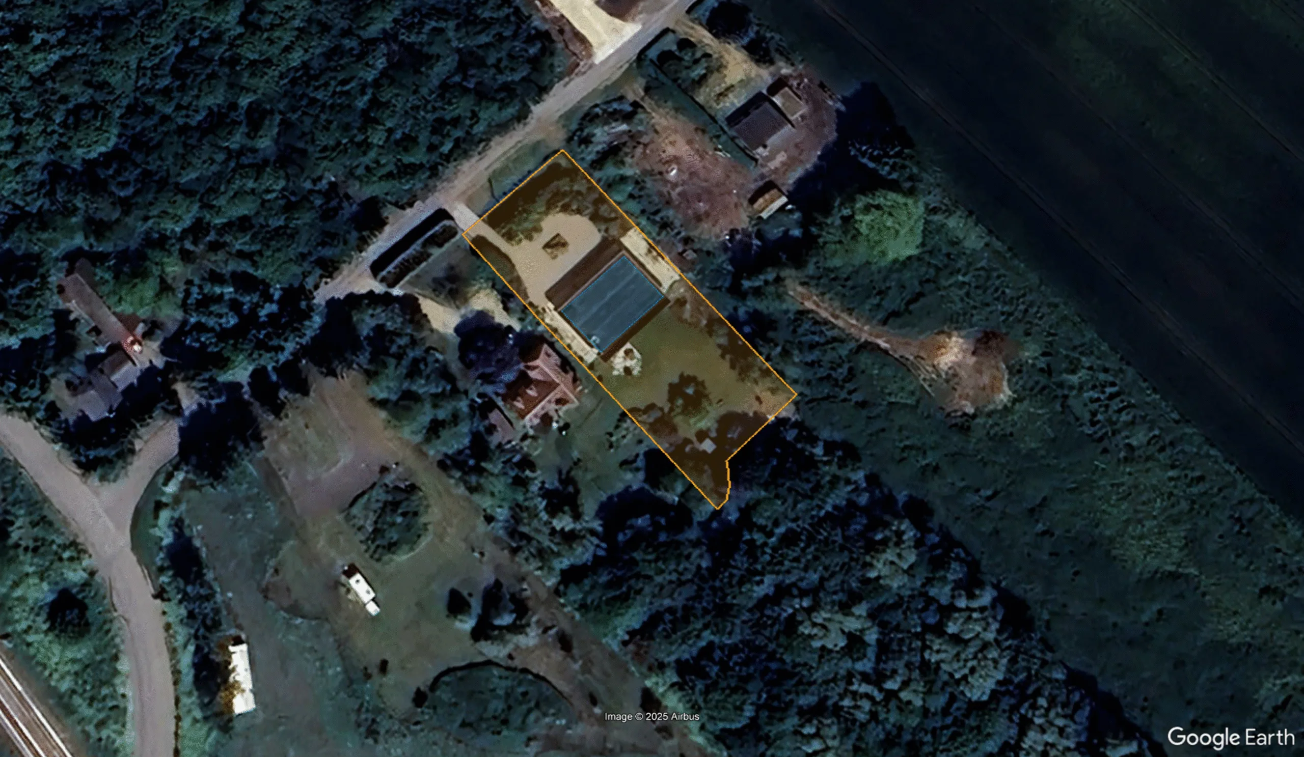
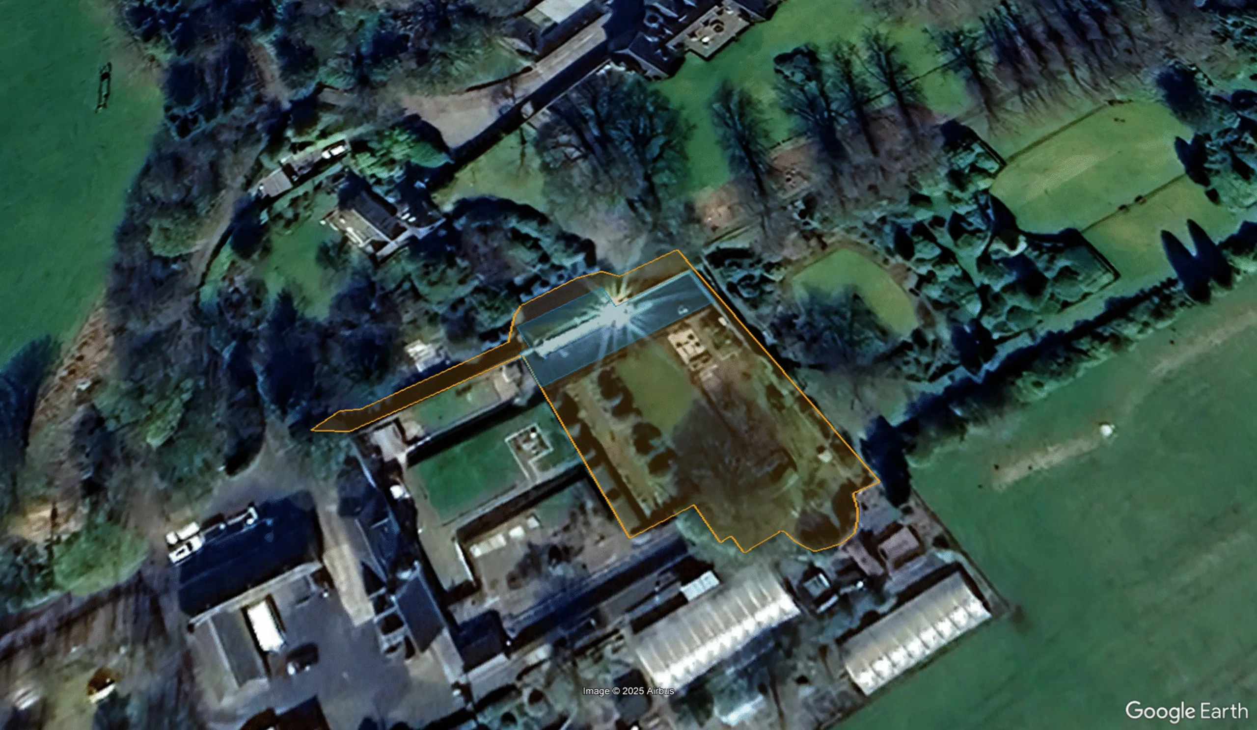
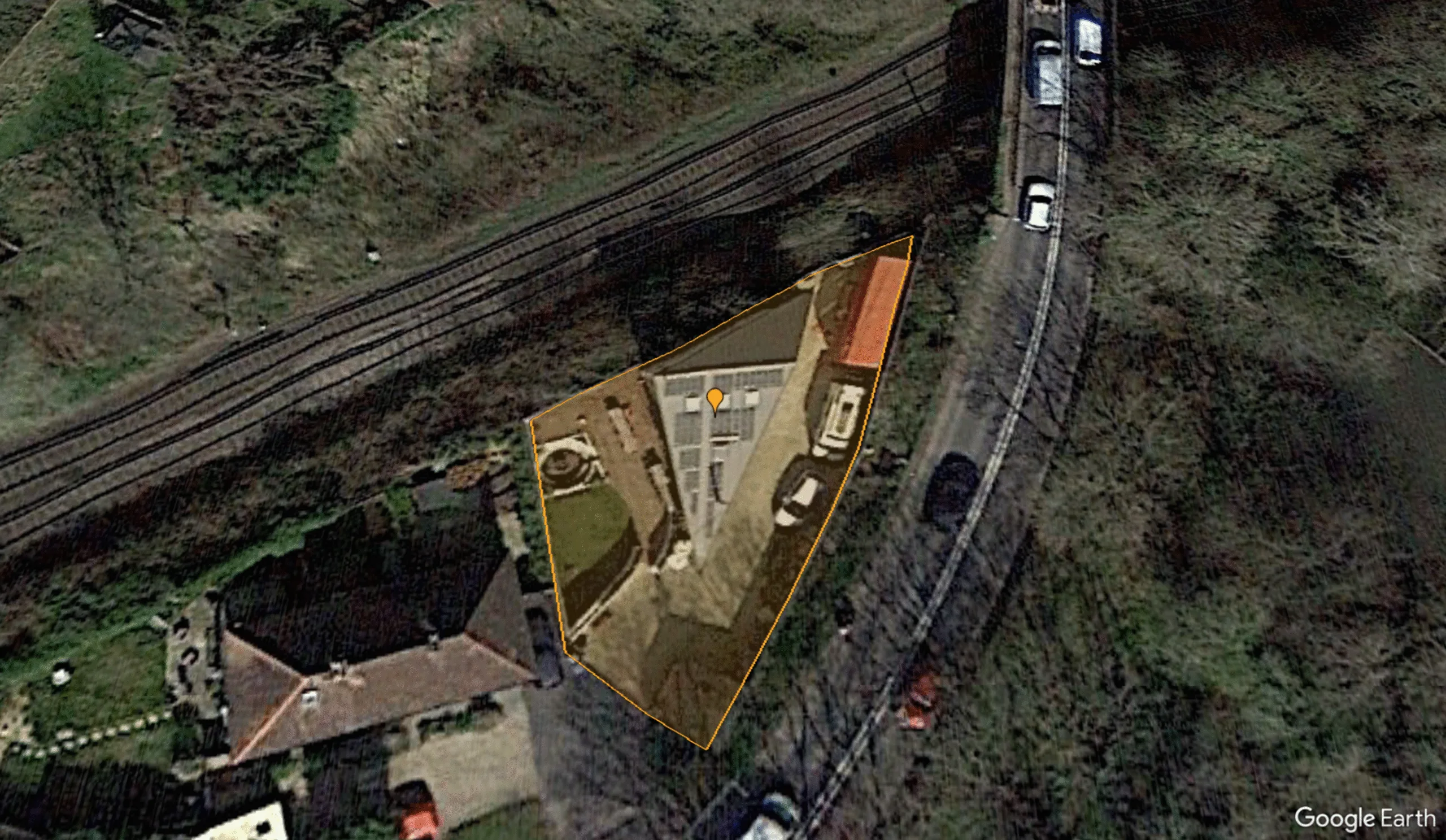
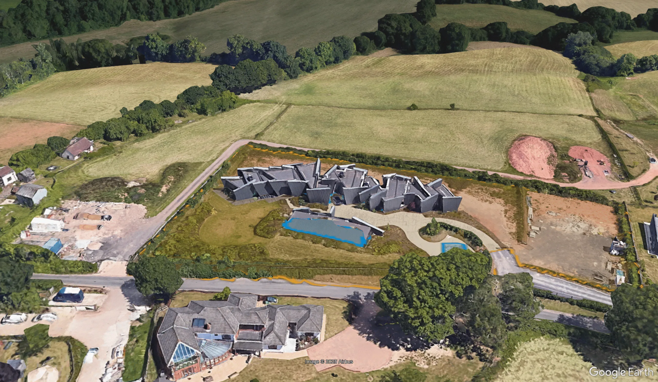
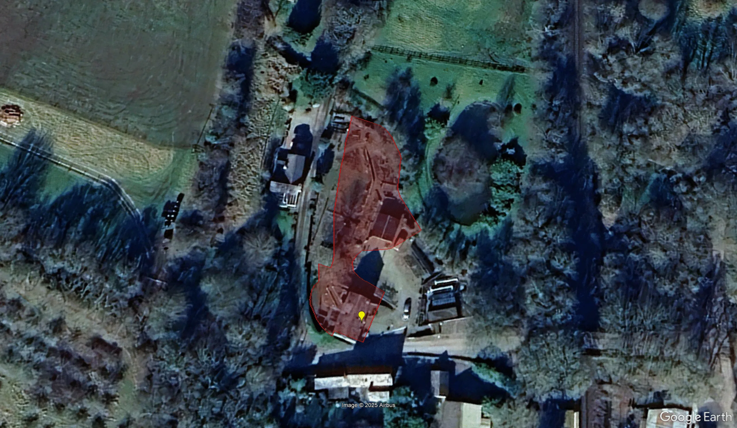
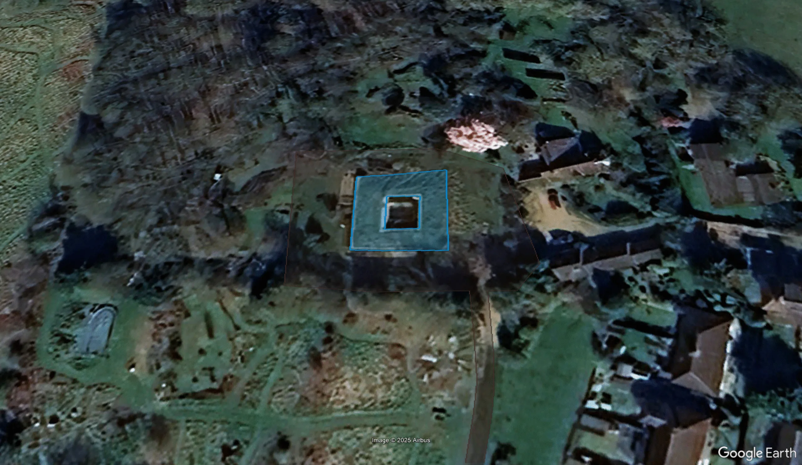
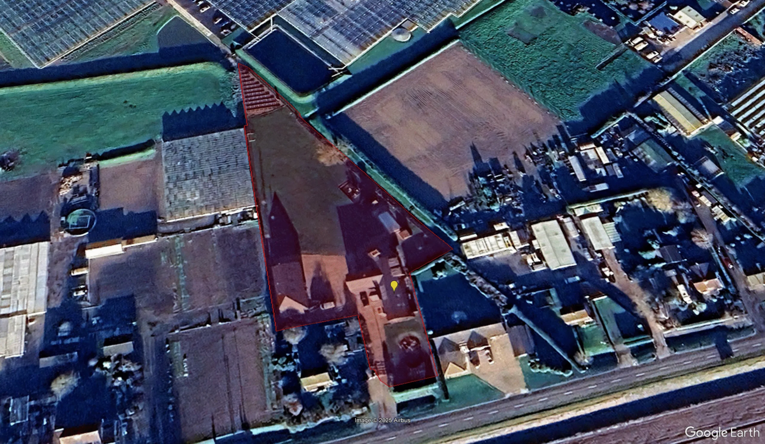
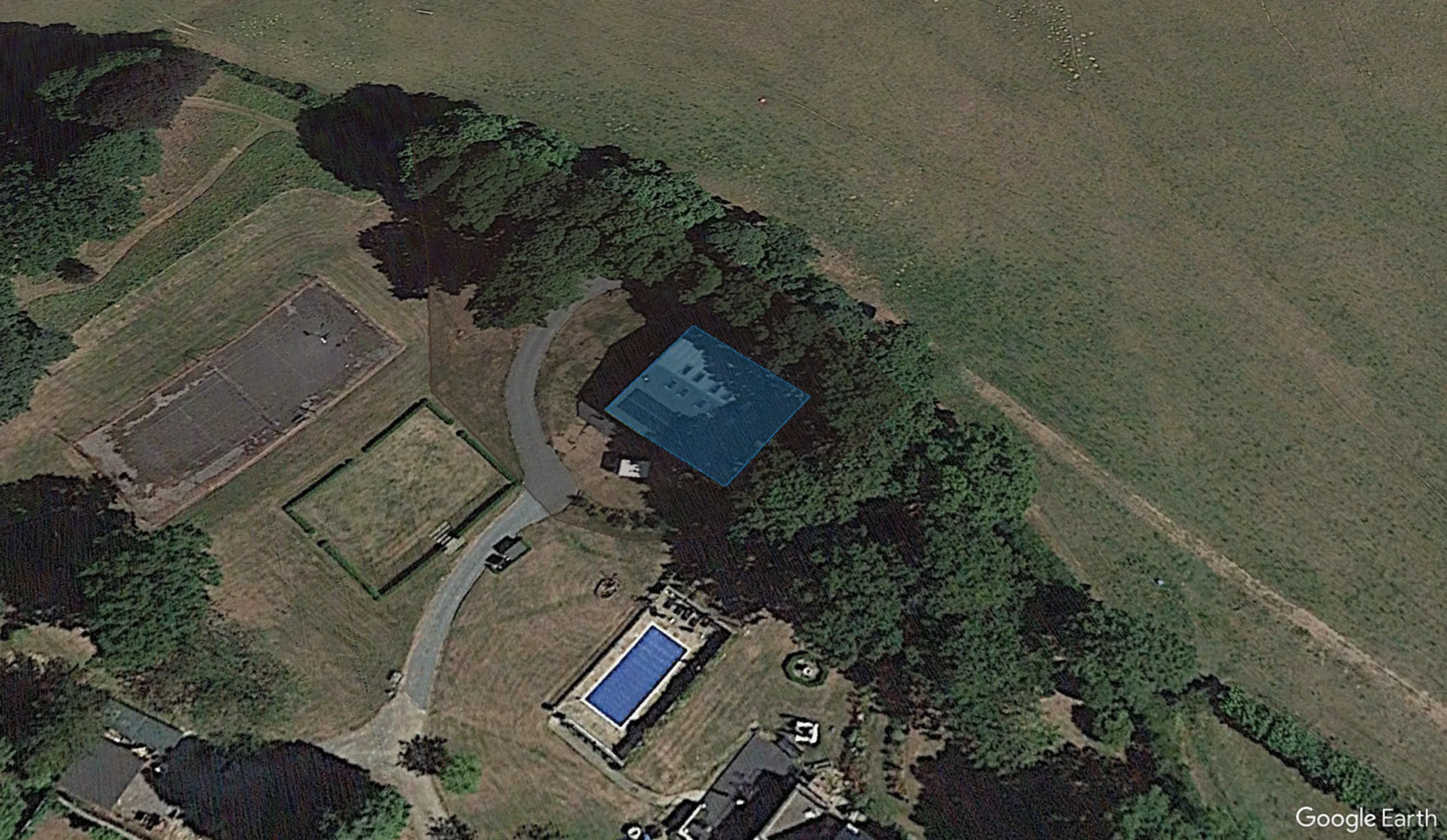
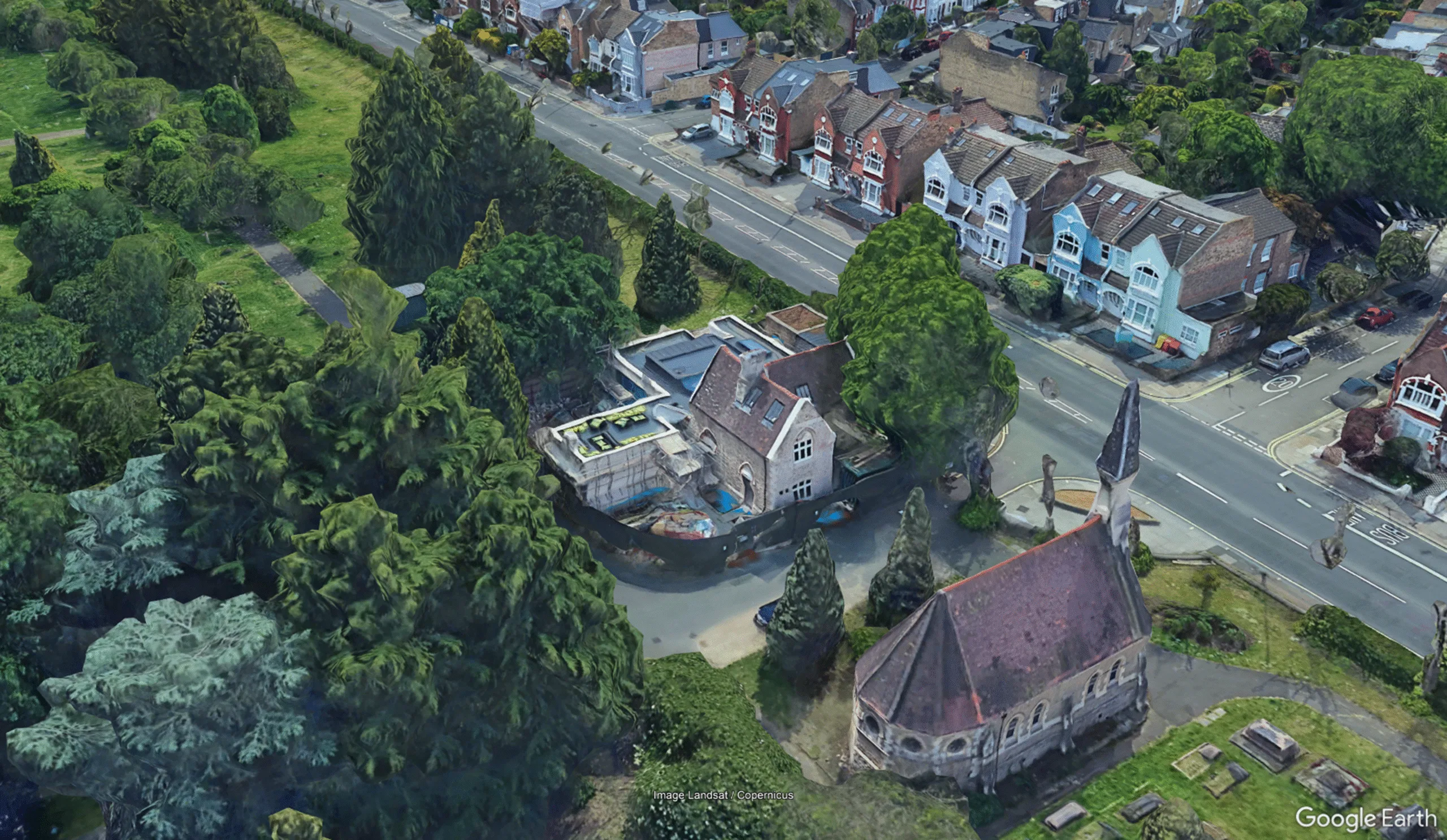
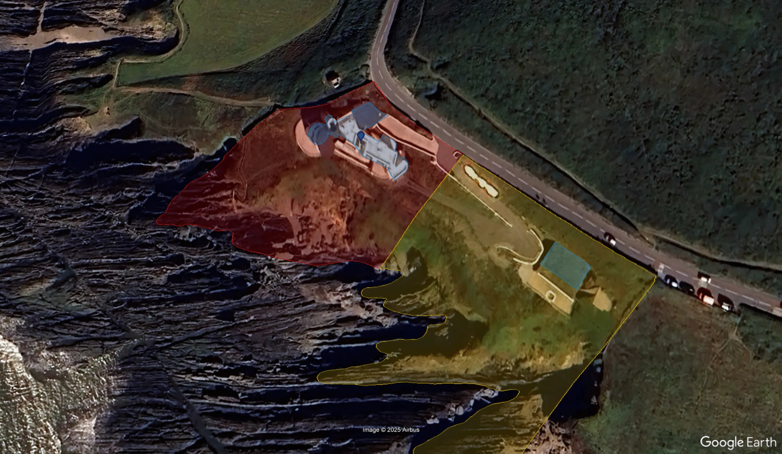
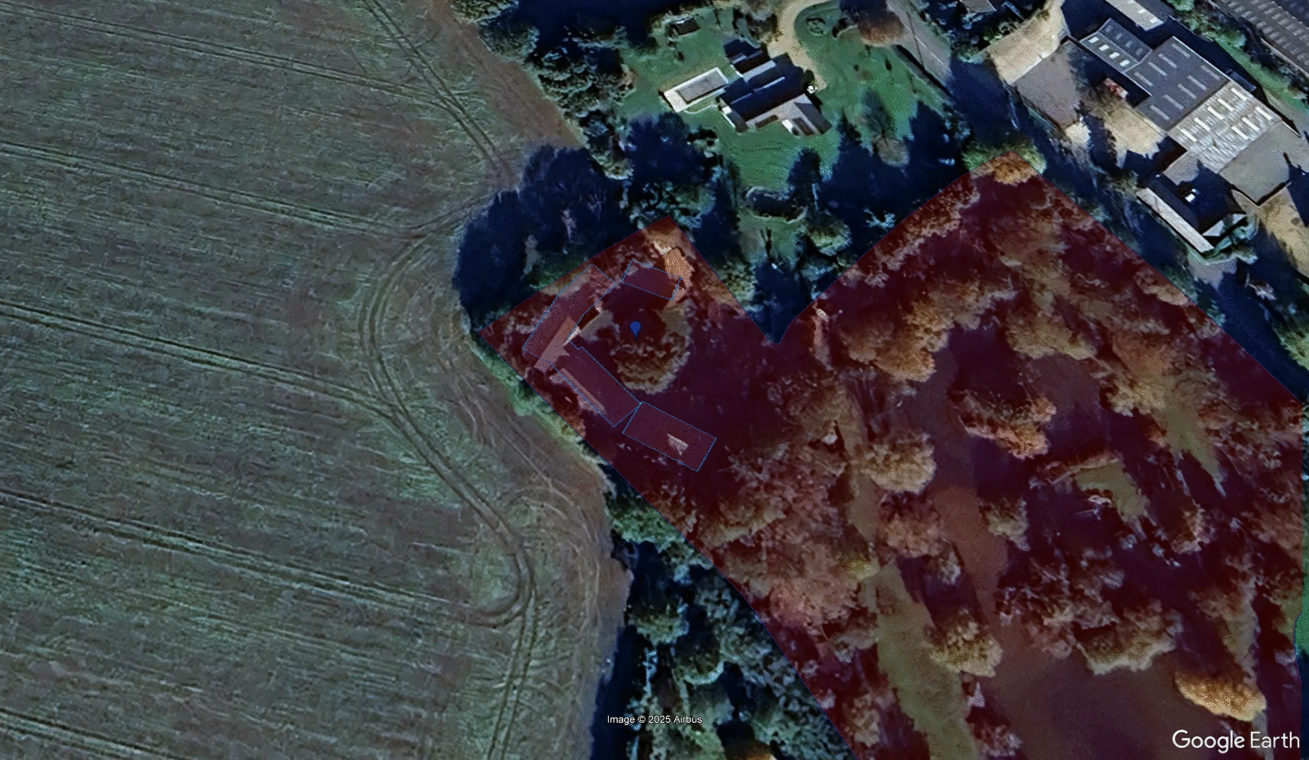
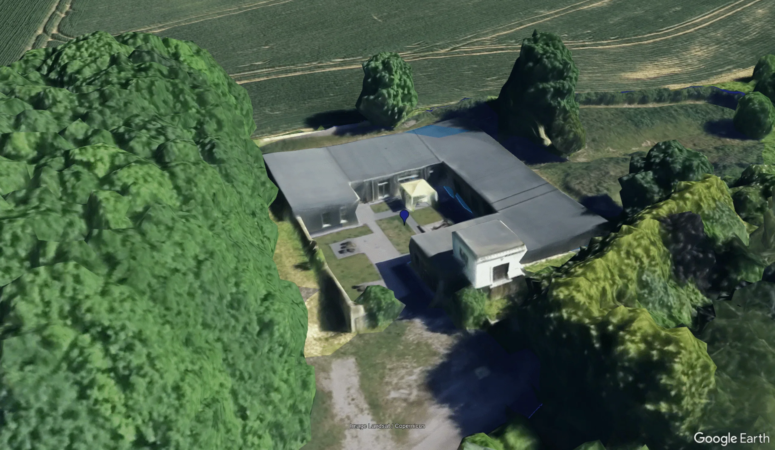
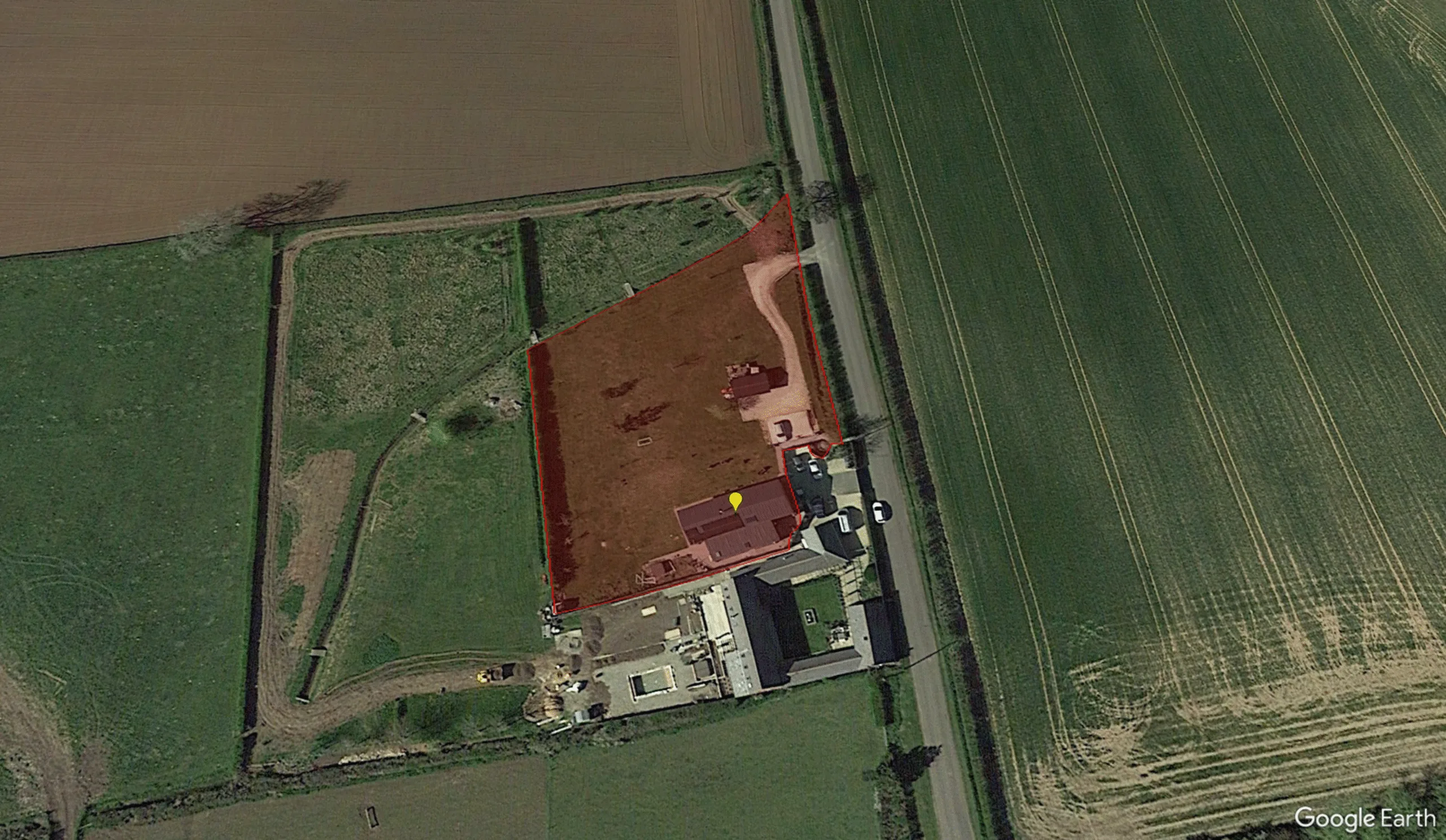
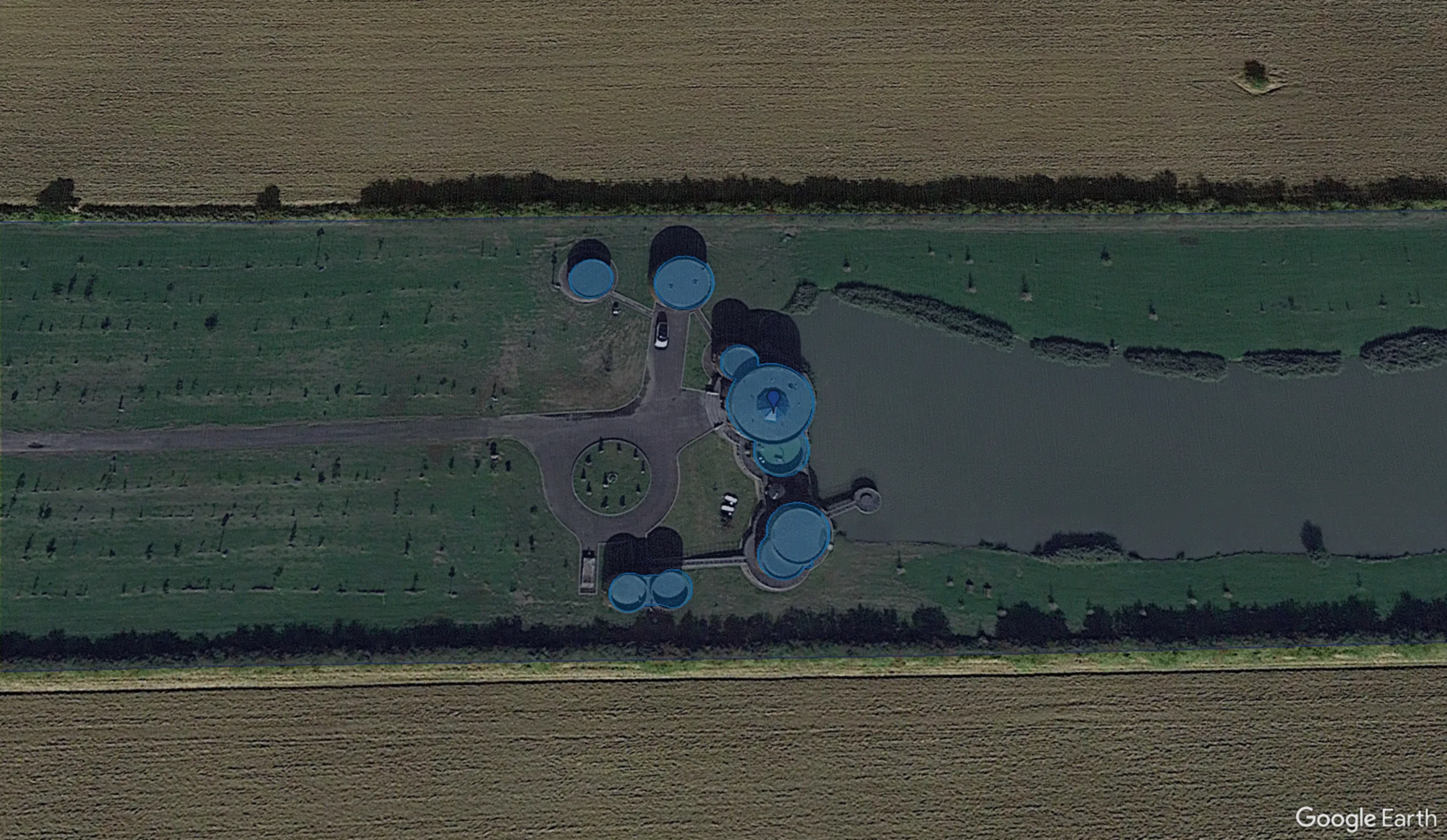
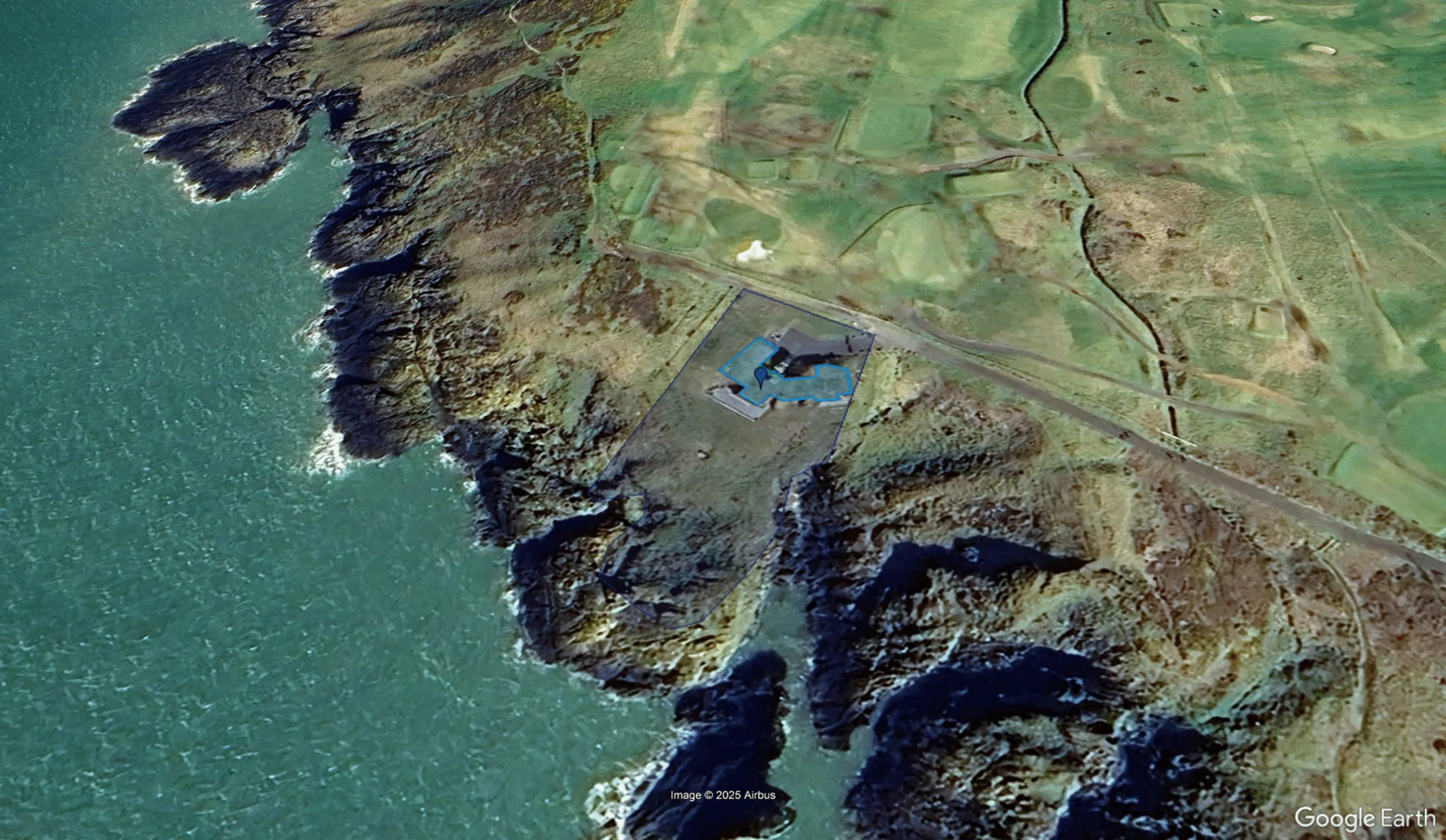
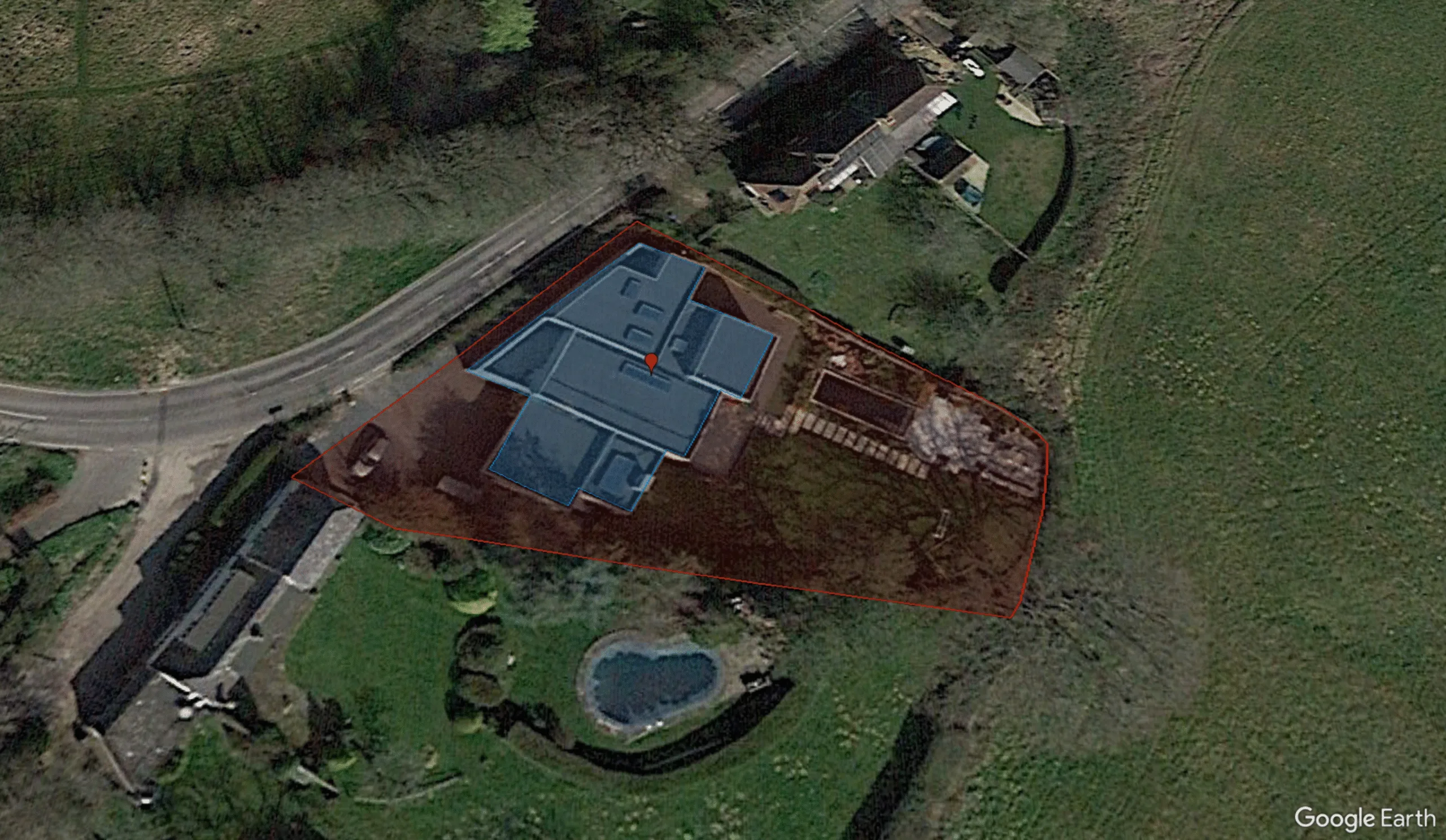
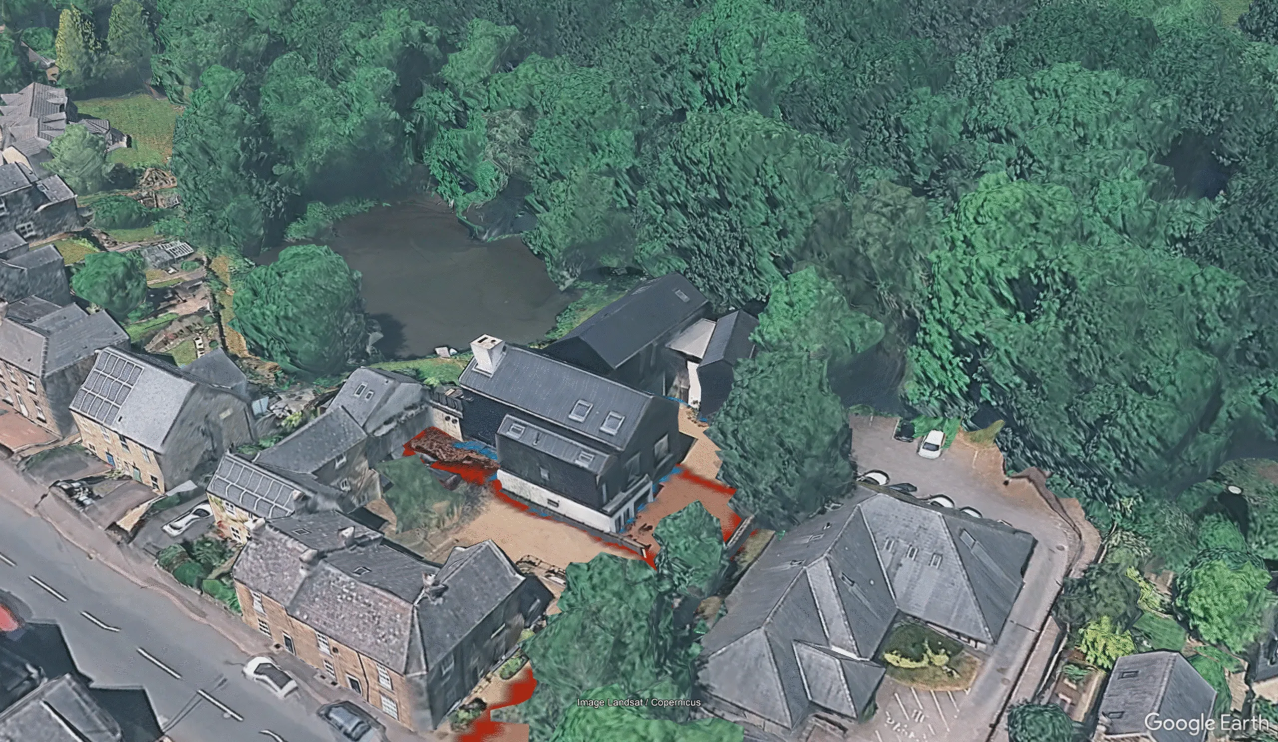
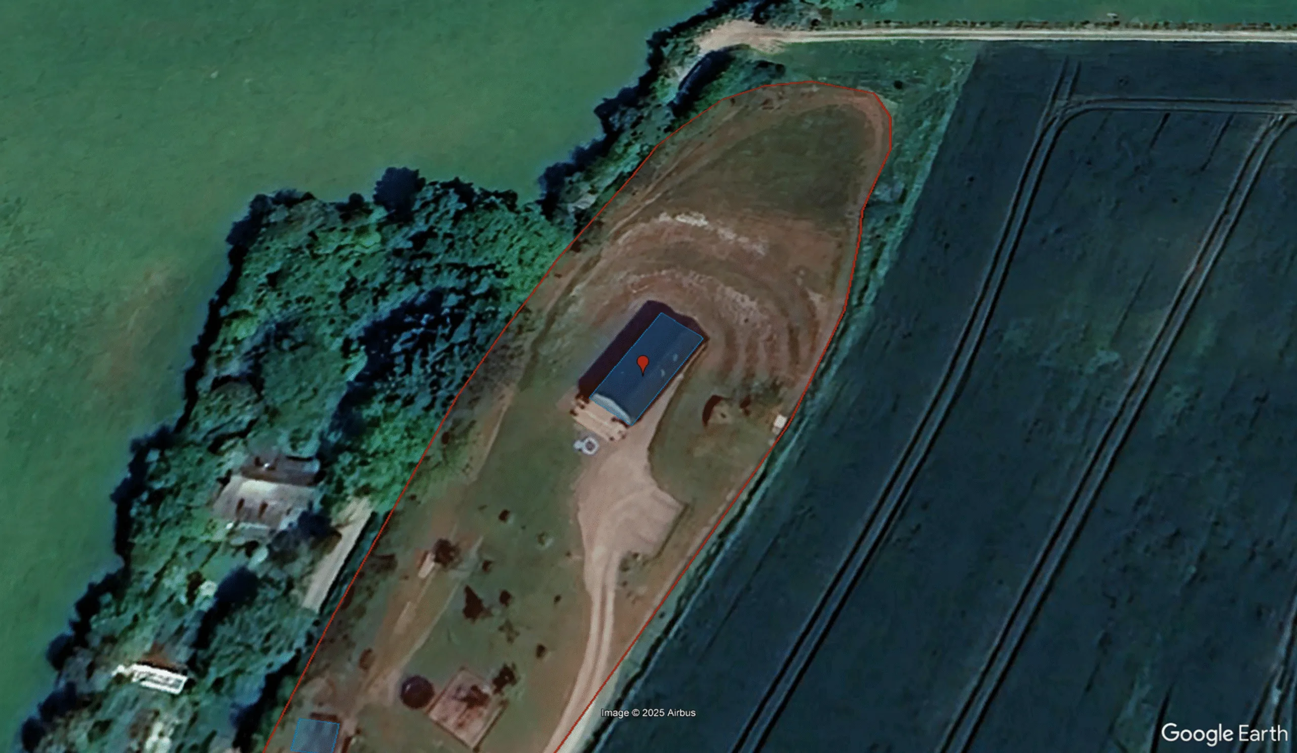
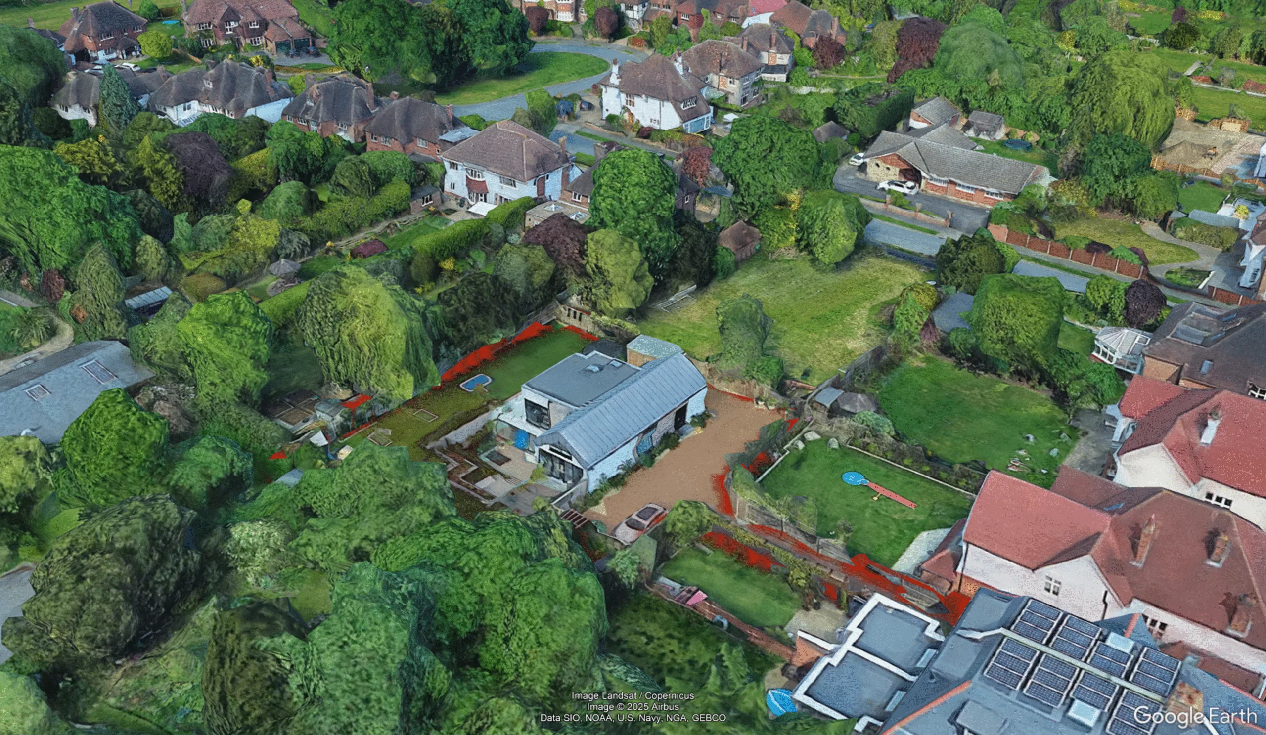
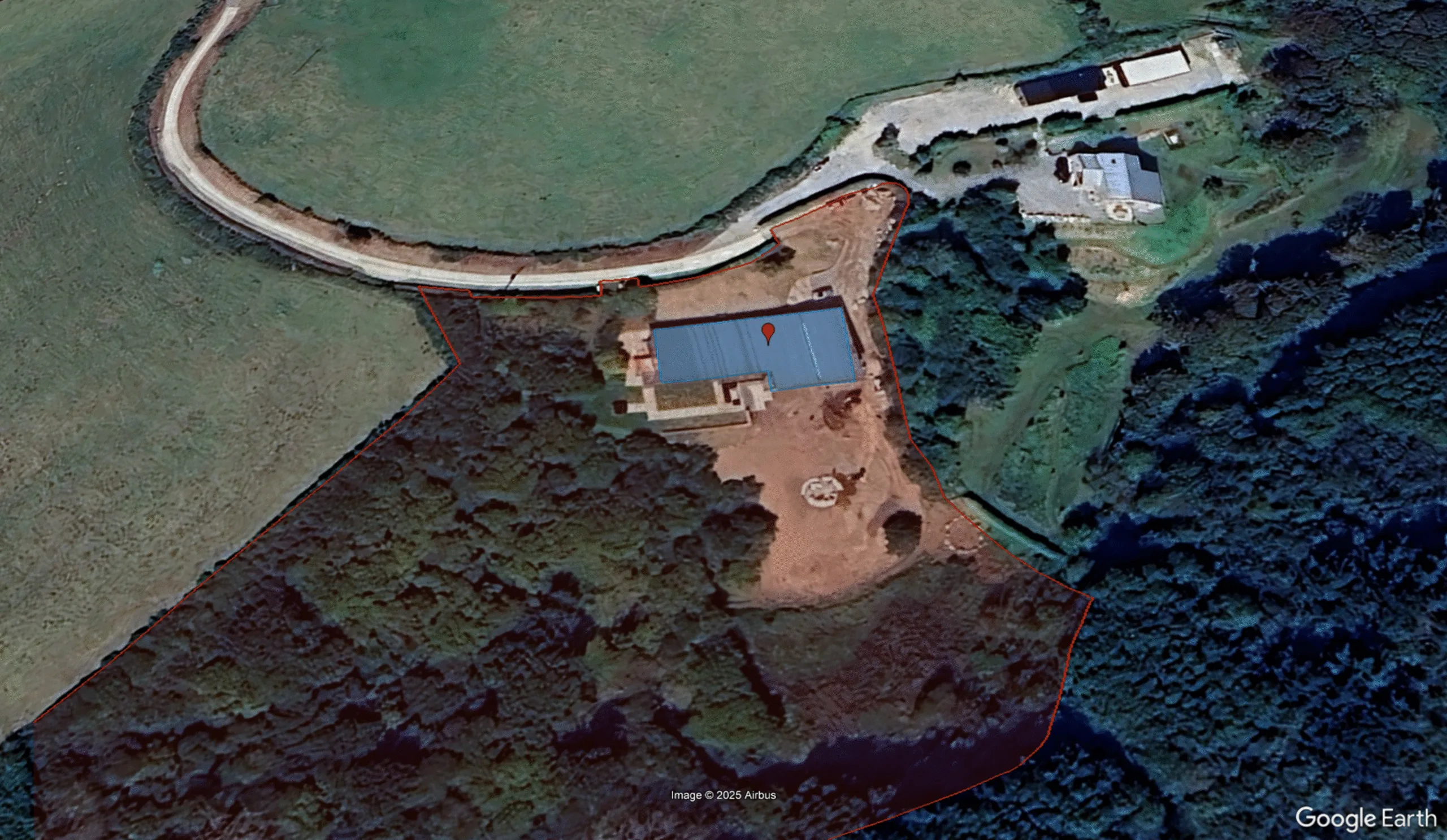
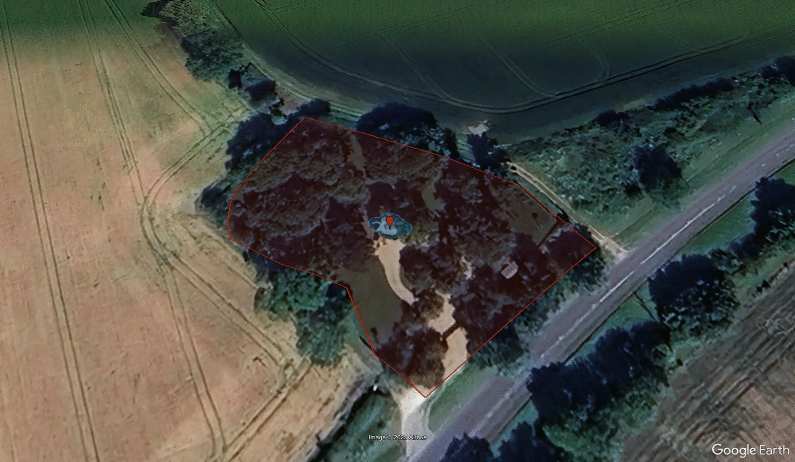
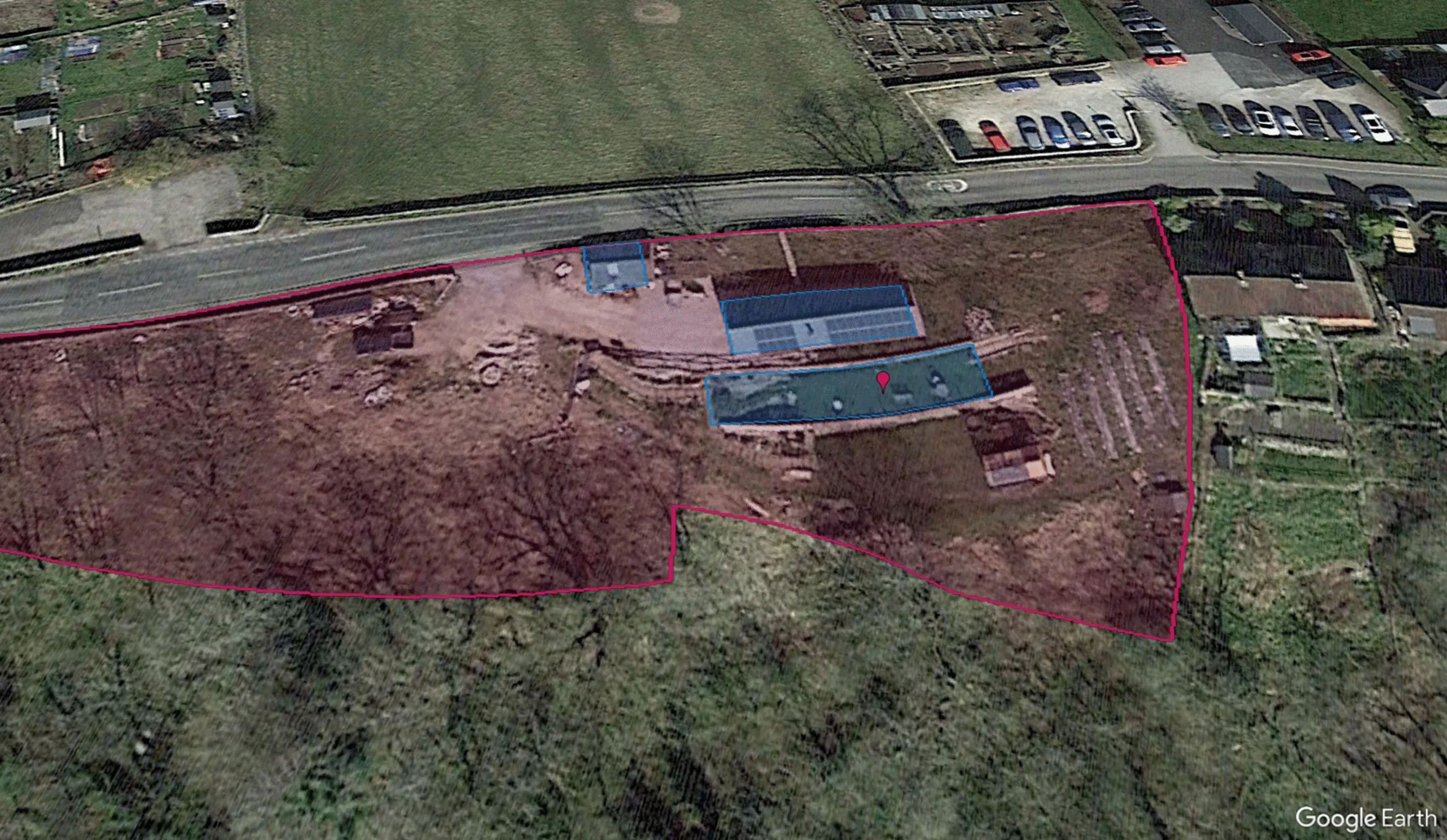
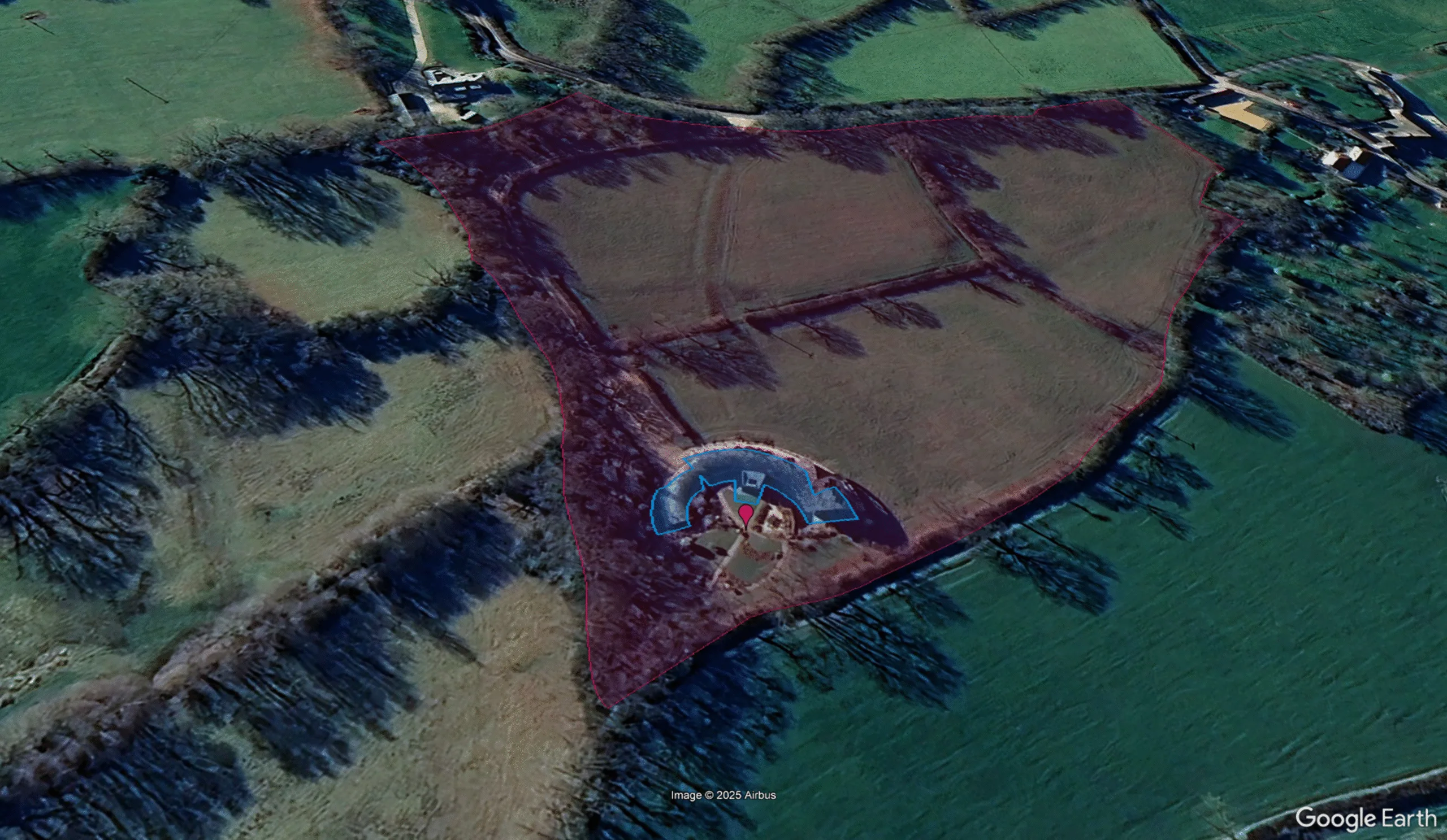
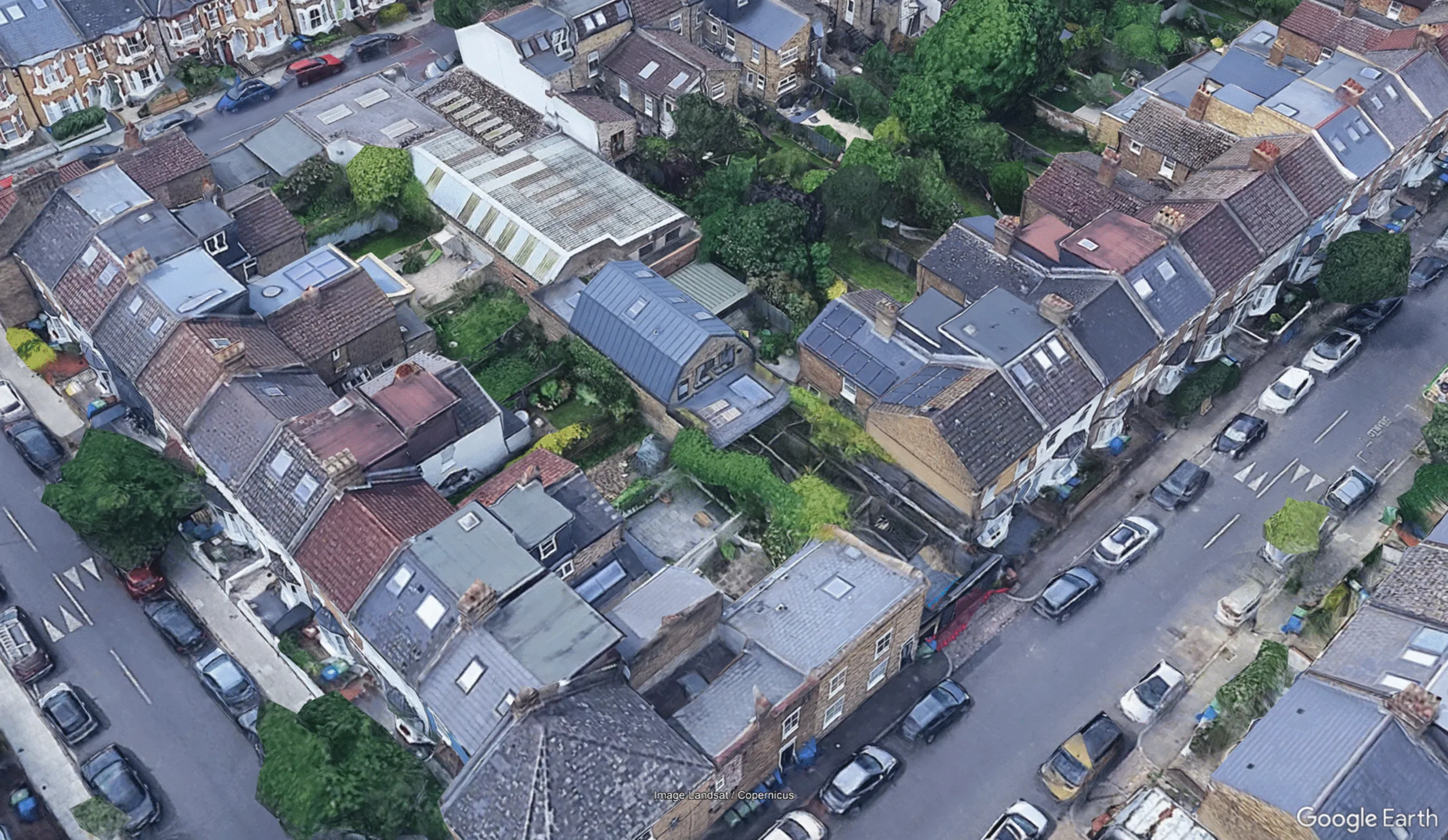
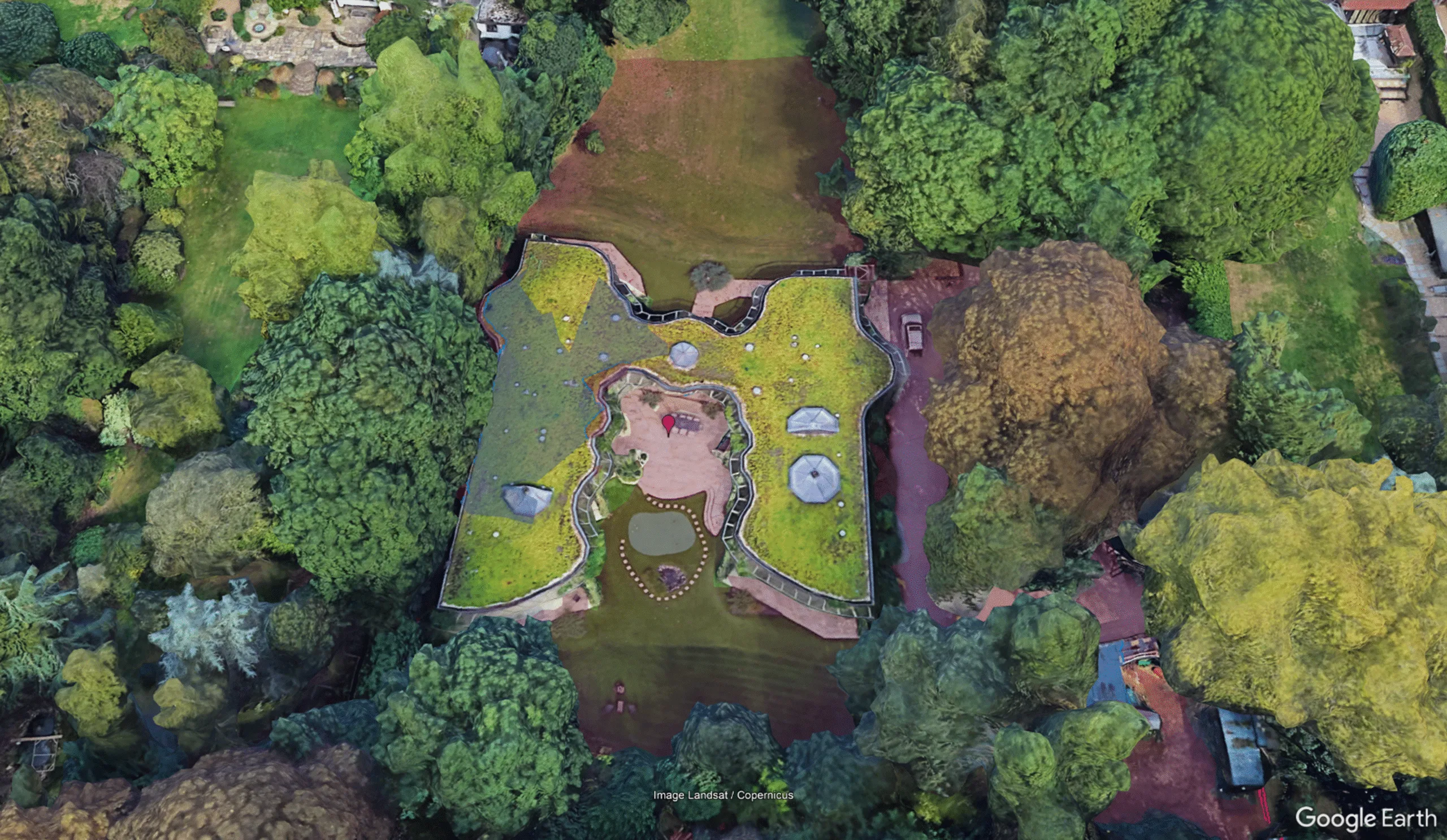
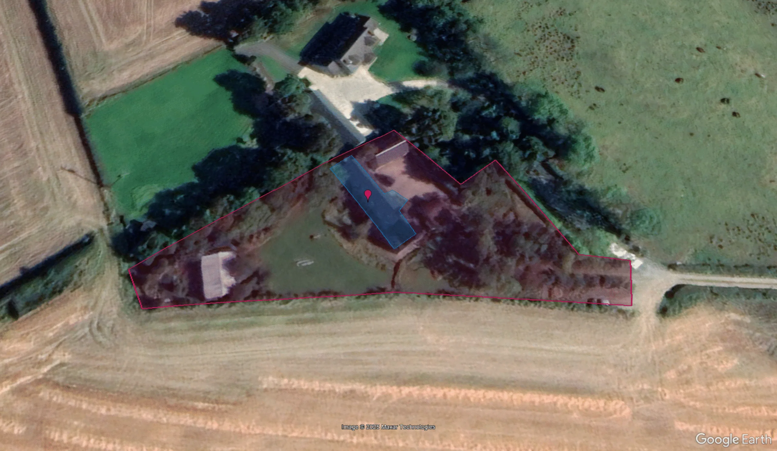
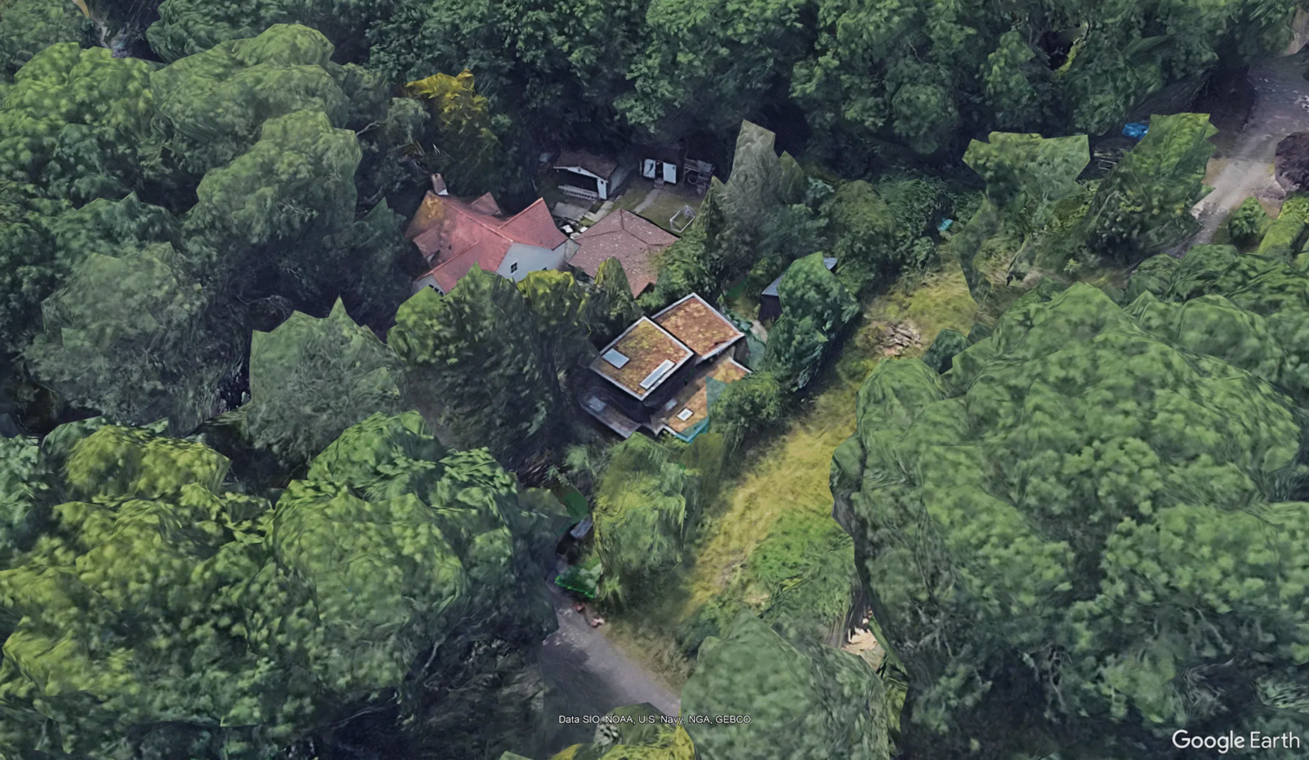
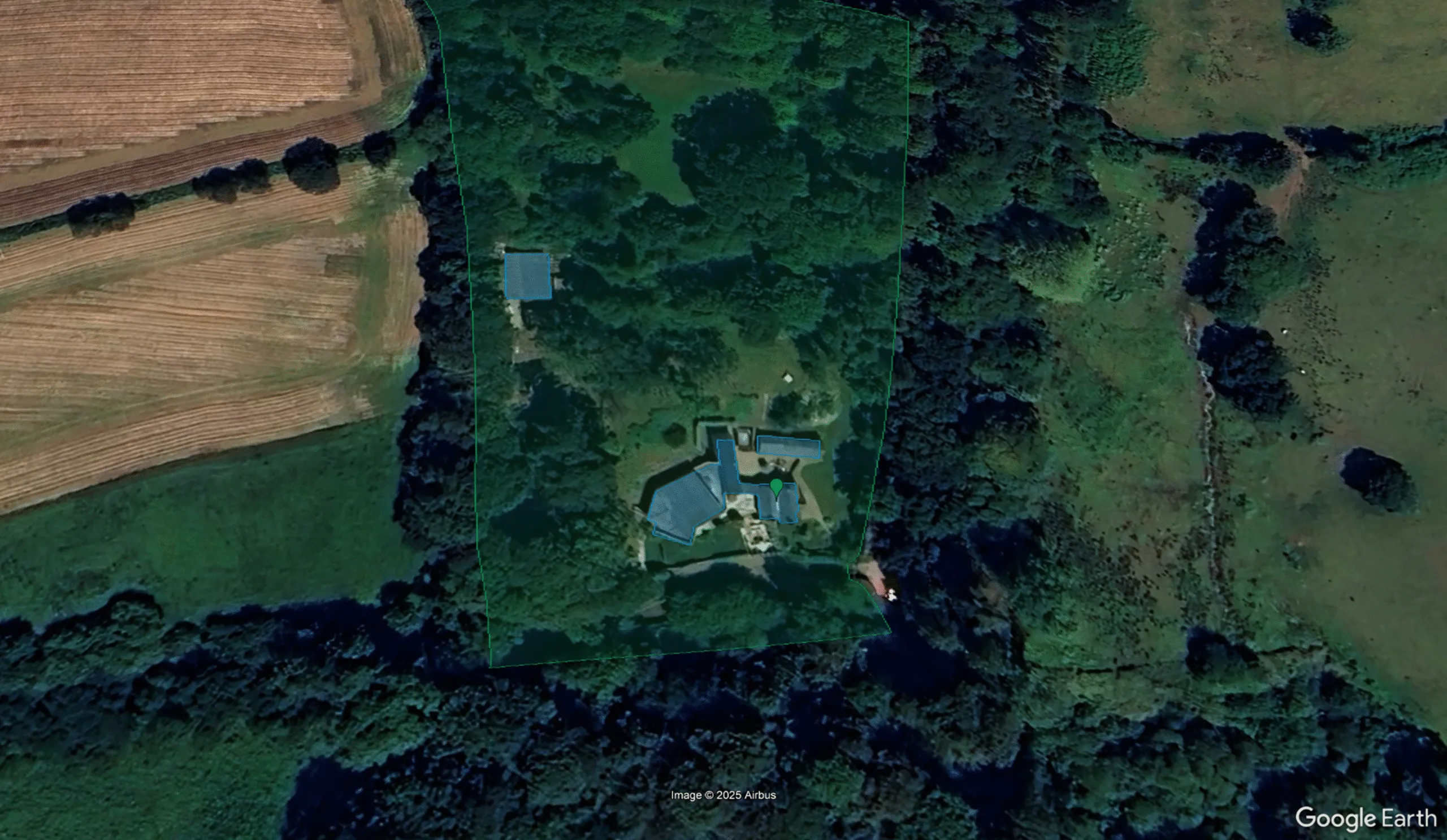
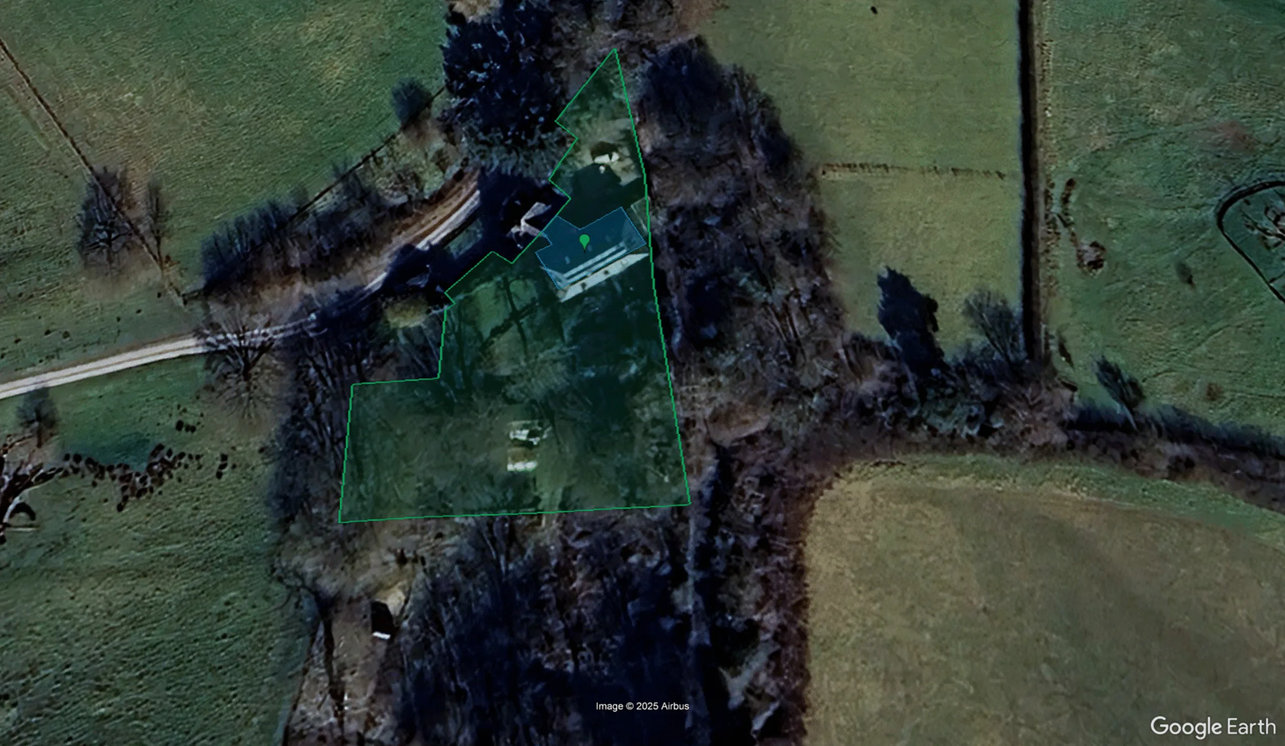
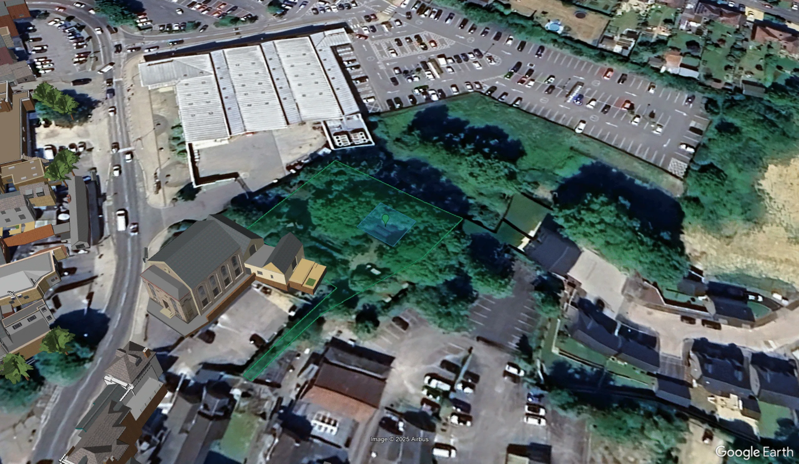
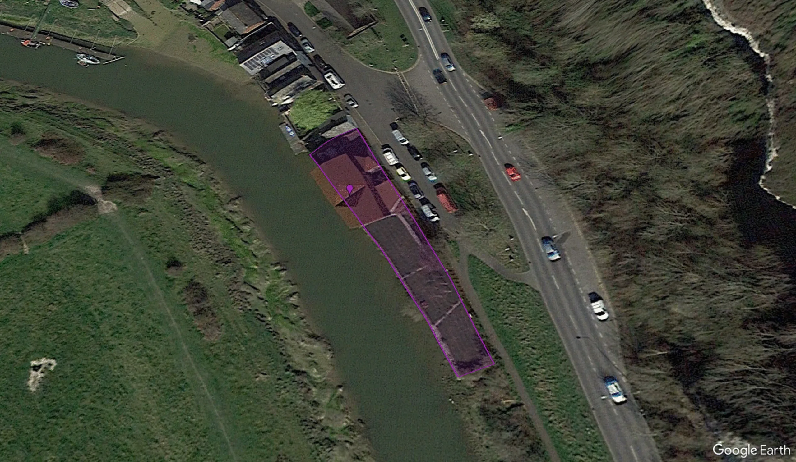
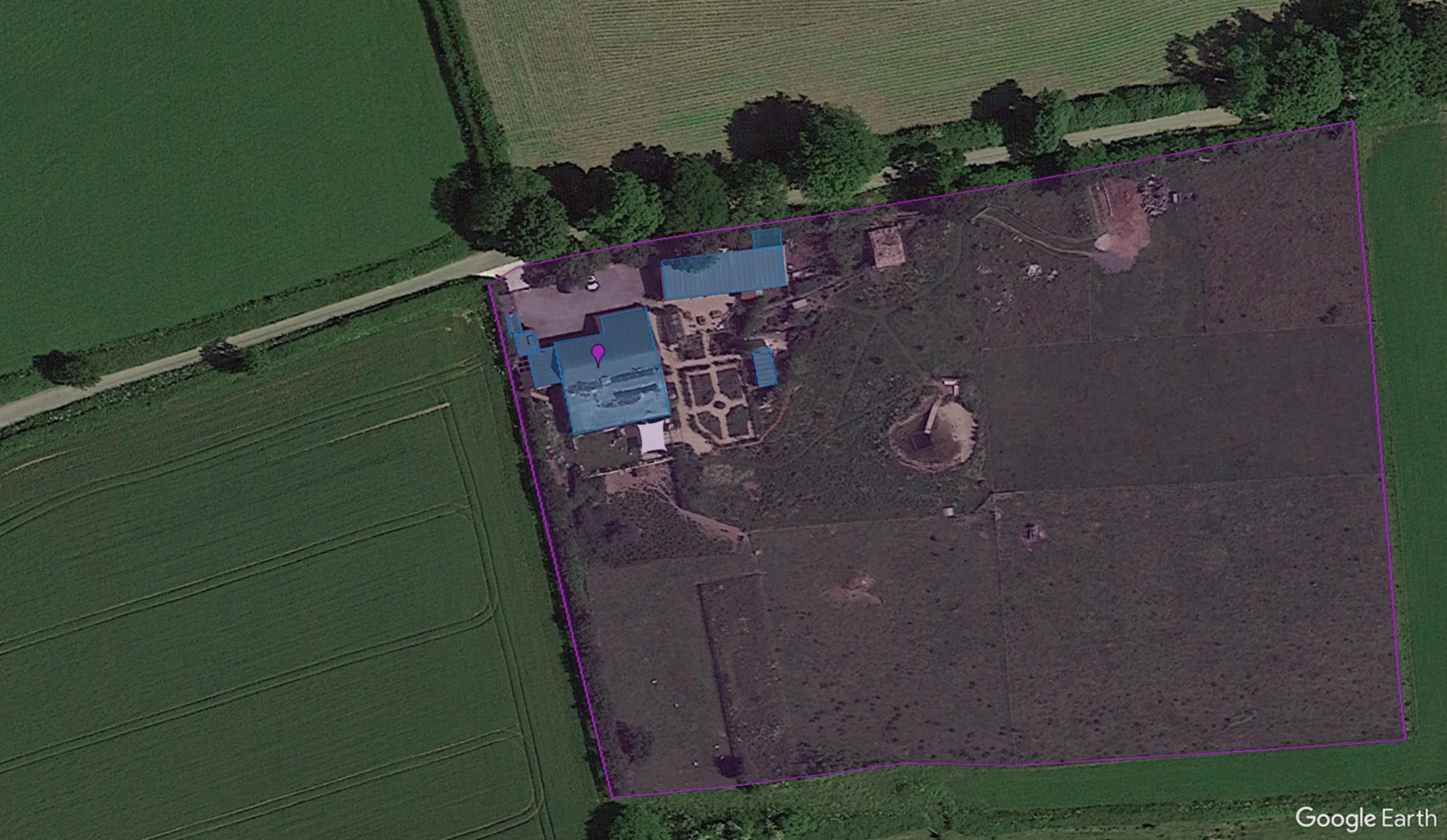
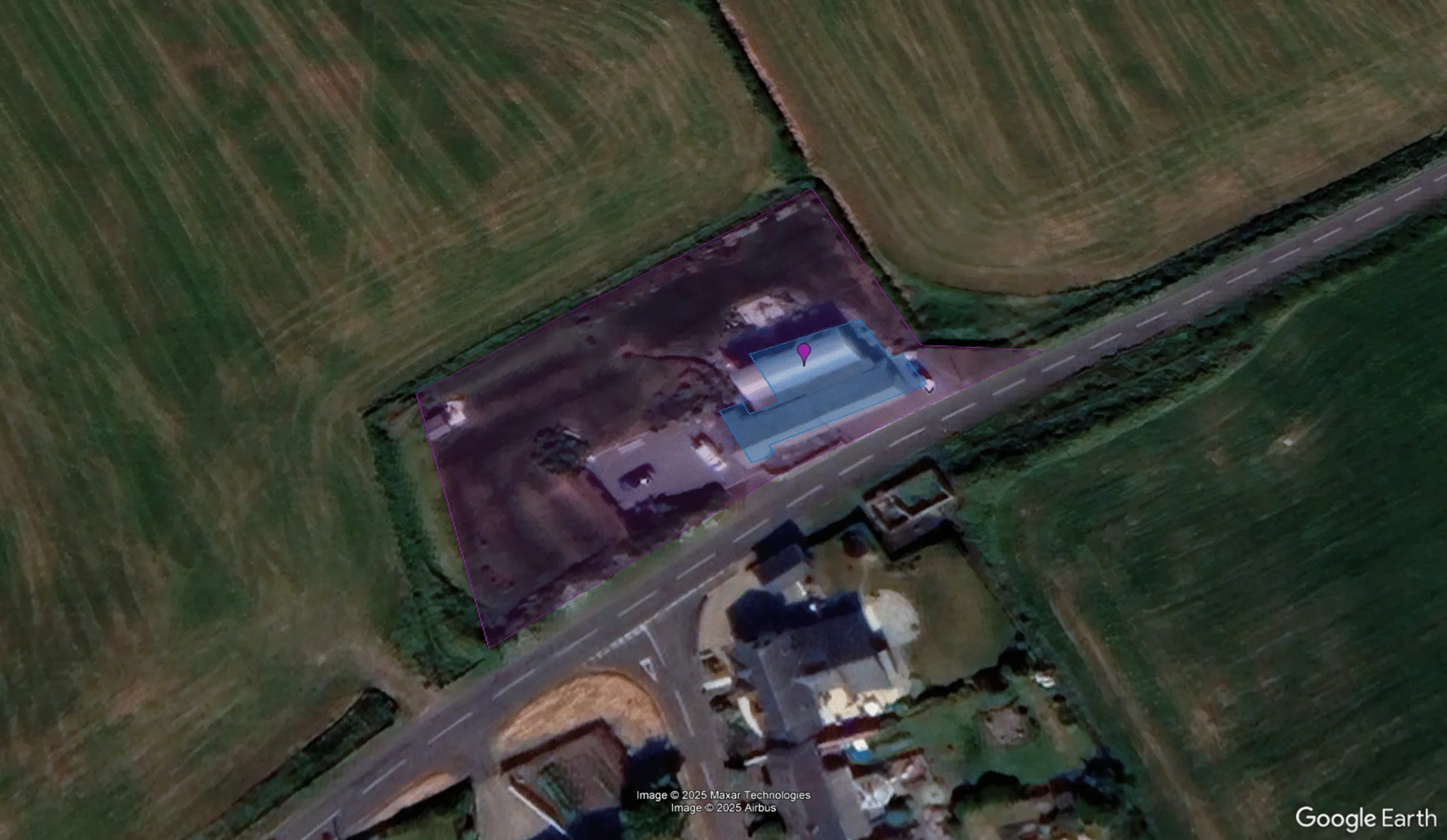
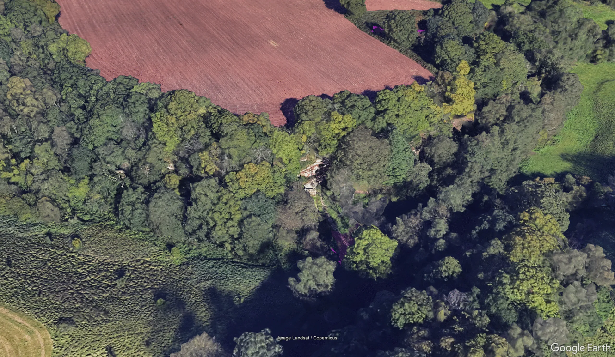
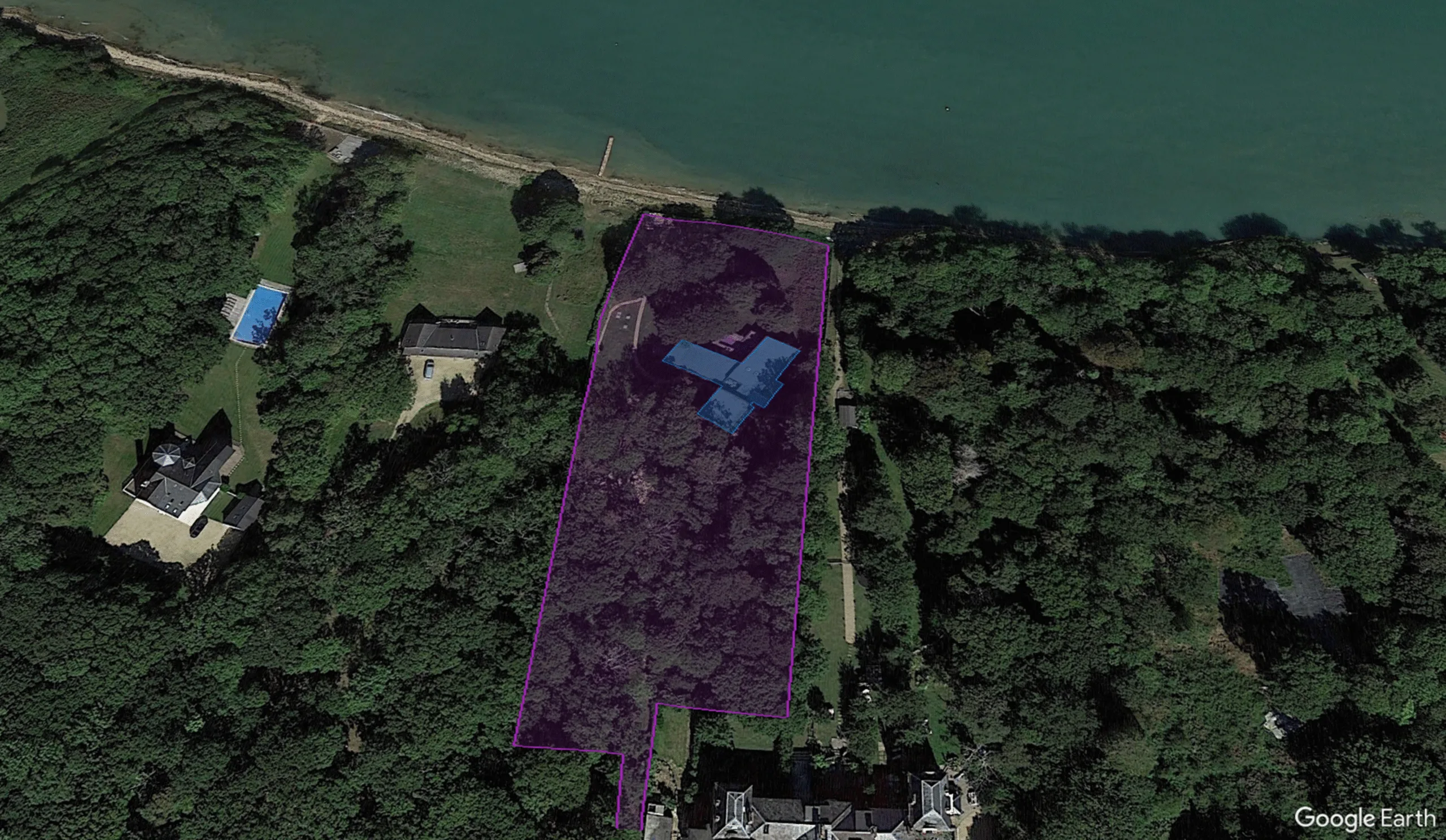
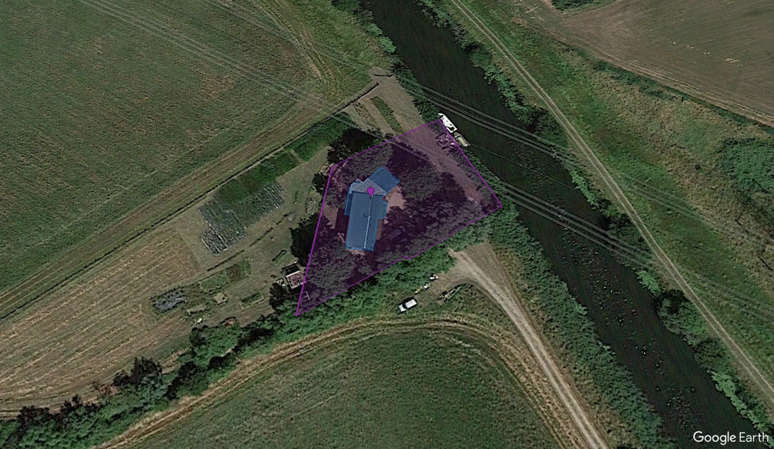
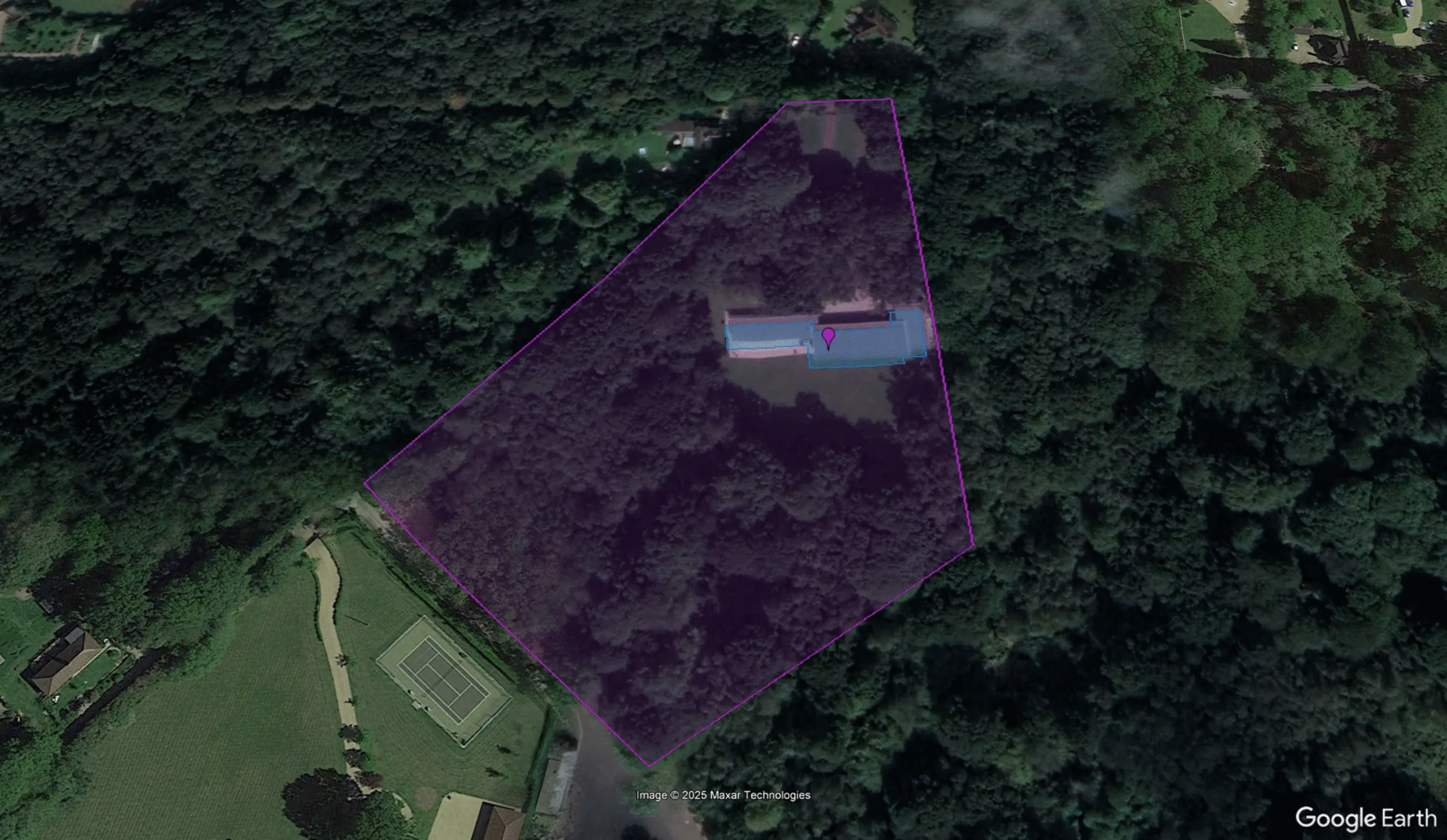
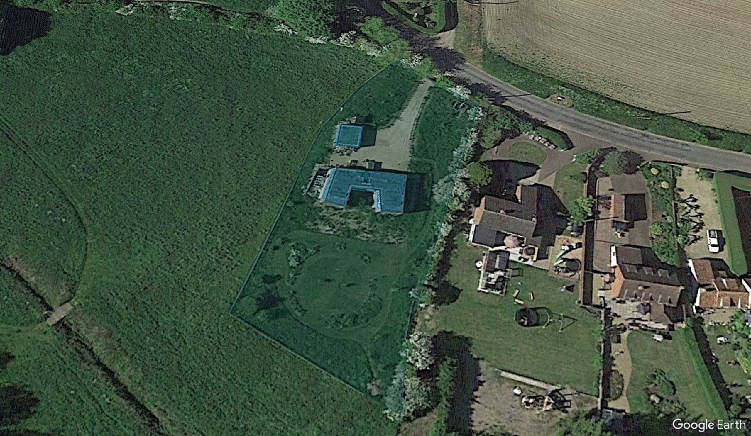
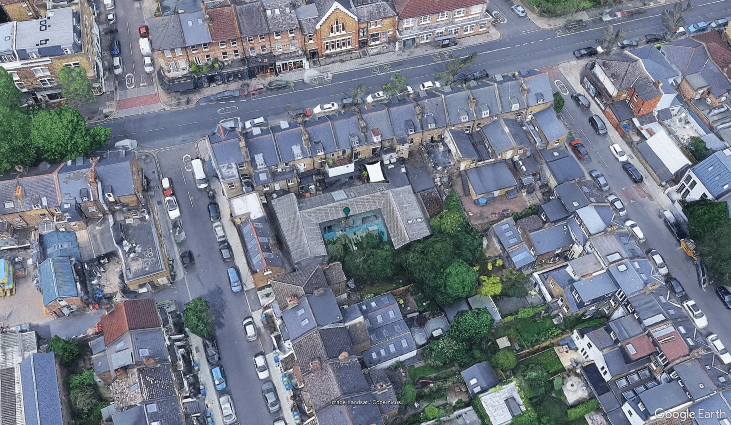
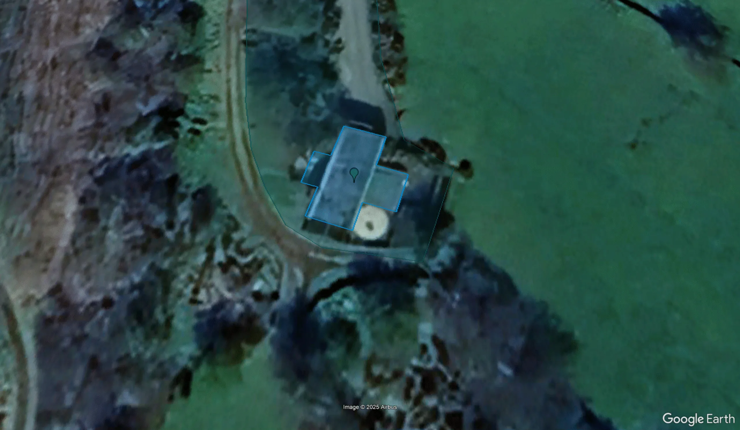
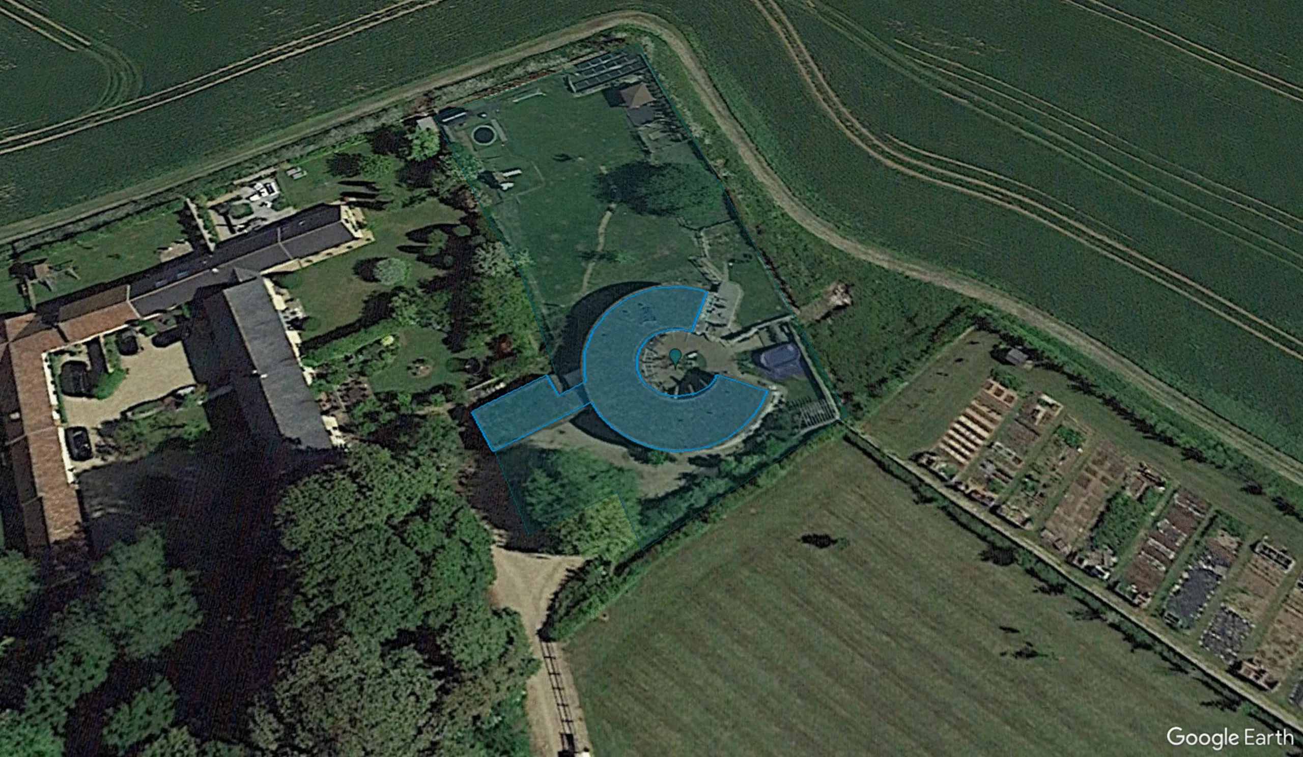
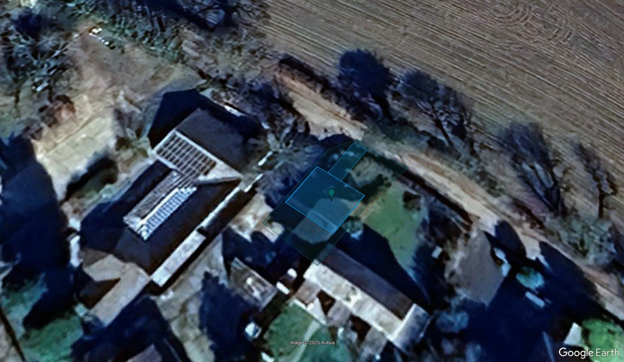
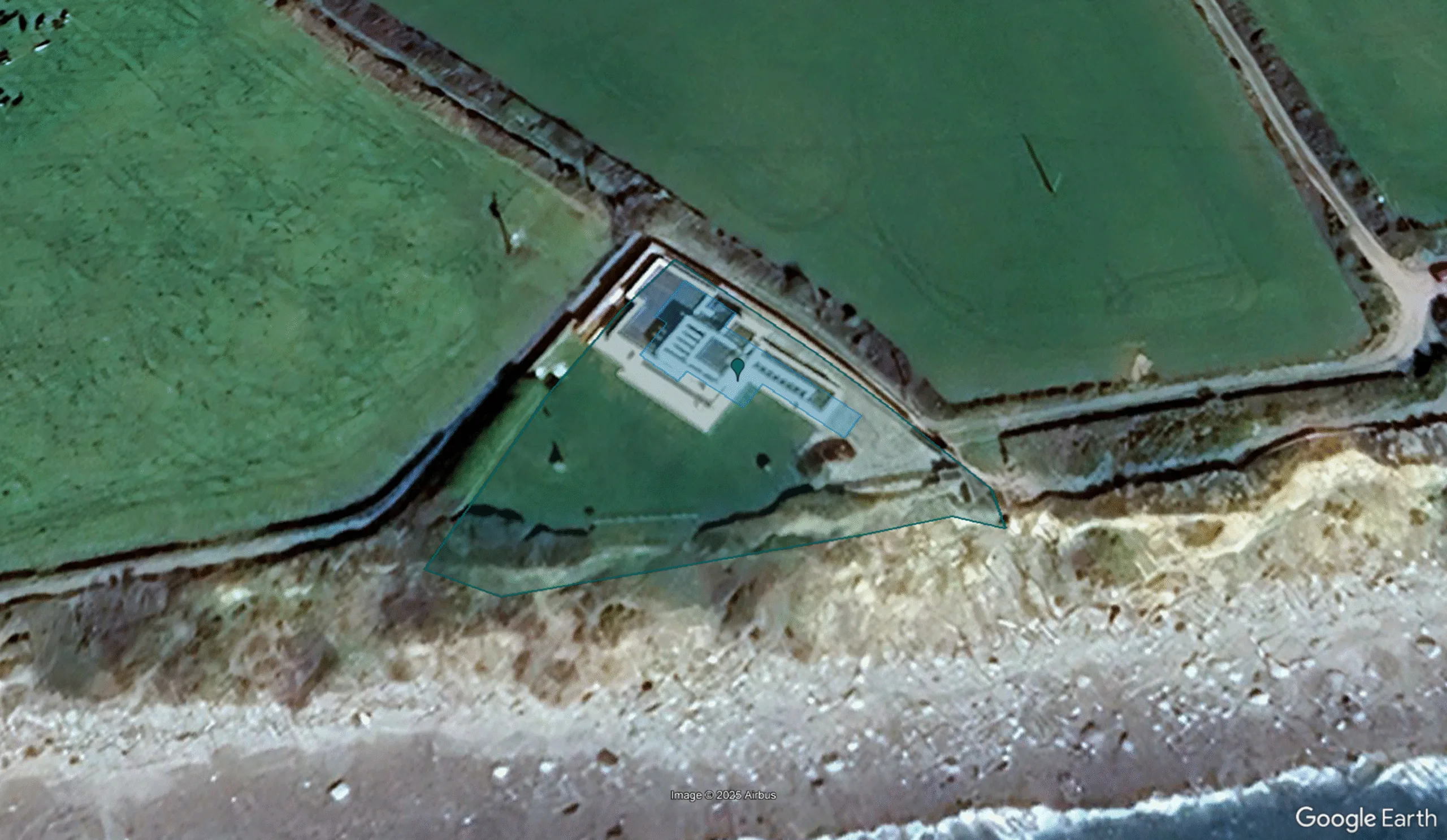
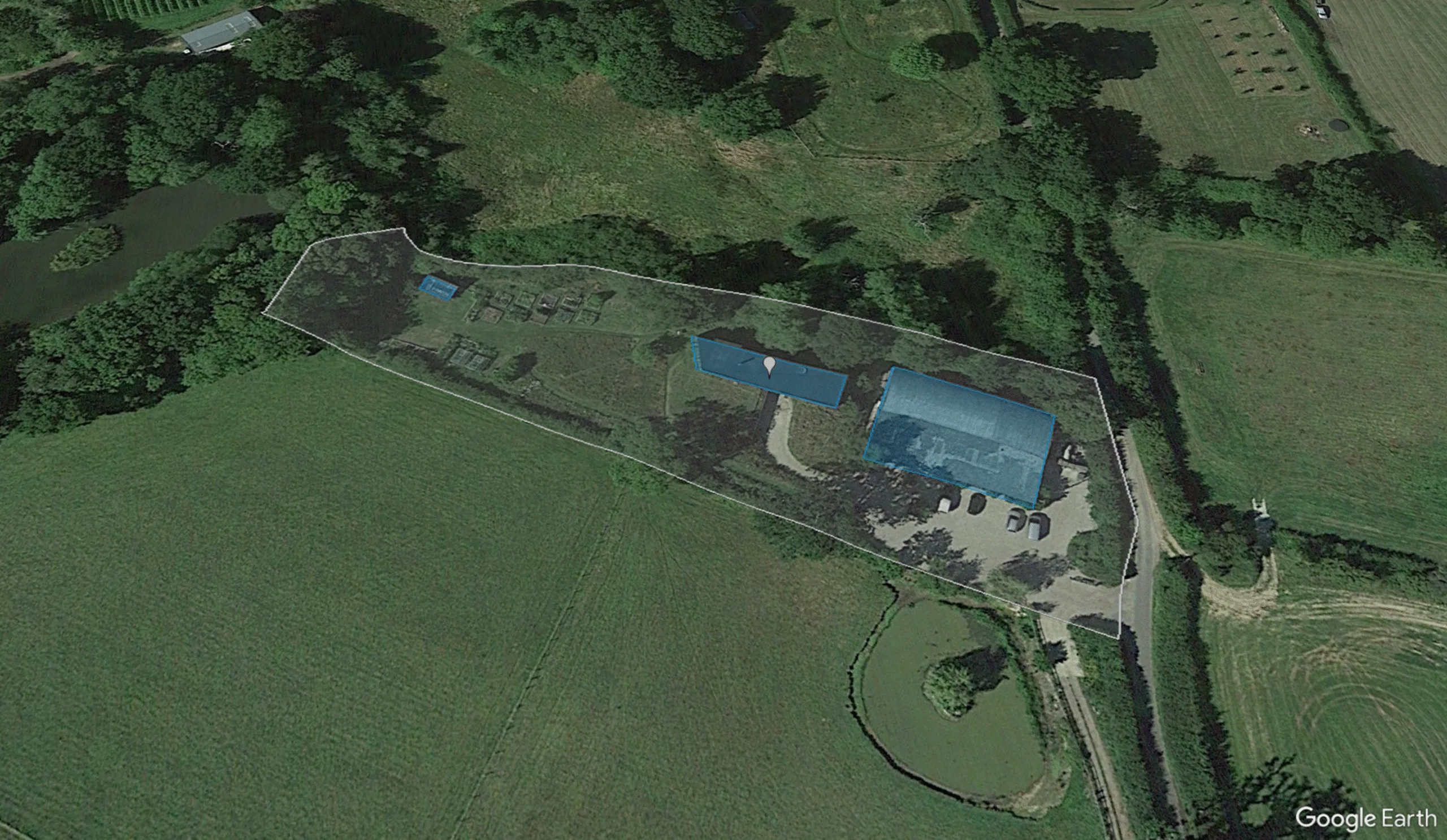
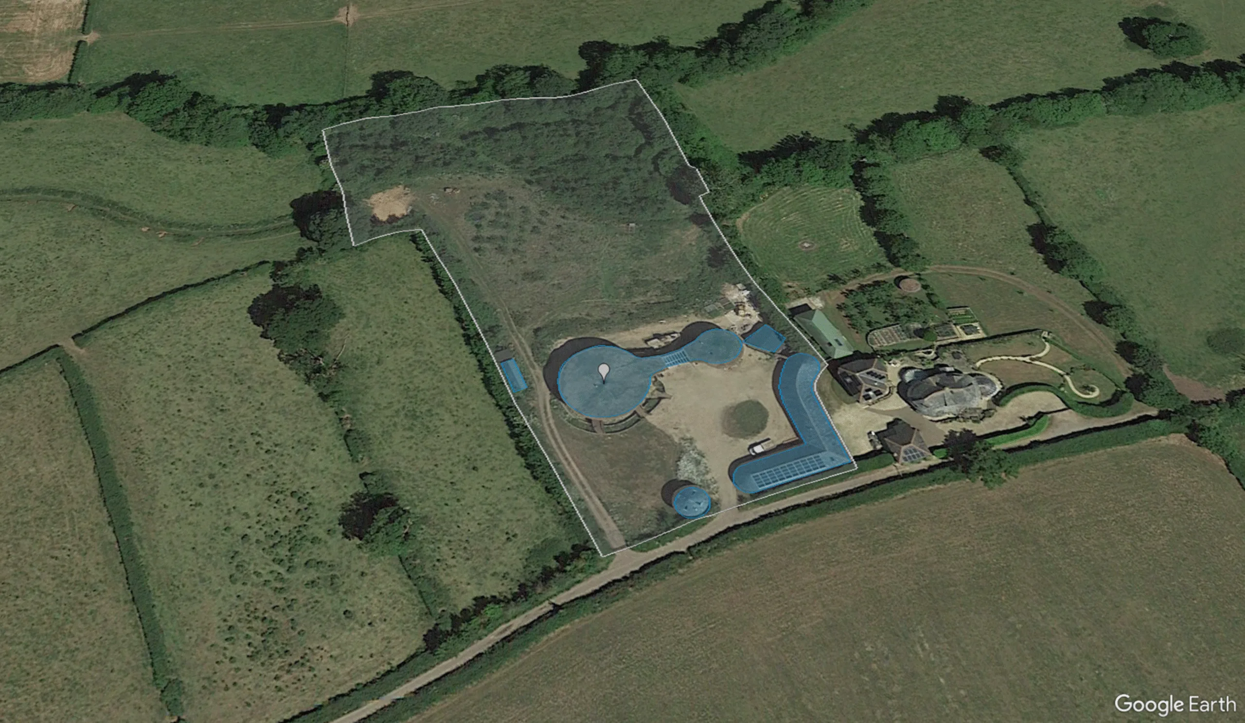
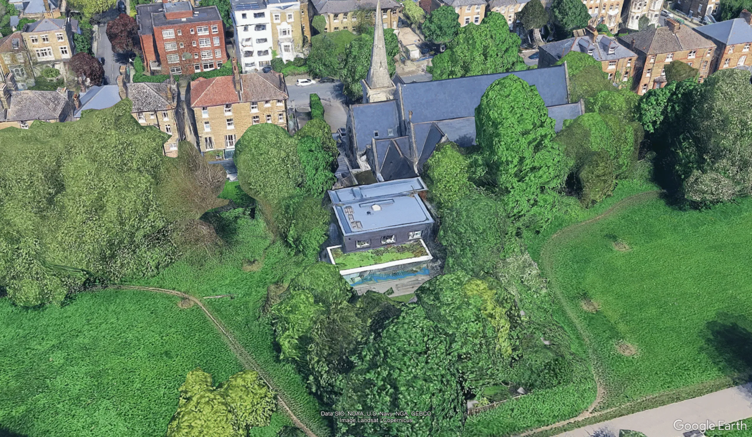
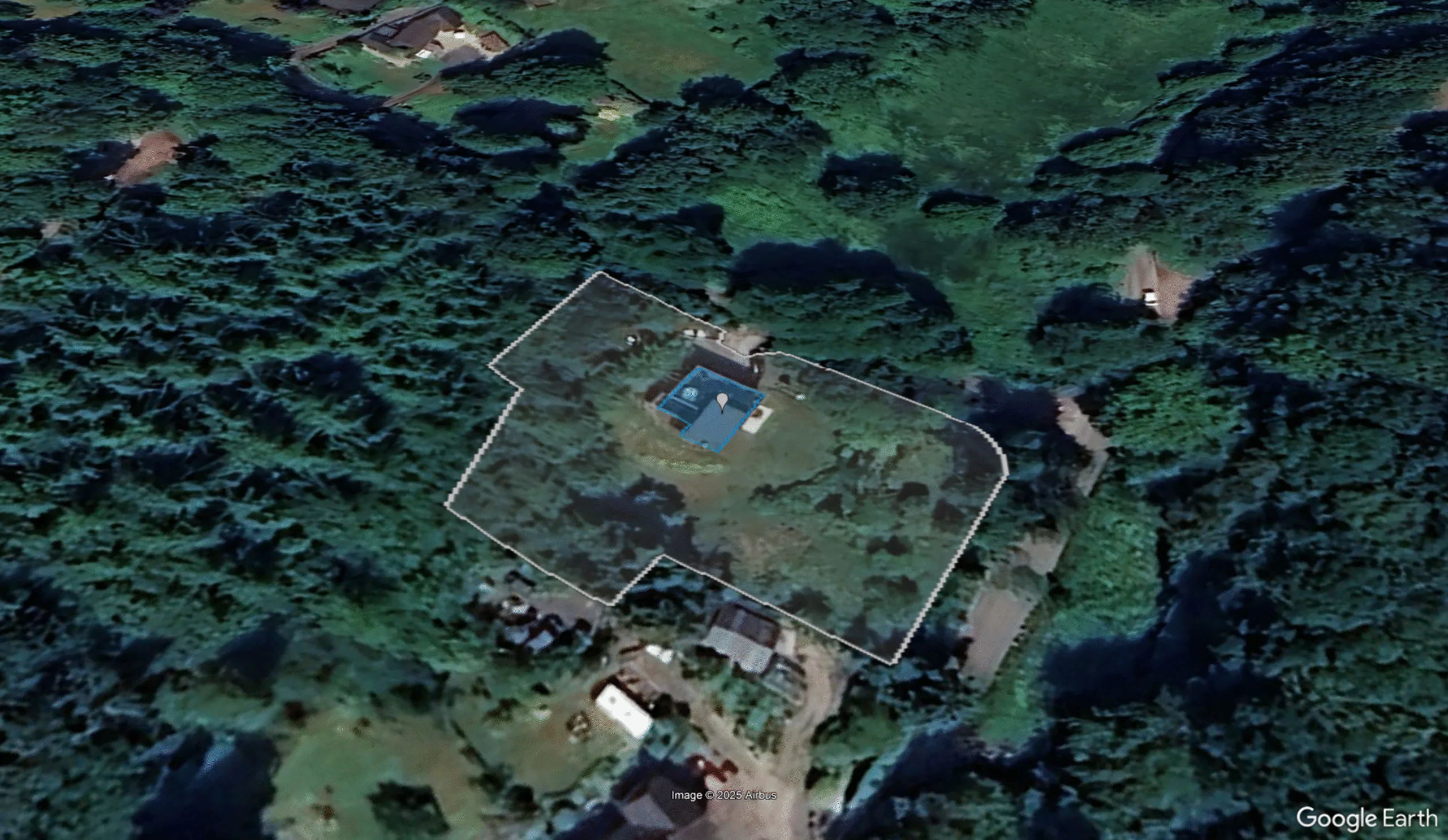
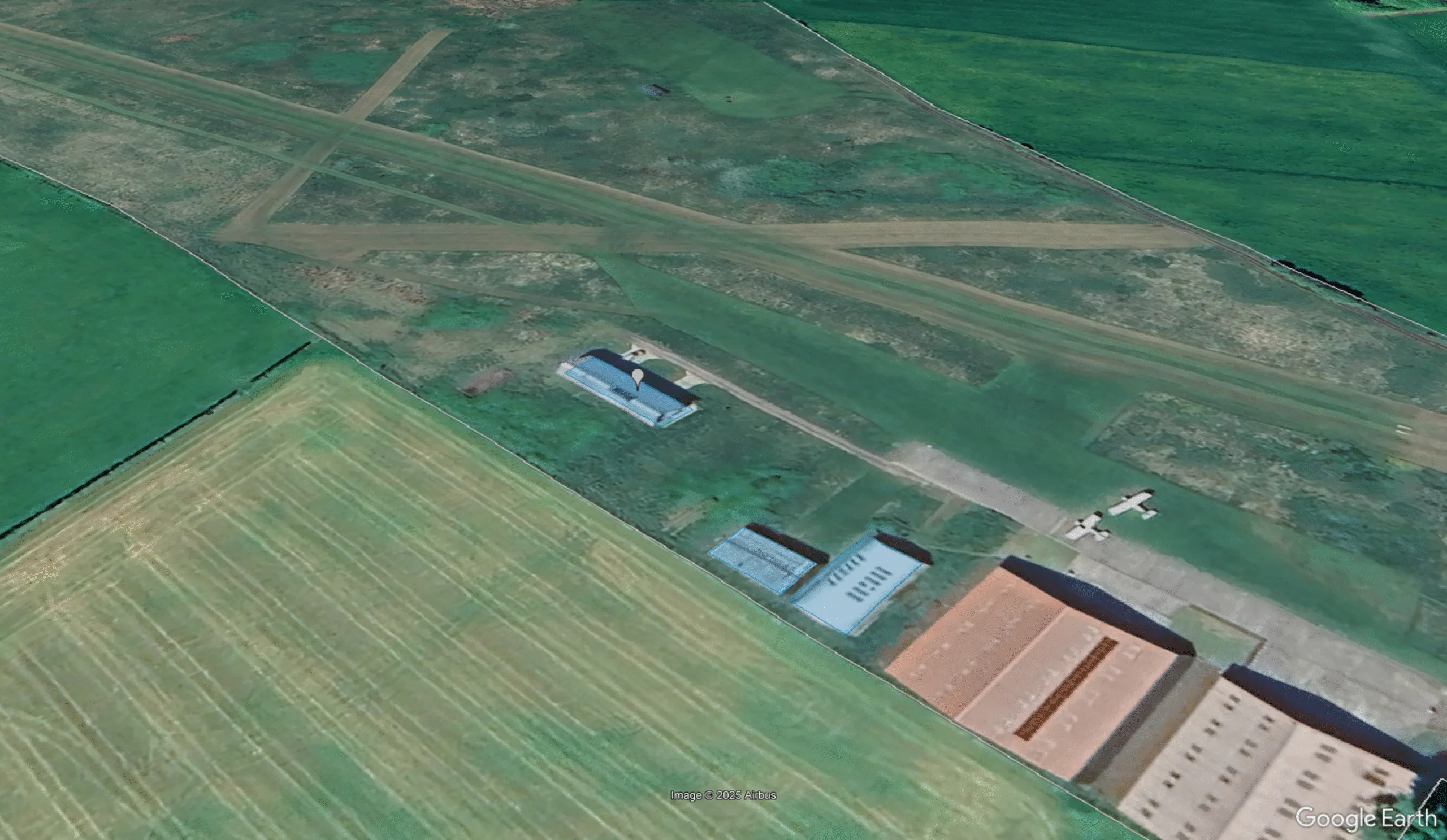
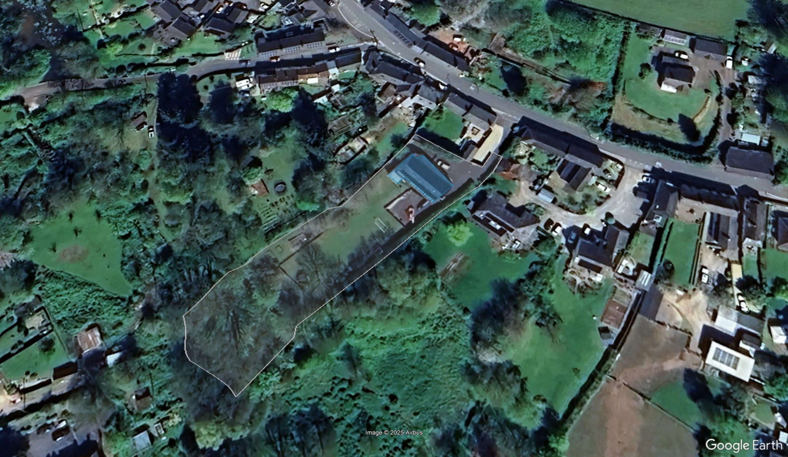
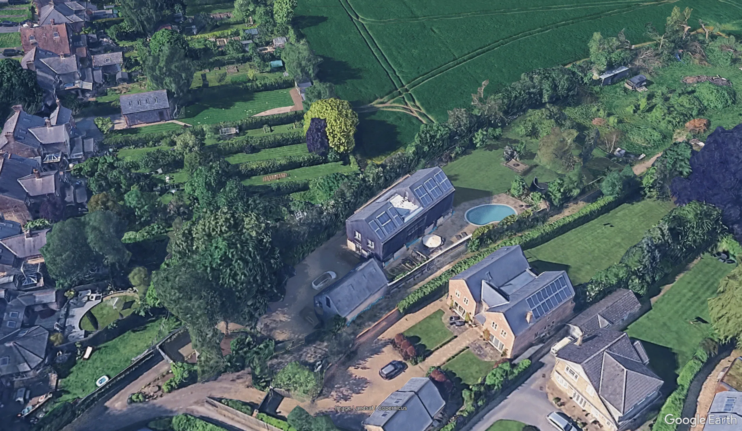
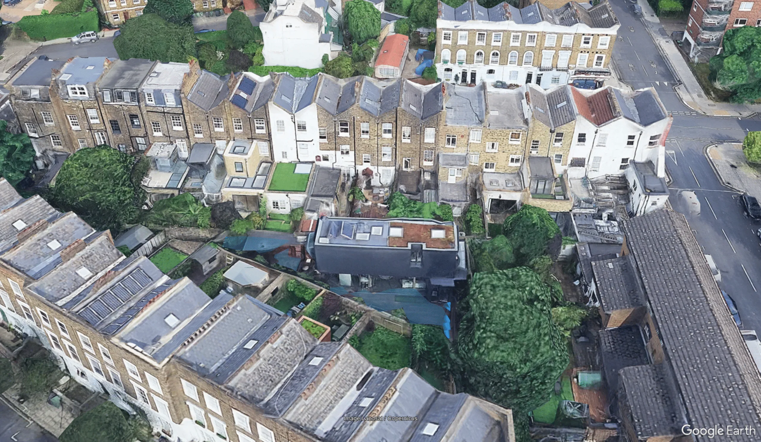
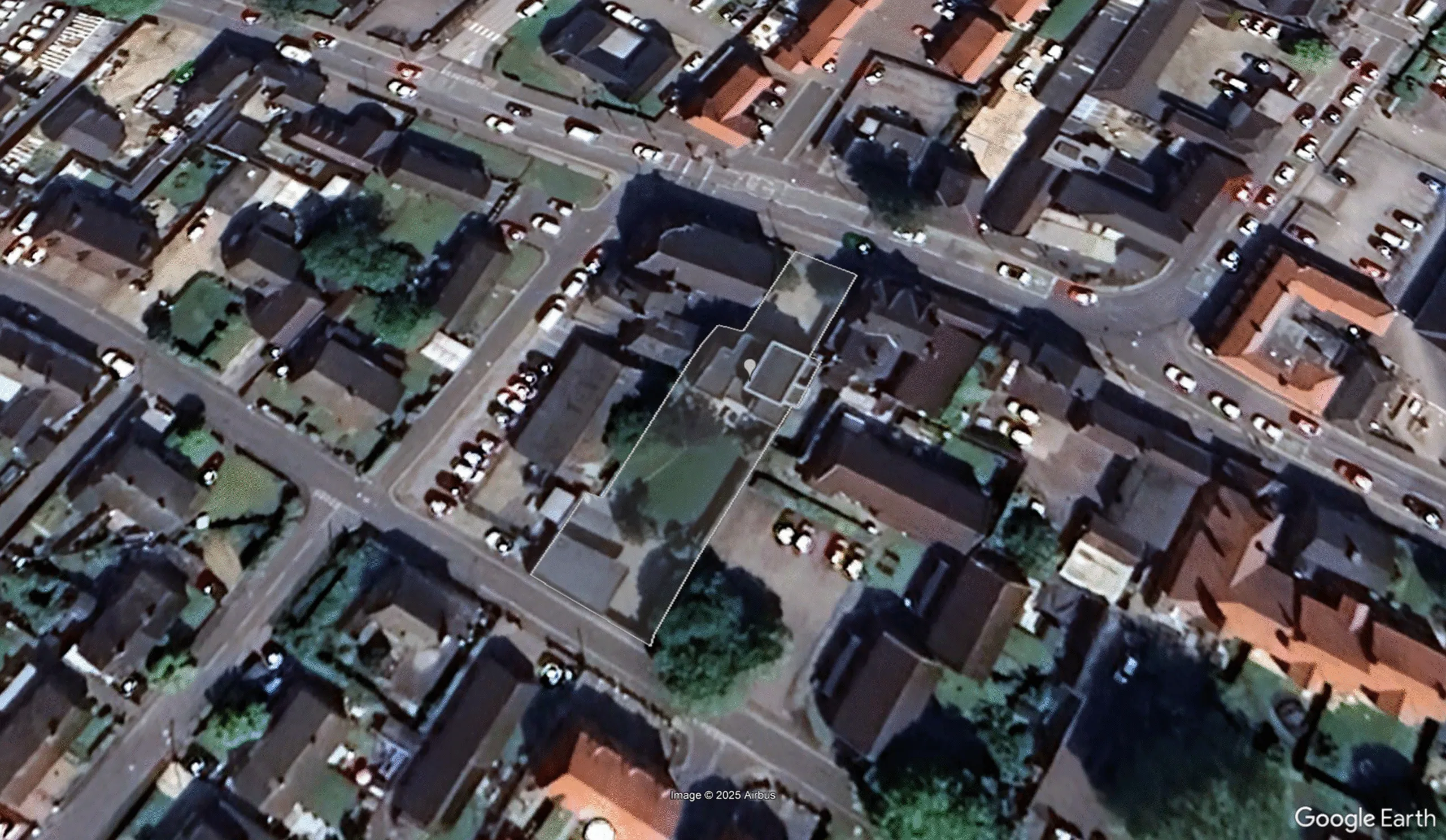
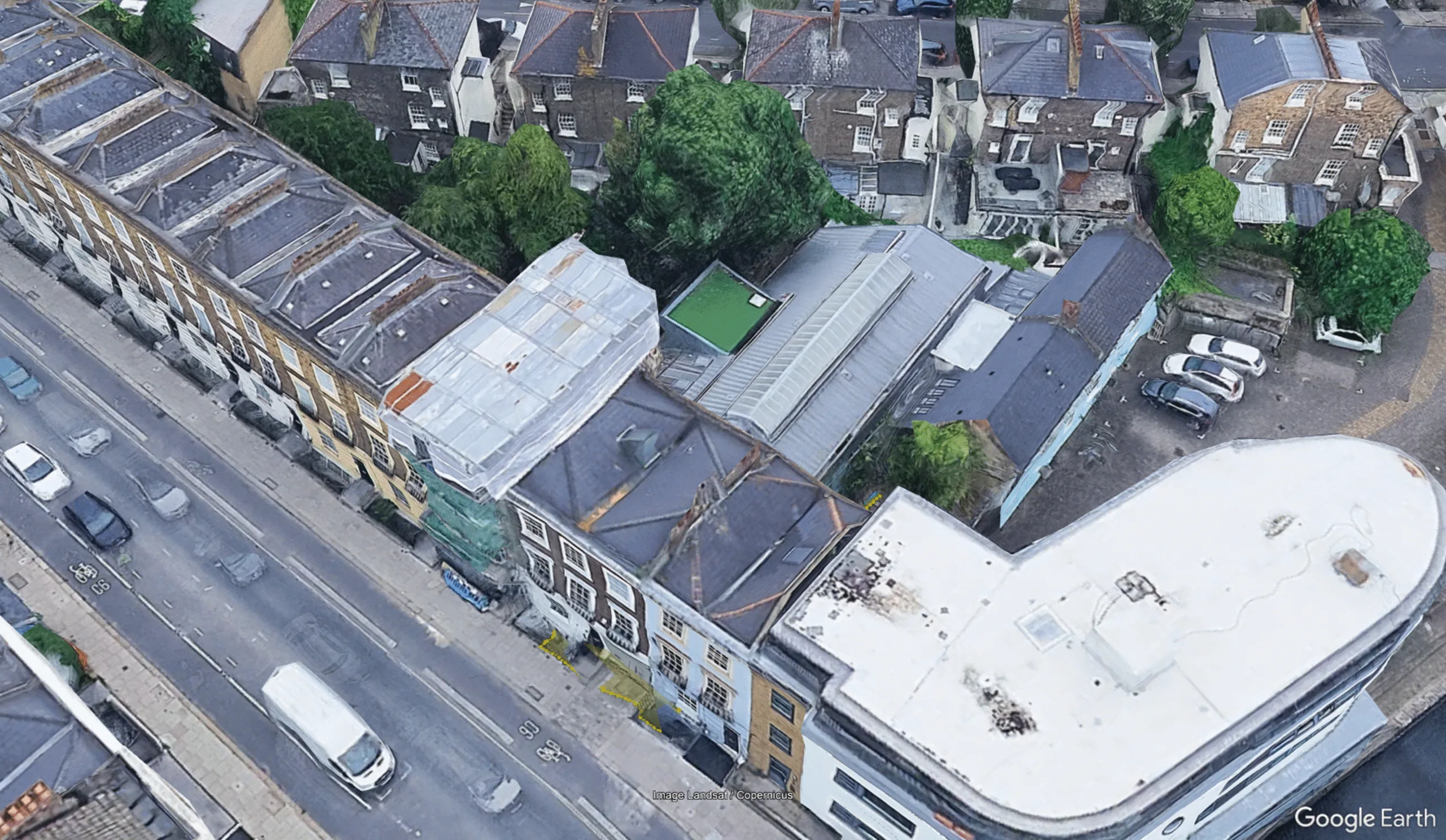
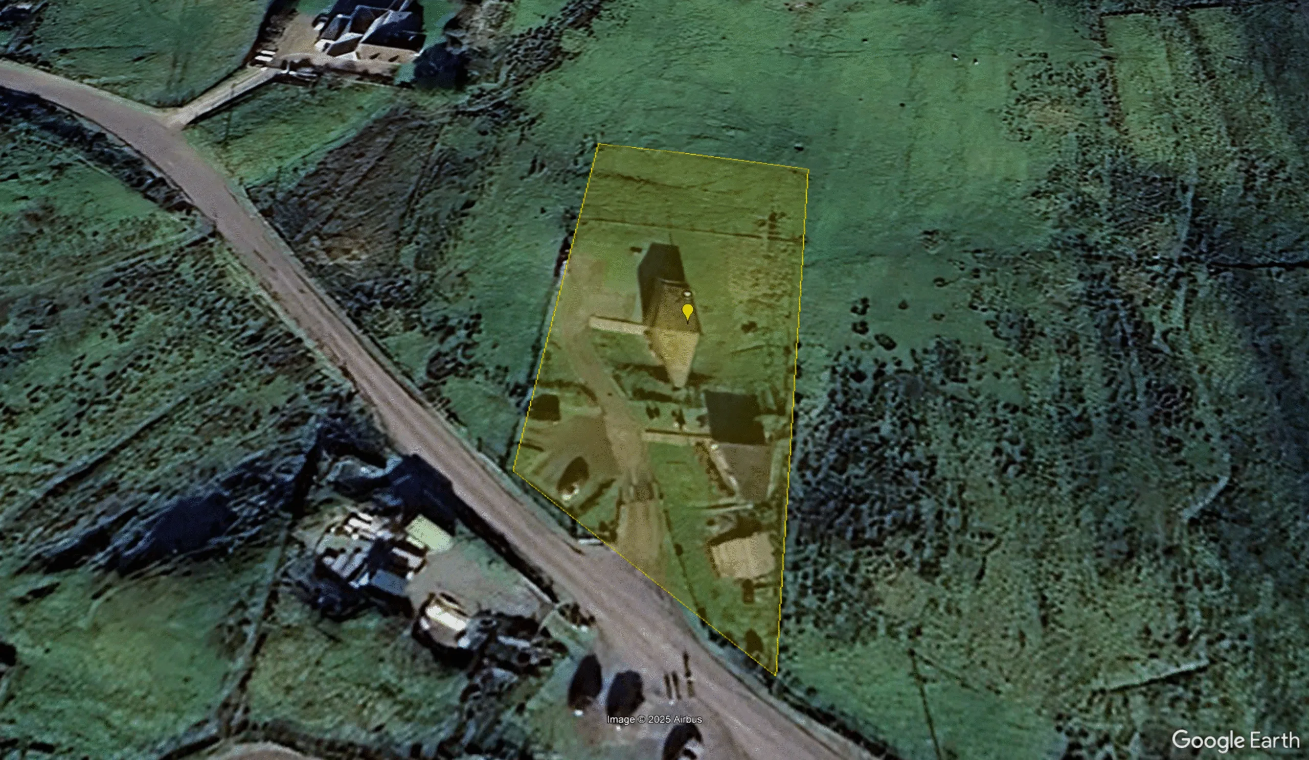
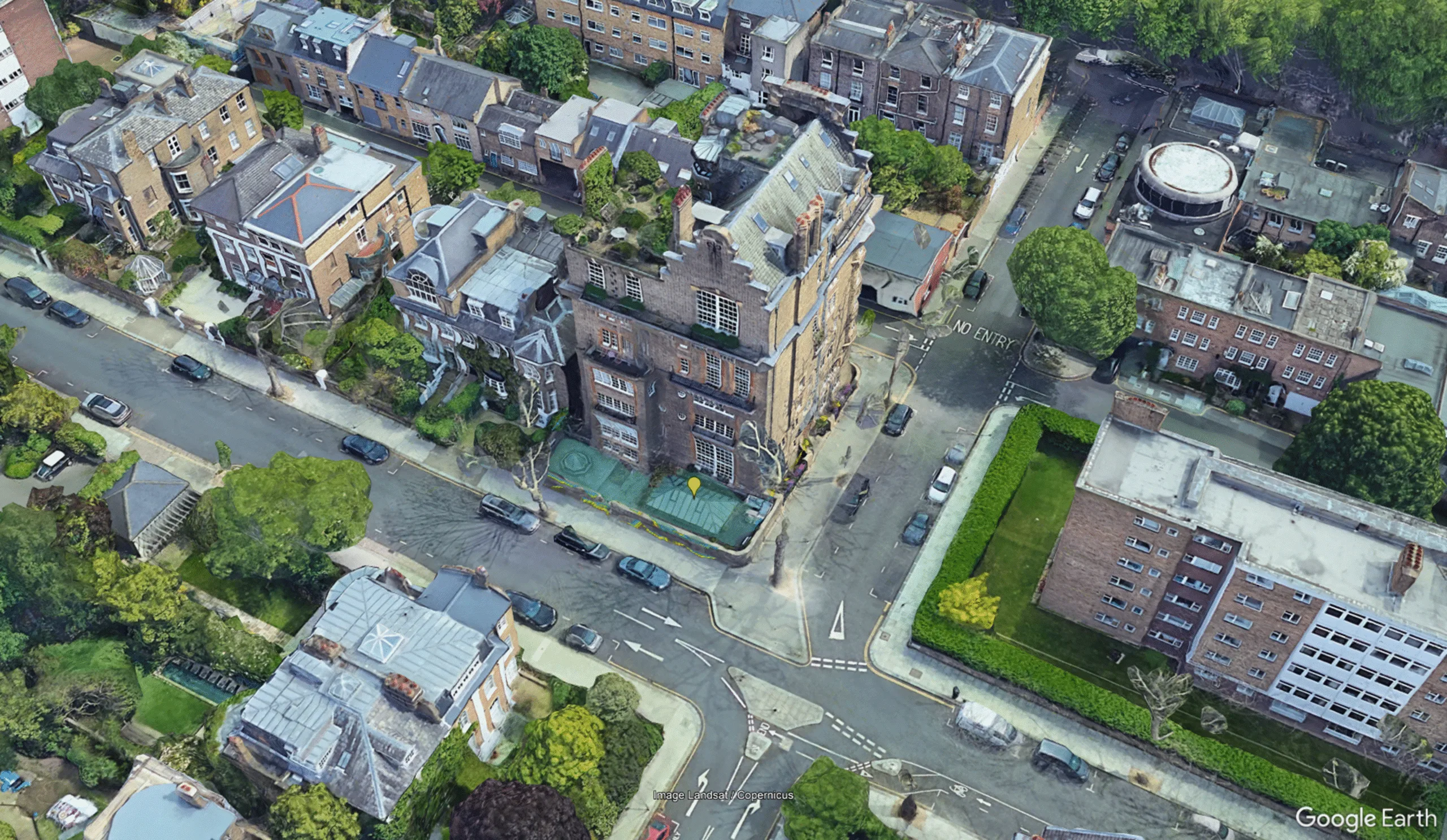
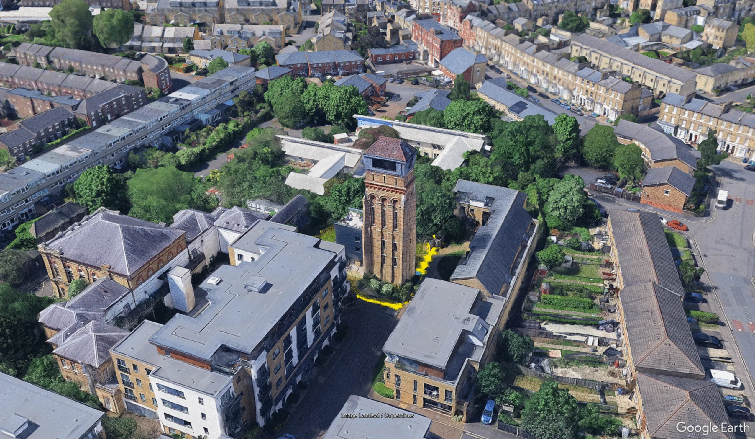
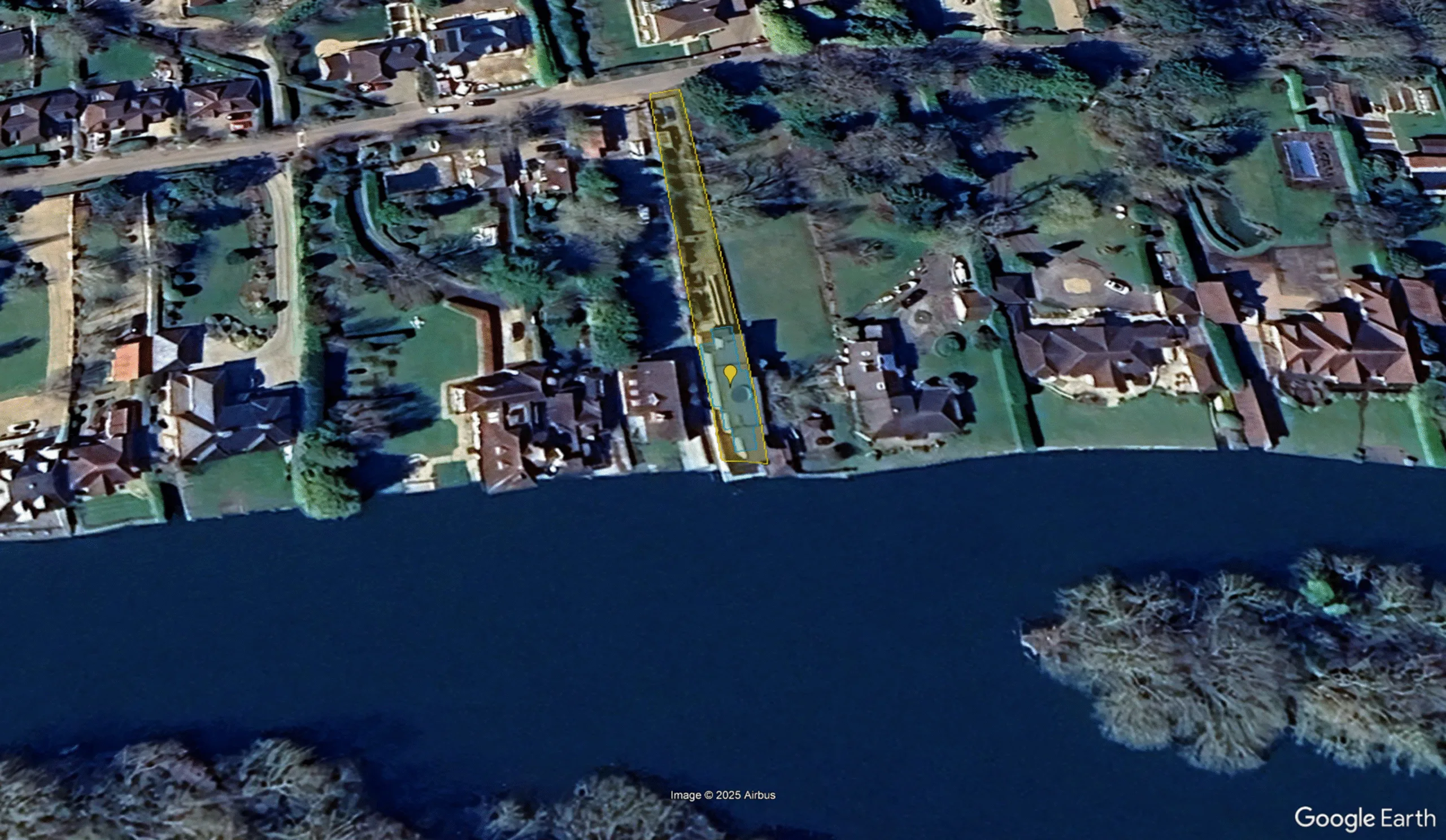
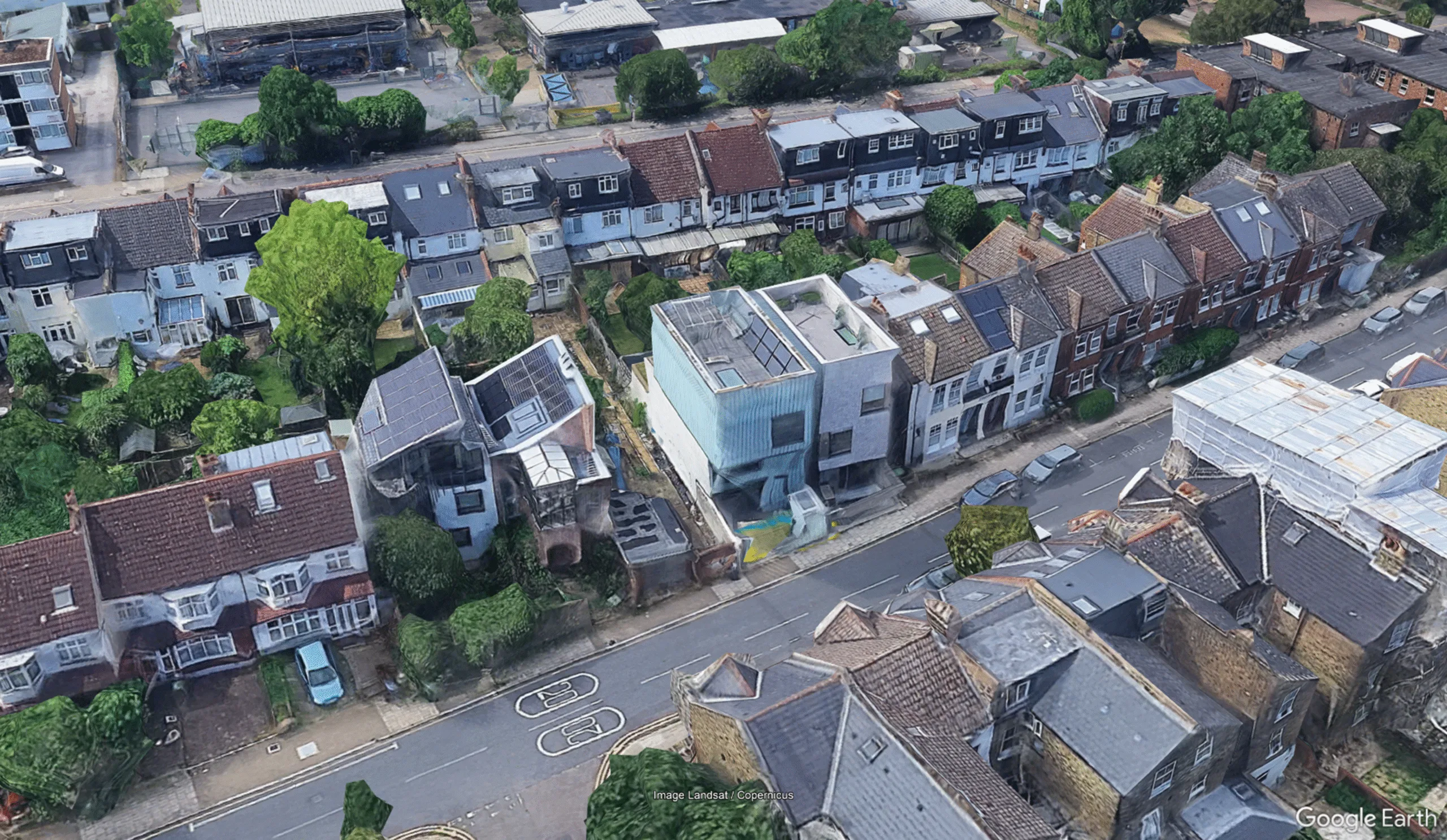
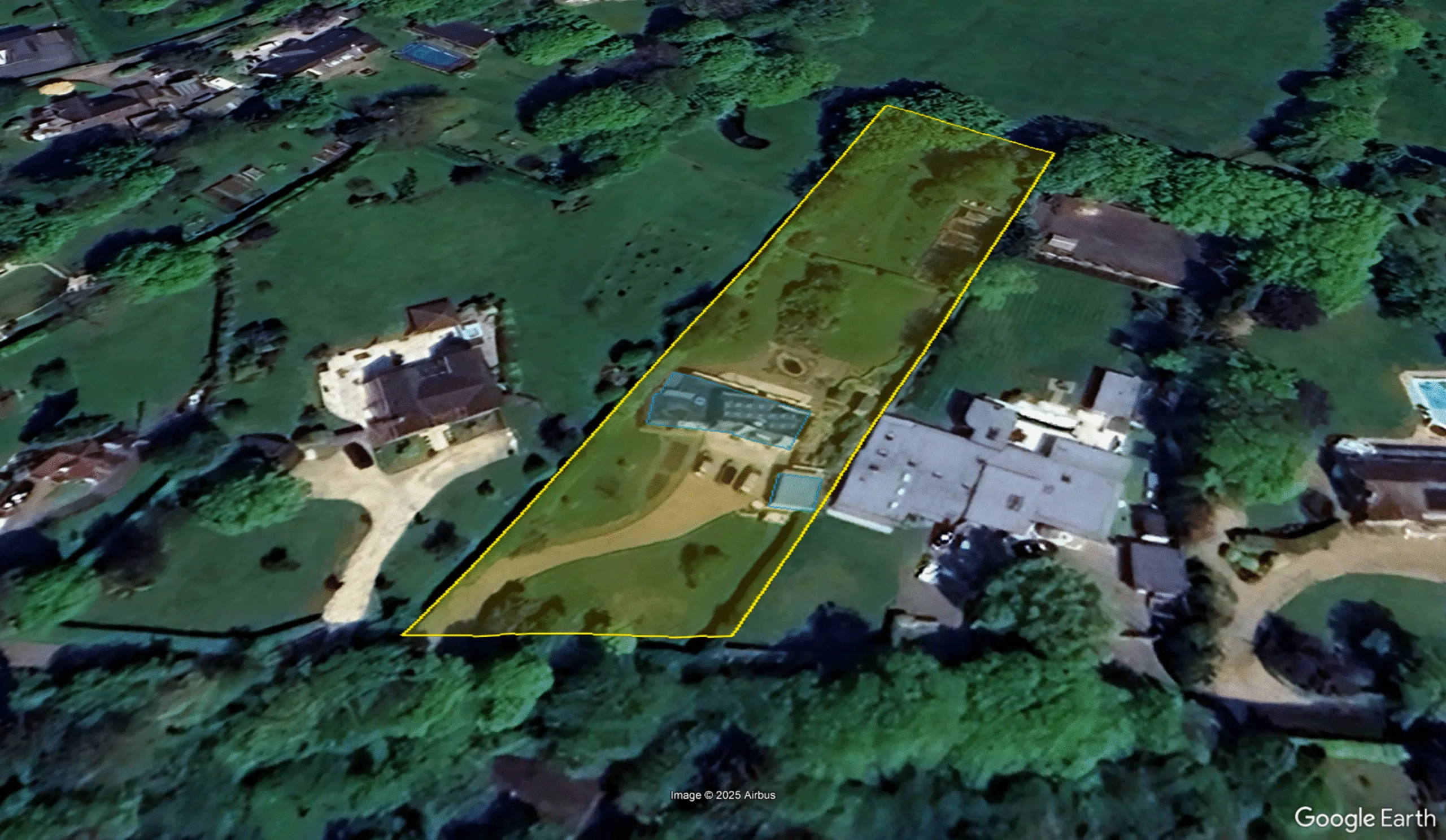
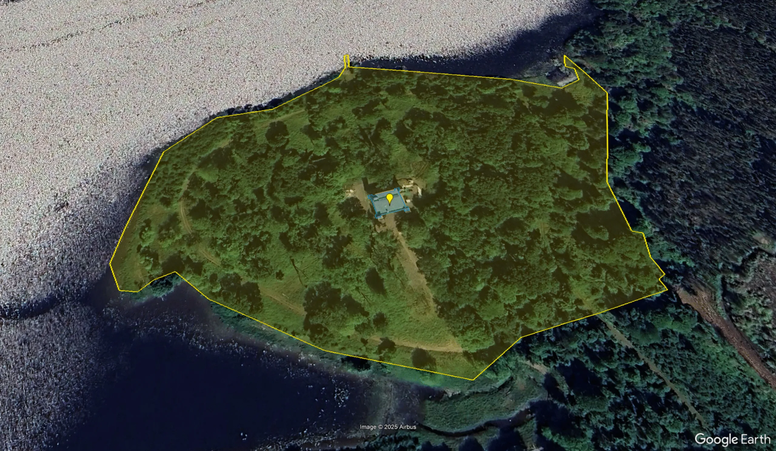
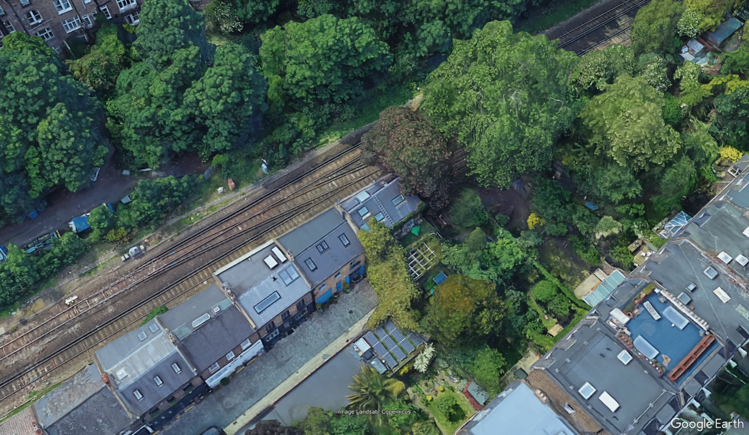
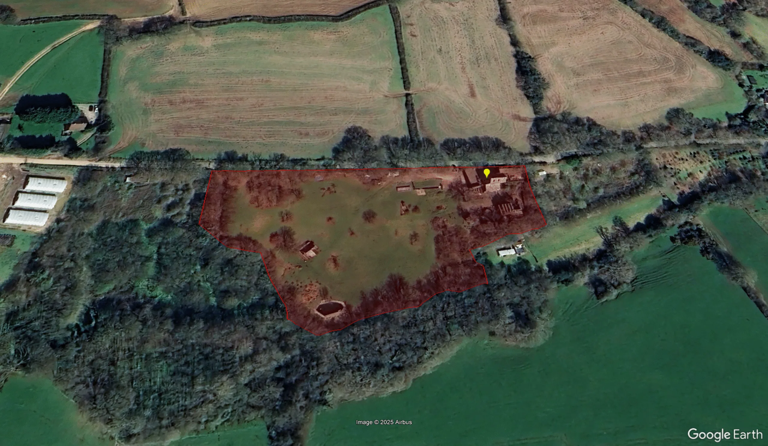
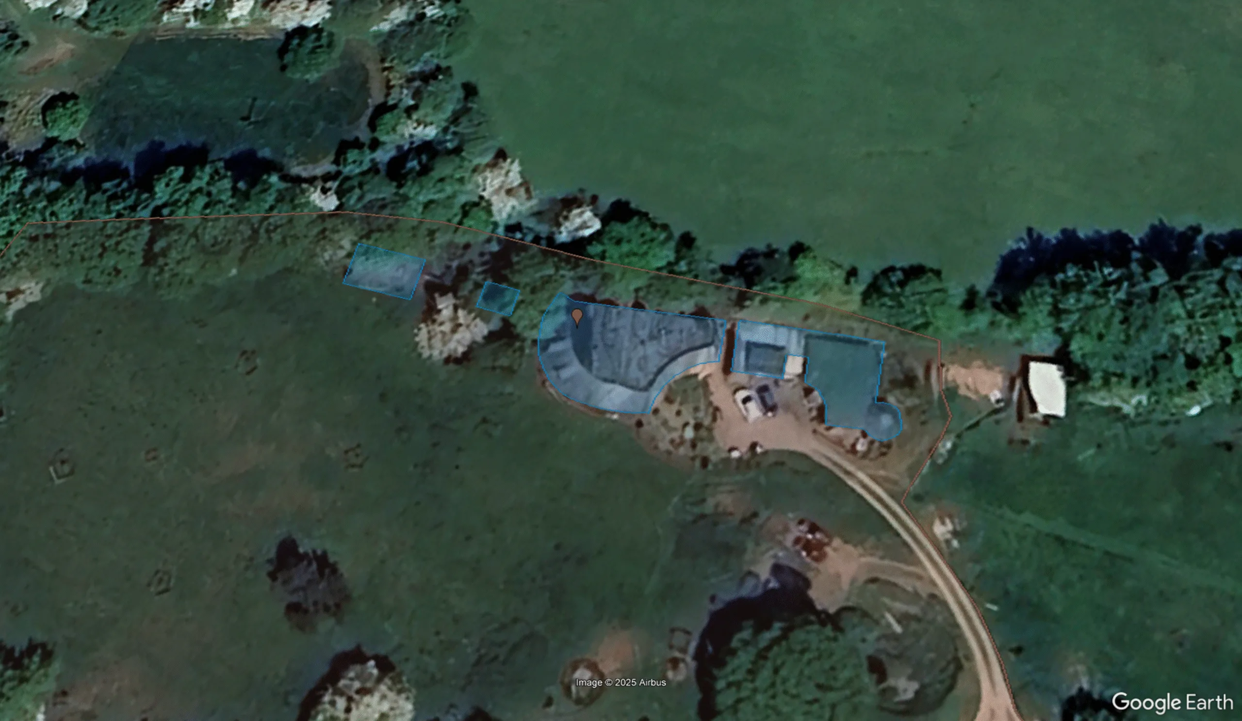
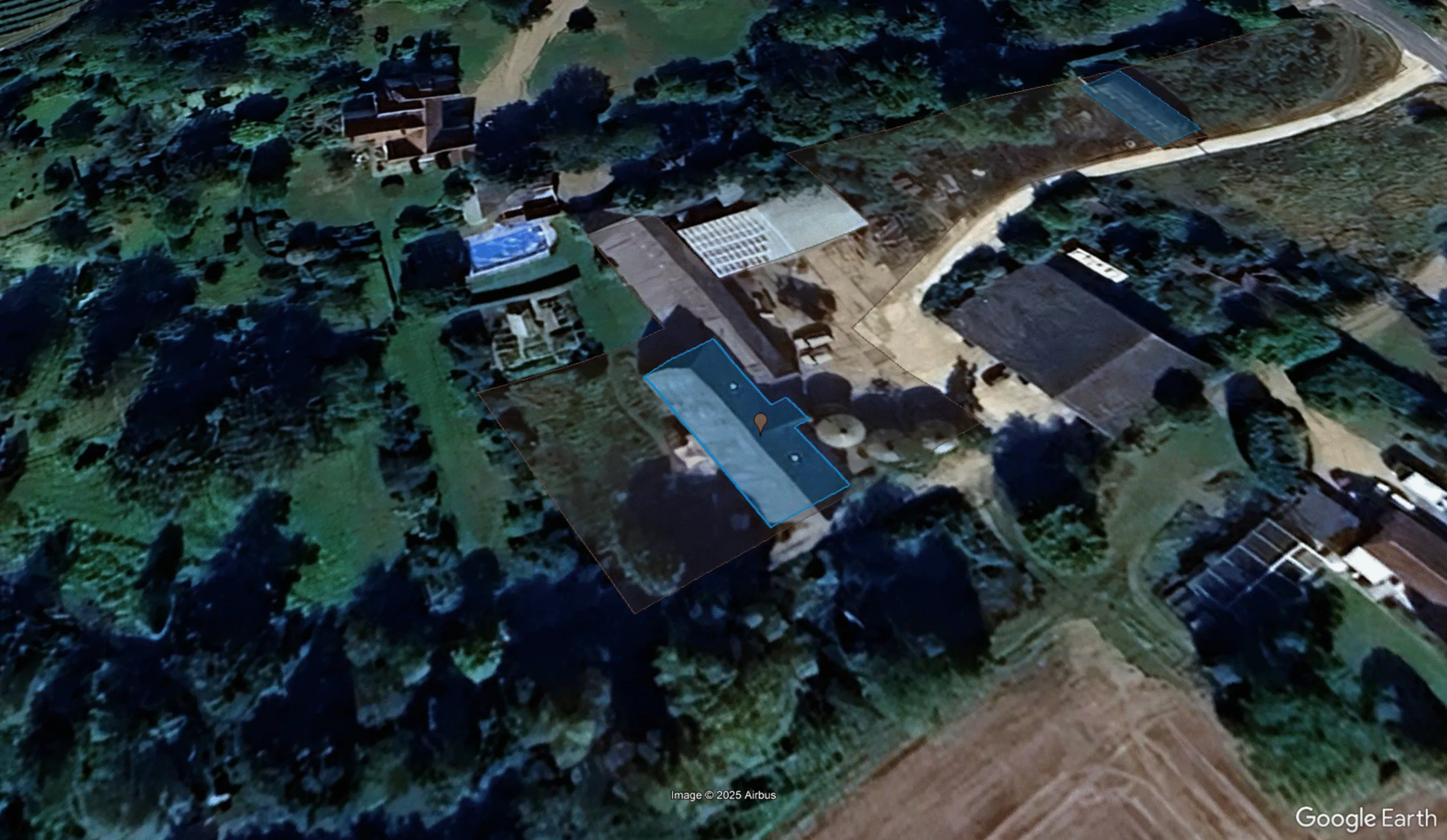
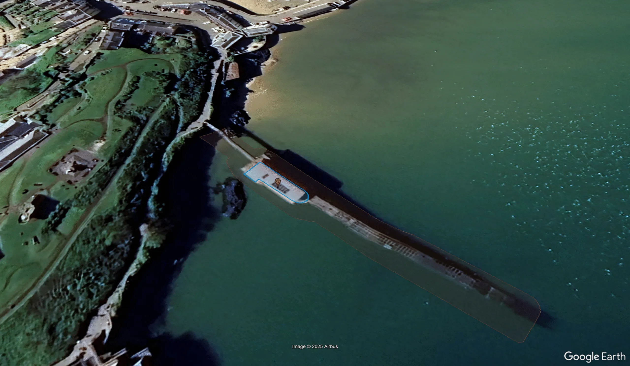
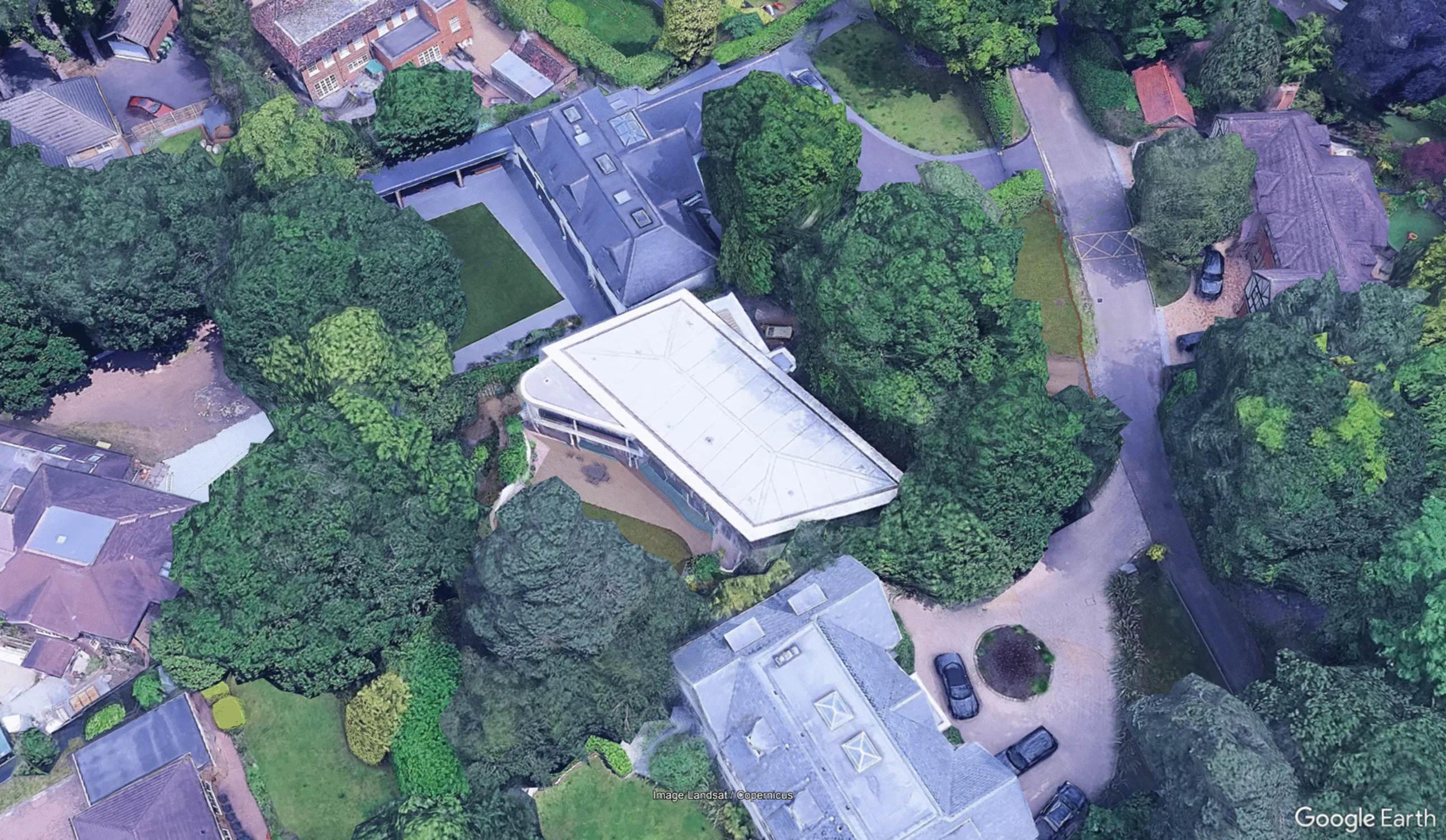
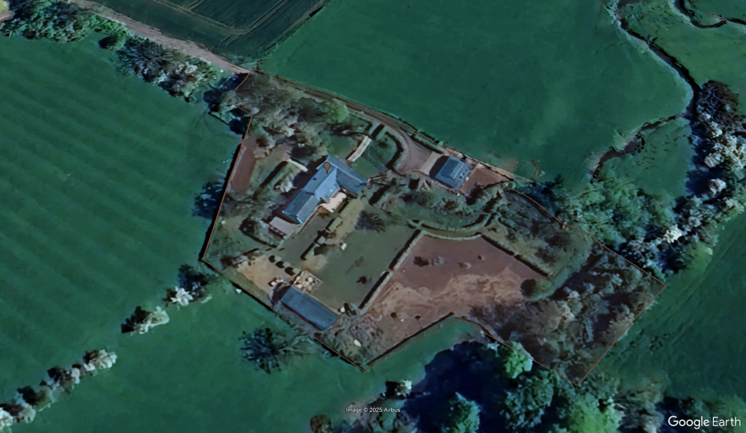
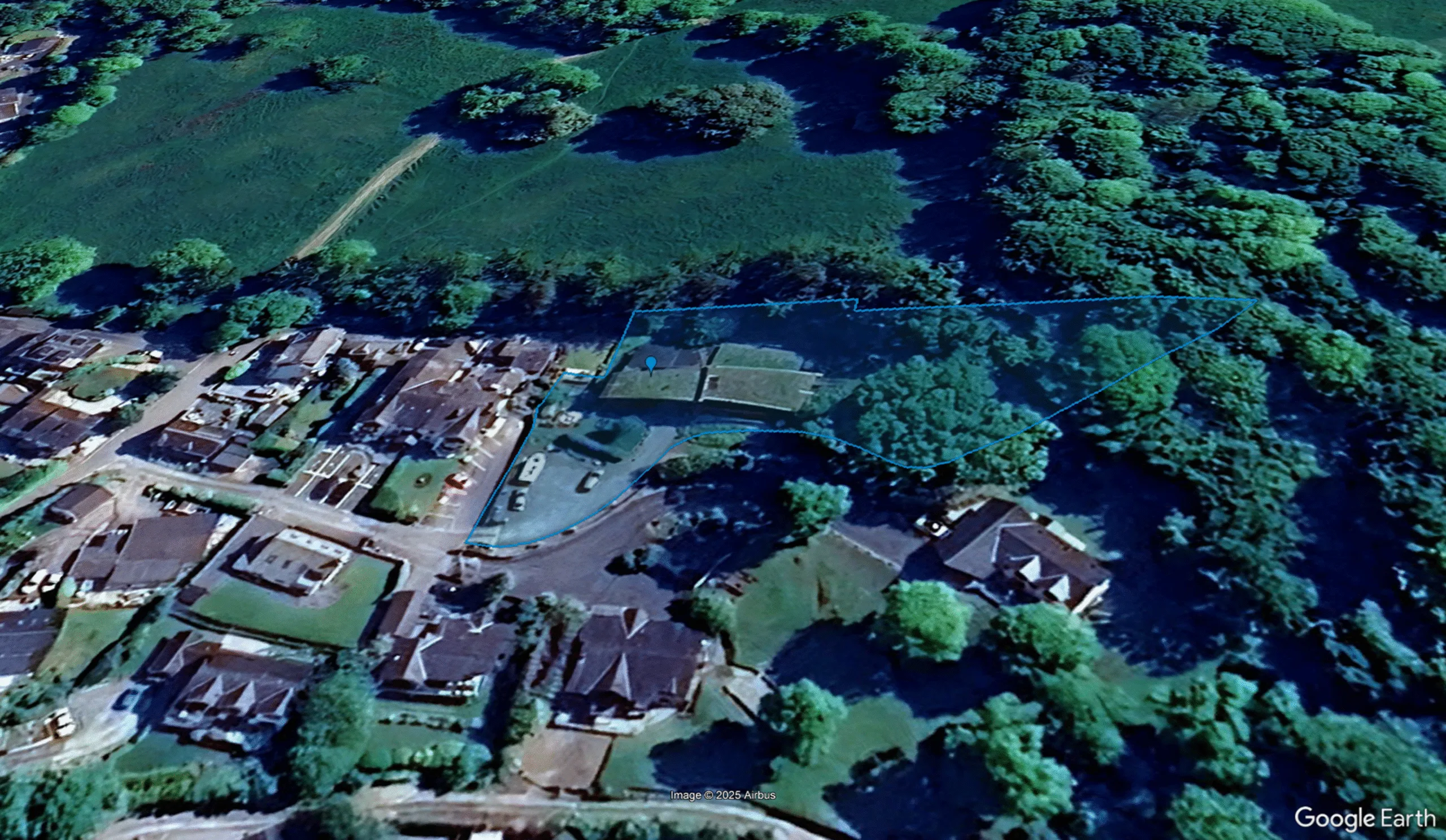
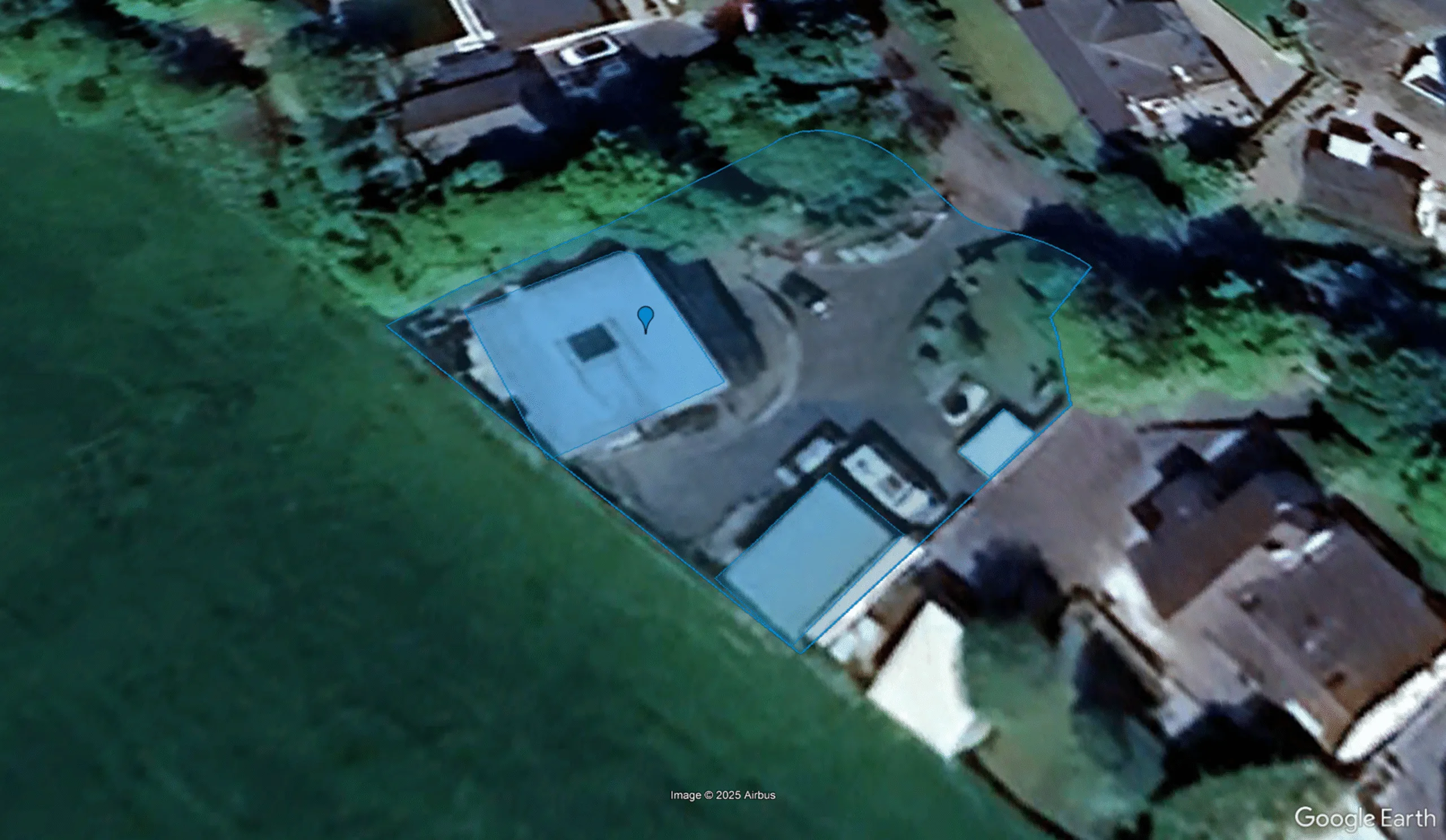
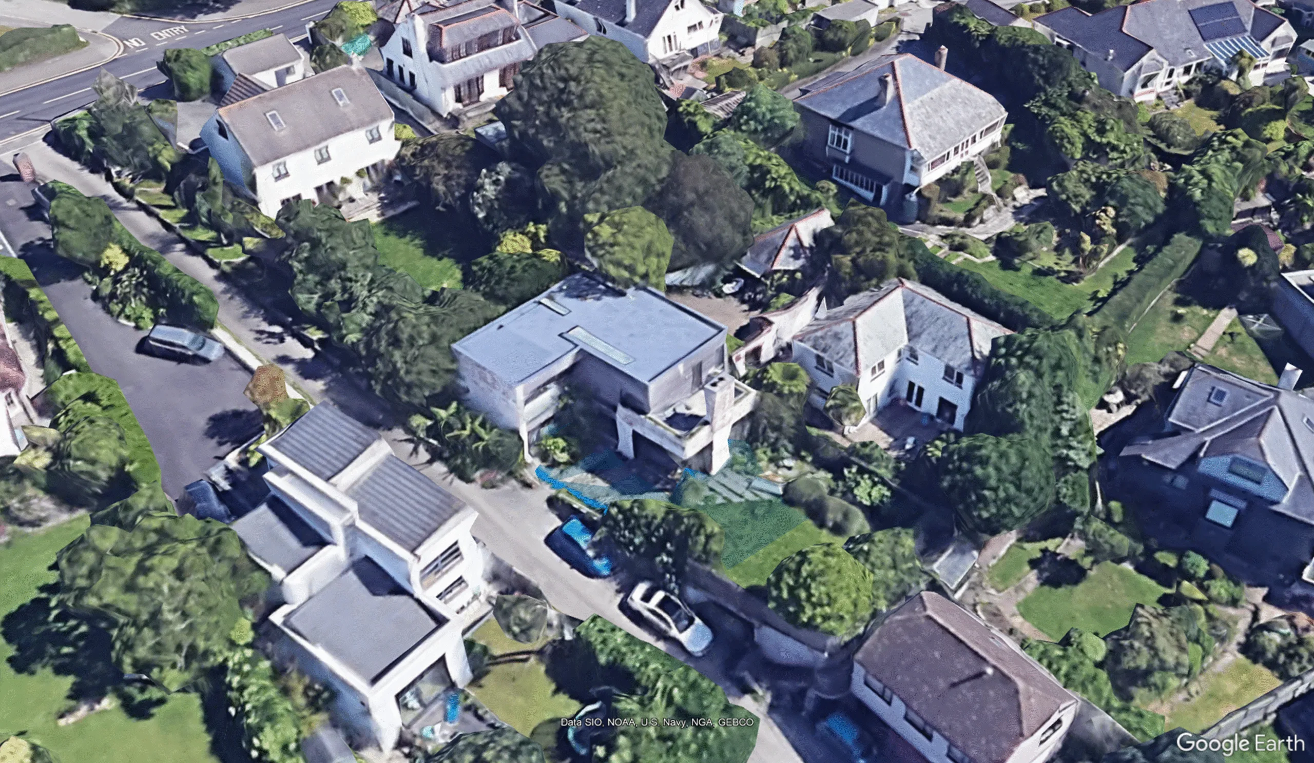
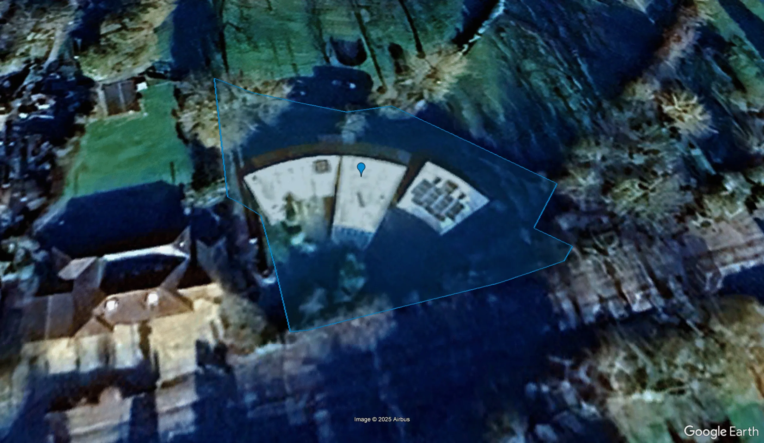
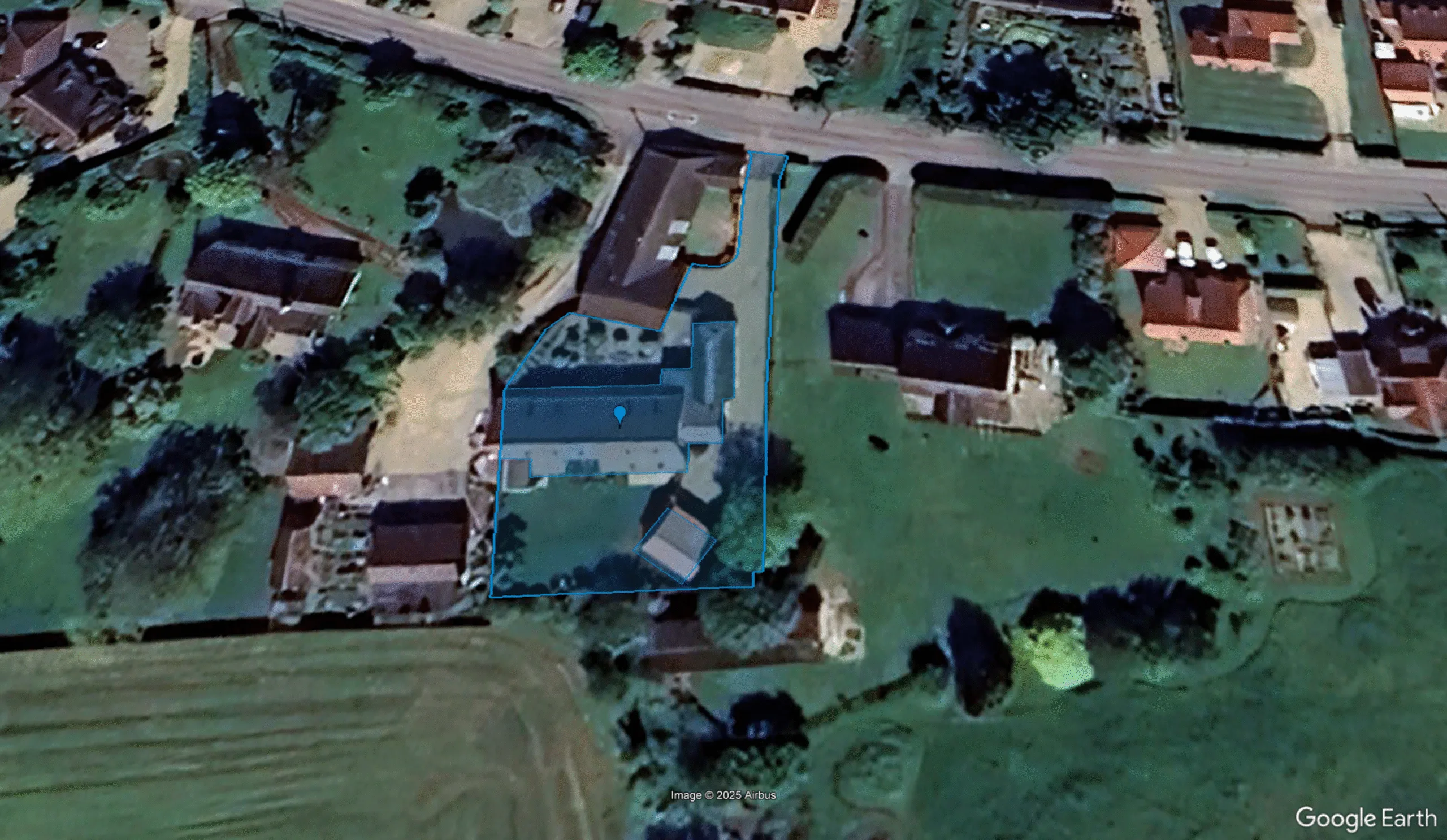
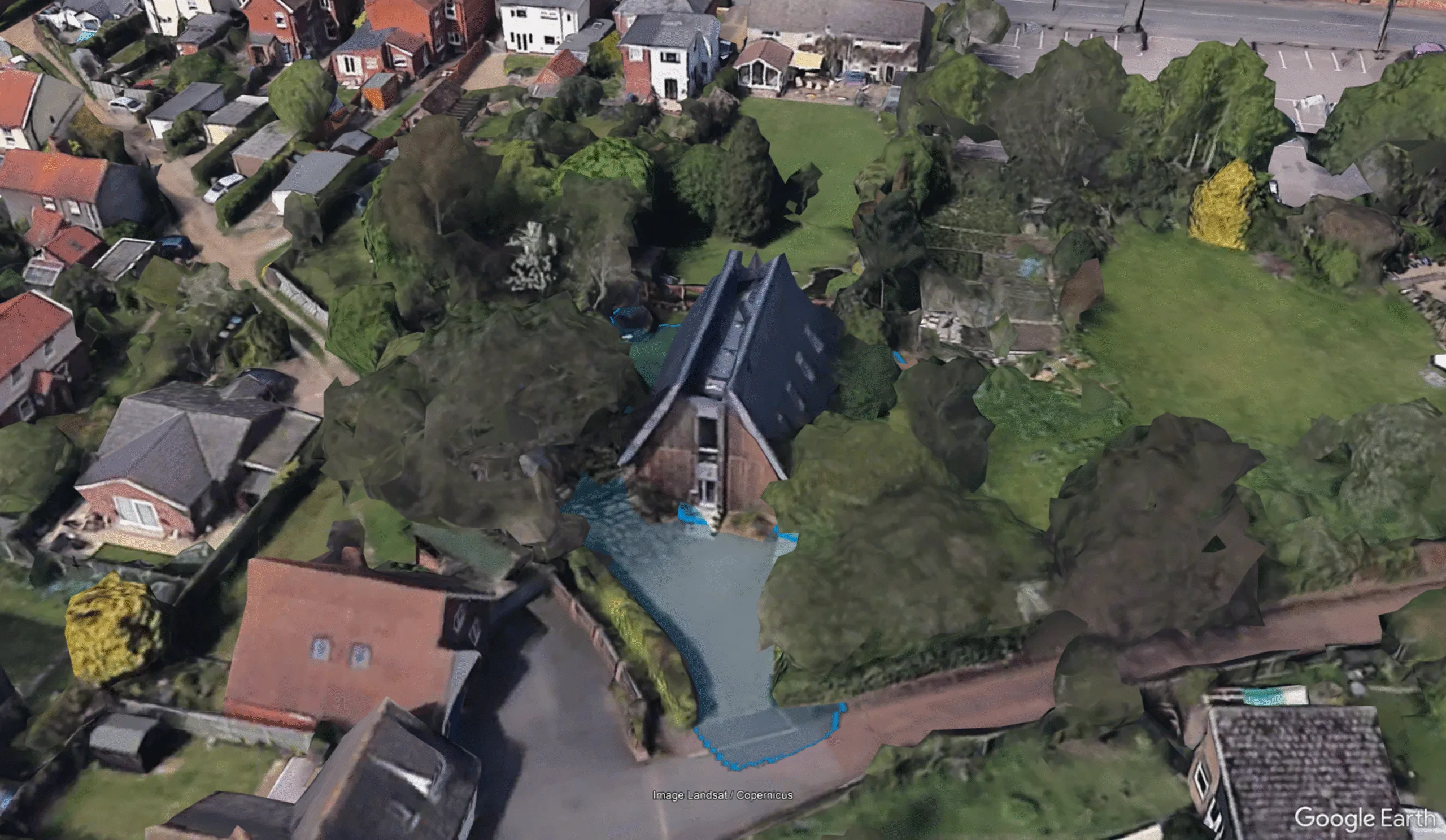
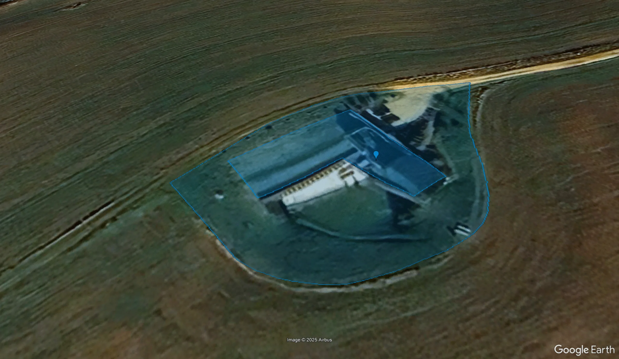
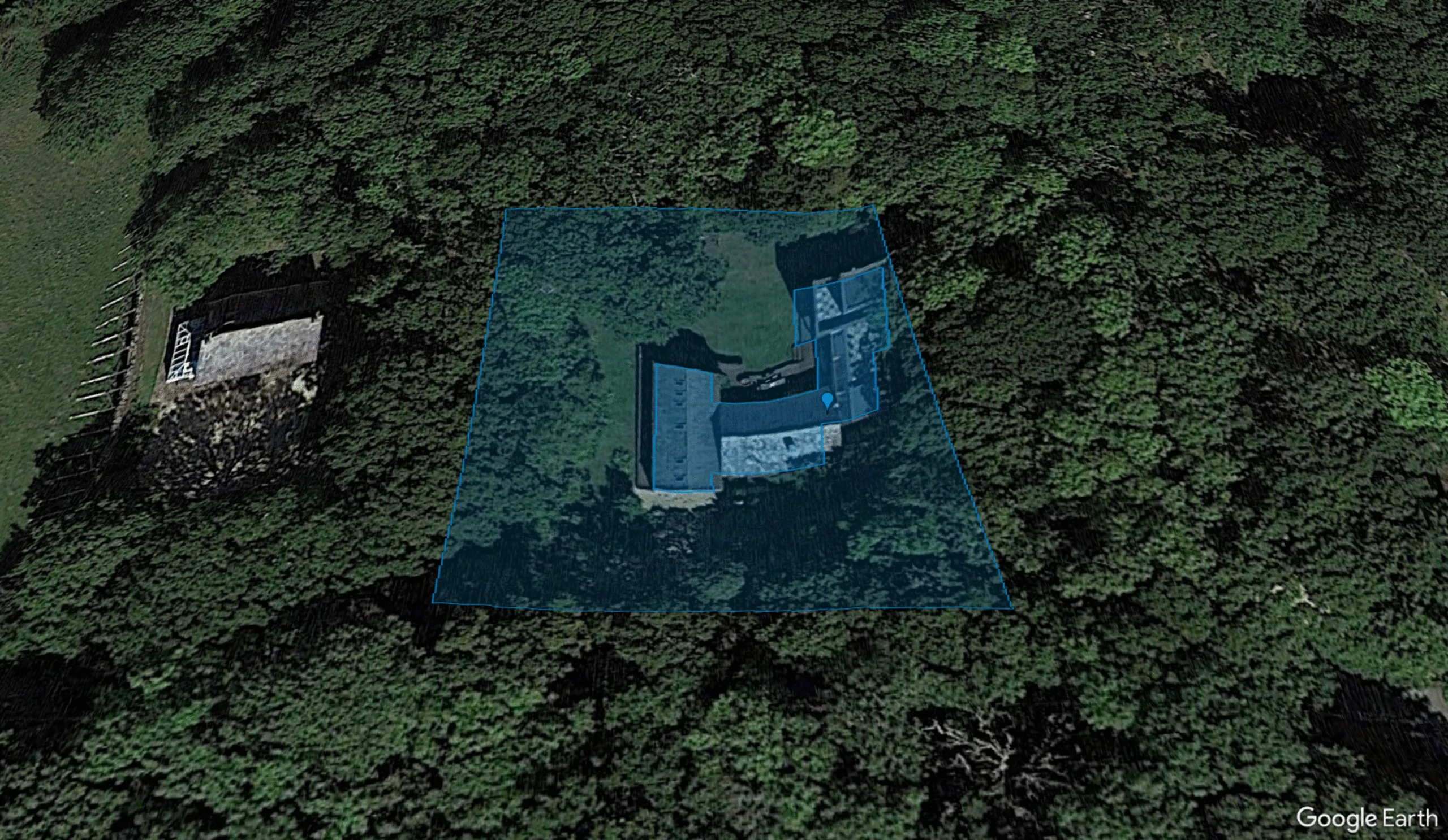
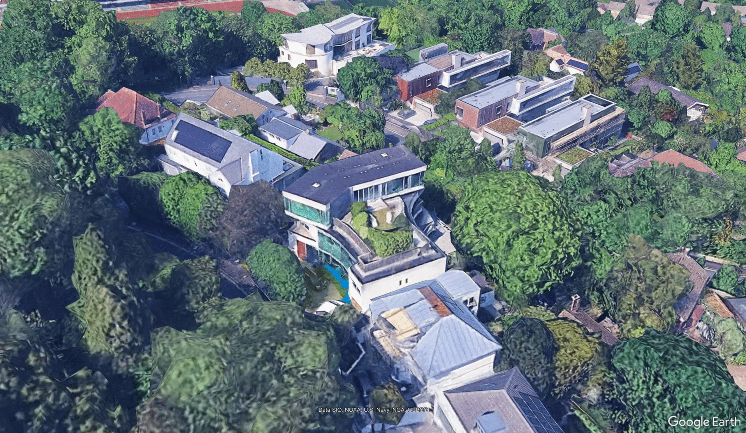
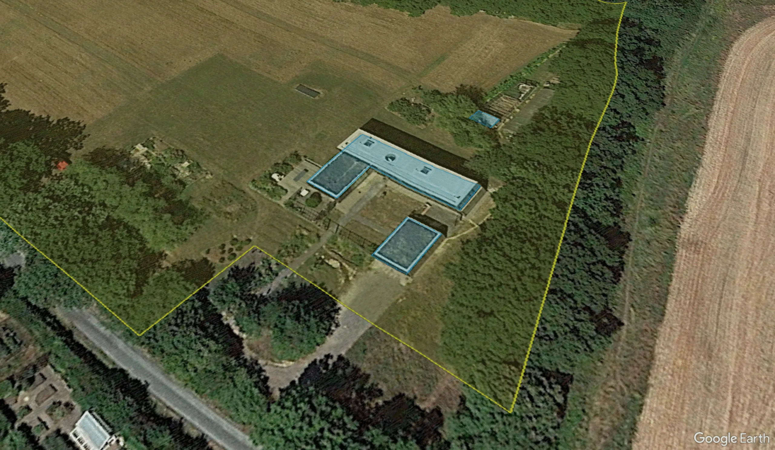
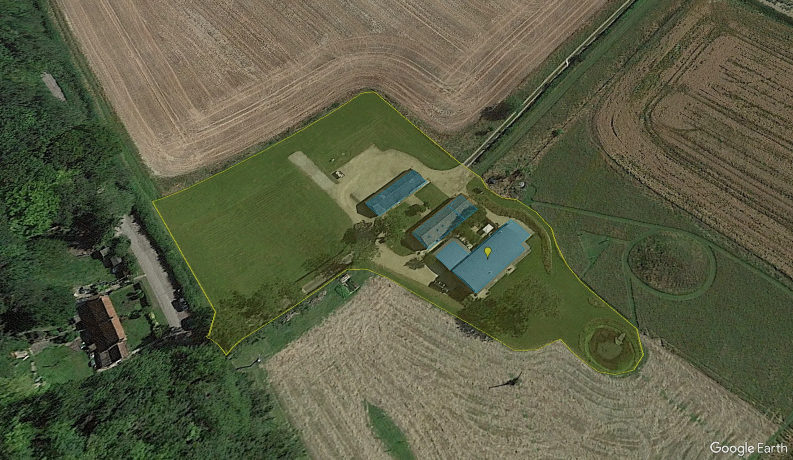
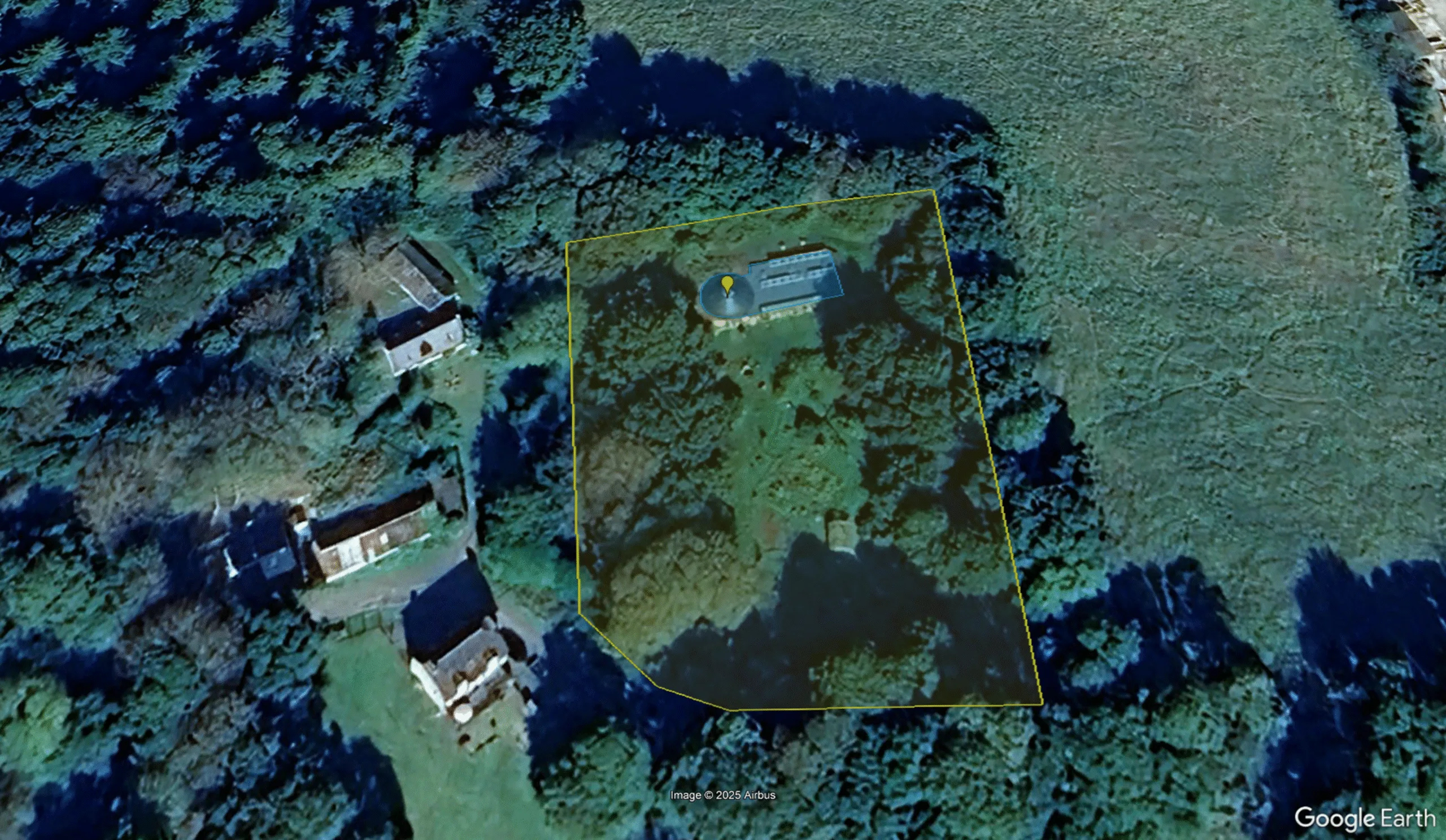
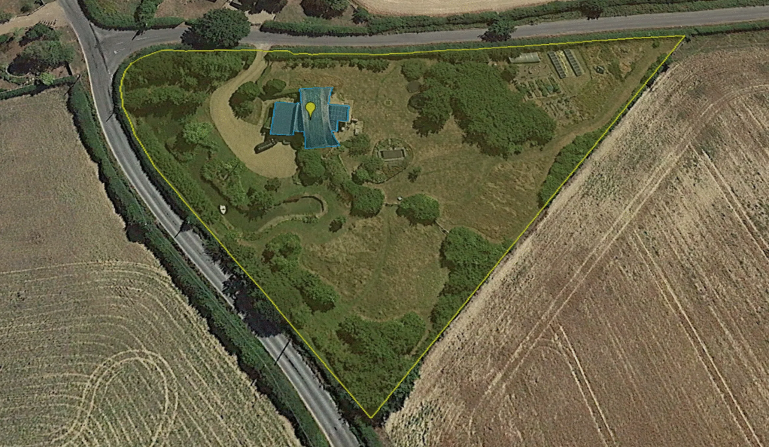
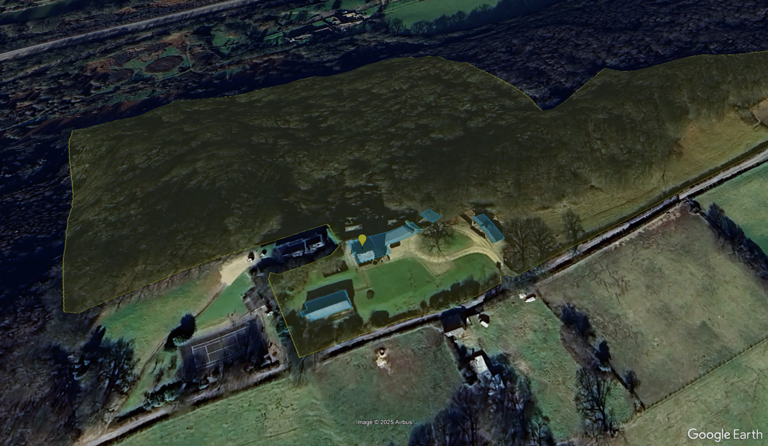
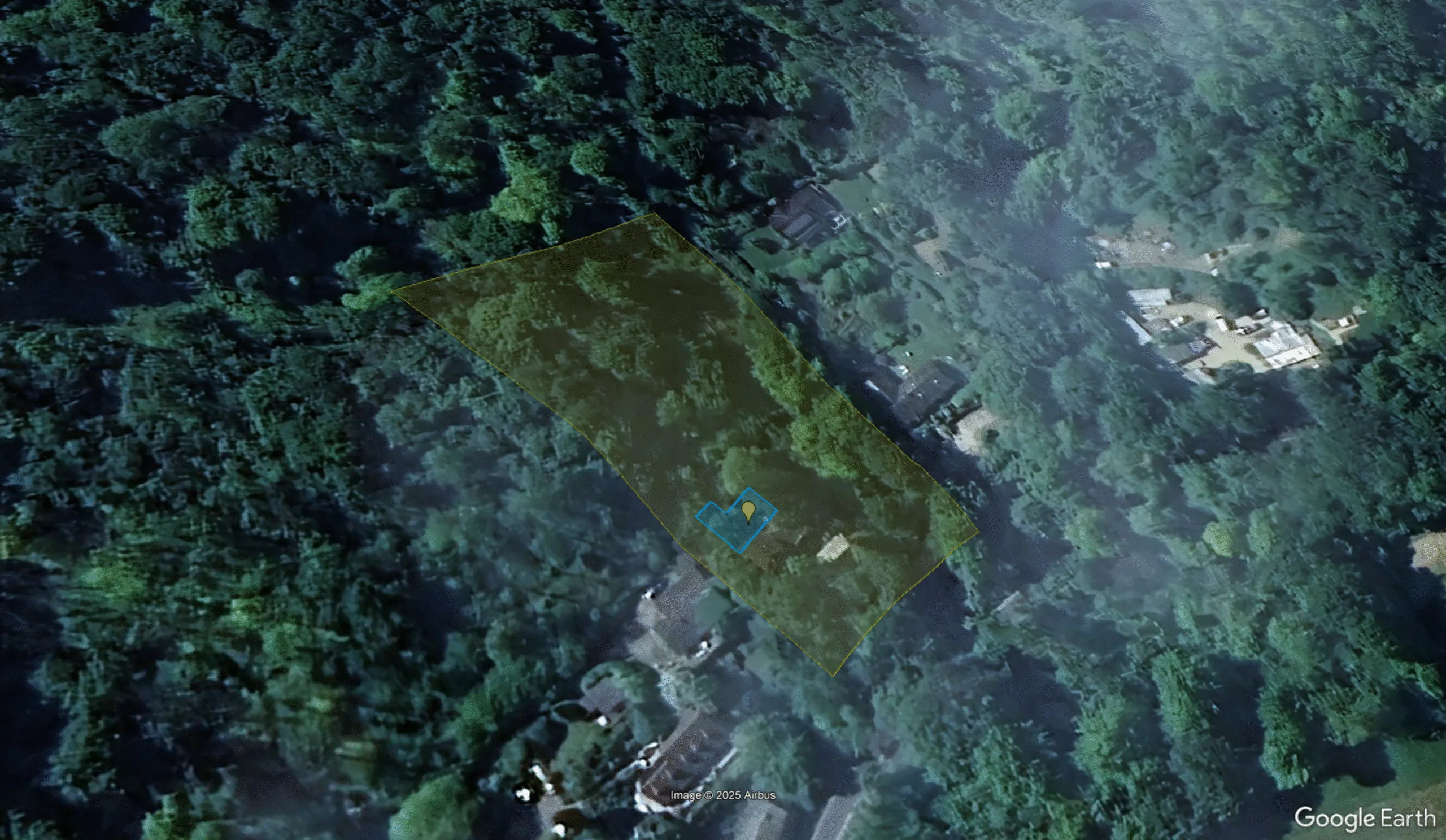
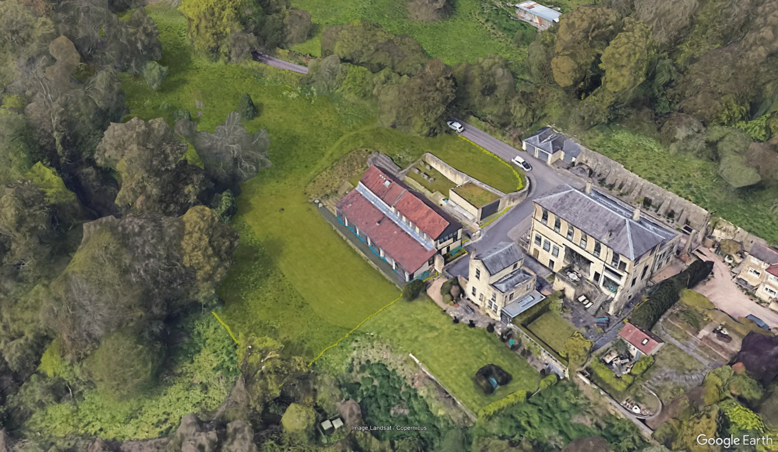
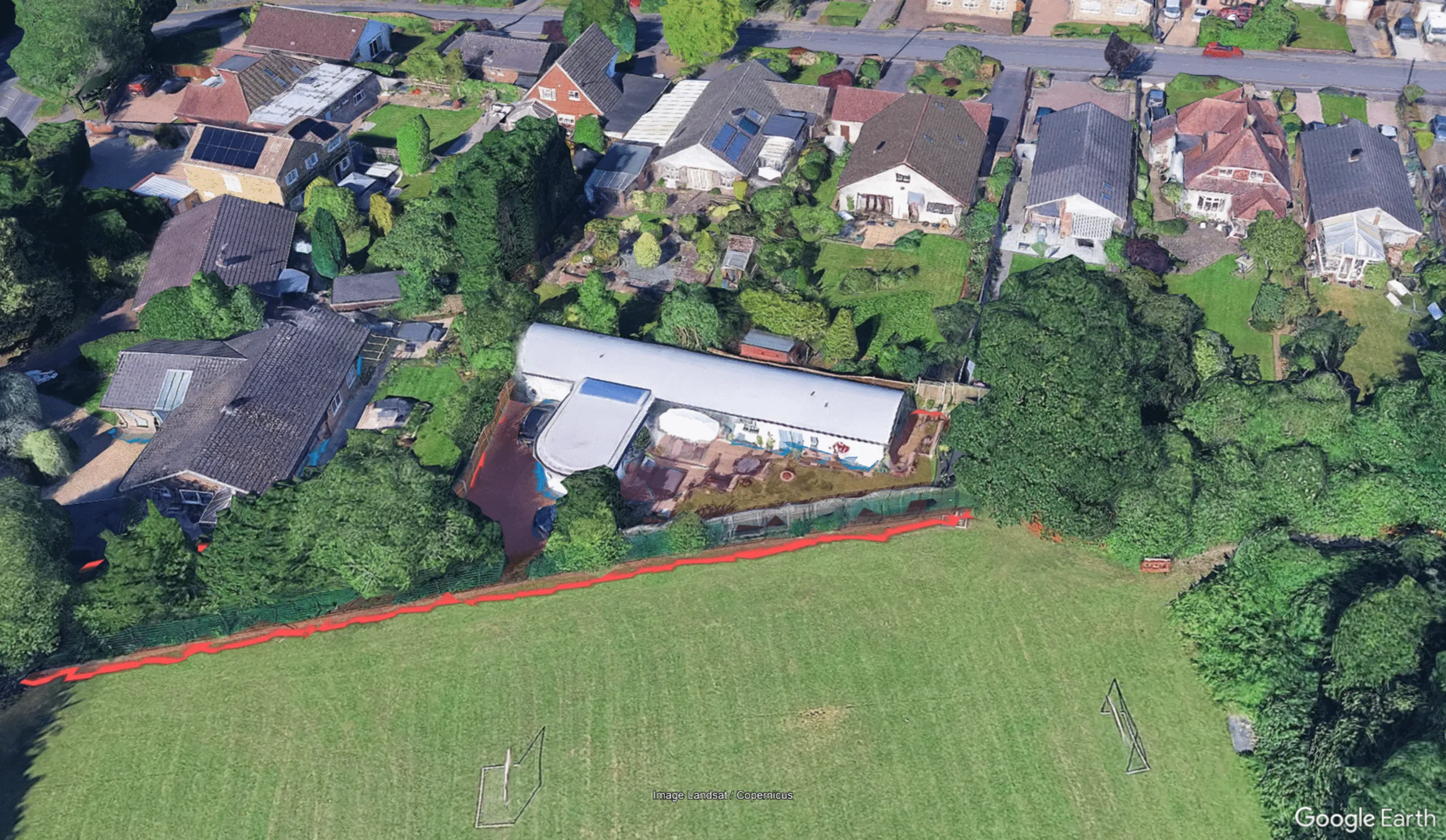
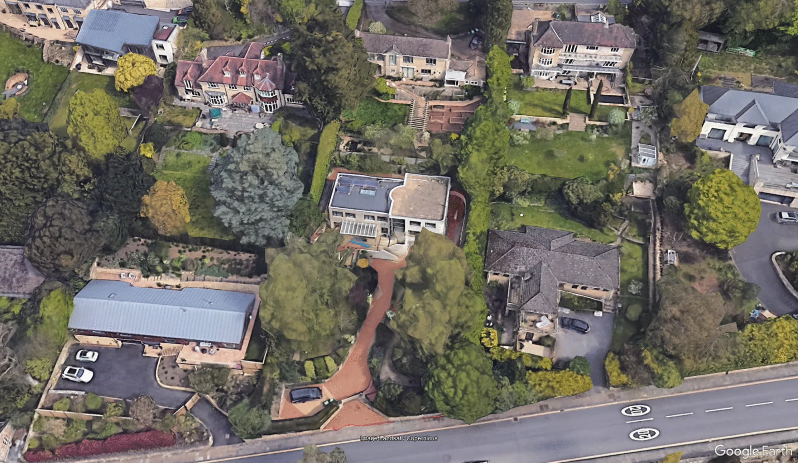
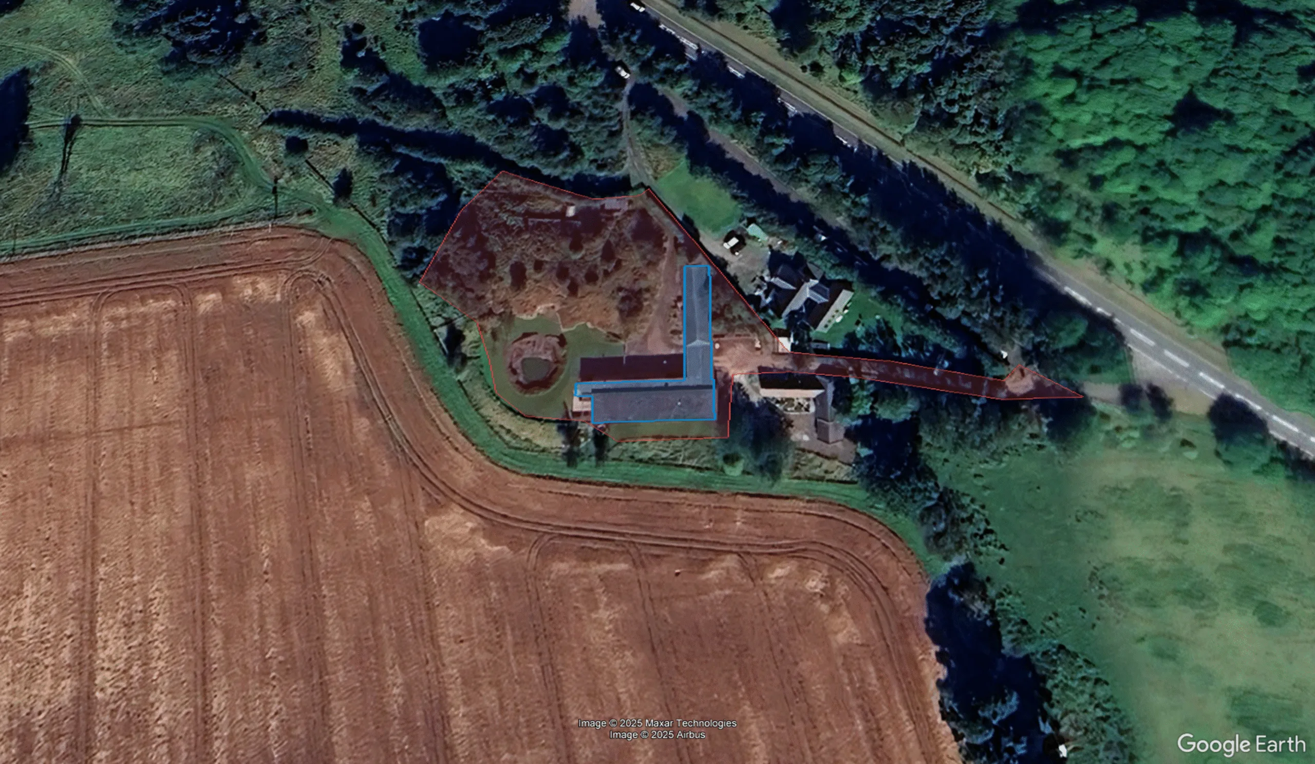
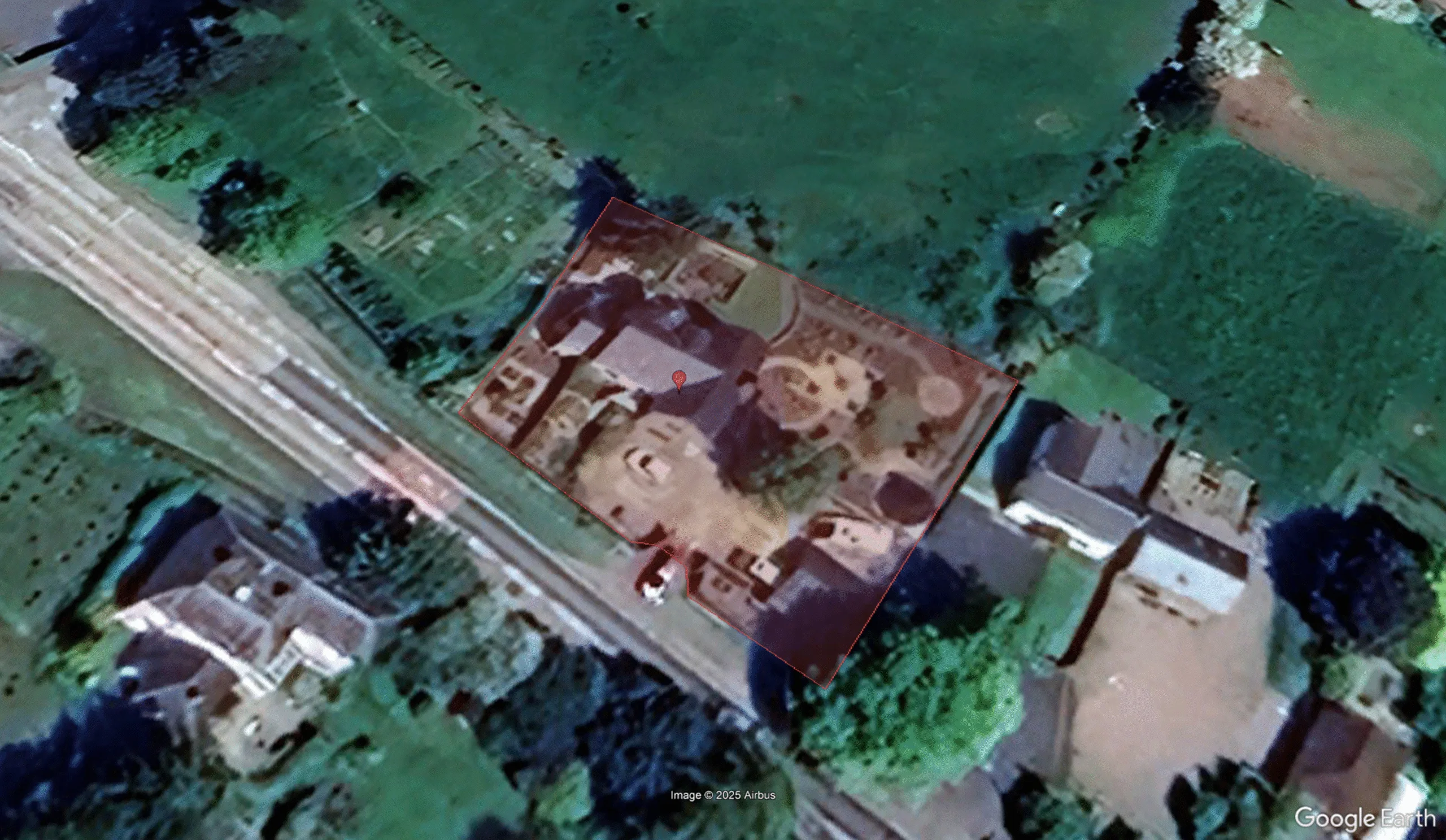
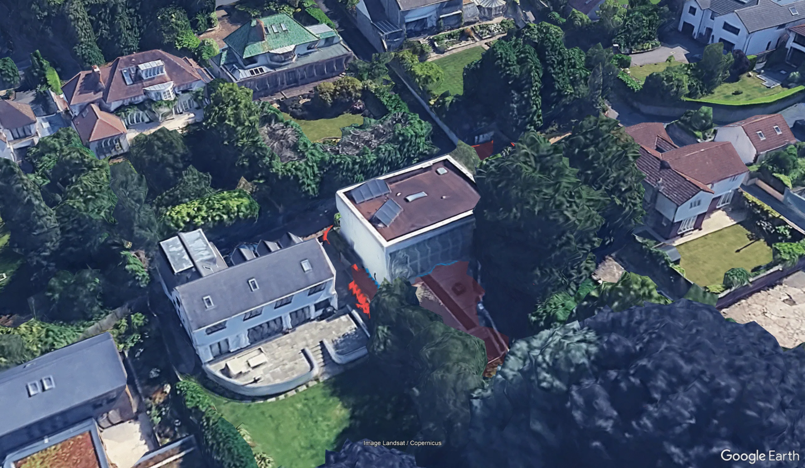
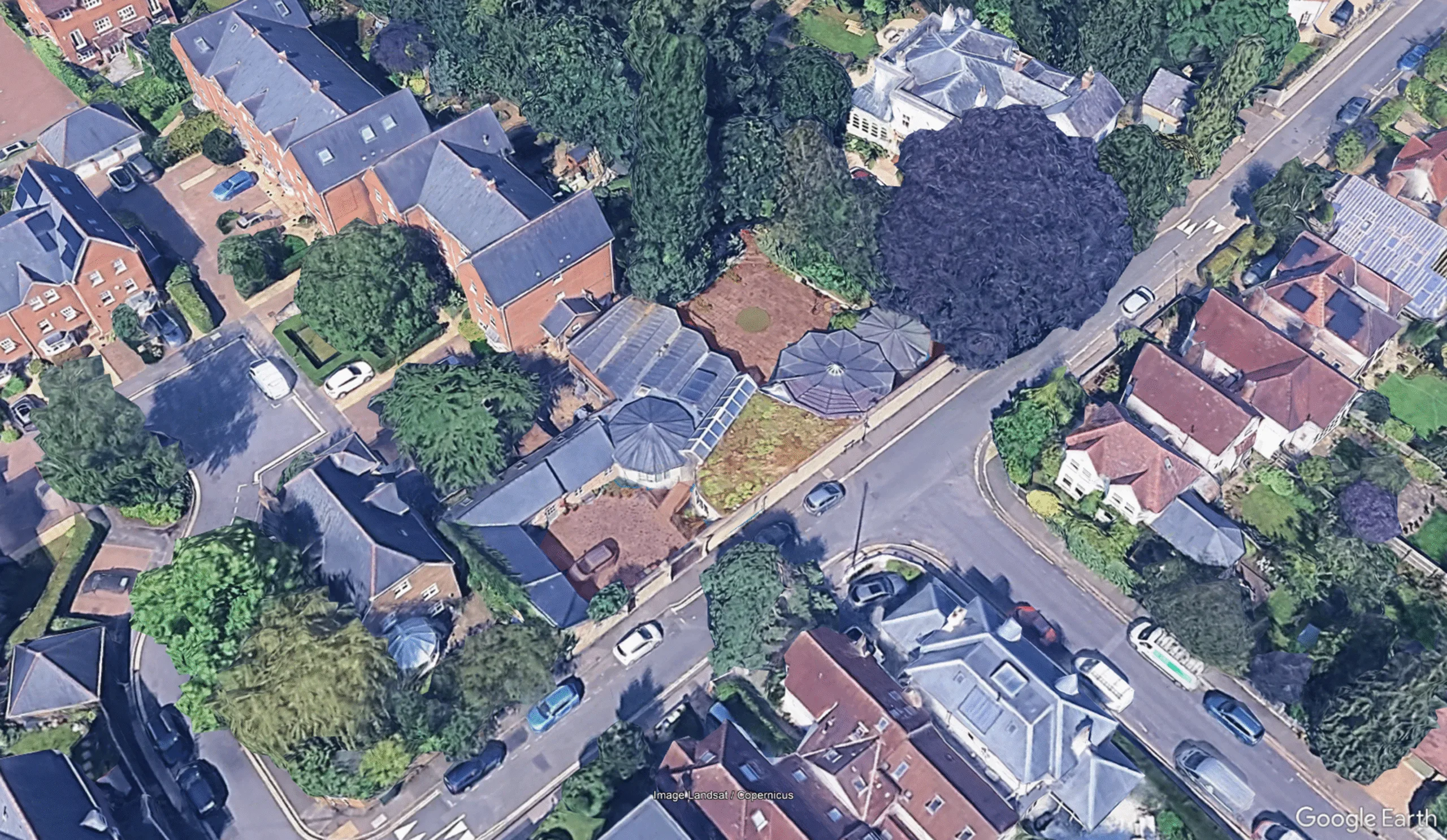
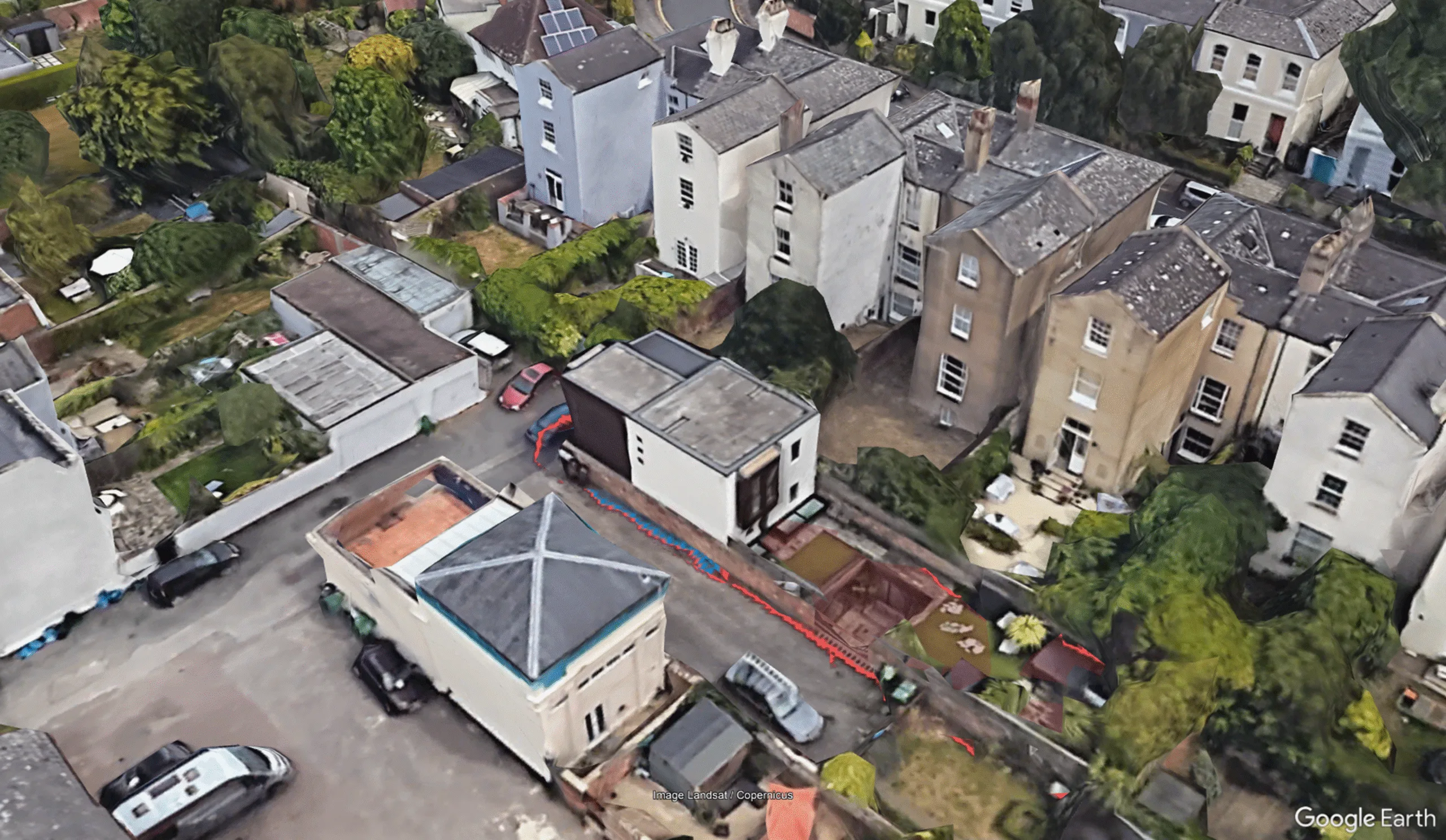
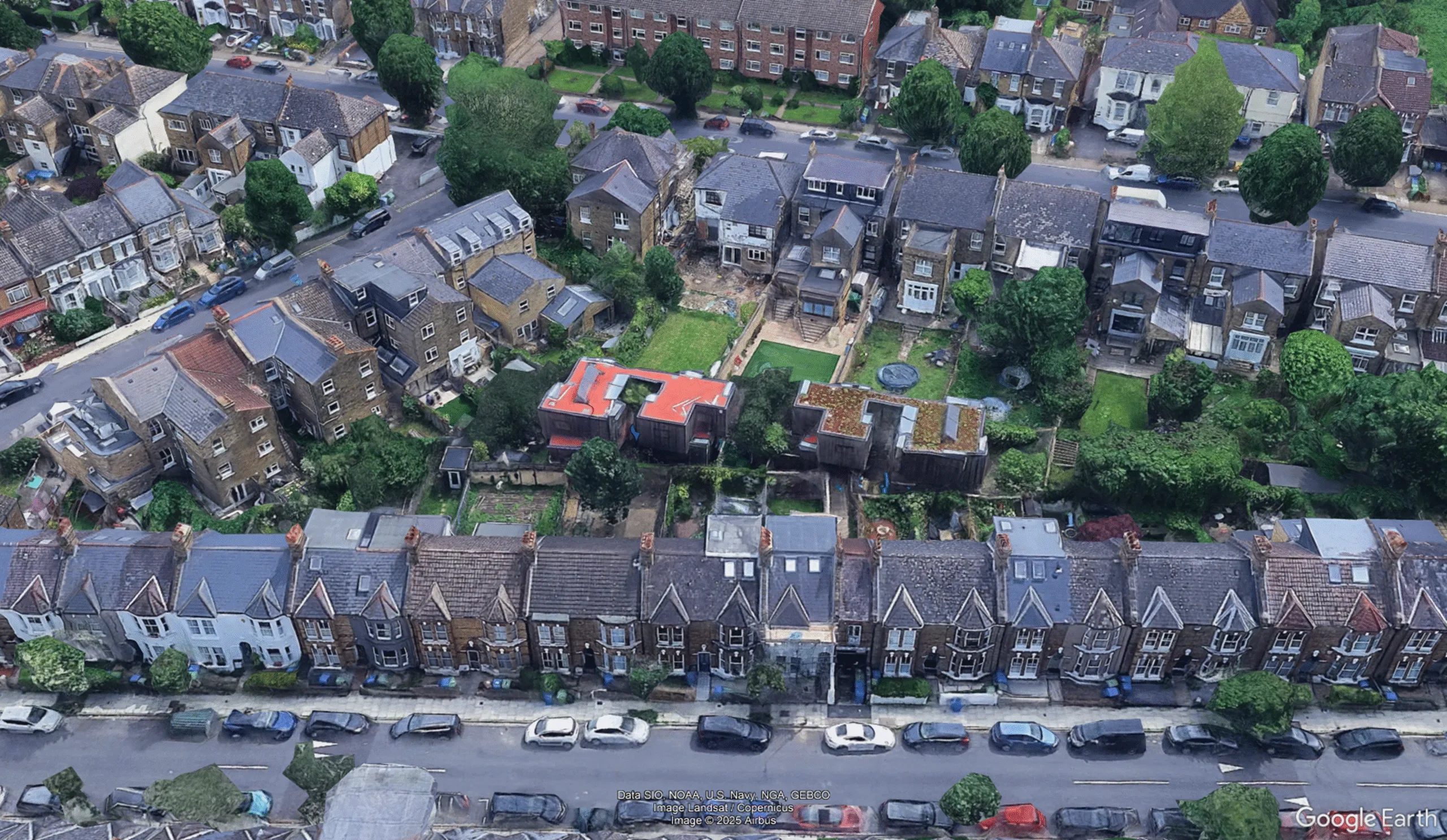
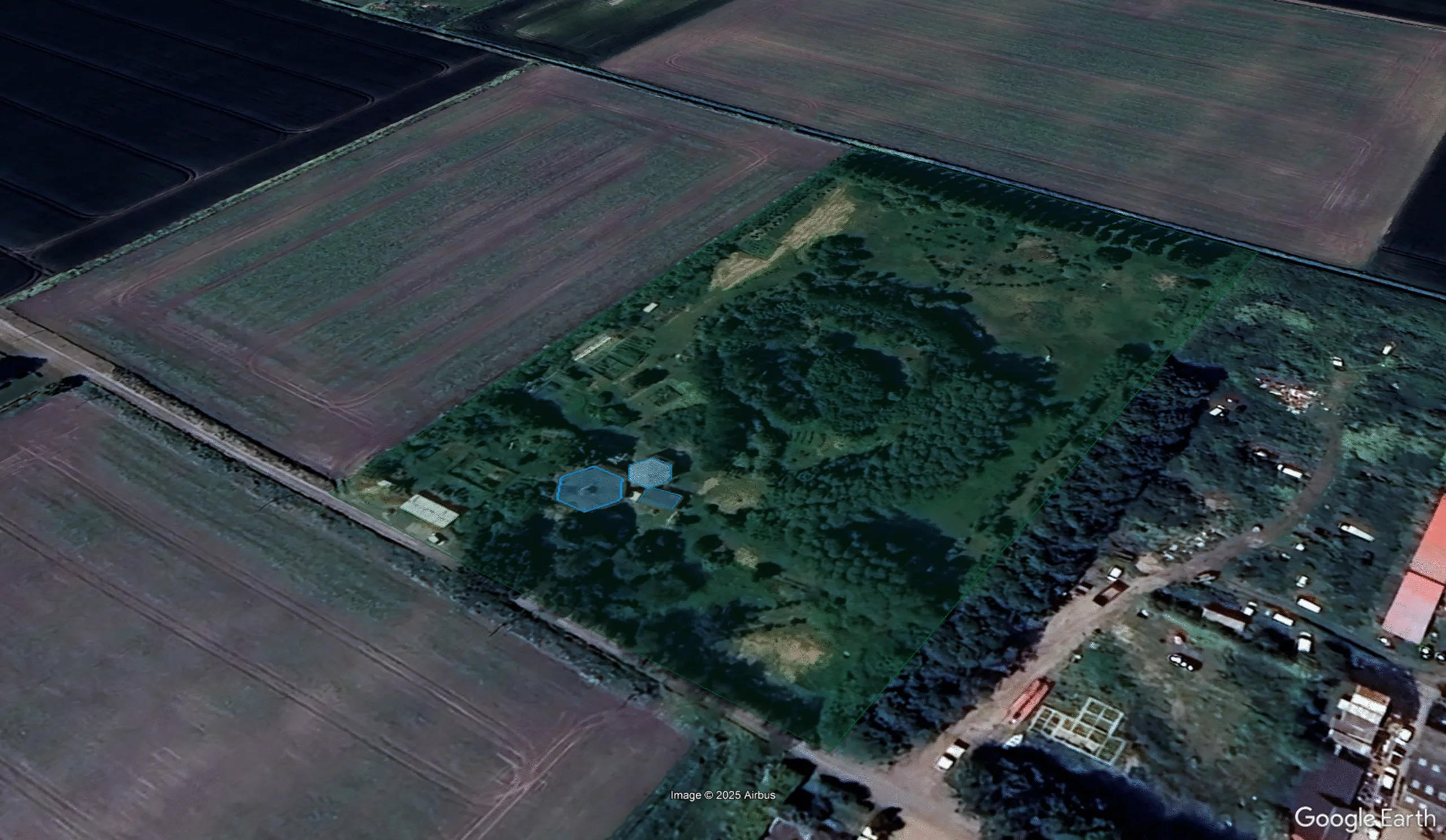
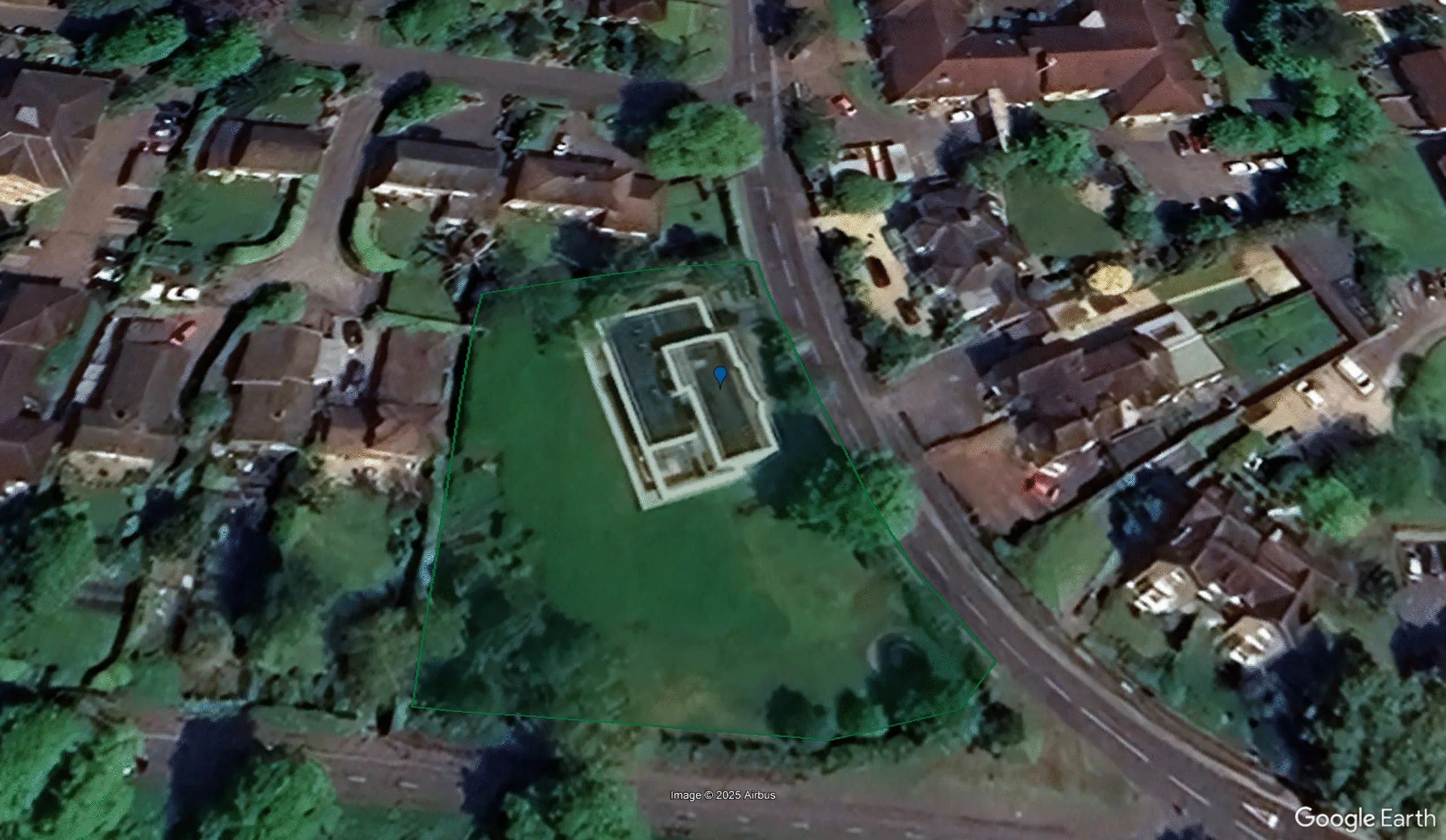
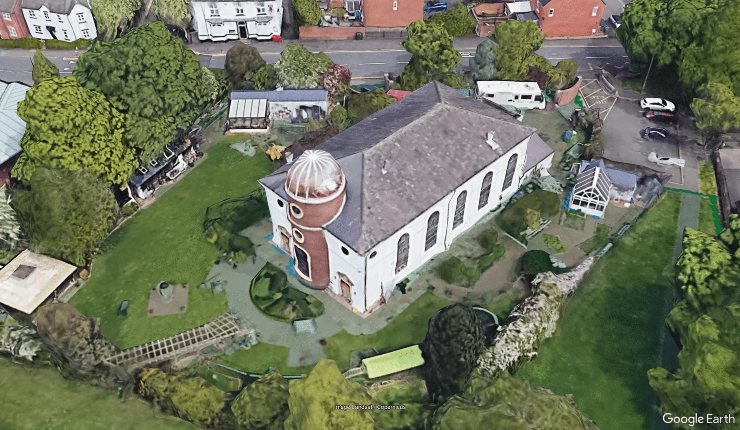
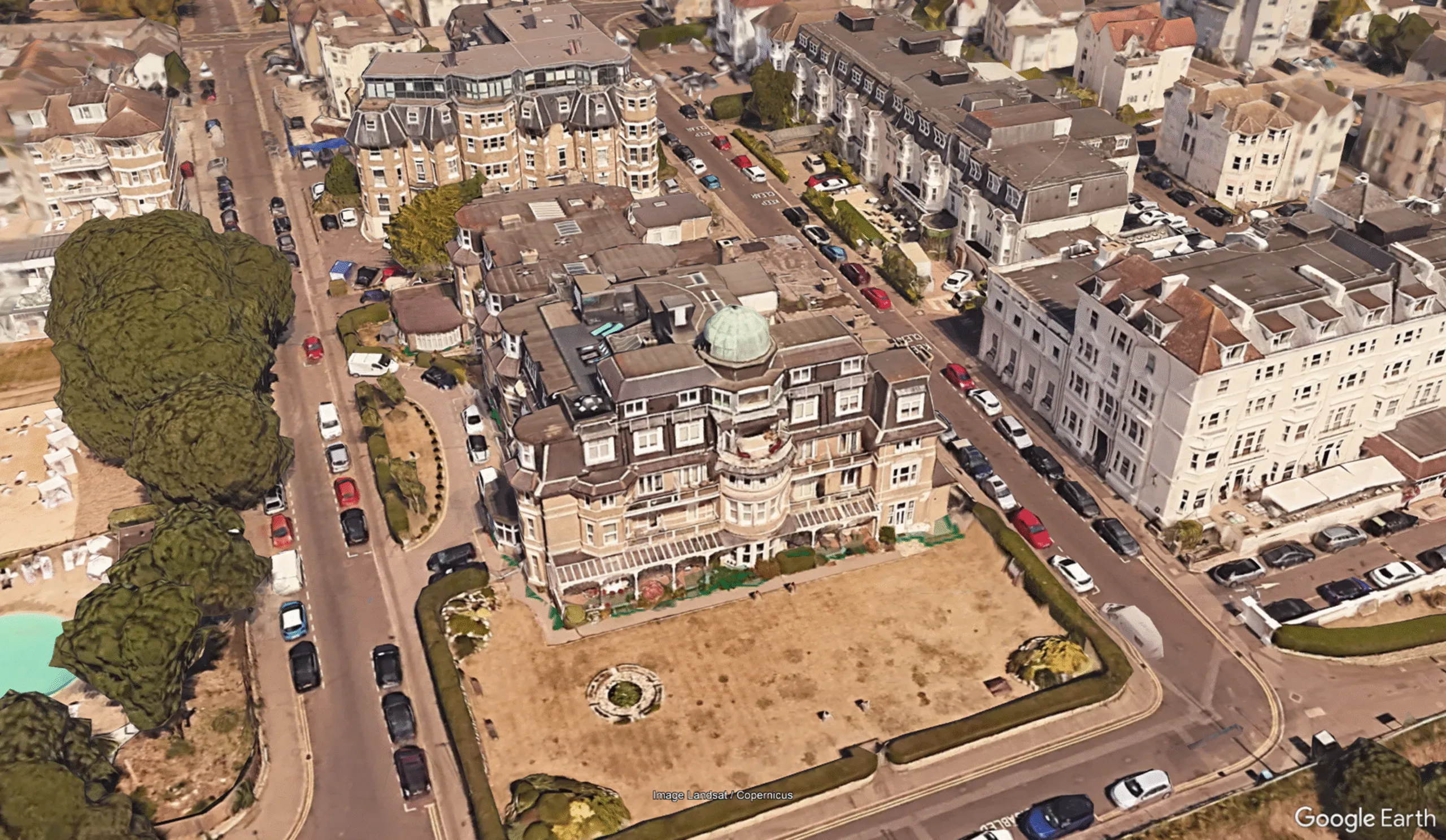
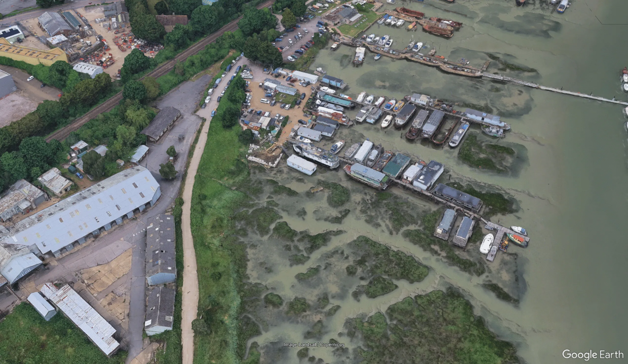
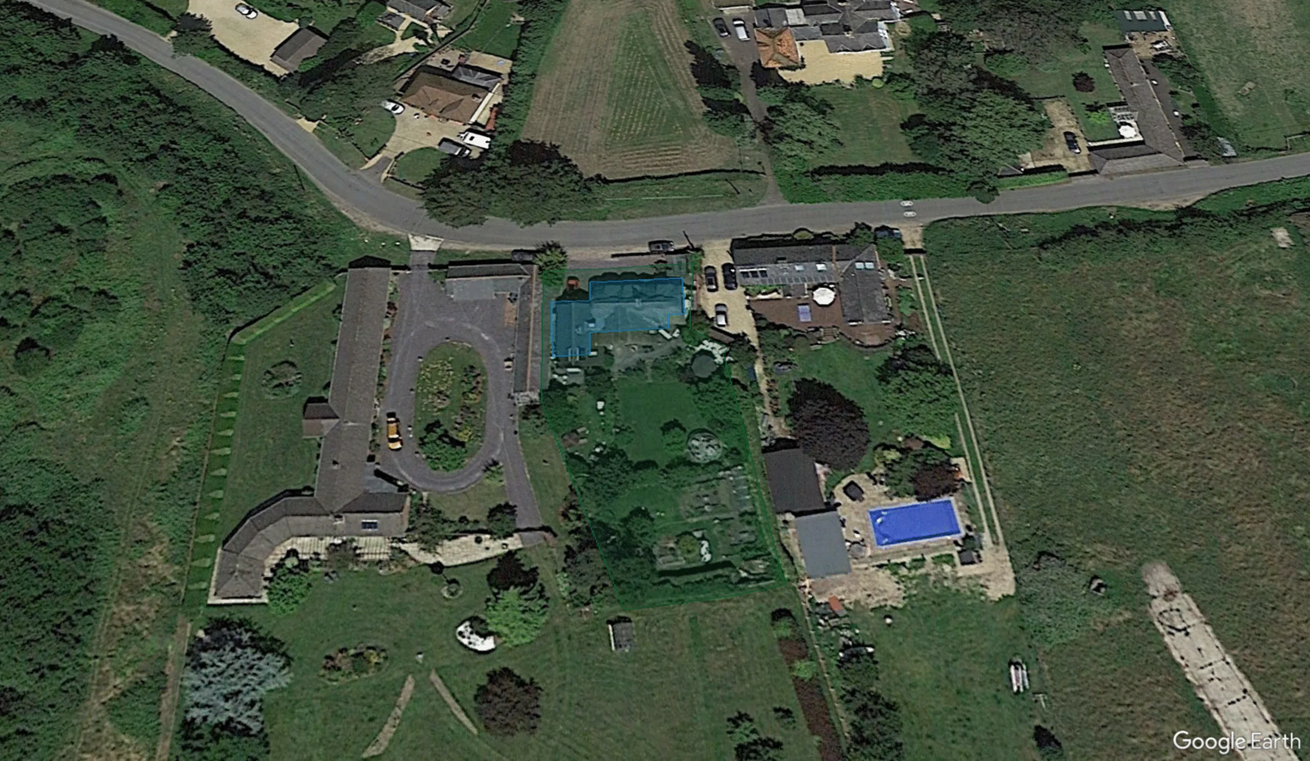
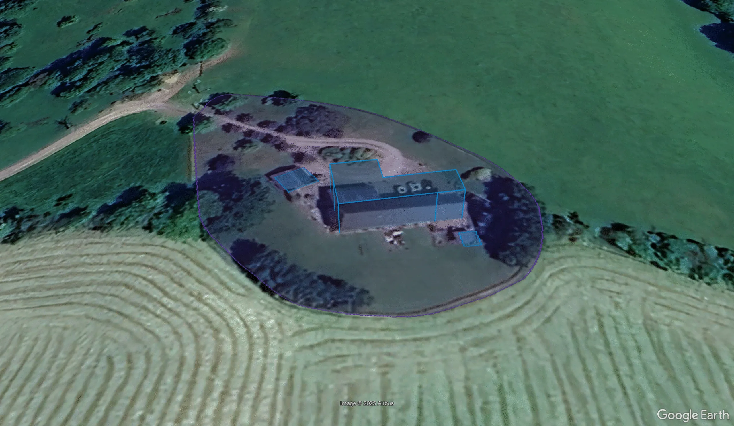
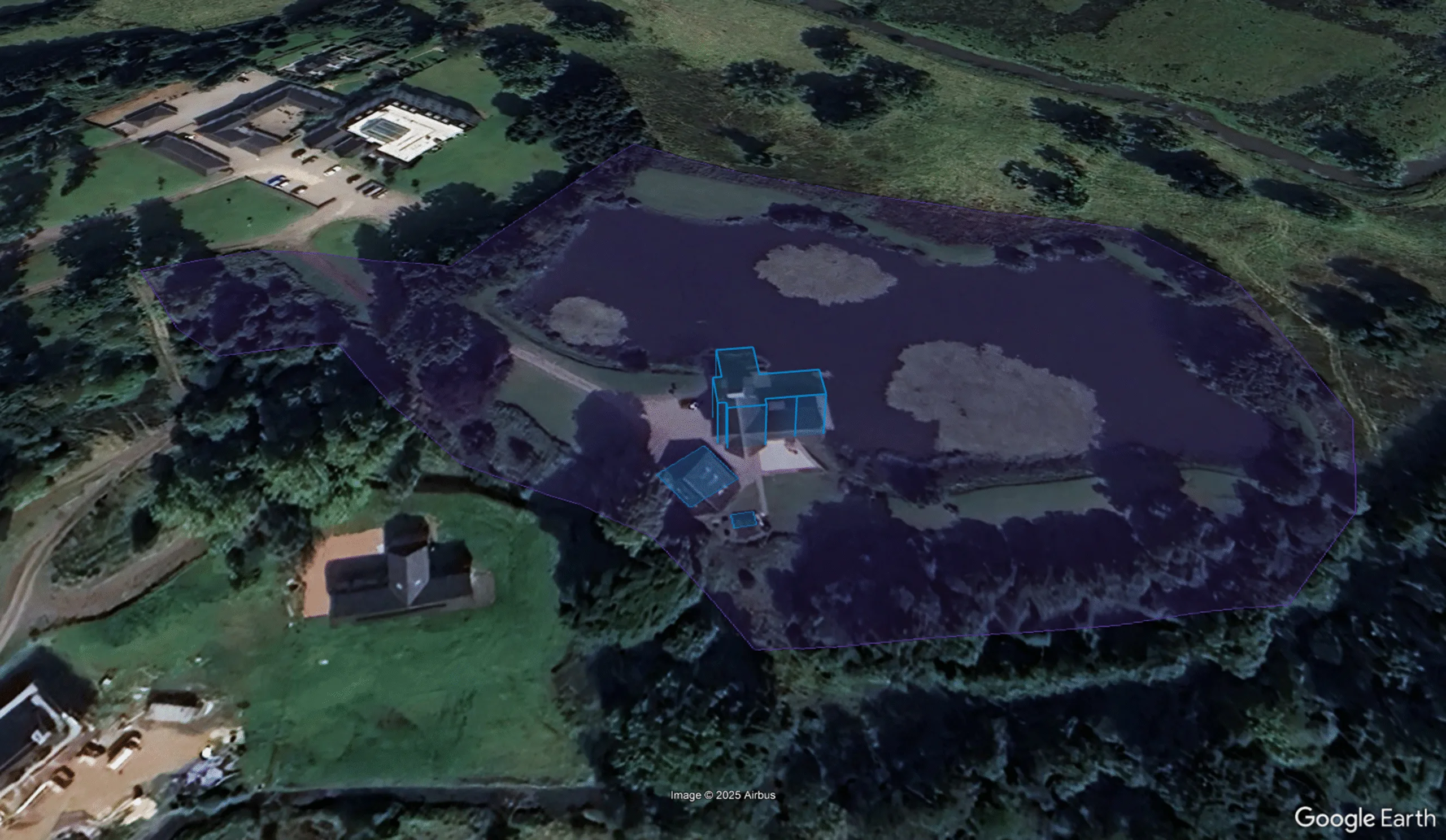
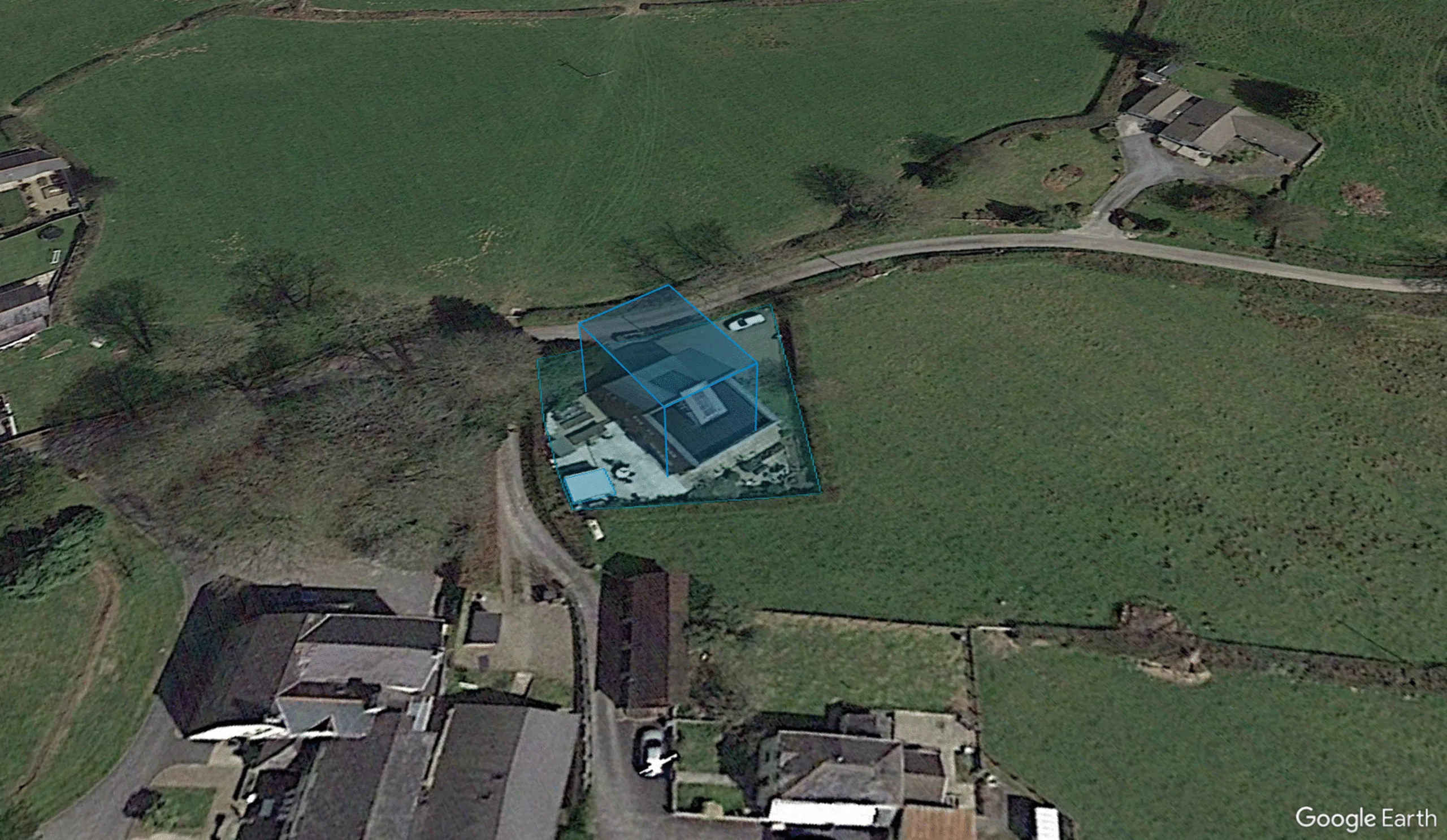
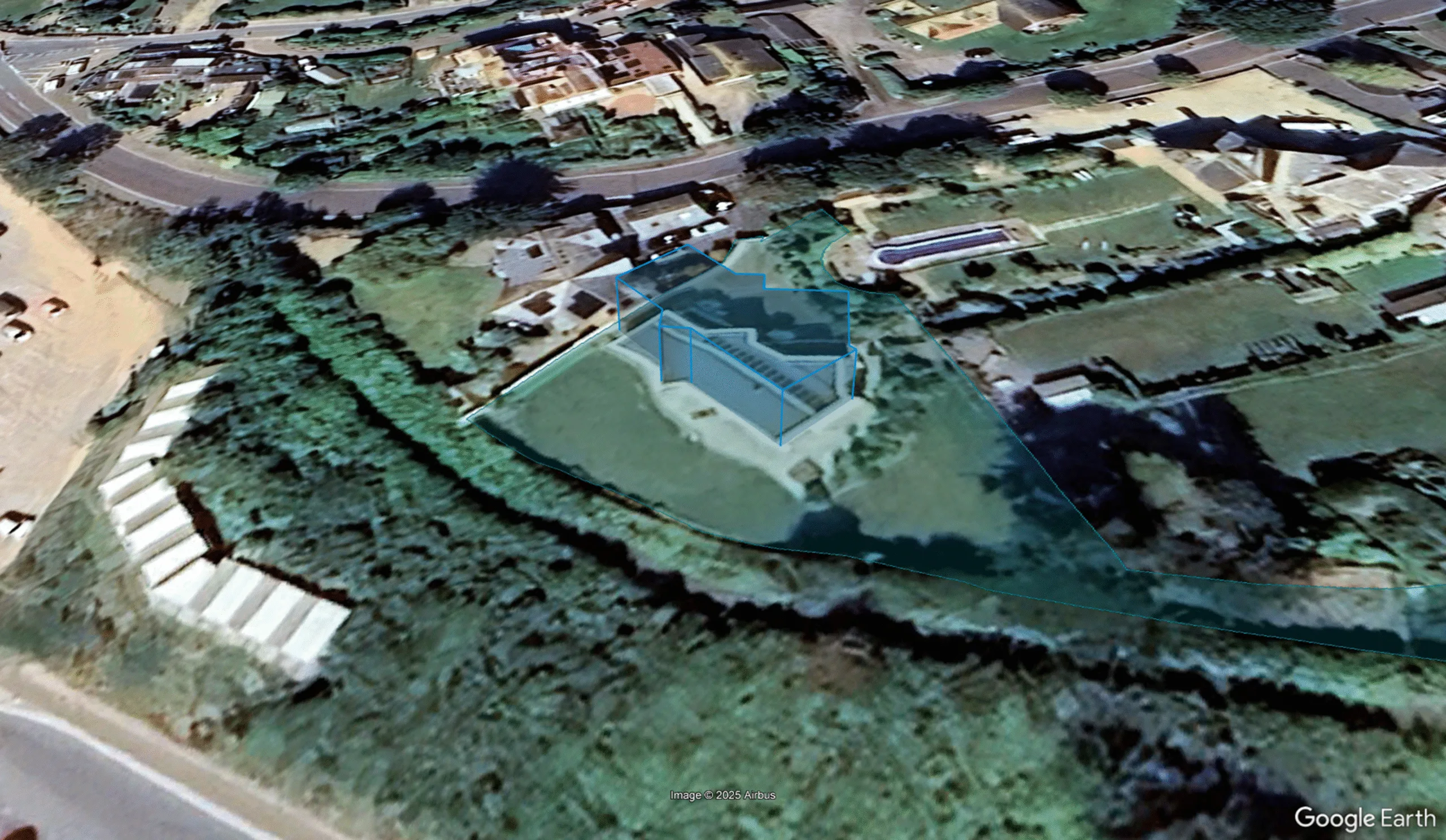
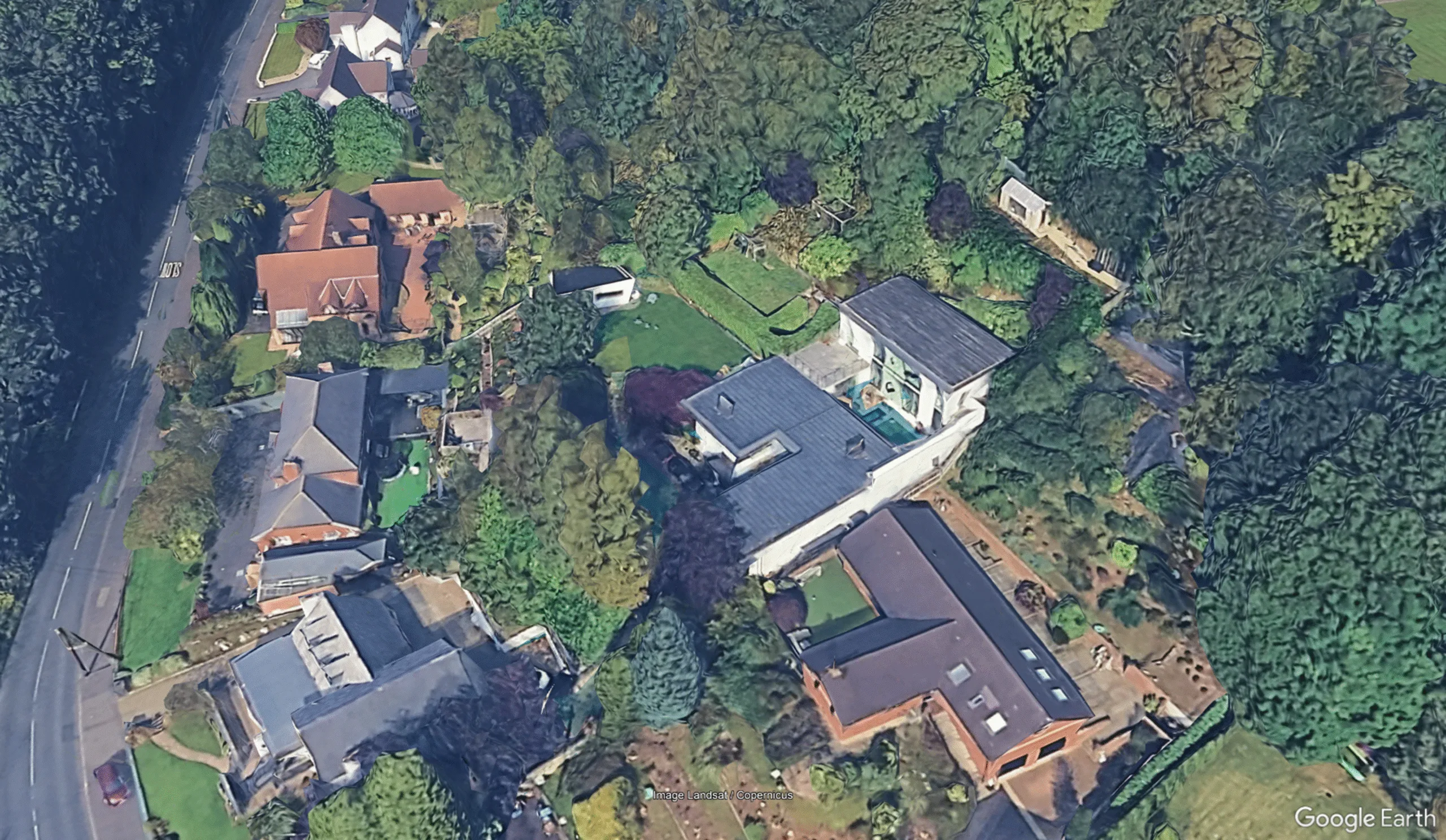
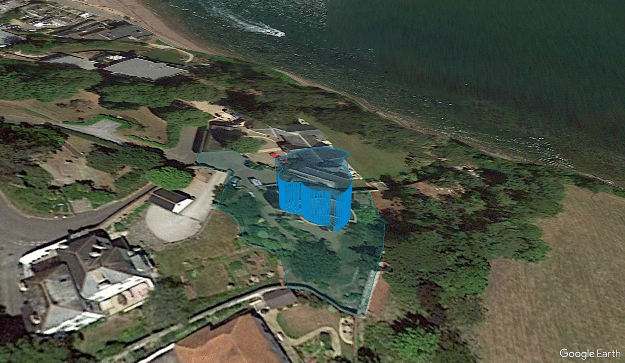
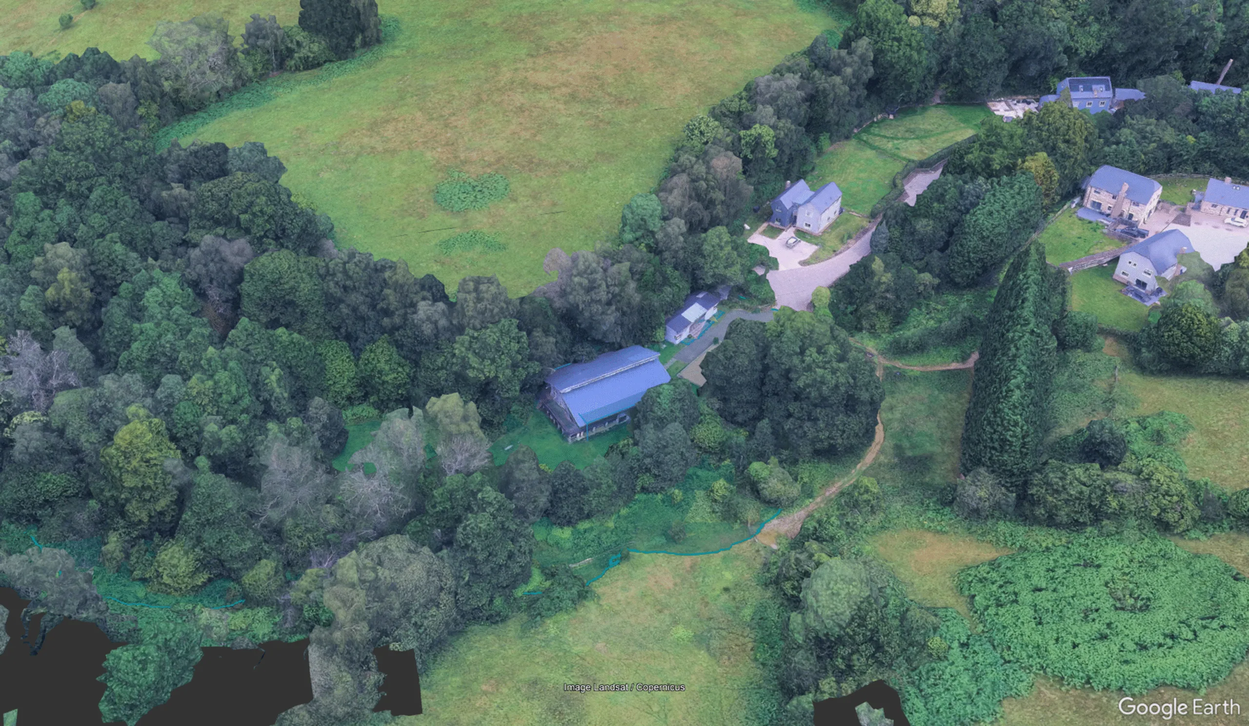
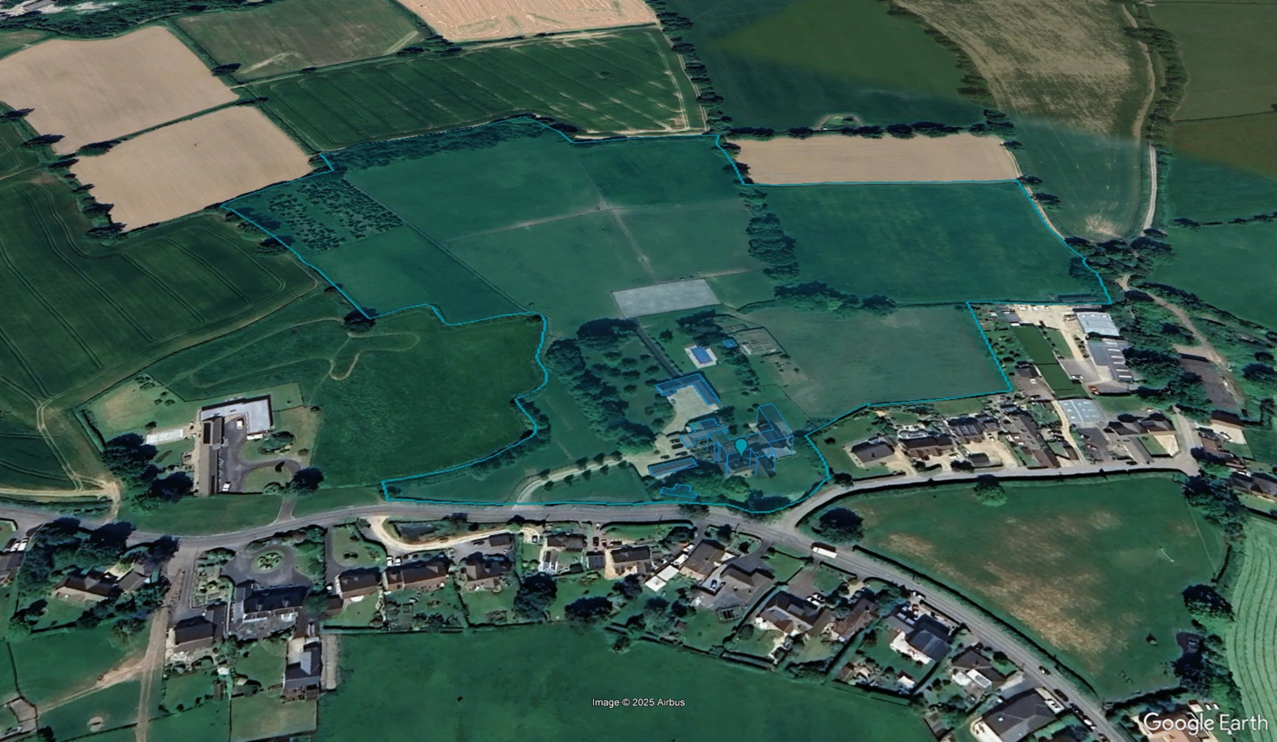
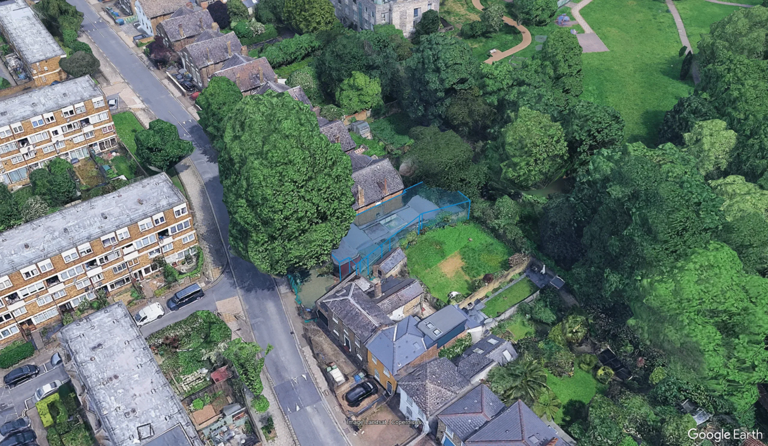
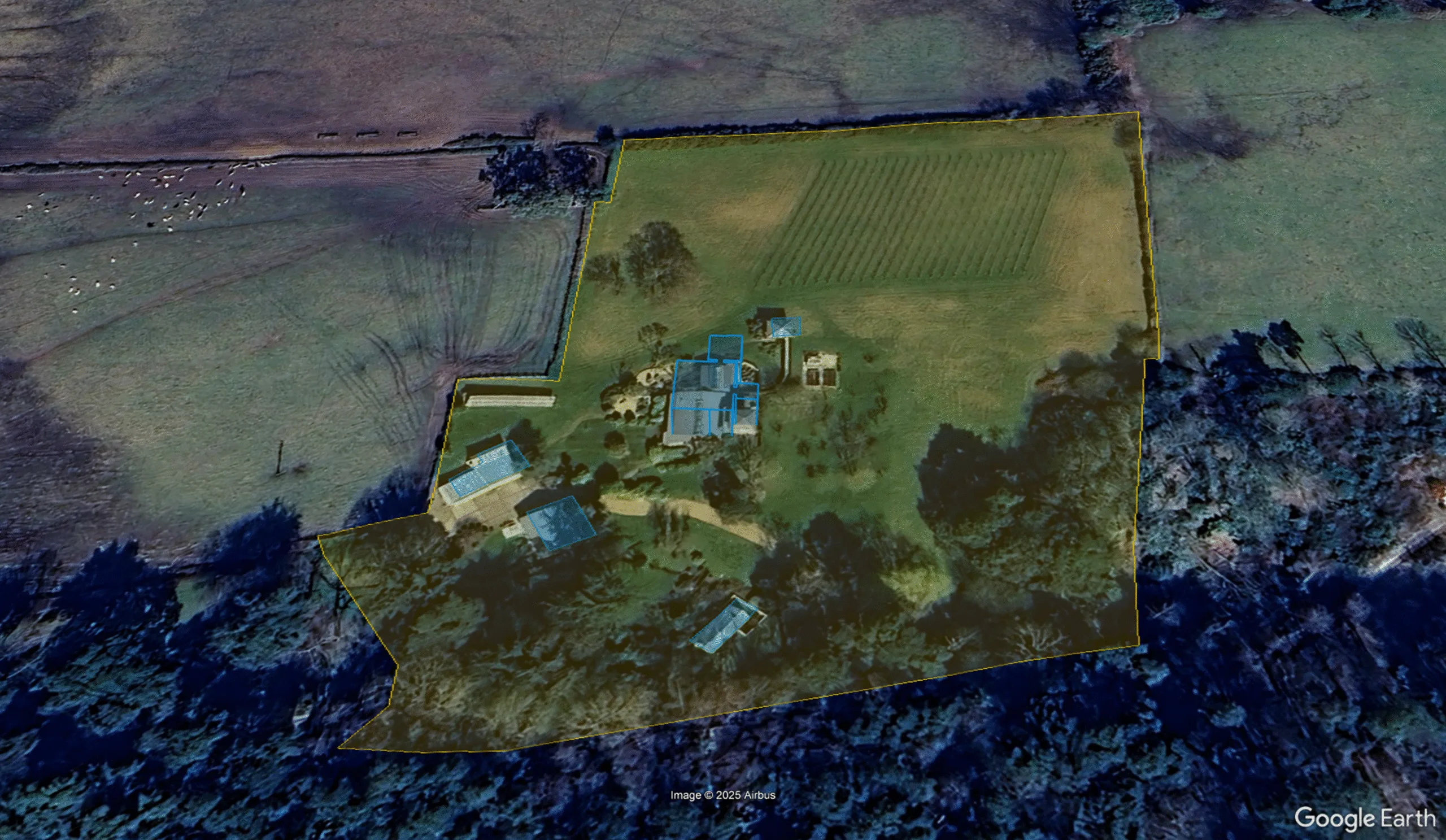
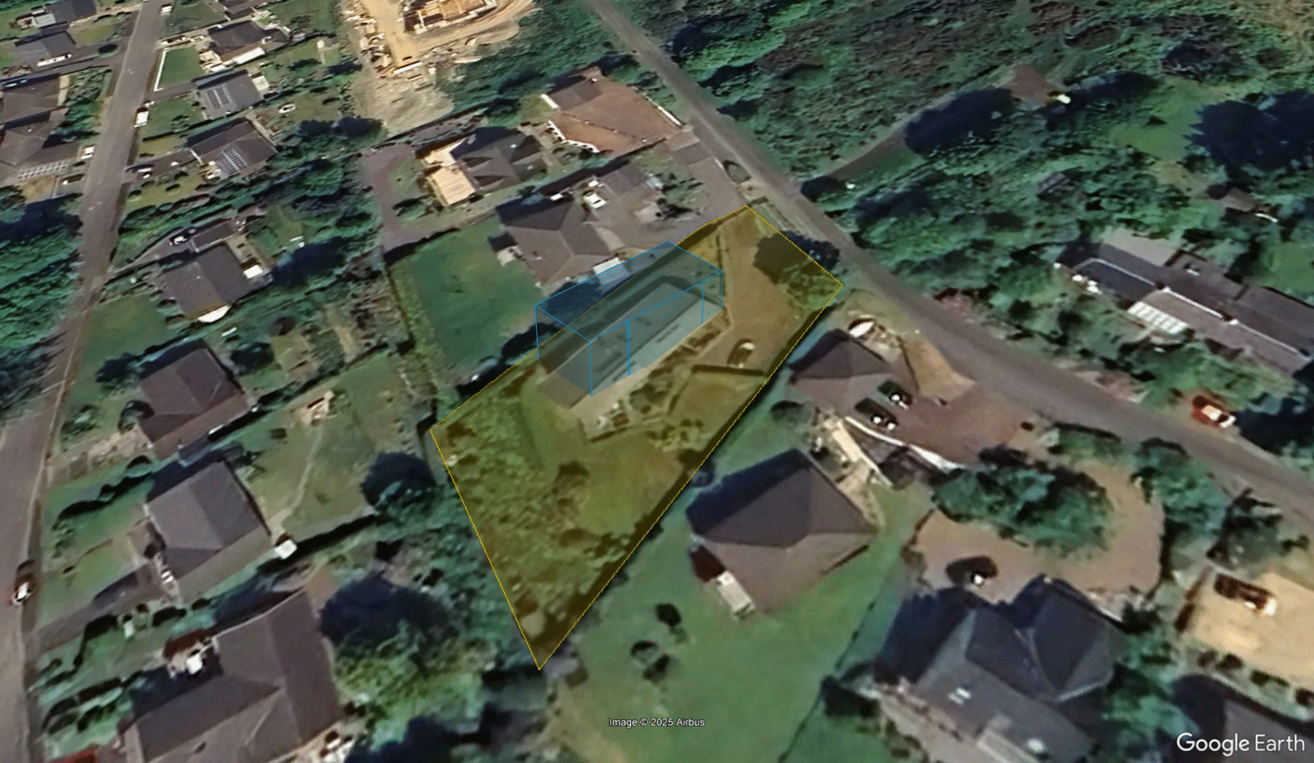
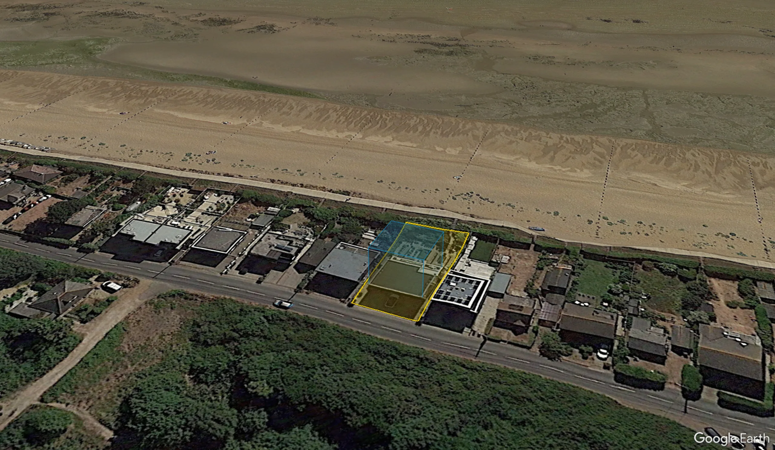
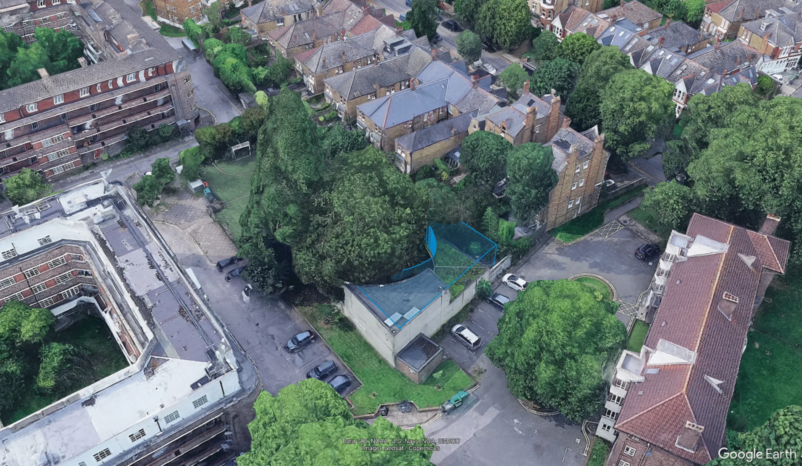
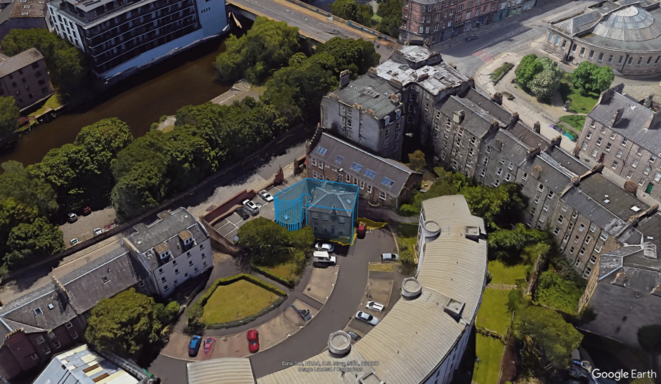
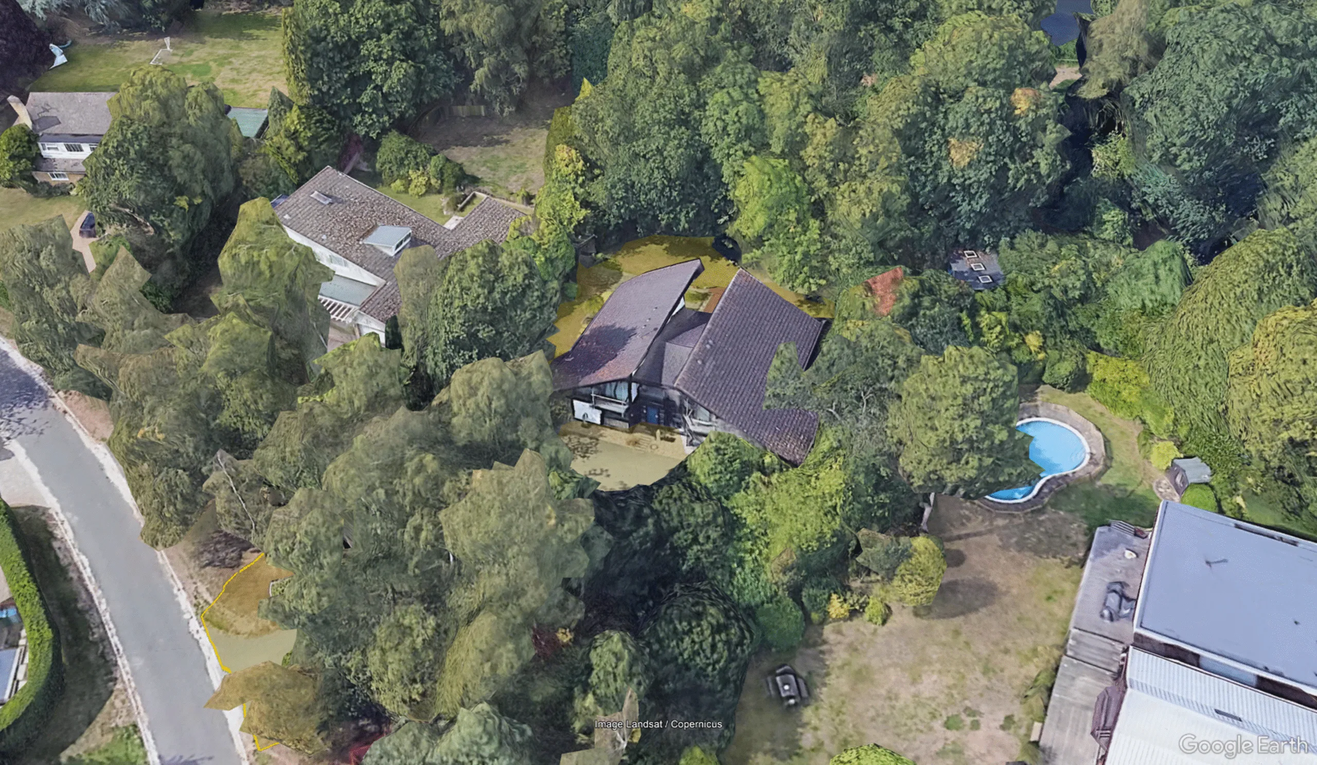
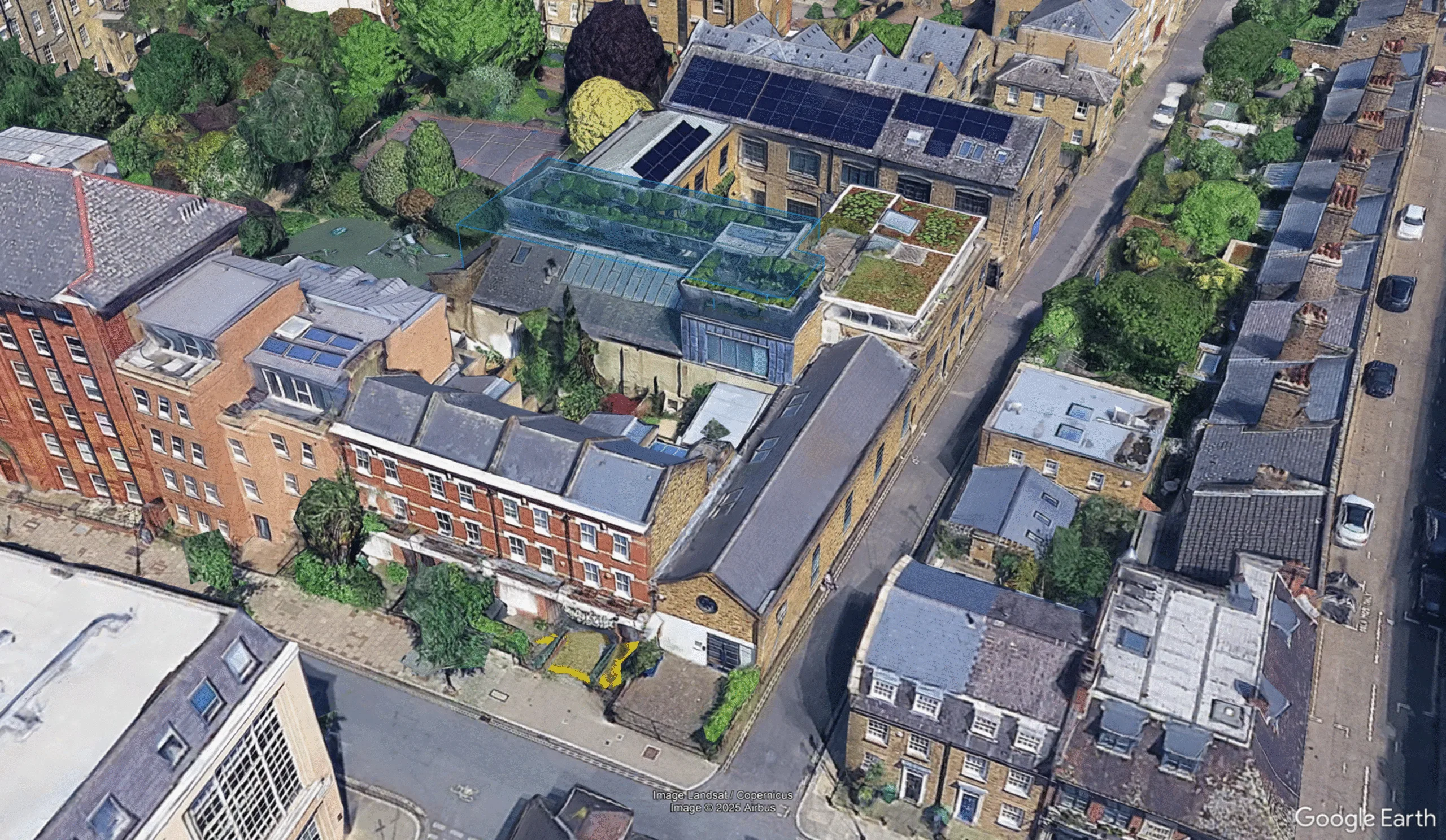
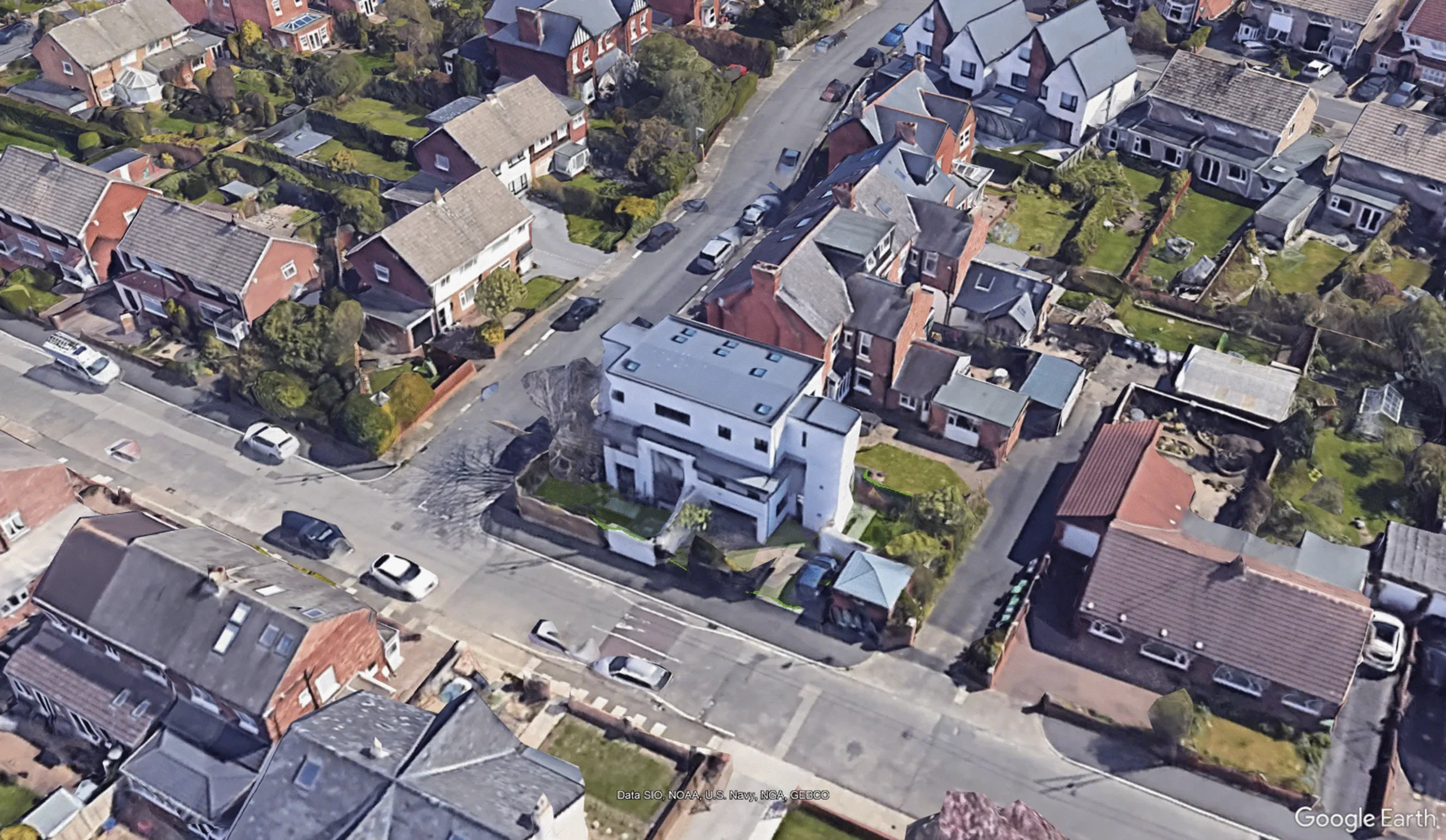
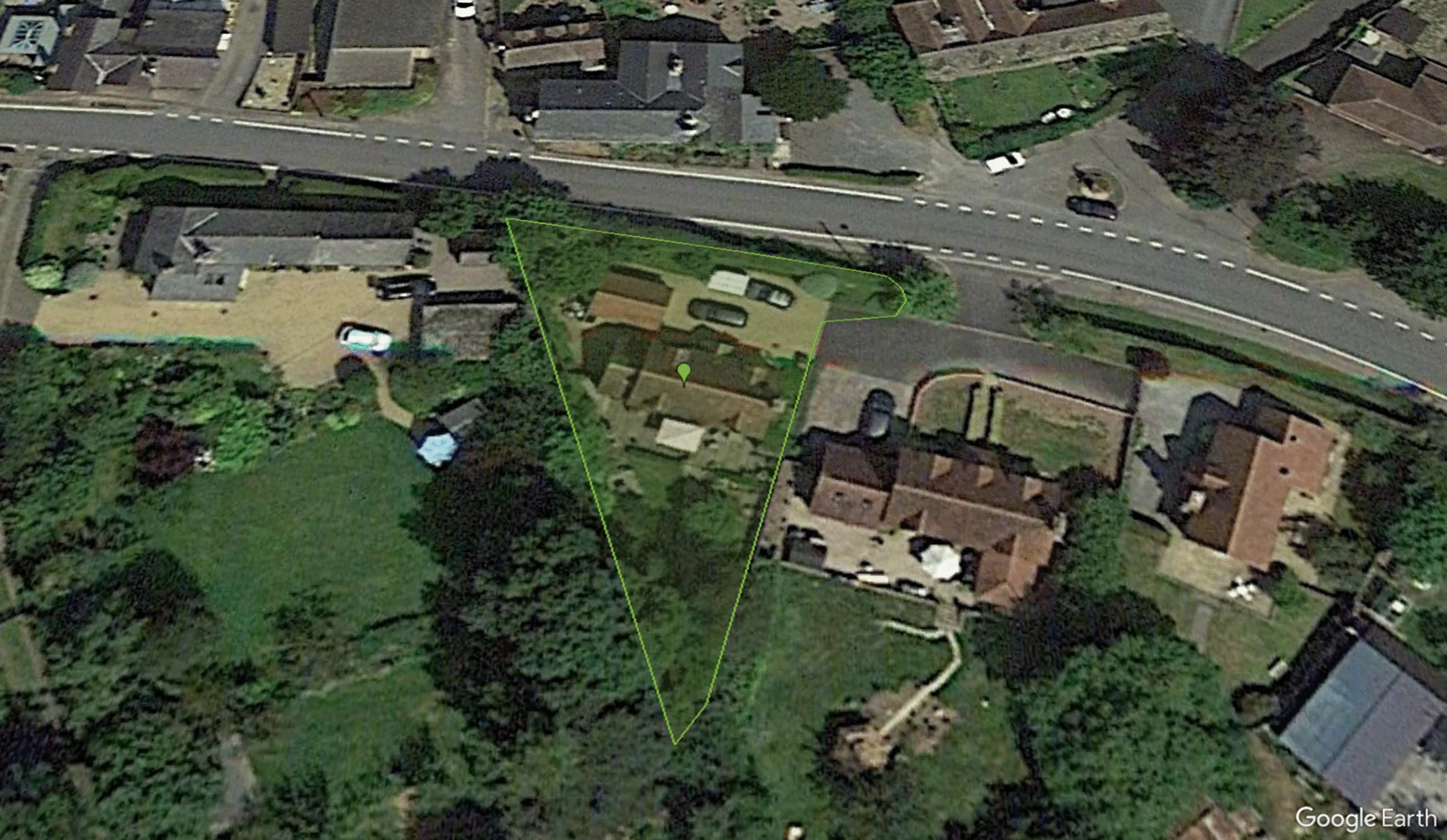
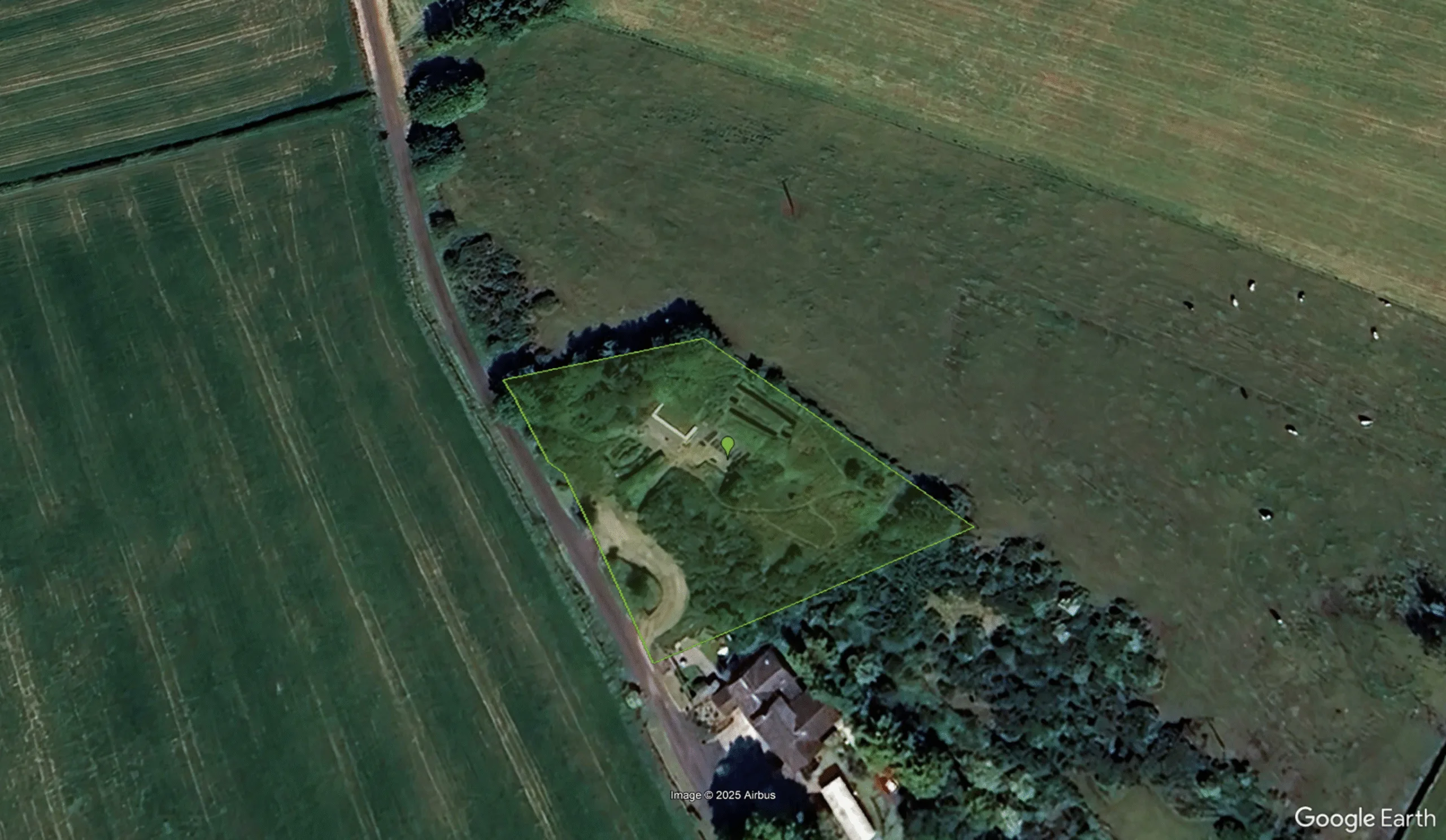
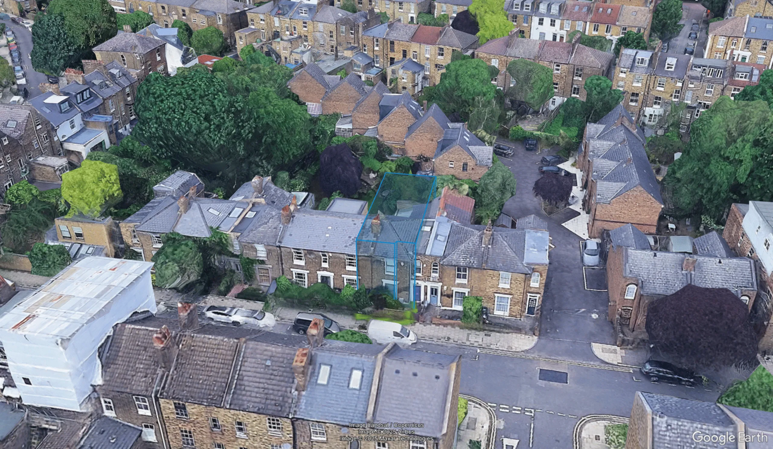
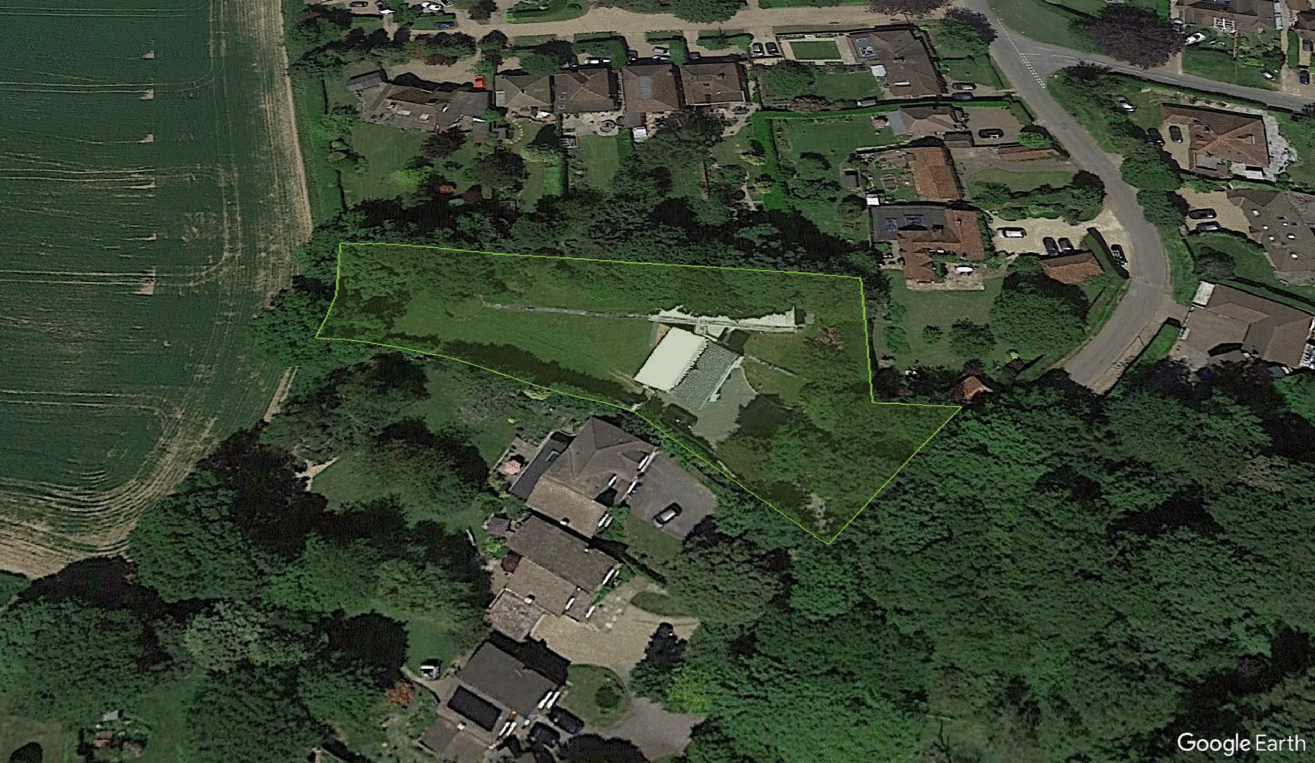
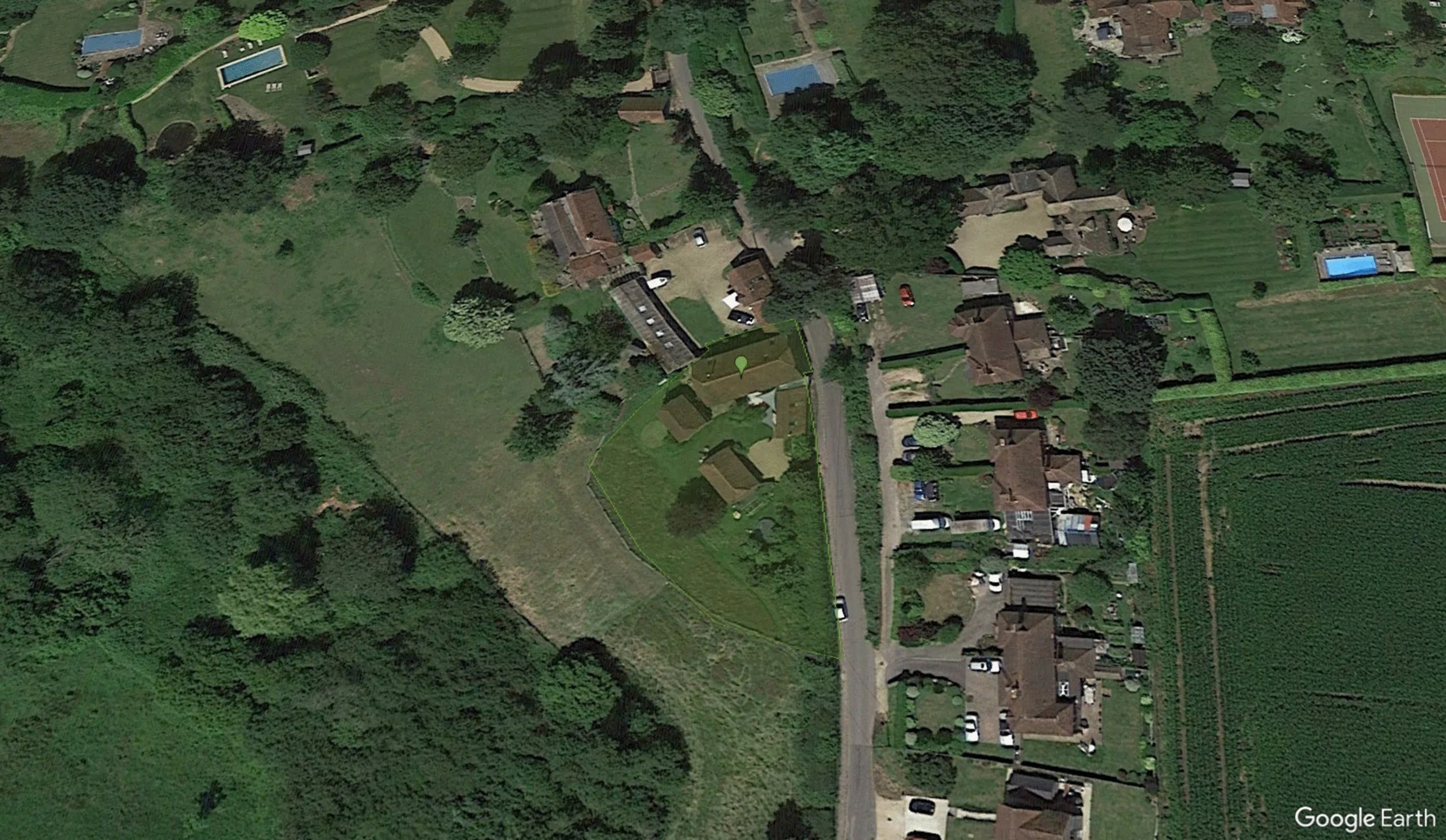
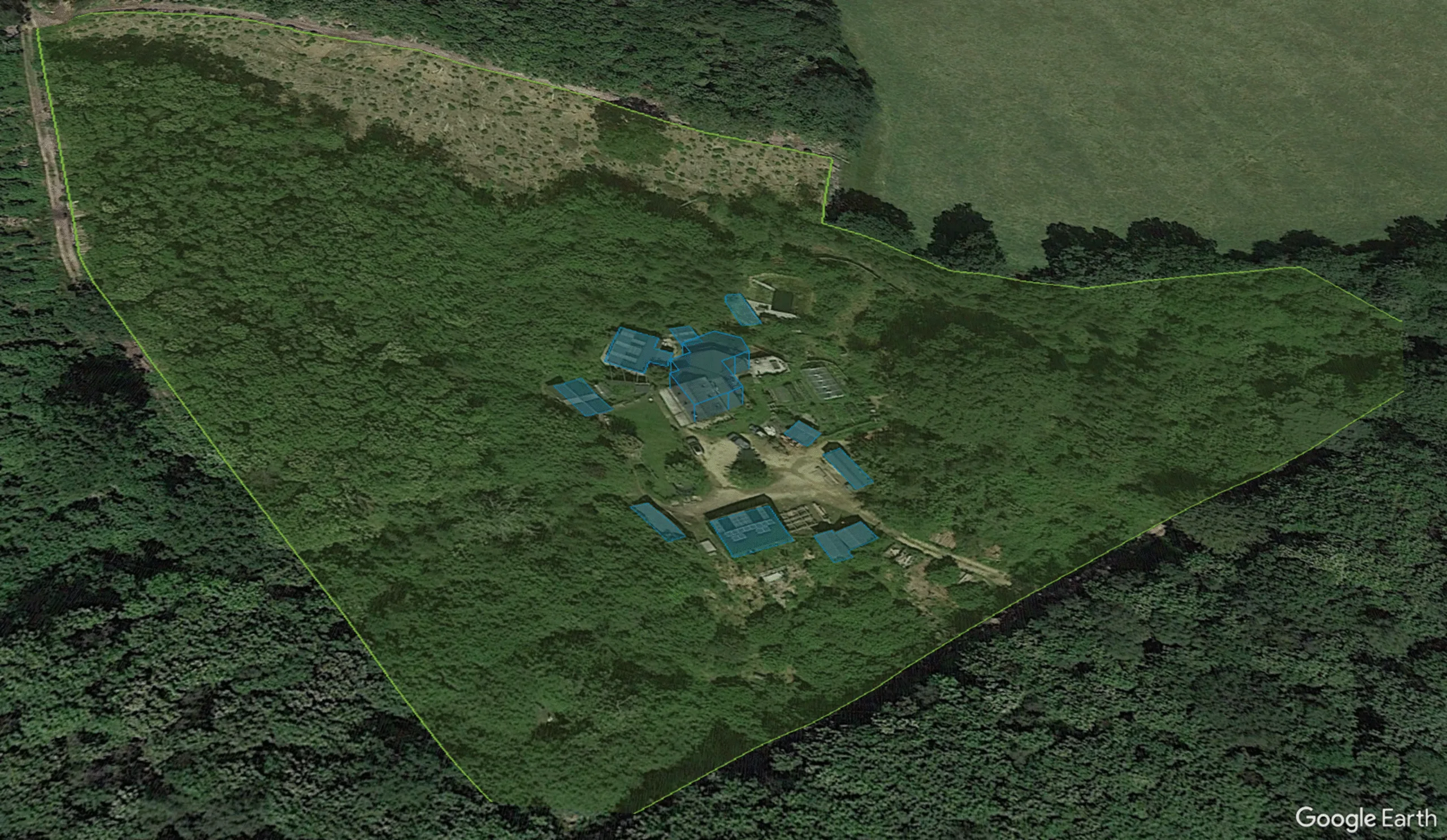
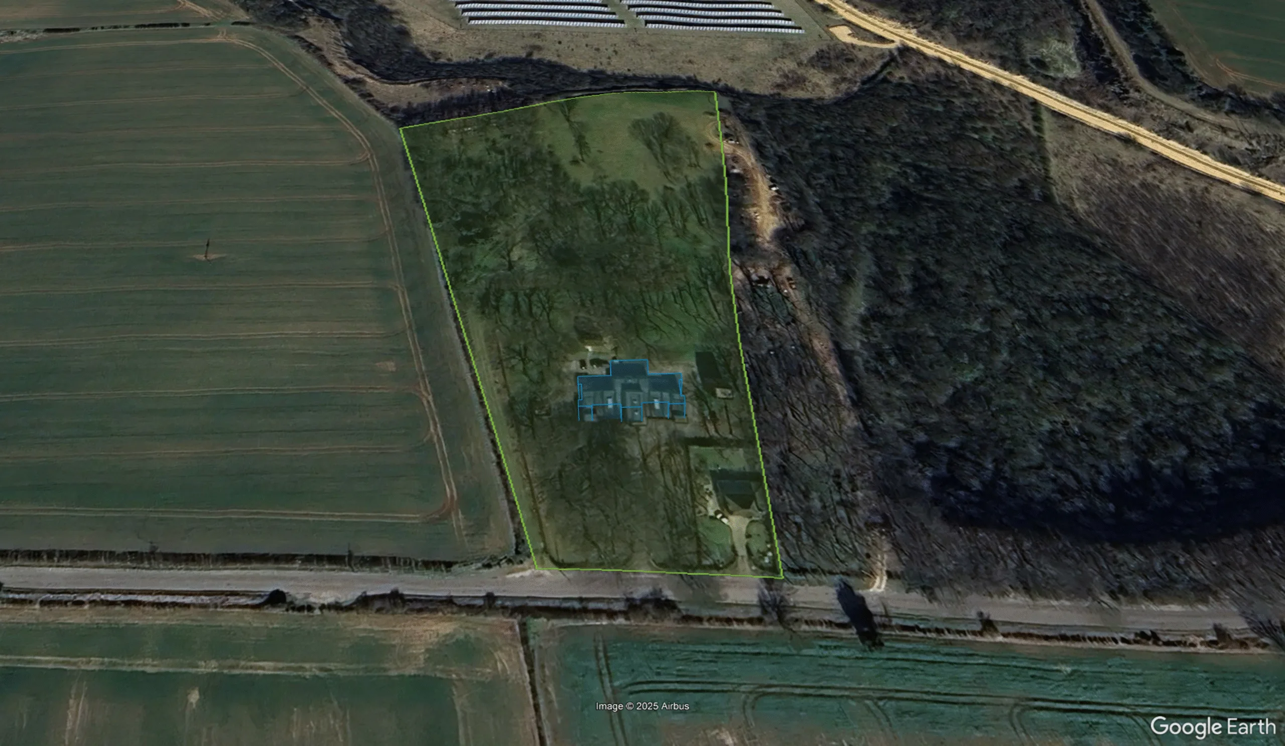
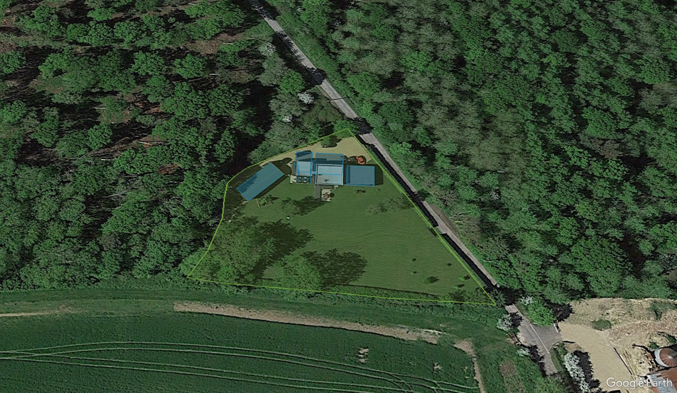
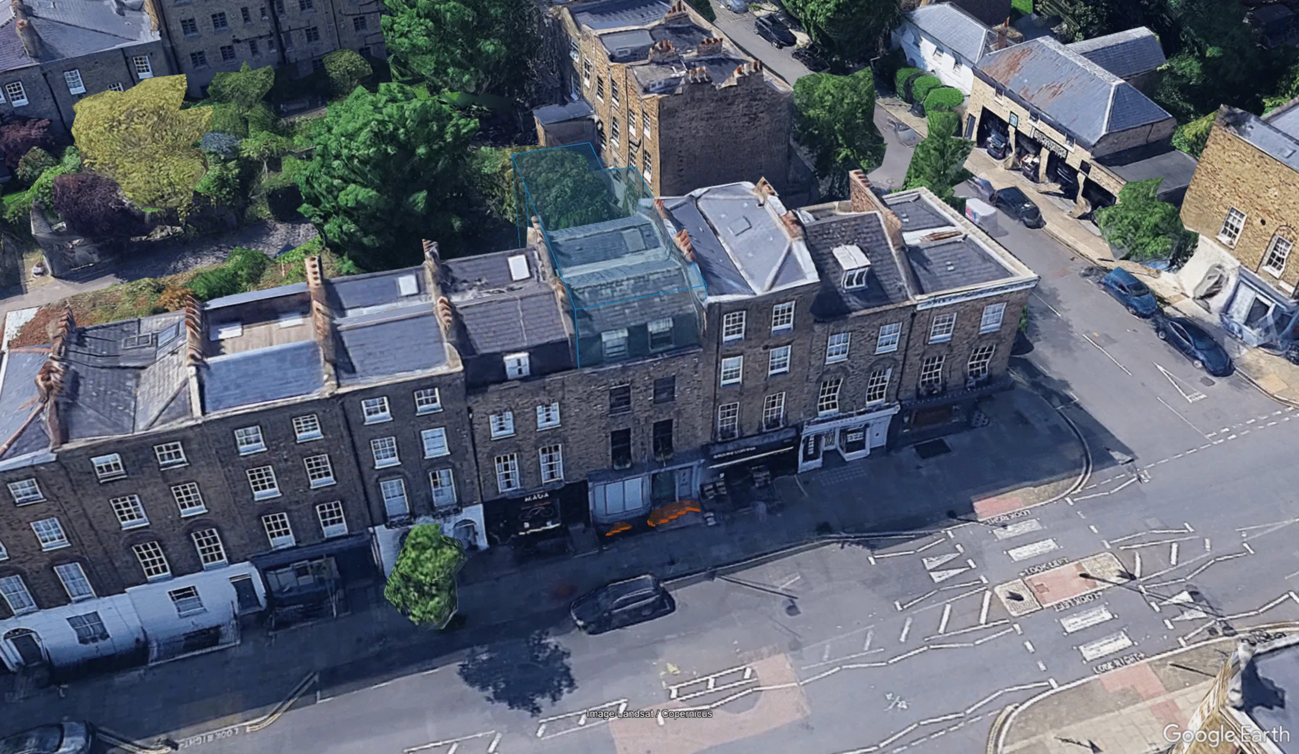
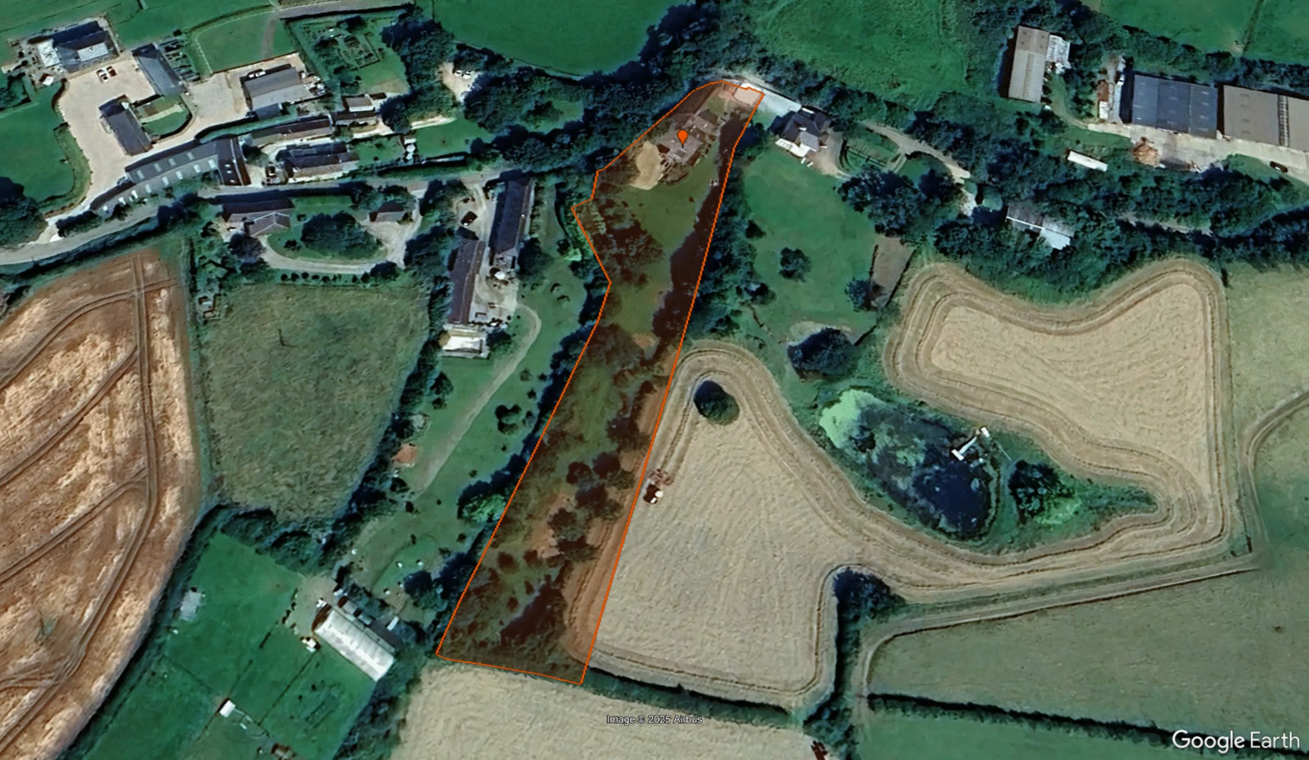
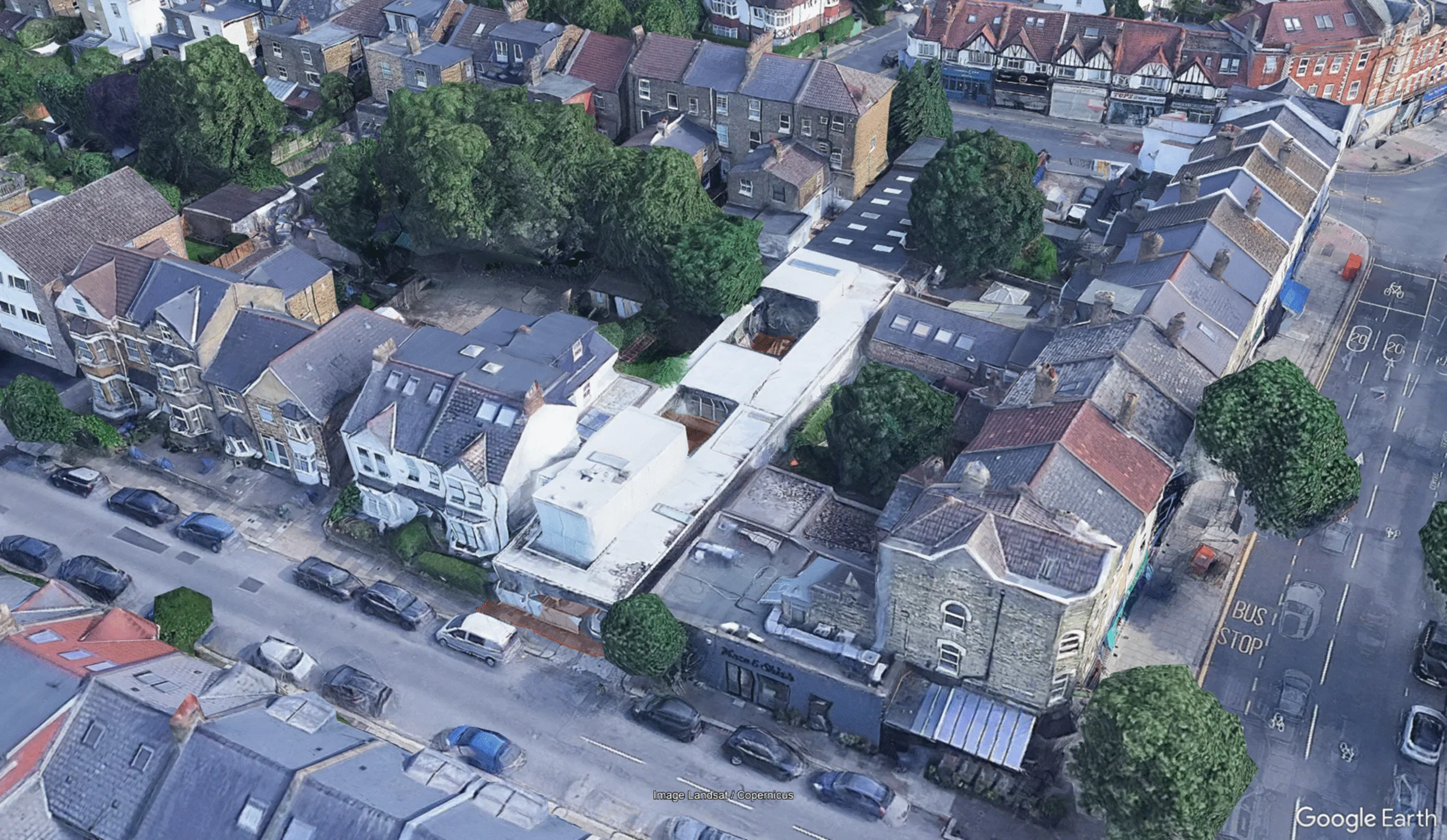
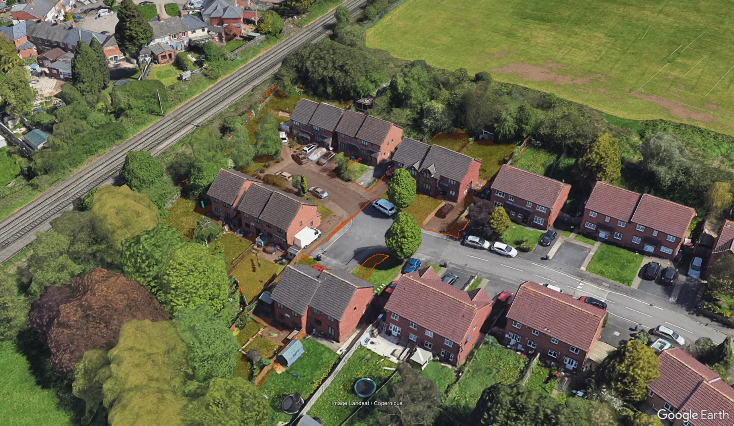
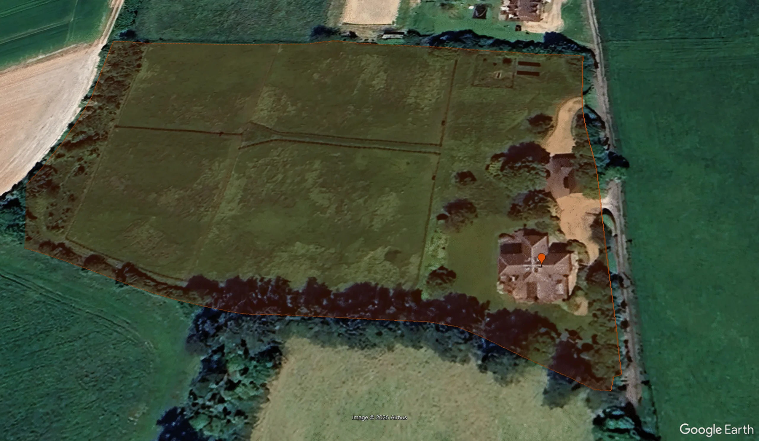
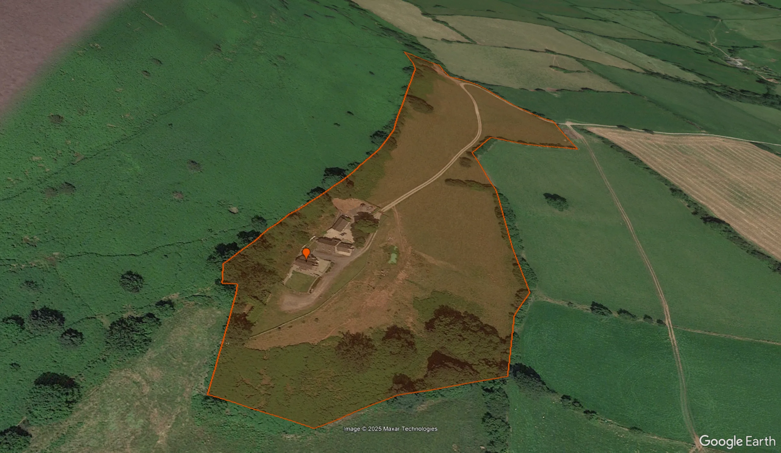
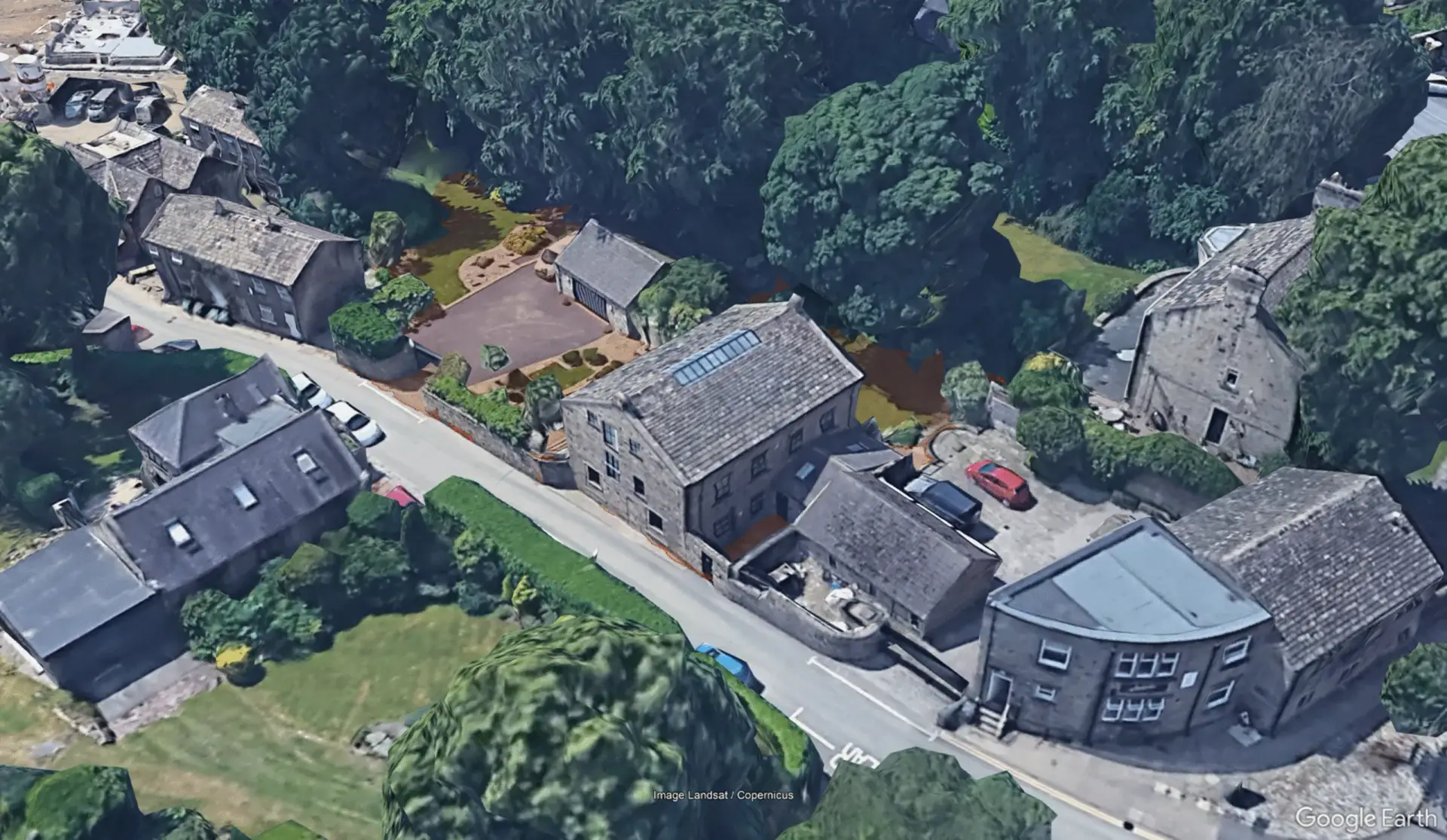
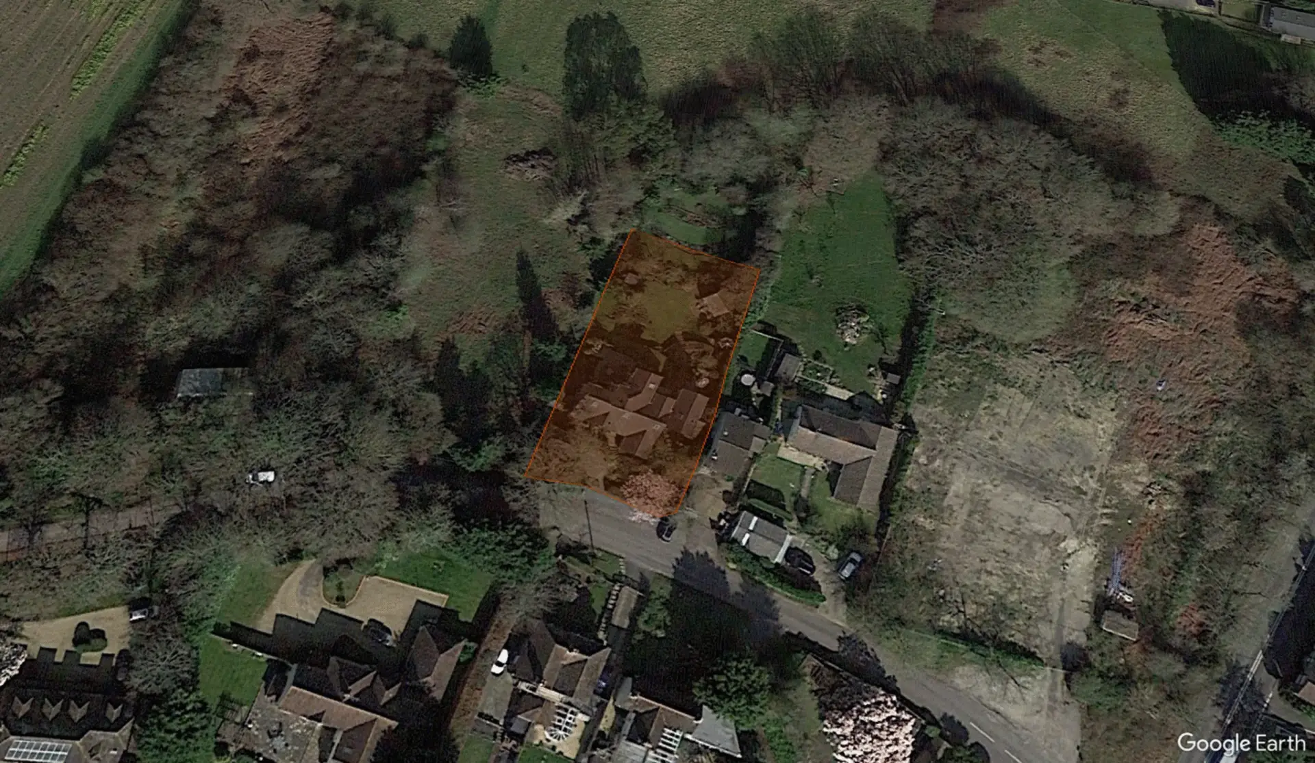
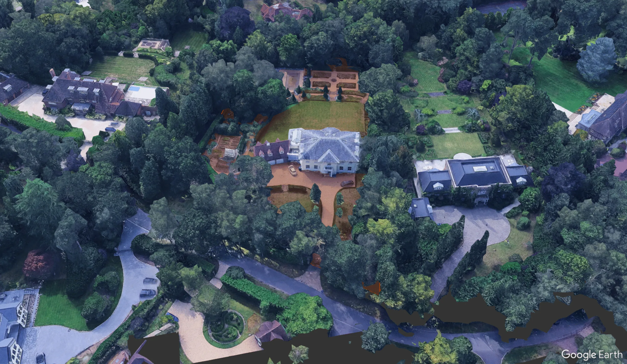
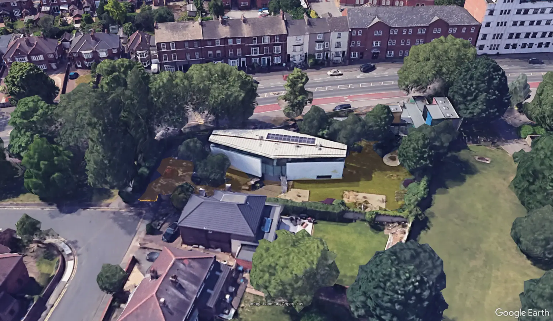
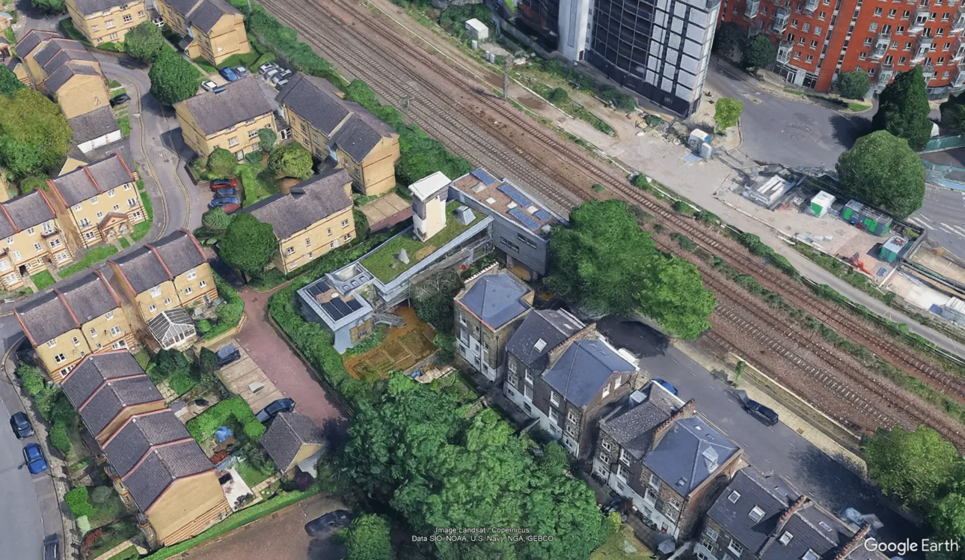
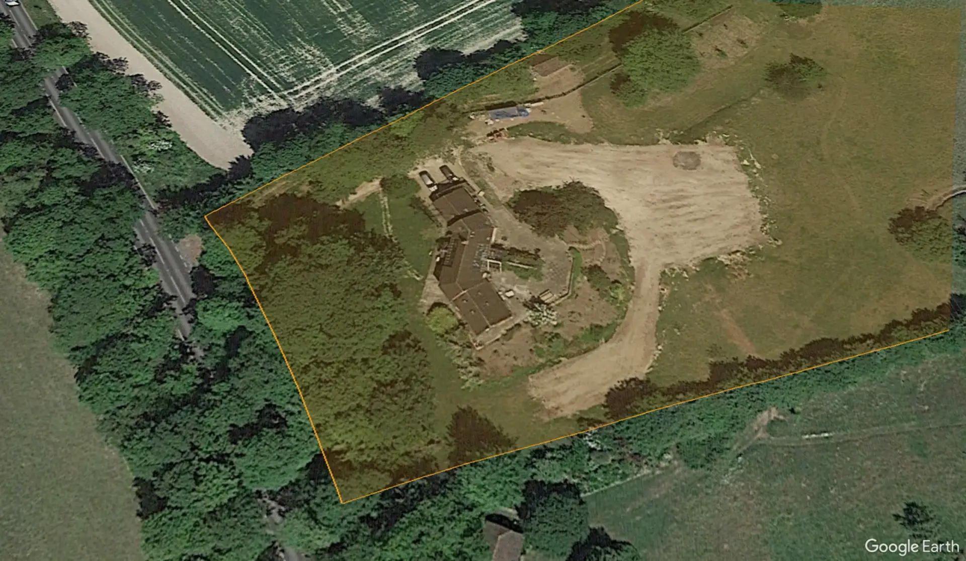
Every location on the map is exact. Each property has been individually identified and the map pin is centred directly on the footprint of the home as seen in the episode. This has been achieved through meticulous visual research, pausing scenes, cross-referencing landmarks, and verifying through mapping tools. It’s taken hundreds of hours to ensure each point reflects the real-world location with precision. You can take a look at the close up in the gallery below.
Can I request a specific location to be added or corrected?
At the moment, all points have been personally researched and verified to the best of my ability. If you have information about an episode I’ve missed (or feel something’s incorrect) feel free to get in touch via hello@brendanburr.com.
Is this an official Channel 4 or Grand Designs project?
No, this is an independent research project created as part of the Measure Twice, Build Once initiative. It’s not affiliated with Channel 4, Boundless, or Grand Designs Magazine, just a deep-dive passion project built to educate and inspire.
How was this map made?
Through hours of detailed observation. This wasn’t scraped from a database it was manually plotted based on what’s visible in each episode. It’s taken hundreds of hours over months, and every dot on the map represents both a real home and a real human story. Google maps, Bing maps, the Planning Portal, Price Paid data, local news articles and other web searches have all played their part in piecing together each location. Some were relatively easy and others were shear fluke that I found them after almost giving up on more than one occasion.
Can I use this map for my own research or media?
You’re welcome to reference the map or use screenshots for educational or editorial use, as long as you credit brendanburr.com and link back to the page. For anything commercial, just reach out first.